Pyhätunturi
| Pyhätunturi | ||
|---|---|---|
|
The skiing center on Pyhätunturi |
||
| height | 540 m | |
| location | Lapland , Finland | |
| Coordinates | 67 ° 1 ′ 0 ″ N , 27 ° 8 ′ 0 ″ E | |
|
|
||
| Type | Fjell | |
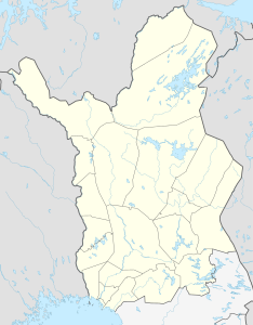
The Pyhätunturi [ Pyhätunturi ] is a 540 meter high Fjell in northern Finland . It is located in the area of the municipality of Pelkosenniemi in central Lapland .
The Pyhätunturi consists of several peaks and, together with Fjell Luosto , which connects to the northwest, forms a 35-kilometer mountain range that clearly stands out from the flat surroundings. The highest peak of Pyhätunturi is named Noitakero, other peaks are Kultakero, Ukonhattu, Laakakero, Peurakero and Soutaja. The Pyhätunturi was formed two billion years ago and consists of hard quartzites that could withstand erosion and was abraded into a round fell by the glaciers of the Ice Age . The melt water from the glaciers formed deep valleys between the peaks. The largest of these is the 220-meter-deep Isokuru Valley between the peaks of Kultakero and Ukonhattu.
Together with the Luosto, the Pyhätunturi belongs to the Pyhä-Luosto National Park . At the Kultakero peak is the Pyhä ski center with a hotel, ten ski slopes and the information center of the national park. Pyhä and neighboring Luosto record a total of around 110,000 overnight stays per year, making them one of the smaller ski sports centers in Lapland.
Individual evidence
- ↑ As of 2003, Lapin liitto: Tourism in Finland and Lapland (Engl.), P. 78.
Web links
- Website of the ski sports center Pyhä (Finnish / English)
- Topographic map

