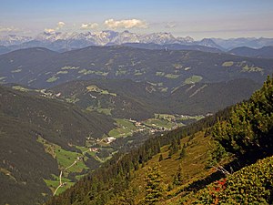
Rossbrand
| Rossbrand | ||
|---|---|---|
|
Rossbrand from the Gasselhöhe |
||
| height | 1770 m above sea level A. | |
| location | Salzburg , Austria | |
| Mountains | Fritztal Mountains , Salzburg Slate Alps | |
| Dominance | 6.4 km → Rötelstein | |
| Notch height | 708 m ↓ Übermoos | |
| Coordinates | 47 ° 24 '55 " N , 13 ° 28' 44" E | |
|
|
||
| rock | Phyllite | |
|
Summit cross, view of the Dachstein |
||
The Rossbrand (formerly Roßbrand ) is a 1770 m high mountain in the Salzburg Slate Alps and is located north of Radstadt in the Austrian state of Salzburg . Directly below the summit is the private Radstädter Hütte and a little to the north at an altitude of 1720 m is the Roßbrandhütte of Austria's Friends of Nature .
A cable car leads from Filzmoos to the eastern ridge of the Rossbrand. The mountain station is just under four kilometers from the summit. The Roßbrandstraße, on the other hand, leads from Radstadt directly to the summit. The 27th stage of the Salzburger Almenweg leads over the Rossbrand .
On the eastern ridge of the Rossbrand there is a 94 meter high directional radio tower made of reinforced concrete in the shape of a type tower similar to the tower of the Ansfelden radio station .
Web links
Individual evidence
- ↑ Section 27 Radstadt - Filzmoos: “The panorama and the high moors of the Roßbrand”. ( Memento of the original from May 23, 2018 in the Internet Archive ) Info: The archive link was inserted automatically and has not yet been checked. Please check the original and archive link according to the instructions and then remove this notice. salzburger-almenweg.at (accessed June 4, 2014).
- ↑ Directional radio towers in Austria. wabweb.net


