Rote Weißeritz
| Rote Weißeritz | ||
|
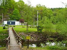
The Rote Weißeritz in Schmiedeberg |
||
| Data | ||
| Water code | DE : 53722 | |
| location | Eastern Ore Mountains in Saxony | |
| River system | Elbe | |
| Drain over | Weißeritz → Elbe → North Sea | |
| origin |
Large gallows pond near Altenberg 50 ° 45 ′ 42 ″ N , 13 ° 44 ′ 13 ″ E |
|
| Source height | 787 m above sea level NN | |
| muzzle | Union in Freital-Hainsberg with the Wilden Weißeritz to Weißeritz Coordinates: 50 ° 58 ′ 54 ″ N , 13 ° 37 ′ 46 ″ E 50 ° 58 ′ 54 ″ N , 13 ° 37 ′ 46 ″ E |
|
| Mouth height | 182.6 m above sea level NN | |
| Height difference | 604.4 m | |
| Bottom slope | 17 ‰ | |
| length | 36.5 km | |
| Catchment area | 161.2 km² | |
| Drain the level Dippoldiswalde 1 + 3 A Eo : 72.9 sq km Location: 15 km above the mouth |
NNQ (23.12.1952) MNQ 1915–2014 MQ 1915–2014 Mq 1915–2014 MHQ 1915–2014 HHQ (13.08.2002) |
0 l / s 136 l / s 1.15 m³ / s 15.8 l / (s km²) 18 m³ / s 193 m³ / s |
| Discharge at gauge Hainsberg 5 A Eo : 153 km² Location: 100 m above the mouth |
NNQ (October 16, 1947) MNQ 1928–2016 MQ 1928–2016 Mq 1928–2016 MHQ 1928–2016 HHQ (June 3, 2013) |
0 l / s 255 l / s 1.74 m³ / s 11.4 l / (s km²) 15.8 m³ / s 67.2 m³ / s |
| Medium-sized cities | Freital | |
| Small towns | Altenberg , Dippoldiswalde , Rabenau | |
The Rote Weißeritz is one of the two source rivers of the Weißeritz in Saxony . It rises near Zinnwald-Georgenfeld (city of Altenberg ) in the Eastern Ore Mountains and unites in Hainsberg (city of Freital ) with the Wild Weißeritz to form the "united" Weißeritz.
course
From the source of the river at the Altenberg reservoir (source rivers: Neugraben , Quergraben , Sandbach) to the middle course, the Rote Weißeritz flows through larger forest areas in a narrow and deeply deepened valley and the places Waldbärenburg , Kipsdorf , Schmiedeberg, Obercarsdorf and Ulberndorf before it reaches Dippoldiswalde . Below Dippoldiswalde, the river is dammed in the Malter reservoir, which was built between 1908 and 1913, for the production of process water , electricity generation and low water regulation . Decisive for the construction of the barrage was the flood protection after a flood in 1897. Below the Malter dam, the Rote Weißeritz flows through the Seifersdorfer Grund and from Seifersdorf finally the narrow and natural valley of the Rabenauer Grund before it merges with the Wild in Freital-Hainsberg Weißeritz united to the Weißeritz.
On the Roten Weißeritz there are also the places Schellerhau , Bärenfels , Naundorf , Paulsdorf , Malter , Seifersdorf, Spechtritz and Coßmannsdorf . It crosses the area of the communities Altenberg, Dippoldiswalde, Rabenau and Freital.
Tributaries
The Rote Weißeritz has the following tributaries. The muzzle is given in brackets:
right tributaries
|
left tributaries
|
further tributaries
|
Former mills
Many mills no longer exist, some have been rebuilt and serve other purposes.
- Schellermühle (Schellerhau) or Buschmühle on Buschmühlenweg (Schellerhau) [1]
- Riedelmühle or Brettmühle (Waldbärenburg) [2]
- Schäfermühle (Forest Bear Castle) [3]
- Forest mill (Bärenfels) [4]
- Lorenzmühle (Bärenfelser Mill) [5]
- Kipsdorfer mill
- Buschmühle (Schmiedeberg)
- Niedermühle or Eisenmühle (Schmiedeberg) [6]
- Hofemühle (Schmiedeberg) [7]
- Klappermühle (Unterstaundorf) [8]
- Obermühle (Obercarsdorf)
- Dorfmühle (Obercarsdorf)
- Niedermühle (Obercarsdorf) [9]
- Frankenmühle or Obere Mühle (Ulberndorf)
- Brettmühle (Ulberndorf)
- Dorfmühle (Ulberndorf)
- Niedermühle (Ulberndorf)
- Oppeltmühle (Ulberndorf)
- Graupenmühle or Pneumant hydraulic works (Dippoldiswalde) [10]
- Schindelmühle (Dippoldiswalde) (demolished 1987) [11]
- Fulling mill or Mendenmühle (Dippoldiswalde) (previously Lohmühle) [12]
- Wetzenmühle (Dippoldiswalde)
- Obere-Stadtmühle (Dippoldiswalde)
- Ratsmühle (Dippoldiswalde) [13]
- Gattermühle (Dippoldiswalde) [14]
- Rupprechtsmühle (Dippoldiswalde) [15]
- Beyermühle (Dippoldiswalde) [16]
- Red Mill (Malter)
- Grundmühle (Paulsdorf)
- Malter Mill (Malter)
- Brettmühle (Seifersdorf), ground down in 1636
- Seifersdorfer Mühle (Seifersdorf)
- Felsenmühle (Spechtritz), also called "Korkmühle" (demolished in 2007)
- Spechtritzer Mill (Spechtritz, demolished in 2009)
- Rabenauer Mühle , today a hotel and inn
- Rolling mill Coßmannsdorf , formerly also called Mittagsmühle, Somsdorfer Mühle or Coßmannsdorfer Mühle (1462, now an apartment building)
Hydropower plants
Hydroelectric power plants on the Rote Weißeritz
- Malter
- Seifersdorf
- Rabenauer reason
use
Numerous mills were built on the Rote Weißeritz that made use of the river's water power. Well-known mills on the river are the Schellermühle near Schellerhau, the Riedelmühle Waldbärenburg, the Dorfmühle Obercarsdorf, the Rathsmühle Dippoldiswalde, the Rabenauer Mühle and the Coßmannsdorfer Mühle . In addition, around 1900 a number of power plants were built on the Rote Weißeritz, there were power plants in Malter, Seifersdorf and Coßmannsdorf.
In June 1961, the world championships in white water racing and canoe slalom were held on the Roten Weißeritz, in the Rabenauer Grund from Seifersdorf to Freital . Sufficient water in the river was ensured by draining the Malter dam. The competitions saw 30,000 to 40,000 spectators.
The valley of the Roten Weißeritz is of particular importance for the traffic development of the Osterzgebirge . Today's federal road 170 was built as a royal Saxon state road in the 1840s. This uses the valley between Dippoldiswalde and Waldbärenburg to cross the mountains in the direction of Teplitz-Schönau and Prague, which was also European route 55 until 2006 . The narrow-gauge Weißeritztalbahn has been running between Hainsberg and Kipsdorf in the valley since 1882/83 .
Flood
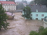
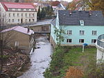
A devastating flood in 1897 destroyed 320 houses in the valley and killed 19 people. In some cases, the river in the Rabenauer Grund had risen 140 times. The 2002 floods also caused great damage. The entire course of the Weißeritztalbahn was badly damaged and has only been completely rebuilt since June 2017. The neighboring towns and the federal highway 170 also suffered severe damage. As a consequence, the river bed was expanded and the Malter dam has not been completely filled since then. As a result, the 2013 flood caused only minor damage.
Landscape protection area
The landscape protection area "Tal der Roten Weißeritz" extends from the barrier wall of the Malter dam to Coßmannsdorf ( Freital ). It was placed under protection on July 4, 1974. It includes the Rabenauer Grund nature reserve , which makes up around 51% of the area.
See also
literature
- Siegfried Gerhardt: Two watercourses with the same name. in: Petra Binder (ed.): Land calendar book for Saxon Switzerland and the Eastern Ore Mountains 2009. Schütze-Engler-Weber Verlag GbR, Dresden 2008, pp. 39–42, ISBN 978-3-936203-11-0 .
- Friedrich Polle: Guide through the Weißeritzthal to Schmiedeberg and its surroundings. Secondary railway Hainsberg – Kipsdorf . Huhle, Dresden 1885 ( digitized version )
- Herbert Wotte : Malter and Klingenberg dams, Rabenauer Grund. Brockhaus-Wanderheft 17, Brockhaus Verlag, Leipzig 1973.
Web links
- Rote Weißeritz between Dippoldiswalde and Freital
- ENSO Energy Experience Trail ( Memento from May 10, 2013 in the Internet Archive ) (PDF; 2.7 MB)
- Information on the mentioned mills
Individual evidence
- ^ German Hydrological Yearbook Elbe Region, Part I 2014. (PDF) State Office for Flood Protection and Water Management Saxony-Anhalt, p. 112 , accessed on November 3, 2018 (from: lhw.sachsen-anhalt.de).
- ↑ Hydrological Handbook. (PDF; 637 kB) Part 3 - Main aquatic values. Free State of Saxony - State Office for Environment and Geology, p. 59 , accessed on December 25, 2017 .
- ↑ The Hainsberg 5 gauge was destroyed in the flood in August 2002, so that the maximum value of 1954 is still valid here ( replacement of the Freital-Hainsberg gauge ( memento of August 25, 2006 in the Internet Archive )).
- ^ Circular hiking trail Dippoldiswalde - Elend - Ulberndorf - Dippoldiswalde , accessed on February 28, 2015
- ↑ From the history of the Rabenauer Grund ( memento from February 6, 2013 in the web archive archive.today )
- ↑ Abridged version of MaP 036 “Valleys of Roter Weißeritz and Oelsabach”. Retrieved April 21, 2014 .


