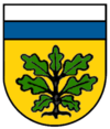
Söcking (Starnberg)
Söcking has been part of the city of Starnberg in Upper Bavaria since it was incorporated as part of the regional reform in 1978 .
location
Söcking lies at an altitude of 695 m above sea level. NN on the terminal moraines of the Würm Ice Age on Lake Starnberg . The district is located above and northwest of Starnberg, on a slope between the Maisinger Gorge and Alersberg .
history
On January 1, 1974, the previously independent municipality Hadorf was incorporated. On May 1, 1978 Söcking lost its independence. Since then it has belonged to the district town of Starnberg.
Worth seeing
The Roman Catholic parish of St. Ulrich is located in Söcking. The church and rectory date from the 1950s. Noteworthy are the 56 meter high tower, the colorful glass windows of the church and above all the altar wall by Georg Brenninger in the east choir. It is the largest altar wall north of the Alps (14 m high and 6 m wide).
The old parish church of St. Stephan dates from the 18th century. Söcking is also known for its war blind course sanatorium . When the weather is good, especially when there is a foehn , you can see the Alps from many points . The second landmark of Söcking is next to the St. Stephen's Church, the mausoleum of Prince Karl of Bavaria on the Kahlberg. In the fortified mausoleum complex are the graves of Count Almeida in a neo-Romanesque columned hall .
In the south of Söcking in the direction of Pöcking , on the connection to Bundesstraße 2 , there is the highest prestressed concrete bridge in Upper Bavaria , which spans the Maisinger Gorge here.
The actor Johannes Heesters , the expressionist painter Fritz Gartz from 1928 until his death in 1960, and the Austrian zoologist , evolutionary biologist and behavioral researcher Irenäus Eibl-Eibesfeldt lived in Söcking . The physicist and philosopher Carl Friedrich von Weizsäcker died in Söcking in 2007.
Federal institutions
Until 2013, at the northern end of Söcking below the Galgenberg, there was an antenna system consisting of seven approximately 40 meter high antennas around a three-story white building, which was already conspicuous from afar . These were a used during World War II Horch site of the Military District Command VII. Since 1948, the plant was until the end of the Cold War as listening posts "Kleefeld" of the "Federal Office for Telecommunications Statistics" or the " Federal Bureau of Telecommunications Statistics " used both cover name for the Federal Intelligence Service (BND). The system was called "Listening Point C". Until 2008, the building, like the former school building in the center of Söcking, was used by Department 7 of the BND (SBND - School of the BND). The facility was completely demolished and a newly built daycare center was opened in January 2015.
Individual evidence
- ^ Federal Statistical Office (ed.): Historical municipality directory for the Federal Republic of Germany. Name, border and key number changes in municipalities, counties and administrative districts from May 27, 1970 to December 31, 1982 . W. Kohlhammer, Stuttgart / Mainz 1983, ISBN 3-17-003263-1 , p. 591 .
- ↑ Katja Sebald: The modern basilica , article in the Süddeutsche Zeitung, online version from September 6, 2017.
Web links
- Website of the Starnberg district of Söcking
- Planning status for the subsequent use of the BND building
Coordinates: 48 ° 0 ' N , 11 ° 19' E


