St. Lucie River
|
St. Lucie River officially: Saint Lucie River |
||
|
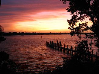
The river at Sewall's Point |
||
| Data | ||
| Water code | US : 294318 | |
| location | Martin County , Florida , USA | |
| River system | Indian River | |
| Drain over | Indian River → Atlantic | |
| origin | Confluence of the North Fork and South Fork Saint Lucie River 27 ° 12 ′ 4 ″ N , 80 ° 15 ′ 48 ″ W |
|
| muzzle | in the Indian River coordinates: 27 ° 10 ′ 10 ″ N , 80 ° 11 ′ 9 ″ W 27 ° 10 ′ 10 ″ N , 80 ° 11 ′ 9 ″ W.
|
|
| length | 11 km | |
| North Fork Saint Lucie River | ||
| Water code | US : 308057 | |
| source | in St. Lucie County, 27 ° 23 ′ 44 ″ N , 80 ° 21 ′ 2 ″ W. |
|
| confluence | with the South Fork Saint Lucie River to the Saint Lucie River 27 ° 12 ′ 3 ″ N , 80 ° 15 ′ 47 ″ W
|
|
| South Fork Saint Lucie River | ||
| Water code | US : 291379 | |
| source | in Martin County, 27 ° 3 ′ 43 " N , 80 ° 13 ′ 37" W. |
|
| confluence | with the North Fork Saint Lucie River to the Saint Lucie River 27 ° 12 ′ 2 ″ N , 80 ° 15 ′ 46 ″ W
|
|
St. Lucie River is a river in Florida . It is a tributary of the Indian River . It is seven miles long and flows through the counties of St. Lucie County and Martin County .
Web links
Commons : St. Lucie River - collection of images, videos, and audio files
