Steinenbach (meadow)
|
Steinenbach upper course: Höllbach ; Middle course: Klosterbach |
||
| Data | ||
| Water code | EN : 2328 | |
| location |
Baden-Württemberg district of Loerrach |
|
| River system | Rhine | |
| Drain over | Meadow → Rhine → North Sea | |
| source | at the foot of Wasen and Schlöttleberg 47 ° 43 '37 " N , 7 ° 43' 59" O |
|
| Source height | approx. 835 m above sea level NN | |
| muzzle | near Hauingen coordinates: 47 ° 38 '25 " N , 7 ° 41' 50" E 47 ° 38 '25 " N , 7 ° 41' 50" E |
|
| Mouth height | approx. 310 m above sea level NN | |
| Height difference | approx. 525 m | |
| Bottom slope | approx. 38 ‰ | |
| length | 13.7 km with Höllbach and Klosterbach | |
| Catchment area | 46.279 km² | |
| Left tributaries | Schwammerich , for more see tributaries | |
| Right tributaries | Heilisaubach , for more see tributaries | |
|
The Steinenbach flows into the meadow |
||
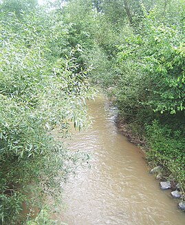
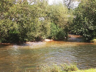
The Steinenbach is a right tributary of the meadow , whose catchment area includes in particular the municipality of Steinen . The upper course is called Höllbach and the middle course is known locally as Klosterbach . It is only in the last section that the name Steinenbach is used colloquially . The brook is routed in the official digital water management network (AWGN) .
In local parlance, it is assumed that only the lower reaches of the Steinenbach is, which has two source brooks - the Klosterbach and the Weitenauerbach (Schwammerich). Two source streams are also assigned to the Klosterbach - the Höllbach and the Aubächle.
geography
course
The Steinenbach rises as Höllbach at the foot of the Wambacher Wasen and the Schlöttleberg at an altitude of 835 meters. It flows in a southerly direction to Schlächtenhaus , where it takes its way through the wild and romantic Höllschlucht at the town hall in Endenburg (approx. 650 m) and overcomes a height difference of approx. 250 meters to Schlächtenhaus (approx. 394 m). After Schlächtenhaus, the stream flows with a significantly lower gradient than Klosterbach further south towards Steinen, where it passes the former Weitenau monastery about halfway . About a kilometer before Steinen - at the Häfnetbuck - it takes up the most important tributary coming from Weitenau , the Schwammerich (also: Weitenauerbach, Schwemmerich) and now flows as Steinenbach still southwards to Steinen. At the entrance to the village, the stream turns to the southwest. After about 2.5 kilometers it takes its second most important tributary, the Heilisaubach . After about another kilometer, after a total of about 14 km, it flows into the meadow in the Lörrach district of Hauingen (approx. 310 m) from the right and north, after having crossed the federal highway 317 shortly before .
Catchment area
The water catchment area of the Steinenbach covers approx. 46 square kilometers. Almost the entire area of the municipality of Steinen lying to the right of the meadow and almost half of the suburb of Hauingen von Lörrach belong to it .
Tributaries
The following streams flow from the source to the mouth of the Steinenbach (each with inflow side, GWKZ , length and possibly catchment area :); only occasionally with higher-order inflows:
- (l) Schlöttlebach (Ruschengraben) ( GKZ 2328112; 0.9 km)
- (l) Schluchtebach (GKZ 2328114; 1.1 km)
- (l) Saulochgraben (GKZ 232812; 2.6 km and 2.1 km²)
- (l) Schneckenmattgraben (GKZ 2328132; 1.3 km)
- (r) Aubächle (GKZ 232814; 3.9 km and 4.7 km²)
- (l) Talmattbach (GKZ 2328152; 0.8 km)
- (r) Hörnetbächle (GKZ 2328154; 1.5 km)
- (l) Little Danube (GKZ 2328156; 1.7 km)
- (l) Rotenbach (GKZ 232816; 1.2 km and 0.7 km²)
- (l) Krebsbach (GKZ 2328192; 1.3 km)
- (r) Schüpflinsgraben (GKZ 2328194; 0.5 km)
- (l) Schwammerich or Weitenauerbach (GKZ 23282; 7.9 km and 11.7 km²)
- (r) Füllenbach (GKZ 232828; 2.0 km)
- (l) Moosmattbach (Neugraben) (GKZ 232832; 2.2 km)
- (r) Lochmattbach (GKZ 232834; 1.3 km)
- (r) Neumattgraben (GKZ 232836; 1.9 km)
- (r) Heilisaubach (GKZ 23284; 6.0 km and 9.0 km²)
- (r) Stegenbach (GKZ 232842; 2.8 km)
- (l) Fahrenbach (GKZ 232844; 2.1 km)
Flood and protective measures
The floods of the Steinenbach have repeatedly caused considerable damage over the centuries. Reports were made of a severe flood in 1758. The implementation of the measures planned at that time was delayed due to disputes with the municipality of Hägelberg and had to be interrupted in the 1790s due to the turmoil of the war . In 1824, the plans for the correction of the Steinenbach under Vogt Johann Michael Scheffelt were resumed and implemented in the years 1827–1832. However, after a flood in 1845 and again in 1857, improvements had to be made. Further water protection measures planned for 1913 were not started because of the looming war. Another severe flood hit Steinen in the winter of 1919/1920.
literature
- Ernst Friedrich Bühler: Our Steinenbach . In: Ernst Friedrich Bühler: stones. Chronicle of a village. Published by the community of Steinen, Gebrüder Weber printer, 1982, Lörrach, pp. 494–496 and work on Steinenbach and an der Wiese , ibid pp. 243–244
Web links
-
Geoportal Baden-Württemberg ( information ), especially with the partial maps / layers
- the State Institute for the Environment, Measurements and Nature Conservation Baden-Württemberg (LUBW)
- "LUBW-FG10": River 1: 10,000
- "LUBW-GEZG": water catchment areas
- the State Institute for the Environment, Measurements and Nature Conservation Baden-Württemberg (LUBW)
Individual evidence
- ↑ Geodata Viewer; Derived from altitude information near the source ( memento of the original from May 7, 2016 in the Internet Archive ) Info: The archive link was automatically inserted and not yet checked. Please check the original and archive link according to the instructions and then remove this notice.
- ↑ Geodata Viewer; Derived from the height of the district of Hauingen ( Memento of the original from May 7, 2016 in the Internet Archive ) Info: The archive link was automatically inserted and not yet checked. Please check the original and archive link according to the instructions and then remove this notice.
- ↑ According to LUBW water network (AWGN)
- ↑ According to LUBW water catchment areas - aggregated areas 04 (AWGN)
- ↑ s. Buhler
- ↑ To the Hell Gorge. Southern Black Forest: scenic hike
- ↑ State Institute for the Environment Baden-Württemberg (LUBW) ( information )
- ↑ Actually only the name of the right upper course, GKZ 23281922
- ↑ s. Buhler
Remarks
- ↑ l = left-hand inflow; r = right-hand inflow, viewed in the direction of flow

