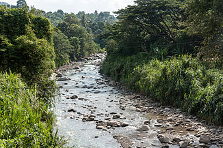
Sungai Liwagu
| Liwagu | ||
|
Sungai Liwagu in Ranau |
||
| Data | ||
| location | Sabah , Borneo , Malaysia | |
| River system | Labuk | |
| Drain over | Labuk → Sulu Lake | |
| source | on the southern slopes of Mount Kinabalu | |
| muzzle |
Sungai Labuk Coordinates: 5 ° 43 '3 " N , 116 ° 51' 9" E 5 ° 43 '3 " N , 116 ° 51' 9" E
|
|
| Catchment area | 2000 km² | |
The Liwagu ( Mal. Sungai Liwagu ) or Liwagu River is a tributary of the Labuk in the Malaysian state of Sabah on Borneo . It rises on the southern slopes of Mount Kinabalu and flows into the Labuk at Kampung Balisok (Ranau district). The catchment area of the Liwagu and its tributaries covers an area of 2000 km².
Flora and fauna
The Liwagu River Trail within Kinabalu National Park is considered an outstanding area for bird watching. The bird species that live here include: Black breast fruit pickers ( Chlamydochaera jefferyi ), Chlorocharis emiliae emiliae , Eumyias indigo cerviniventris , Harpactes whiteheadi , Megalaima pulcherrima , Napothera crassa Luzon and Zosterops atricapilla .
Web links
Commons : Sungai Liwagu - Collection of Images
Individual evidence
- ↑ a b Office for Irrigation and Drainage, Sabah: GAUGING AND SUSPENDED SEDIMENT STATIONS INVENTORY ( Memento of the original from January 26, 2009 in the Internet Archive ) Info: The archive link was inserted automatically and has not yet been checked. Please check the original and archive link according to the instructions and then remove this notice. ; Accessed January 28, 2012
- ↑ Universiti Kebangsaan Malaysia: "Environmental impact assessment of Liwagu Hydro power project" Sub-study No. 3: Ecology, pp. 5-13, 1989
