Tanvald
| Tanvald | ||||
|---|---|---|---|---|
|
||||
| Basic data | ||||
| State : |
|
|||
| Region : | Liberecký kraj | |||
| District : | Jablonec nad Nisou | |||
| Area : | 1244.7281 ha | |||
| Geographic location : | 50 ° 44 ′ N , 15 ° 19 ′ E | |||
| Height: | 455 m nm | |||
| Residents : | 6,252 (Jan 1, 2019) | |||
| Postal code : | 468 41 | |||
| License plate : | L. | |||
| traffic | ||||
| Railway connection: |
Liberec – Tanvald Tanvald – Harrachov Železný Brod – Tanvald |
|||
| structure | ||||
| Status: | city | |||
| Districts: | 3 | |||
| administration | ||||
| Mayor : | Petr Polák (as of 2007) | |||
| Address: | Palackého 359 468 41 Tanvald |
|||
| Municipality number: | 563820 | |||
| Website : | www.tanvald.cz | |||
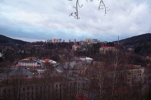
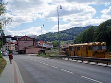
Tanvald (German Tannwald ) is a town in the Okres Jablonec nad Nisou in the Czech Republic .
Geographical location

The city is located in northern Bohemia at 466 m above sea level. M. in the Jizera Mountains on the Kamnitz (tributary of the Jizera), which takes in the Desse here . The European route 65 and the Silnice I / 14 trunk road (until the end of 2015 Rychlostní silnice 14 ) run through Tanvald .
The small town of Desná ( Dessendorf ) lies north of Tanvald , Velké Hamry ( Großhammer ) to the south and Smržovka ( Morchenstern ) to the west . The winter sports center Harrachov ( Harrachsdorf ) is located about 15 kilometers northeast of Tanvald.
history
The place emerged in the 16th century from a woodcutter colony, the first written mention of which comes from the year 1586. From 1628 Tannwald belonged to the manorial Morchenstern (Smržovka) of the counts Desfours on Castle United Rohosetz . The branch church St. Peter and Paul was built and endowed in 1788 by the former judge Friedrich at his own expense.
The first glass grinding shop was built at the end of the 18th century, and the textile and mechanical engineering industries were added in the first half of the 19th century. In 1850 after the abolition of patrimonial , Tannwald became the administrative seat of the Tannwald judicial district .
In 1868 the Náchod textile industrialist Isaak Mautner founded a mechanical weaving mill in what is now the Šumburk (Schumburg) district , in which 550 mechanical looms and around 23,500 spindles were in use around 1880 . In 1894 Tannwald received a rail connection through the Reichenberg-Gablonz-Tannwalder Railway . In 1886 Tannwald had 2726 inhabitants. In 1905 the municipality of Tannwald was elevated to a town. The rupture of the dam on the White Desse on July 29, 1916 also caused severe damage in Tannwald.
After the First World War , Tannwald was annexed to the newly created Czechoslovakia in 1919 . Due to the Munich Agreement , Tannwald belonged from 1938 to 1945 to the district of Gablonz an der Neisse , district of Aussig , in the Reichsgau Sudetenland of the German Empire . In 1942 the cities of Tannwald and Schumburg an der Desse were merged to form the city of Tannwald (Jizera Mountains) . After the end of the Second World War , the German-speaking population was largely expropriated and expelled .
Demographics
Until 1945 Tannwald was mostly populated by German Bohemia , which were expelled.
| year | Residents | Remarks |
|---|---|---|
| 1830 | 995 | in 157 houses |
| 1900 | 3592 | German residents |
| 1930 | 4423 | |
| 1939 | 3519 |
| year | 1970 | 1980 | 1991 | 2001 | 2003 |
|---|---|---|---|---|---|
| Residents | 6 168 | 7 592 | 7 055 | 7 001 | 6 921 |
City structure
The city of Tanvald consists of the districts Šumburk nad Desnou (Schumburg an der Desse) , Tanvald (Tannwald) and Žďár (Brand) . Basic settlement units are Český Šumburk (Böhmisch Schumburg) , Horní Tanvald (Obertannwald) , Malý Špičák, Popelnice (Popelnitz) , Průmyslový obvod, Světlá (Swetla 2nd part) , Špičák, Šumburk, Šumburk-střed and Tanvaldý střina
The municipality is divided into the cadastral districts of Šumburk nad Desnou and Tanvald.
Attractions
- Church of St. Francis of Assisi in the Šumburk district. It was built in 1900.
- Tanvaldský Špičák (Tannwalder Spitzberg) , the center of the ski run in the Jizera Mountains with a stone lookout tower.
- Terezínka (Theresienhöhe) rock view , opened to the public in 1853.
sons and daughters of the town
- Otto Josef von Berndt (1865–1957), Austrian kuk field marshal lieutenant and cavalry officer
- Arnold Hartig (1878–1972), sculptor and medals
- Wilhelm Dreßler (1893-19 ??), politician (NSDAP)
- Adalbert Hartmann (1895–1949), lawyer and politician
- Helmut Borufka (1918–2003), General of the National People's Army
Recreational facilities
Stadium for athletics, grass football field, sports hall and gymnasium, multi-purpose sports field with artificial turf. Tennis court, forest pool, miniature golf. Ski center Tanvaldský Špičák (Spitzberg), ski slopes, ski school, ski rental. Magistral of the Jizera Mountains for cross-country skiing. Concerts, theater.
Twin cities
- Burbach (North Rhine-Westphalia)
- Marcinowice (Poland)
- Wittichenau (Saxony)
literature
- Erich Huyer: Tannwald - my hometown. Königsbrunn: Self-published Augsburg 1951.
Web links
- Tanvald on tschechische-gebirge.de
Individual evidence
- ↑ http://www.uir.cz/obec/563820/Tanvald
- ↑ Český statistický úřad - The population of the Czech municipalities as of January 1, 2019 (PDF; 7.4 MiB)
- ^ A b Johann Gottfried Sommer : The Kingdom of Bohemia . Volume 2: Bunzlauer Kreis , Prague 1834, p. 325, item 5).
- ^ Meyer's Large Conversational Lexicon . 6th edition, Volume 19, Leipzig and Vienna 1909, p. 313.
- ^ A b Michael Rademacher: German administrative history from the unification of the empire in 1871 to the reunification in 1990. Gablonz district on the Neisse. (Online material for the dissertation, Osnabrück 2006).
- ↑ Czech population statistics
- ↑ http://www.uir.cz/casti-obce-obec/563820/Obec-Tanvald
- ↑ http://www.uir.cz/zsj-obec/563820/Obec-Tanvald
- ↑ http://www.uir.cz/katastralni-uzemi-obec/563820/Obec-Tanvald


