Terai
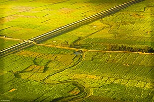
Terai or Teraï ( nepali तराई, tarāī) means wet land and denotes the fertile lowlands that extend south of the Himalayas in India , Nepal and Bhutan from Yamuna in the west to Brahmaputra in the east. Between the Terai and the actual High Himalayas lie Bhabhar , Siwaliks and the Upper Himalayas .
The Terai is combined with the Duars (Bengali: ডুয়ার্স ) of the eastern part to form a common WWF ecoregion , the 'Terai-Duars Savannah and Grassland'.
Terai in Nepal
The 25–100 km wide, a few hundred meters above sea level lying low plain stretches along the approximately 800 km long border with India. The Terai with its tropical to subtropical monsoon climate is the warmest and wettest part of the country, which makes up 17% of the land area of Nepal; 47% of the population live here. About 18% of the area of Nepal is used for agriculture, of which more than half (53%) is in the Terai region.
history

For a long time, large parts of the Terai overgrown with monsoon forest and elephant grass were barely populated. The Tharu , who probably came from the West Indies, probably settled here as early as the 16th century. Due to the extreme risk of malaria , however, hardly any other settlers dared to come here except for the Tharus. It was not until the 1950s that the Nepalese government started a large-scale program to combat malaria . At the same time, the economic situation in the mountains deteriorated drastically, so that many impoverished farmers have relocated to the Terai. The population of the Terai grew rapidly; In order to create new settlement areas, large parts of the forests were cleared using DDT . While the total annual population growth in Nepal is 2.6%, in the Terai, due also to the influx of Indian immigrants, the growth rate is 4%; in the mountain regions it is only 1.2%.

Significant sites
Lumbini , located in the Rupandehi district in Nepal, is the birthplace of Siddharta Gautamas , the later Buddha . Here you can still find sculptures, remains of the Ashoka column and ruins of an old monastery. Lumbini was declared a World Heritage Site in 1997 . Only about 10 km away is the place Devadaha , where Maya , the mother of the enlightened one, and her sister Mahapajapati Gotami , his foster mother, were born.

Chitwan National Park
The 932 km² Chitwan National Park was declared Nepal's first national park in 1973 . Countless animal species live in the jungle area , which is mainly overgrown with sage trees , including those threatened with extinction such as the Indian rhinoceros , the Bengal tiger and the gavial . The protection program developed with the help of the Frankfurt Zoological Society contributed to the recovery of endangered populations, so that animals from the Terai have now been relocated to other Nepalese national parks. The park's Indian rhinoceros population is the second largest in the world. The Chitwan National Park has been a World Heritage Site since 1984 .
fauna
In addition to the endangered Indian rhinoceros , Bengal tigers , elephants and dolphins , the fauna of the Terai includes many mammals such as leopards , deer , jackals , bears , martens , various monkeys as well as amphibians and reptiles such as snakes and gavials , around 500 species of birds and over 100 species of fish countless species of insects and butterflies.
literature
- Arjun Guneratne (Ed.): The Tarai: History, Society, Environment. Himal Books, Kathmandu 2011, ISBN 9789937842167
Web links
- Asia: Bhutan, India, and Nepal . Terai-Duar savanna and grasslands (IM0701) . WWF
- Terai and Chitwan. travallo.de
