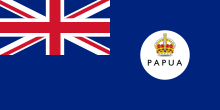
Papua Territory

The territory of Papua (also: Papuaterritorium , English Territory of Papua ) was de facto an Australian colonial possession in the southeast of the island of New Guinea , which existed from 1902 to 1949. The area was previously served as British New Guinea from London managed and remained de jure a British possession until Papua New Guinea became independent 1975th The territory covered by the provinces of Southern Highlands , Western , Gulf and Central and Oro and Milne Bay about half of the current territory of Papua New Guinea.
history
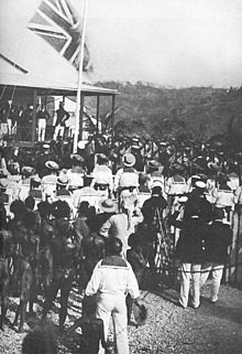
In 1883 Thomas McIlwraith, the Prime Minister of Queensland , commissioned the police judge on Thursday Island , Henry Chester, to take possession of the eastern part of New Guinea and the neighboring islands on behalf of the British government in the newly established settlement of Port Moresby . Chester hoisted the British flag on April 4, 1883, but the British government did not recognize the action.
After the Australian colonies had pledged financial support the following year, the area was declared a British Protectorate on November 6, 1884 .
On September 4, 1888, the south-eastern part of the island of New Guinea was annexed by Great Britain as British New Guinea along with some offshore, eastern islands.
The northeastern part of today's Papua New Guinea, the former Kaiser-Wilhelms-Land , was part of the German colony of German New Guinea . Since 1884 the economic sphere of influence of German trading companies, including the New Guinea Company , it became a German colony in 1885 and belonged to German New Guinea from 1899 to 1914.
In 1902 Papua was placed under the control of the new British Dominion Australia . With the passage of the Papua Act in 1905, the area was officially named The Territory of Papua . Formal administration of Papua was transferred to Australia in 1906, but the territory of Papua remained de jure a British colony until Papuan -New Guinea independence in 1975.
Immediately after the start of the Pacific War in 1941, the island of New Guinea was occupied by Japanese troops. Most of Western New Guinea , then also known as Dutch New Guinea , was occupied, as was large parts of the territory of New Guinea , the former German New Guinea, which was also under Australian administration after the First World War . Because of its location in the south of the island and protected by the almost impassable Owen Stanley Mountains in the north, the Japanese troops did not reach Papua until July 1942. The Japanese army was supposed to advance to Port Moresby via the Kokoda Track . However, the Japanese advance came to a halt at Ioribaiwa within sight of Port Moresby.
After the war, the Papua and New Guinea Territory and Mandate New Guinea were united by the Papua and New Guinea Act of 1949 to form the Territory of Papua and New Guinea . In 1975 Papua New Guinea gained independence.
administration
- Governors
- 1895-1897 William MacGregor
- 1898–1903 George Le Hunte
- 1903-1904 Christopher Stansfield Robinson
- 1904-1907 Francis Rickman Barton
- 1908–1940 Hubert Murray
- 1940–1942 Hubert Leonard Murray
- Military administration
The civil administration was replaced by a military administration for the duration of the war in 1942.
- 1942-1946 Basil Moorhouse Morris
- Administrator
(after the restoration of civil administration in 1945)
- 1945–1952 Jack Keith Murray

