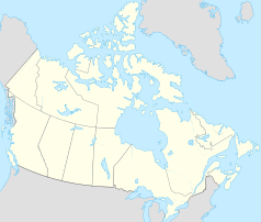
Teslin (Yukon)
| Teslin | ||
|---|---|---|
 |
||
| Location in Yukon | ||
|
|
||
| State : |
|
|
| Territory : | Yukon | |
| Coordinates : | 60 ° 10 ′ N , 132 ° 44 ′ W | |
| Height : | 705 m | |
| Area : | 1.92 km² | |
| Residents : | 124 (as of 2016) | |
| Population density : | 64.6 inhabitants / km² | |
| Time zone : | Pacific Time ( UTC − 8 ) | |
| Postal code : | Y0A 1B0 | |
| Area code : | +1 867 | |
Teslin is a Canadian municipality in the Yukon Territory and is located on 144 km long Teslin Lake , which is traversed by the Teslin River , a tributary of the Yukon . Teslin is one of only eight official communities in the territory and has the legal status of a village ( English Village ).
history
Until the end of the 19th century, Teslin was a summer camp of the Tlingit , in whose language the word referred to a long, narrow watercourse. A first permanent settlement emerged during the Klondike gold rush in 1898; the Hudson's Bay Company set up a trading post there in 1903.
At Mile 804 on the Alaska Highway is the George Johnston Museum , whose name is reminiscent of the photographer George Johnston , a Tlingit whose photos from the early 20th century are on display there. There are also artifacts from the Tlingit culture.
In 1923, the Northwest Territories and Yukon Radio System was established to improve communications in Whitehorse . In 1941 the first Aeradio Navigation Range station followed in Teslin, more precisely on Teslin Hill at the local airfield. The equipment was transported there over the Teslin River before the Alaska Highway was built . These stations were initially used for aircraft navigation in support of the Soviet Union ; a total of 8,100 aircraft based on their signals. The opening ceremony was attended by Peter Johnston, Chief of the Teslin Tlingit Tribal Council , as well as Clara Jules, Mayor of Teslin, Lieutenant-Colonel Laniel of the Canadian Air Force , Ministers Marian Horne and Elaine Taylor and other notables. Teslin was a local First Nation parish at the time with only five non-Native American residents. The news was morsed. Similar stations were in Beaton River , Swift River , Aishihik and Snag . Today this radio station resides in the local George Johnston Museum . The radio system existed until 1955.
climate
The climate in Teslin is cold- temperate ( Dfc according to the Köppen and Geiger climate classification ). The average temperature in July is 14.1 ° C and in January -17.1 ° C and the annual average is -0.6 ° C. The lowest temperature was measured on January 30, 1947 at −52.8 ° C.
Demographics
The last official census , the 2016 Census , showed a population of 124 inhabitants for the settlement, after the 2011 census still showed a population of 122 inhabitants for the municipality. The population increased by 1.6% compared to the last census in 2011 and developed significantly less than the average for the territory, there with a population increase of 5.8%. In the census period from 2006 to 2011, the number of inhabitants in the municipality had already decreased by 13.5%, while it increased by 11.6% on average for the territory.
At the 2016 census, the average age of the residents was 39.8 years, above the territory's average of 39.1 years. The median age of the residents was determined to be 41.3 years. The median age of all residents of the territory was 39.5 years in 2016. For the 2011 census, a median age of 31.8 years was determined for the inhabitants of the municipality and 39.1 years for the inhabitants of the territory.
traffic
The community is connected via the Alaska Highway (also Yukon Highway 1) with Whitehorse in the northwest and Watson Lake in the east. The local airport is located about 3 kilometers northwest of the municipality ( IATA airport code : YZW, ICAO code : CYZW, Transport Canada Identifier: -). The airfield, like many of the airfields in northern Canada, only has a gravel runway of 1,522 meters in length.
tourism
The bridge " Johnsons Crossing " in front of Teslin is the starting point for river travelers who paddle over the Teslin River and the Yukon Stream to Dawson (about 780 km).
Web links
Individual evidence
- ↑ a b Teslin Community Profile. Census 2016. In: Statistics Canada . August 9, 2019, accessed September 20, 2019 .
- ↑ Exhibit opening commemorates dots and dashes , in: Yukon News, July 8, 2011.
- ↑ 1981 to 2010 Canadian Climate Normals station data. Environment and Climate Change Canada , June 11, 2019, accessed September 20, 2019 .
- ^ Teslin Community Profile. Census 2011. In: Statistics Canada . May 31, 2016, accessed September 20, 2019 .
- ↑ Canadian Airports Charts. (PDF; 76.9 MB) NAV CANADA , accessed on September 20, 2019 (English).
