Tsugaru Peninsula
| Tsugaru Peninsula | ||
 Landsat image of the Tsugaru Peninsula |
||
| Geographical location | ||
|
|
||
| Coordinates | 40 ° 57 ′ 0 ″ N , 140 ° 29 ′ 0 ″ E | |
| Waters 1 | Sea of Japan , Tsugaru Strait | |
| Waters 2 | Aomori Bay , Mutsu Bay | |
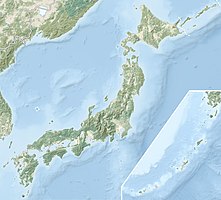
The Tsugaru Peninsula ( Japanese 津 軽 半島 , Tsugaru-hantō ) is a peninsula in Aomori Prefecture at the northern end of the island of Honshū in Japan .
The peninsula juts north into Tsugaru Strait , which separates Honshū from Hokkaidō . The west coast is on the Sea of Japan , on the east coast are Aomori Bay and Mutsu Bay . On the other side of Tsugaru Strait is the Matsumae Peninsula , to which it is connected at the narrowest point of the road with the Seikan Tunnel . The northernmost part of the peninsula is Cape Tappi .
