
Uftrungen
|
Uftrungen
South Harz municipality
Coordinates: 51 ° 29 ′ 56 " N , 10 ° 58 ′ 47" E
|
|
|---|---|
| Height : | 191 m above sea level NHN |
| Area : | 29.65 km² |
| Residents : | 1070 (December 31, 2008) |
| Population density : | 36 inhabitants / km² |
| Incorporation : | January 1, 2010 |
| Postal code : | 06536 |
| Area code : | 034653 |
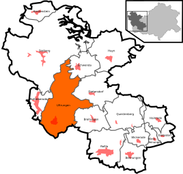  Location of river valleys in the southern Harz
|
|
.JPG)
Uftrungen is a district of the municipality of Südharz in the district of Mansfeld-Südharz , Saxony-Anhalt , Germany.
Geographical location
Uftrungen is located in the southern Harz on state road 236 between Stolberg (Harz) and Berga . The hazel flows through the village . It flows into the Thyra to the southwest of the Uftrungen . Not far from there is the Heimkehle gypsum cave , first mentioned in 1357 , which is a popular destination.
history
Uftrungen was first mentioned in a document between the years 802 to 817.
Uftrungen was once subordinate to the Counts of Stolberg . In November 1437 the people of Halberstadt near Uftrungen suffered a military defeat in one of the numerous feuds of this century.
On July 6, 1719, the village was ceded by Count Christoph Friedrich zu Stolberg-Stolberg to his brother Jost Christian zu Stolberg-Roßla , who set up an official residence for the County of Stolberg-Roßla here. Until 1815 Uftrungen was under the sovereignty of the Kingdom of Saxony and then came to the administrative district of Merseburg of the Prussian province of Saxony . In 1819 903 inhabitants lived in 182 houses in Uftrungen.
During the Second World War , around 1,500 concentration camp inmates from the Rottleberode subcamp of the Dora-Mittelbau concentration camp toiled in the Heimkehle karst cave producing armaments for the Junkers factories in Dessau . After their evacuation in April 1945, 1,000 of them perished in the massacre in the Isenschnibbe barn , and another 300 in a subsequent death march .
From 1952 to 1990 Uftrungen belonged to East Germany - Halle Region .
During the GDR era, VEB Bau-Union Halle built and maintained the " Katja Niederkirchner " company holiday camp for the children of its employees.
On January 1, 2010, the communities of Uftrungen, Bennungen , Breitenstein , Breitungen , Dietersdorf , Drebsdorf , Hainrode , Hayn (Harz) , Kleinleinungen , Questenberg , Roßla , Rottleberode and Schwenda merged to form the new community of Südharz. At the same time, the Roßla-Südharz administrative community , to which Uftrungen belonged, was dissolved.
Memorials
- Monumental picture by the artist Wilhelm Schmied from 1971 in the Heimkehle in memory of the victims of forced labor
traffic
The location is on the Berga-Kelbra – Stolberg (Harz) railway line, which was closed in 2012 . There are also bus connections to the surrounding towns.
Attractions
- Home throat
- St. Andrew's Church ; Baroque hall , which was built from 1732 to 1734.
- Bernecke desert
Web links
Individual evidence
- ^ Wolfgang Kahl : First mention of Thuringian towns and villages. A manual. Rockstuhl Verlag, Bad Langensalza, 2010, ISBN 978-3-86777-202-0 , p. 386.
- ↑ StBA: Area changes from January 01 to December 31, 2010
|
.JPG)

.JPG)