
Westmount
| Westmount | |||
|---|---|---|---|
 View from Westmount |
|||
| Location in Quebec | |||
|
|||
| State : |
|
||
| Province : | Quebec | ||
| Administrative region : | Montreal | ||
| Coordinates : | 45 ° 29 ′ N , 73 ° 36 ′ W | ||
| Height : | 49 m | ||
| Area : | 4.02 km² | ||
| Residents : | 19,931 (as of 2011) | ||
| Population density : | 4,958 inhabitants / km² | ||
| Time zone : | Eastern Time ( UTC − 5 ) | ||
| Postal code : | H3Y, H3Z | ||
| Area code : | +1 514 | ||
| Mayor : | Peter Trent | ||
| Website : | www.westmount.org | ||
 Location of Westmount in the Montreal agglomeration |
|||

Westmount is a city in the southwest of the Canadian province of Québec . It is located on the Île de Montréal and forms an enclave in the urban area of Montreal . The municipality has an area of 4.02 km² and has 19,931 inhabitants (2011).
geography
Westmount is located in the central part of the Île de Montréal, slightly elevated around the 201 meter high Westmount Summit, the southernmost of the three peaks of Mont Royal . The municipality is completely enclosed by the area of the city of Montreal, namely by the boroughs of Ville-Marie in the northeast, Le Sud-Ouest in the southeast and Côte-des-Neiges-Notre-Dame-de-Grâce in the west. Downtown Montreal is about three kilometers away.
history
In 1898 excavations on the southern slope of Westmount Summit unearthed an Algonquian burial ground dating from before the 15th century. In 1684 the Séminaire de Saint-Sulpice built a mission station to shield the natives under their care from the influence of dissolute traders in Montreal. The settlement of the hill (which was then called Petit Montagne and Côte Saint-Antoine ) by farmers began in the mid-17th century.
After the British conquest of Québec in 1760, little changed in the agricultural character of the area. In the 19th century, Montreal businessmen began buying up the farms and converting them into mansions. In 1874 the municipality of Côte-Saint-Antoine was founded. The opening of a tram line in 1894 resulted in a significant growth spurt and the community developed into the preferred place of residence for wealthy Anglophones. In 1895 the parish was renamed Westmount, and in 1908 it was given town status.
In the early 20th century, the architect Robert Findlay built numerous public buildings that characterize the cityscape today. Opened in 1898 and demolished in 1918, the Montreal Arena was the second hall in Canada specially designed for ice hockey games ; in it played the Montreal Wanderers and the Montreal Canadiens . Westmount has long been considered an enclave of the wealthy British elite (mostly of Scottish origin), which stood out from the largely francophone city of Montreal. For this reason, the city was the preferred target of bombings by the Front de liberation du Québec (destroyed in 1970 during the October crisis ).
On January 1, 2002, 27 parishes on the island were merged with Montreal. Resistance arose especially in communities with a high proportion of English speakers, as this measure had been ordered by the provincial government of the separatist Parti Québécois . From 2003, the Parti libéral du Québec provided the government and promised to reverse the merger of the municipalities. On July 20, 2004, referendums were held in 22 former municipalities. In Westmount, 92.1% of voters were in favor of the separation. The community was re-established on January 1, 2006, but had to cede numerous competencies to the community association.
Attractions
Westmount has two National Historic Sites ; on the one hand the historic city center with numerous buildings from the turn of the century, on the other hand the Saint-Léon de Westmount church, built in 1901 . The oldest preserved building is the Maison Hurtubise, a farmhouse from 1739. The townscape is also characterized by the castle-like town hall in the style of the Tudor revival , the Victoria Hall, the Dawson College (largest CEGEP in the province) and that of Ludwig Mies van der Rohe designed high-rise district Westmount Square in an international style . The hilltop of Westmount Summit is located in a park.
population
According to the 2011 census, Westmount had 19,931 inhabitants, which corresponds to a population density of 4958 inh / km². 54.9% of the population stated English as their main language, while French accounted for 20.0%. 2.0% said they were bilingual (French and English), other languages and multiple answers accounted for 21.1%. The most important non-official major languages were Arabic (2.8%) and Spanish (2.7%). Only English spoke 20.1%, only French 2.4%. In 2001, 31.0% of the population were Roman Catholic , 23.2% Jewish , 21.5% Protestant , 3.7% Orthodox , 2.7% Muslim and 14.9% non-denominational.
traffic
Due to the hillside location, the main traffic arteries run in a north-east-south-west direction. These are The Boulevard, Rue Sherbrooke , Boulevard De Maisonneuve and Rue Sainte-Catherine . Since 1966 Westmount has been connected to the Montreal Metro with the Atwater station (located on the northeastern outskirts) . In addition, several bus routes operated by the Société de transport de Montréal open up the urban area.
Personalities
- Eugenie Bouchard (* 1994), tennis player
- Leonard Cohen (1934-2016), singer-songwriter and writer
- Charles Drury (1912–1991), general and politician
- Kenneth Farmer (1912-2005), ice hockey player
- Don Getty (1933-2016), politician
- Edgar William Richard Steacie (1900–1962), chemist
photos

Dawson College

Westmount Town Hall

Saint-Léon church

Maison hurtubise

Victoria Hall
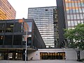
Westmount Square


Web links
- Westmount Official Website (French, English)
Individual evidence
- ↑ La période amér Indienne. (No longer available online.) City of Westmount, archived from the original on January 6, 2014 ; Retrieved January 6, 2013 (French). Info: The archive link was inserted automatically and has not yet been checked. Please check the original and archive link according to the instructions and then remove this notice.
- ↑ L'arrivée des Français. (No longer available online.) City of Westmount, archived from the original on January 6, 2014 ; Retrieved January 6, 2013 (French). Info: The archive link was inserted automatically and has not yet been checked. Please check the original and archive link according to the instructions and then remove this notice.
- ^ Sous le règne britannique. (No longer available online.) City of Westmount, archived from the original on January 6, 2014 ; Retrieved January 6, 2013 (French). Info: The archive link was inserted automatically and has not yet been checked. Please check the original and archive link according to the instructions and then remove this notice.
- ↑ Westmount. Commission de toponymie Québec, accessed August 16, 2011 (French).
- ↑ Référendums du 20 juin 2004. Directeur général des élections du Québec, accessed on August 17, 2011 (French).
- ↑ Westmount Parish Population Profile. In: 2011 Census. Statistics Canada , 2011, accessed January 6, 2014 (French).
- ↑ Westmount Parish Population Profile. In: 2001 Census. Statistics Canada , 2001, accessed January 6, 2014 (French).