Yukon-Charley Rivers National Preserve
| Yukon-Charley Rivers National Preserve | ||
|---|---|---|
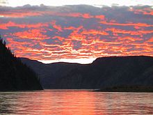
| Estuary of the Charley River into the Yukon | ||
|
|
||
| Location: | Alaska , United States | |
| Next city: | Fairbanks | |
| Surface: | 10,220 km² | |
| Founding: | December 1, 1978 | |
| Visitors: | 12,784 (2005) | |
| Map of the Yukon-Charley Rivers National Preserve | ||
The Yukon-Charley Rivers National Preserve is a nature reserve under the administration of the National Park Service in east-central Alaska on the border with the Canadian Yukon Territory . It includes 185 km of the Yukon River and the catchment area of Charley Rivers .

In contrast to the Yukon, which flows through the lowlands, the Charley River flows through higher regions with tundra and boreal coniferous forests . The preserve, within the boundaries of which there are no roads, can be reached via Circle downstream at the end of the Steese Highway or Eagle on the border with Canada at the end of the Taylor Highway . The park administration is also located in Eagle.
Many relics from the time of the gold rush on the Klondike River at the end of the 19th century, to which many prospectors came via the Yukon, are located in the region of the reserve, as are paleontological and archaeological sites.
The reserve was established as a National Monument on December 1, 1978 . On December 2, 1980, the Alaska National Interest Lands Conservation Act changed its status to that of a National Preserve .
Web links
- National Park Service: Yukon-Charley Rivers National Preserve (official site; English)
- Cultural Resources of Yukon-Charley National Preserve ( September 9, 2012 memento in the Internet Archive )
- Map of the Yukon-Charley Rivers National Preserves


