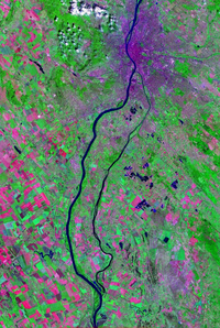
Csepel Island

Csepel Island (Hungarian: Csepel-sziget, Hungarian pronunciation: [ˈtʃɛpɛl]) is an island on the Danube in Hungary. It is 48 km (30 mi) long; its width after 3 km (2 mi) sections of bifurcation and rejoining (confluence) varies from 6 to 8 km (4 to 5 mi). It has an area of 257 km2 (99 sq mi) and its population is 165,000.[1]
The isle extends south from Budapest; its northern point or section is Csepel – Budapest's District XXI. Most of the island is accessible from Budapest by the suburban railway. Towns include Ráckeve, Szigetszentmiklós, Szigethalom and Tököl.
Csepel island was the first centre of the Hungarian conquest of the Carpathian Basin (Hungarian: honfoglalás: "conquest of the homeland"), being the early homestead of Árpád's tribe. The island is named after Árpád's horse groom, Csepel.
It features Hungary's tallest structure, Lakihegy Tower, a 314-metre (1,030 ft) radio mast used today intermittently for power network control purposes.[2][3]
References[edit]
External links[edit]
 Media related to Csepel at Wikimedia Commons

