
Mariaheide
Mariaheide | |
|---|---|
_church.JPG) Our Lady of Good Counsel Church in Mariaheide | |
 Mariaheide Location in the province of North Brabant in the Netherlands  Mariaheide Mariaheide (Netherlands) | |
| Coordinates: 51°38′02″N 5°34′49″E / 51.63389°N 5.58028°E | |
| Country | Netherlands |
| Province | North Brabant |
| Municipality | Meierijstad |
| Area | |
| • Total | 4.18 km2 (1.61 sq mi) |
| Elevation | 9 m (30 ft) |
| Population (2021)[1] | |
| • Total | 1,650 |
| • Density | 390/km2 (1,000/sq mi) |
| Time zone | UTC+1 (CET) |
| • Summer (DST) | UTC+2 (CEST) |
| Postal code | 5464[1] |
| Dialing code | 0413 |
| Major roads | A50, N265 |
Mariaheide is a village in the south of the Netherlands. It is situated in the municipality of Meierijstad, North Brabant.
History[edit]
Mariaheide was founded as a linear settlement along the road from Veghel to Uden. Real population growth never got off the ground though, and in 1907 Mariaheide still only consisted of several farms on cultivated former heathland. However that year, Mariaheide split off from the St. Lambert Parish in Veghel, to form a new and separate parish, the Our Lady of Good Counsel Parish, and got its own church. In 1912, the Franciscan Sisters of the Immaculate Conception of the Holy Mother of God from Veghel, founded the St. Nicholas Monastery in Mariaheide.
Gallery[edit]
-
 Church and monastery
 -
 St. Nicholas Monastery
 -
 Our Lady of Good Counsel School
 -
 Monumental warehouse
 -
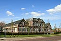
 Farmhouse


,_farmhouse.JPG)
References[edit]
- ^ a b c "Kerncijfers wijken en buurten 2021". Central Bureau of Statistics. Retrieved 17 April 2022.
two entries
- ^ "Postcodetool for 5464NA". Actueel Hoogtebestand Nederland (in Dutch). Het Waterschapshuis. Retrieved 17 April 2022.