Mistrató
Mistrato | |
|---|---|
Municipality and town | |
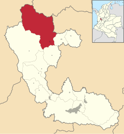
 Location of the municipality and town of Mistrato in the Risaralda Department of Colombia. | |
| Country | |
| Department | Risaralda Department |
| Area | |
| • Total | 690 km2 (270 sq mi) |
| Elevation | 1,570 m (5,150 ft) |
| Population (2023) | |
| • Total | 17,527 |
| • Density | 25/km2 (66/sq mi) |
| Time zone | UTC-5 (Colombia Standard Time) |
Mistrato is a town and municipality in the Department of Risaralda, Colombia. About 86 km away from the capital Pereira. In 2023 the town had an estimated population of 17,527.[2]
Climate[edit]
Mistrató has a subtropical highland climate with an average annual temperature of 20°C.[3]
References[edit]
- ^ "Municipalities of Colombia". statoids. Retrieved 26 April 2020.
- ^ Telefónicas, Telencuestas-Encuestas. "Cuántos habitantes tiene Mistrató, Risaralda en 2023". Telencuestas (in Spanish). Retrieved 2023-09-28.
- ^ Risaralda, Gobernación de (2016-09-28). "Mistrató". Gobernación de Risaralda (in Spanish). Retrieved 2023-09-28.
5°18′N 75°53′W / 5.300°N 75.883°W


