
Overveen
Overveen | |
|---|---|
Village | |
 Overveen | |
 Overveen Location in the Netherlands  Overveen Location in the province of North Holland in the Netherlands | |
| Coordinates: 52°23′32″N 4°37′3″E / 52.39222°N 4.61750°E | |
| Country | Netherlands |
| Province | North Holland |
| Municipality | Bloemendaal |
| Area | |
| • Total | 4.22 km2 (1.63 sq mi) |
| Elevation | 4.2 m (13.8 ft) |
| Population (2021)[1] | |
| • Total | 4,390 |
| • Density | 1,000/km2 (2,700/sq mi) |
| Time zone | UTC+1 (CET) |
| • Summer (DST) | UTC+2 (CEST) |
| Postal code | 2051[1] |
| Dialing code | 023 |
Overveen is a village in North Holland in the Netherlands, in the municipality of Bloemendaal. Overveen lies on the eastern fringe of the North Sea dunes. To the east it borders the built-up areas of Haarlem. A few kilometres to the west of the town lies the Erebegraafplaats Bloemendaal (Honorary Cemetery), where many Second World War victims have been reburied, including resistance fighter Hannie Schaft, sculptor and resistance leader Gerrit van der Veen, banker and resistance member Walraven van Hall, Physician and former Wehrmacht officer Karl Groeger, and sculptor and resistance member Johan Limpers. The town is connected to rail service by the Overveen railway station which opened in 1881 on the Haarlem to Zandvoort railway line.[3]
Landmarks[edit]
Lonbar Petrilaan 28, in the Kweekduin neighborhood, was built in 1956-57 by noted Dutch architect Gerard Holt. Its garden, designed by Mien Ruys, was the first bielzentuin in the Netherlands. The house is on the list of municipal monuments.[4]
Gallery[edit]
-
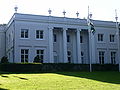 The Bloemendaal town hall in Overveen
 -
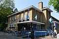 Supermarket
 -
 Office building
 -
 Catholic church


References[edit]
- ^ a b c "Kerncijfers wijken en buurten 2021". Central Bureau of Statistics. Retrieved 28 April 2022.
- ^ "Postcodetool for 2051AA". Actueel Hoogtebestand Nederland (in Dutch). Het Waterschapshuis. Retrieved 28 April 2022.
- ^ "station Overveen". Stationweb (in Dutch). Retrieved 28 April 2022.
- ^ "Straat: Lonbar Petrilaan" (PDF). Gemeentelijke Monumentenlijst. Bloemendaal. Archived from the original (PDF) on 9 June 2011. Retrieved 18 May 2010.
| International | |
|---|---|
| National | |
| Geographic | |
This North Holland location article is a stub. You can help Wikipedia by expanding it. |