
Popovičky
Popovičky | |
|---|---|
 Church of Saint Bartholomew | |
 Flag  Coat of arms | |
 Popovičky Location in the Czech Republic | |
| Coordinates: 49°57′45″N 14°35′52″E / 49.96250°N 14.59778°E | |
| Country | |
| Region | Central Bohemian |
| District | Prague-East |
| First mentioned | 1352 |
| Area | |
| • Total | 5.20 km2 (2.01 sq mi) |
| Elevation | 377 m (1,237 ft) |
| Population (2023-01-01)[1] | |
| • Total | 454 |
| • Density | 87/km2 (230/sq mi) |
| Time zone | UTC+1 (CET) |
| • Summer (DST) | UTC+2 (CEST) |
| Postal code | 251 70 |
| Website | popovicky |
Popovičky is a municipality and village in Prague-East District in the Central Bohemian Region of the Czech Republic. It has about 500 inhabitants.
Administrative parts[edit]
The villages of Chomutovice and Nebřenice are administrative parts of Popovičky.
Etymology[edit]
The name is diminutive of Popovice. It was derived either from the personal name Pop, or from the old Czech word pop (i.e. 'priest'), meaning "the village of Pop's/priest's people".[2]
Geography[edit]
Popovičky is located about 10 km (6 mi) southeast of Prague. It lies in the Benešov Uplands. The highest point is at 495 m (1,624 ft) above sea level. The stream Chomutovický potok flows across the municipality.
History[edit]
The first written mention of Popovičky is from 1352. Chomutovice was first mentioned in 1205 and Nebřenice in 1437.[3]
Demographics[edit]
|
|
| ||||||||||||||||||||||||||||||||||||||||||||||||||||||
| Source: Censuses[4][5] | ||||||||||||||||||||||||||||||||||||||||||||||||||||||||
Transport[edit]
There are no railways or major roads passing through the municipality.
Sport[edit]
There is a modern golf course in Nebřenice.[6]
Sights[edit]
The landmark of Popovičky is the Church of Saint Bartholomew. The originally medieval church was completely rebuilt in the Baroque style in 1731–1736.[7]
The Nebřenice Chateau was built as a hunting lodge in the early 19th century. Today, it is the seat of the golf clubhouse.[8]
Gallery[edit]
-
 Upper common
 -
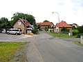 Lower common


References[edit]
- ^ "Population of Municipalities – 1 January 2023". Czech Statistical Office. 2023-05-23.
- ^ Profous, Antonín (1951). Místní jména v Čechách III: M–Ř (in Czech). p. 436.
- ^ "Historie" (in Czech). Obec Popovičky. Retrieved 2022-03-19.
- ^ "Historický lexikon obcí České republiky 1869–2011 – Okres Praha-východ" (in Czech). Czech Statistical Office. 2015-12-21. pp. 9–10.
- ^ "Population Census 2021: Population by sex". Public Database. Czech Statistical Office. 2021-03-27.
- ^ "Golf". Oaks Prague. Retrieved 2022-10-23.
- ^ "Kostel sv. Bartoloměje" (in Czech). National Heritage Institute. Retrieved 2022-10-23.
- ^ "History & Renovation". Oaks Prague. Retrieved 2022-10-23.
External links[edit]
| Authority control databases: National |
|---|