
Sint-Annaland
Sint-Annaland | |
|---|---|
Village | |
 View on Sint-Annaland | |
 Flag  Coat of arms | |
 Sint-Annaland Location in the province of Zeeland in the Netherlands  Sint-Annaland Sint-Annaland (Netherlands) | |
| Coordinates: 51°35′59″N 4°6′10″E / 51.59972°N 4.10278°E | |
| Country | Netherlands |
| Province | Zeeland |
| Municipality | Tholen |
| Area | |
| • Total | 14.29 km2 (5.52 sq mi) |
| Elevation | 0.7 m (2.3 ft) |
| Population (2021)[1] | |
| • Total | 3,785 |
| • Density | 260/km2 (690/sq mi) |
| Time zone | UTC+1 (CET) |
| • Summer (DST) | UTC+2 (CEST) |
| Postal code | 4697[1] |
| Dialing code | 0166 |
Sint-Annaland is a village in the Dutch province of Zeeland. It is a part of the municipality of Tholen, and lies about 18 km northwest of Bergen op Zoom.
History[edit]
The village was first mentioned in 1493 as Sint Annenlant, and is named after Saint Anne, the patron saint of Anna van Bourgondië who ordered the poldering of the land.[3] Sint Annaland developed after the salt marshes of the Oudelandpolder were diked in 1476. In 1668, the Suzannapolder, named after the daughter of Constantijn Huygens, was reclaimed and a harbour was added to the village.[4]
The Dutch Reformed church was built 1899 as a cruciform church and has a tower with wooden lantern. It replaced the church from 1494.[4] The nameless grist mill of Sint-Annaland was built around 1684, and is the oldest extant wind mill of Zeeland. It was in service until 1960 and bought by the municipality in 1966. It was restored the same year, but mainly errors were made in the reconstruction. Between 2005 and 2006, it was restored again and the mistakes were corrected. The wind mill is in service on a voluntary basis.[5]
Since 1899, there is a potato auction in Sint-Annaland. It is the only remaining potato auction of the Netherlands and functions as a Dutch auction where the buyers have to watch the clock and the potatoes are sold to whoever presses the button first. It is open for tourists on Wednesdays.[6]
Sint-Annaland was home to 1,792 people in 1840.[7] was affected by the North Sea flood of 1953. In 1960, the old harbour was filled up and a new harbour was constructed to the north of the village.[4]
Sint-Annaland was a separate municipality until 1971, when it was merged with Tholen.[8]
Gallery[edit]
-
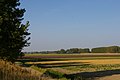 Landscape near Sint Annaland
 -
 Former town hall (1966)


References[edit]
- ^ a b c "Kerncijfers wijken en buurten 2021". Central Bureau of Statistics. Retrieved 22 April 2022.
- ^ "Postcodetool for 4697BA". Actueel Hoogtebestand Nederland (in Dutch). Het Waterschapshuis. Retrieved 22 April 2022.
- ^ "Sint Annaland - (geografische naam)". Etymologiebank (in Dutch). Retrieved 22 April 2022.
- ^ a b c Piet van Cruyningen & Ronald Stenvert (2003). Sint-Annaland (in Dutch). Zwolle: Waanders. ISBN 90 400 8830 6. Retrieved 22 April 2022.
- ^ "(standerdmolen)". Molen database (in Dutch). Retrieved 22 April 2022.
- ^ "Sint-Annaland". Zalig-Zeeland (in Dutch). Retrieved 22 April 2022.
- ^ "Sint-Annaland". Plaatsengids (in Dutch). Retrieved 22 April 2022.
- ^ Ad van der Meer and Onno Boonstra, Repertorium van Nederlandse gemeenten, KNAW, 2011.
External links[edit]
 Media related to Sint Annaland at Wikimedia Commons