
Smoke Bend, Louisiana
(Redirected from Smoke Bend)
Smoke Bend | |
|---|---|
 Rome House, on Louisiana Highway 1, northeast of intersection with Delaney Road | |
 Smoke Bend | |
| Coordinates: 30°6′29.99″N 91°1′13.01″W / 30.1083306°N 91.0202806°W | |
| Elevation | 22 ft (7 m) |
Smoke Bend is an unincorporated community in Ascension Parish, Louisiana, United States.[1][2]
A small cottage from the 1870s named Rome House, listed on the National Register of Historic Places, is located here.[3][4]
Notable person[edit]
- Earl Ernest Veron - United States federal judge
References[edit]
- ^ "placenames". www.placenames.com. Archived from the original on August 6, 2012.
- ^ "Smoke Bend, LA - Smoke Bend, Louisiana Map & Directions - MapQuest". www.mapquest.com.
- ^ "Archived copy". crt.louisiana.gov. Archived from the original on December 12, 2012. Retrieved February 3, 2022.
{{cite web}}: CS1 maint: archived copy as title (link) - ^ http://www.crt.state.la.us/hp/nationalregister/nhl/parish03/scans/03014001.pdf[permanent dead link]
Municipalities and communities of Ascension Parish, Louisiana, United States | ||
|---|---|---|
| Cities | 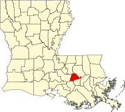 | |
| Town | ||
| CDPs | ||
| Other unincorporated communities | ||
| Footnotes | ‡This populated place also has portions in an adjacent parish or parishes | |
30°06′31″N 91°01′13″W / 30.10861°N 91.02028°W
This Louisiana state location article is a stub. You can help Wikipedia by expanding it. |