
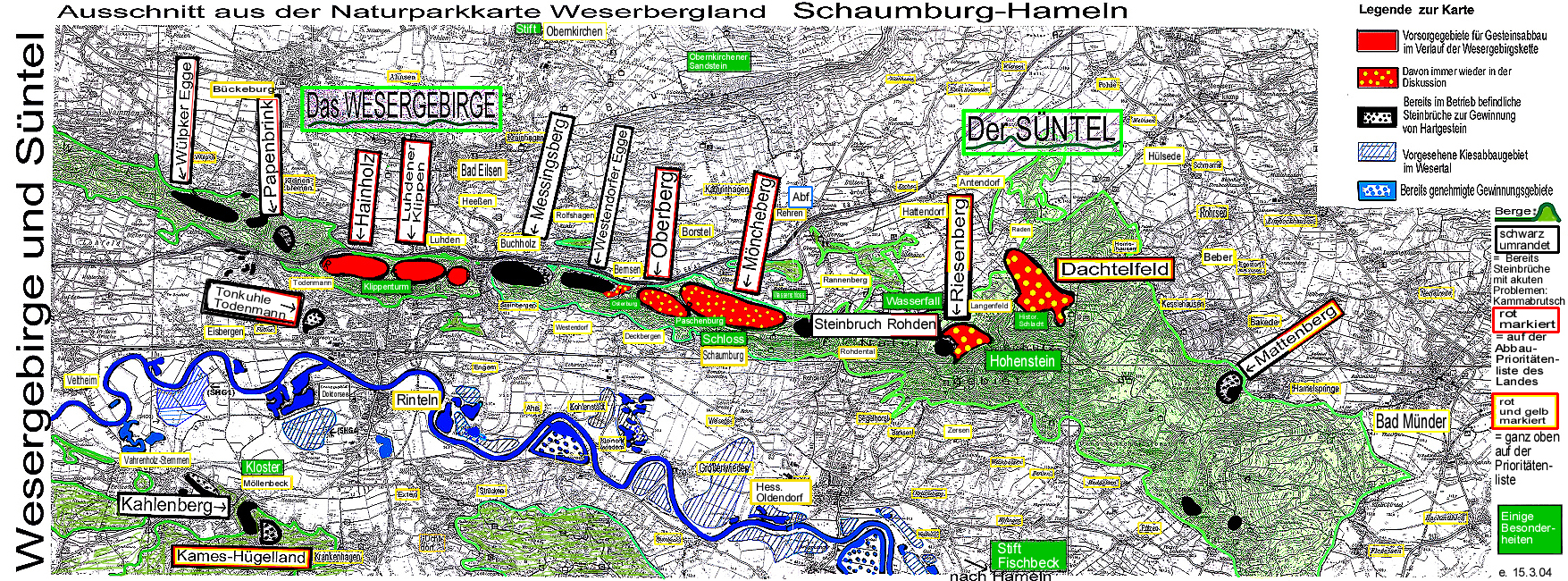
Roof field
The roof field is a plateau up to 350 m high and about 100 hectares in size in the Süntel on the edge of the Deister-Süntel valley . It is wooded. On the southern edge there are a number of springs, including the Blutbach spring. Tradition has it that the Battle of the Süntel took place on the roof field in 782 , in which the Saxons were able to achieve a victory over the Franks (from tachteln = to beat). Plans for lime mining find criticism.
Individual evidence
Coordinates: 52 ° 12 ′ 37.8 ″ N , 9 ° 20 ′ 1 ″ E