List of architectural monuments in St. Lorenzen (South Tyrol)
The list of architectural monuments in St. Lorenzen (Italian: San Lorenzo di Sebato ) contains the 64 objects designated as architectural monuments in the area of the municipality of St. Lorenzen in South Tyrol .
The basis is the official directory of the monuments in South Tyrol, which can be viewed on the Internet. These can be, for example, sacred buildings , residential houses, farms and aristocratic residences. The order in this list is based on the designation, alternatively it can also be sorted according to the address or the date on which it was placed under protection.
list
| photo | designation | Location | registration | description | Metadata |
|---|---|---|---|---|---|

|
Amtmannhaus ID: 17012 |
46 ° 47 ′ 6 "N, 11 ° 53 ′ 36" E |
October 14, 1985 (BLR-LAB 5201) |
Rural house / farm |
KG: Sankt Lorenzen building plot: 113
|
| Ausluger ID: 50212 |
St. Martin 58 46 ° 46 ′ 33 ″ N, 11 ° 54 ′ 7 ″ E |
7th Mar 1994 (BLR-LAB 1146) |
Rural house / farm |
KG: Sankt Lorenzen building plot: 185/1
|
|
| Ausserpfaffenberg ID: 17036 |
46 ° 44 ′ 43 "N, 11 ° 53 ′ 2" E |
October 14, 1985 (BLR-LAB 5201) |
Rural house / farm |
KG: Sankt Lorenzen building plot: 366
|
|
| Baumüller ID: 16992 |
46 ° 46 ′ 20 ″ N, 11 ° 52 ′ 0 ″ E |
October 14, 1985 (BLR-LAB 5201) |
Rural house / farm |
KG: Montal building plot: 34
|
|
|
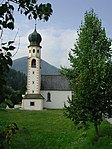
Trinity Church in Pflaurenz ID: 17014 |
46 ° 46 ′ 53 "N, 11 ° 53 ′ 28" E |
October 14, 1985 (BLR-LAB 5201) |
church |
KG: Sankt Lorenzen building plot: 143
|
| Way of the Cross ID: 50457 |
46 ° 47 ′ 7 "N, 11 ° 54 ′ 40" E |
Dec. 4, 2006 (BLR-LAB 4477) |
four wayside shrines the other wayside shrines are at 46 ° 47 ′ 7.4 " N , 11 ° 54 ′ 24.2" E , 46 ° 47 ′ 4.8 " N , 11 ° 54 ′ 16.1" E and 46 ° 47 '3.6 " N , 11 ° 54' 10.8" O . |
KG: Sankt Lorenzen building plot: 546, 550, 552, 553
|
|

|
Gaderturn ID: 17038 |
46 ° 46 ′ 20 ″ N, 11 ° 53 ′ 24 ″ E |
October 14, 1985 (BLR-LAB 5201) |
Raised hide |
KG: Sankt Lorenzen building plot: 393
|

|
Gasthaus Maria Saalen ID: 17032 |
Saalen 4 46 ° 45 ′ 56 ″ N, 11 ° 52 ′ 1 ″ E |
October 14, 1985 (BLR-LAB 5201) |
Gasthaus Gasthof Saaler Wirt |
KG: Sankt Lorenzen building plot: 344/1
|

|
Court House ID: 17006 |
46 ° 46 ′ 59 ″ N, 11 ° 54 ′ 10 ″ E |
July 28, 1972 (MD) |
Rural house / farm |
KG: Sankt Lorenzen building plot: 71, 72/1
|
|
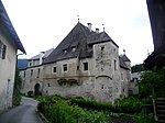
Glurnhör (Hebenstreit) ID: 17023 |
46 ° 47 '16 "N, 11 ° 53' 22" E |
October 14, 1985 (BLR-LAB 5201) |
Raised hide |
KG: Sankt Lorenzen building plot: 284
|
| Graspeinter ID: 17030 |
46 ° 47 ′ 17 "N, 11 ° 52 ′ 16" E |
October 14, 1985 (BLR-LAB 5201) |
Rural house / farm |
KG: Sankt Lorenzen building plot: 317
|
|

|
Happacher ID: 17004 |
46 ° 46 ′ 57 ″ N, 11 ° 54 ′ 9 ″ E |
October 14, 1985 (BLR-LAB 5201) |
Rural house / farm |
KG: Sankt Lorenzen building plot: 57/1
|
|
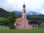
Heiligkreuz in Fronwies ID: 17020 |
46 ° 47 ′ 11 "N, 11 ° 54 ′ 37" E |
October 14, 1985 (BLR-LAB 5201) |
church |
KG: Sankt Lorenzen building plot: 213, 214/1
|

|
Hellweger ID: 17002 |
46 ° 46 ′ 59 "N, 11 ° 54 ′ 8" E |
December 30, 1988 (BLR-LAB 9023) |
Rural house / farm |
KG: Sankt Lorenzen building plot: 49/1
|

|
Court judge ID: 17009 |
46 ° 47 ′ 13 "N, 11 ° 53 ′ 30" E |
October 14, 1985 (BLR-LAB 5201) |
Rural house / farm |
KG: Sankt Lorenzen building plot: 80, 81
|
| Innerpfaffenberg with home and chapel ID: 17035 |
46 ° 44 ′ 43 "N, 11 ° 53 ′ 3" E |
October 14, 1985 (BLR-LAB 5201) |
Rural house / farm |
KG: Sankt Lorenzen building plot: 365, 367 basic plot: 3037
|
|

|
Jakobstöckl ID: 16997 |
46 ° 44 ′ 41 ″ N, 11 ° 49 ′ 59 ″ E |
5th Mar 1990 (BLR-LAB 1190) |
Wayside shrine |
KG: Onach basic parcel: 768
|
| Jörglmair ID: 17039 |
46 ° 46 ′ 10 "N, 11 ° 53 ′ 51" E |
October 14, 1985 (BLR-LAB 5201) |
Rural house / farm |
KG: Sankt Lorenzen building plot: 408, 408/1, 408/2
|
|
| Chapel at Gschlier ID: 17034 |
46 ° 44 ′ 28 "N, 11 ° 52 ′ 33" E |
October 14, 1985 (BLR-LAB 5201) |
chapel |
KG: Sankt Lorenzen building plot: 357
|
|

|
Chapel near Heidenberger ID: 17044 |
46 ° 45 ′ 36 "N, 11 ° 55 ′ 23" E |
October 14, 1985 (BLR-LAB 5201) |
chapel |
KG: Sankt Lorenzen Basic parcel: 3112
|
| Chapel at Oberwelis ID: 17046 |
46 ° 45 ′ 52 "N, 11 ° 55 ′ 53" E |
October 14, 1985 (BLR-LAB 5201) |
chapel |
KG: Sankt Lorenzen Basic parcel: 3887/1
|
|

|
Chapel at the Stadler ID: 17027 |
46 ° 47 '43 "N, 11 ° 52' 28" E |
Feb 2, 1955 (MD) |
chapel |
KG: Sankt Lorenzen building plot: 304
|
|
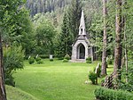
Chapel in the monastery forest with heroes' cemetery ID: 17042 |
46 ° 47 ′ 17 "N, 11 ° 53 ′ 9" E |
October 14, 1985 (BLR-LAB 5201) |
chapel |
KG: Sankt Lorenzen Building plot: 475 Basic plot: 230/1
|

|
Chapel in Moos ID: 17045 |
46 ° 46 ′ 13 ″ N, 11 ° 53 ′ 45 ″ E |
October 14, 1985 (BLR-LAB 5201) |
chapel |
KG: Sankt Lorenzen Basic parcel: 3402/1
|
| Knee pass ID: 17029 |
46 ° 47 '24 "N, 11 ° 52' 14" E |
October 14, 1985 (BLR-LAB 5201) |
Rural house / farm built in Gothic forms. |
KG: Sankt Lorenzen building plot: 314
|
|

|
Krüglwirt in Sonnenburg ID: 17022 |
46 ° 47 ′ 16 "N, 11 ° 53 ′ 25" E |
October 14, 1985 (BLR-LAB 5201) |
Rural house / farm |
KG: Sankt Lorenzen building plot: 283
|

|
Loreto Church in Maria Saalen ID: 17033 |
46 ° 45 ′ 57 ″ N, 11 ° 52 ′ 2 ″ E |
October 14, 1985 (BLR-LAB 5201) |
church |
KG: Sankt Lorenzen building plot: 345/2
|

|
Magnus Chapel in Lothen ID: 17025 |
46 ° 47 ′ 31 ″ N, 11 ° 53 ′ 22 ″ E |
October 14, 1985 (BLR-LAB 5201) |
chapel |
KG: Sankt Lorenzen building plot: 298
|
| Mair zu Gasteig with grain bin and oven ID: 17018 |
46 ° 46 ′ 40 "N, 11 ° 53 ′ 46" E |
October 14, 1985 (BLR-LAB 5201) |
Rural house / farm |
KG: Sankt Lorenzen building plot: 208, 209, 210
|
|

|
Maisterle ID: 17016 |
46 ° 46 ′ 36 "N, 11 ° 53 ′ 44" E |
October 14, 1985 (BLR-LAB 5201) |
Rural house / farm |
KG: Sankt Lorenzen building plot: 203/1
|

|
Maria-Schnee-Kapelle bei Astner ID: 50544 |
46 ° 44 '54 "N, 11 ° 51' 33" E |
Oct 11, 2010 (BLR-LAB 1660) |
chapel |
KG: Onach building plot: 35
|
| Maria-Hilf-Chapel near Unterguggenberg ID: 16991 |
46 ° 46 ′ 19 ″ N, 11 ° 51 ′ 3 ″ E |
October 14, 1985 (BLR-LAB 5201) |
chapel |
KG: Montal building plot: 25
|
|
| Marienkapelle bei Pichler in Runggen ID: 17031 |
46 ° 46 ′ 50 "N, 11 ° 52 ′ 14" E |
October 14, 1985 (BLR-LAB 5201) |
chapel |
KG: Sankt Lorenzen building plot: 320
|
|

|
Michelsburg ID: 50213 |
46 ° 46 ′ 20 "N, 11 ° 53 ′ 33" E |
30th Mar 1996 (BLR-LAB 1267) |
Castle ruins |
KG: Sankt Lorenzen building plot: 395, 396 basic plot: 3427, 3432/1
|

|
Oberhammer in Lothen ID: 17026 |
46 ° 47 ′ 42 "N, 11 ° 53 ′ 19" E |
October 14, 1985 (BLR-LAB 5201) |
Rural house / farm |
KG: Sankt Lorenzen building plot: 299
|

|
Ochsenhauser ID: 50523 |
46 ° 47 ′ 17 "N, 11 ° 53 ′ 21" E |
May 25, 2009 (BLR-LAB 1396) |
Rural house / farm |
KG: Sankt Lorenzen building plot: 287, 288
|

|
Parish church St. Jakob with cemetery ID: 16993 |
46 ° 44 '49 "N, 11 ° 51' 49" E |
October 14, 1985 (BLR-LAB 5201) |
church |
KG: Onach building plot: 27 Basic plot: 309
|

|
Parish church of St. Lorenz with Eger chapel and cemetery ID: 16998 |
46 ° 47 ′ 0 ″ N, 11 ° 54 ′ 10 ″ E |
October 14, 1985 (BLR-LAB 5201) |
church |
KG: Sankt Lorenzen Building plot: 1, 544 Basic plot: 1
|

|
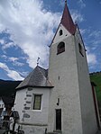
Parish church of St. Margareth with cemetery ID: 16990 |
46 ° 46 ′ 17 "N, 11 ° 51 ′ 31" E |
October 14, 1985 (BLR-LAB 5201) |
church |
KG: Montal building plot: 11 basic plot: 73
|
|
Parish church of Saints John and Paul with cemetery ID: 16988 |
46 ° 46 ′ 37 "N, 11 ° 50 ′ 9" E |
October 14, 1985 (BLR-LAB 5201) |
church |
KG: Ellen building plot: 35 Basic plot: 273
|

|
Pfarrwidum ID: 16999 |
46 ° 47 ′ 1 ″ N, 11 ° 54 ′ 10 ″ E |
October 14, 1985 (BLR-LAB 5201) |
Widum / Canon House |
KG: Sankt Lorenzen building plot: 3/1
|

|
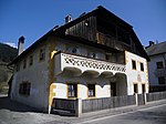
Pitschelin ID: 17013 |
46 ° 46 ′ 52 "N, 11 ° 53 ′ 24" E |
October 14, 1985 (BLR-LAB 5201) |
Rural house / farm |
KG: Sankt Lorenzen building plot: 120/1
|
|
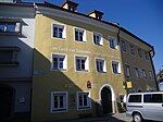
Rader ID: 17000 |
46 ° 47 ′ 1 ″ N, 11 ° 53 ′ 58 ″ E |
October 14, 1985 (BLR-LAB 5201) |
Rural house / farm |
KG: Sankt Lorenzen building plot: 26/1
|
|
Town hall ID: 17003 |
46 ° 46 ′ 58 "N, 11 ° 54 ′ 8" E |
October 17, 1988 (BLR-LAB 6771) |
Administrative building |
KG: Sankt Lorenzen building plot: 50
|

|
Locksmith ID: 17011 |
46 ° 47 ′ 6 "N, 11 ° 53 ′ 32" E |
October 14, 1985 (BLR-LAB 5201) |
Rural house / farm |
KG: Sankt Lorenzen building plot: 105
|
| Schwarzhorn ID: 17015 |
46 ° 46 ′ 29 "N, 11 ° 53 ′ 49" E |
October 14, 1985 (BLR-LAB 5201) |
Rural house / farm |
KG: Sankt Lorenzen building plot: 191/1
|
|
| Söhler ID: 17037 |
46 ° 46 ′ 5 "N, 11 ° 53 ′ 37" E |
October 14, 1985 (BLR-LAB 5201) |
Rural house / farm |
KG: Sankt Lorenzen building plot: 379
|
|
|
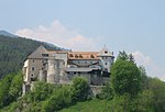
Sonnenburg ID: 17010 |
46 ° 47 '8 "N, 11 ° 53' 26" E |
October 14, 1985 (BLR-LAB 5201) |
monastery |
KG: Sankt Lorenzen building plot: 97
|

|
Hospital with St. John's Chapel ID: 17008 |
46 ° 47 ′ 15 "N, 11 ° 53 ′ 28" E |
October 14, 1985 (BLR-LAB 5201) |
hospital |
KG: Sankt Lorenzen building plot: 78/1, 78/2, 78/3
|

|
St. Agnes in Bad Ramwald ID: 16995 |
46 ° 45 ′ 45 "N, 11 ° 50 ′ 52" E |
October 14, 1985 (BLR-LAB 5201) |
chapel |
KG: Onach building plot: 85
|
| St. Margareth in Kniepaß ID: 17028 |
46 ° 47 '24 "N, 11 ° 52' 15" E |
October 14, 1985 (BLR-LAB 5201) |
church |
KG: Sankt Lorenzen building plot: 313
|
|

|
St. Martin ID: 17017 |
46 ° 46 ′ 36 "N, 11 ° 53 ′ 42" E |
October 14, 1985 (BLR-LAB 5201) |
church |
KG: Sankt Lorenzen building plot: 204
|

|
St.-Martin-Strasse 1 ID: 50207 |
St.-Martin-Strasse 1 46 ° 46 ′ 56 ″ N, 11 ° 54 ′ 10 ″ E |
Nov. 24, 2003 (BLR-LAB 4243) |
Raised hide |
KG: Sankt Lorenzen building plot: 62/1, 62/2
|

|
St. Notburga in Hörschwang ID: 16994 |
46 ° 45 ′ 27 "N, 11 ° 50 ′ 52" E |
October 14, 1985 (BLR-LAB 5201) |
church |
KG: Onach building parcel: 76 Basic parcel: 893
|
| St. Stephan in Stephansdorf ID: 17041 |
46 ° 46 ′ 7 ″ N, 11 ° 55 ′ 24 ″ E |
October 14, 1985 (BLR-LAB 5201) |
church |
KG: Sankt Lorenzen building plot: 424
|
|
|
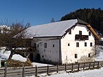
Stocker ID: 17007 |
46 ° 47 ′ 15 "N, 11 ° 53 ′ 32" E |
October 14, 1985 (BLR-LAB 5201) |
Rural house / farm |
KG: Sankt Lorenzen building plot: 77
|

|
Referrer in Sonnenburg ID: 17024 |
46 ° 47 '23 "N, 11 ° 53' 13" E |
October 14, 1985 (BLR-LAB 5201) |
Rural house / farm |
KG: Sankt Lorenzen building plot: 289
|
| Unterlindner in Stephansdorf ID: 17040 |
46 ° 46 ′ 8 ″ N, 11 ° 55 ′ 21 ″ E |
June 27, 1983 (BLR-LAB 3789) |
Rural house / farm |
KG: Sankt Lorenzen building plot: 423/1
|
|
| Unterramwalder ID: 16987 |
46 ° 46 ′ 2 "N, 11 ° 50 ′ 48" E |
December 30, 1988 (BLR-LAB 9023) |
Rural house / farm |
KG: Ellen building plot: 20
|
|
| Villa Kerschbaumer with park ID: 17043 |
46 ° 46 ′ 51 ″ N, 11 ° 54 ′ 8 ″ E |
December 30, 1988 (BLR-LAB 9023) |
Villa / summer cottage |
KG: Sankt Lorenzen Building plot : 491 Base plot: 727/2
|
|
|
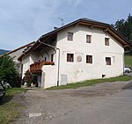
Wastlmair in Fassing ID: 17021 |
46 ° 47 '29 "N, 11 ° 53' 46" E |
October 14, 1985 (BLR-LAB 5201) |
Rural house / farm |
KG: Sankt Lorenzen building plot: 273
|

|
Widum at Heiligkreuz ID: 17019 |
46 ° 47 ′ 10 "N, 11 ° 54 ′ 35" E |
December 30, 1988 (BLR-LAB 9023) |
Widum / Canon House |
KG: Sankt Lorenzen building plot: 211
|

|
Wiesenegg ID: 17005 |
46 ° 46 ′ 56 ″ N, 11 ° 54 ′ 10 ″ E |
July 17, 1962 (MD) |
Raised hide |
KG: Sankt Lorenzen building plot: 61
|

|
Wildberg ID: 17001 |
46 ° 46 ′ 53 "N, 11 ° 53 ′ 56" E |
October 14, 1985 (BLR-LAB 5201) |
Raised hide |
KG: Sankt Lorenzen building plot: 36/1, 36/2, 36/3, 36/4, 36/5 |
If no coordinates are known for a monument, the cadastral data at the time it was placed under protection are given as a substitute. These are neither official nor necessarily up-to-date.
The addresses taken from the State Monuments Office may be out of date.
| Photo: | Photograph of the monument. Click the photo generates an enlarged view. There are also two symbols: |
| ID | Identifier at the South Tyrolean Monuments Office |
| KG | Cadastral parish |
| MD | Ministerial Decree |
| BLR-LAB | Decision of the state government - state committee decision |
Web links
- Monument browser of the South Tyrolean Monuments Office
