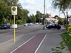
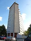
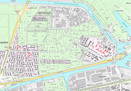
List of streets and squares in Berlin-Charlottenburg-Nord

The list of streets and squares in Berlin-Charlottenburg-Nord shows the streets and squares in the Berlin district of Charlottenburg-Nord with their historical references. At the same time, this compilation is part of the lists of all Berlin streets and squares .
overview
Charlottenburg-Nord has 19,597 inhabitants (as of December 30, 2019) and includes the postal code areas 10589 and 13627.
In the district, 320 meters of the Bundesautobahn 100 (exit to Tegeler Weg) and 3.6 kilometers of the main lane of the Bundesautobahn 111 belong to the spacious and 10.4 kilometers of the A 100 and 2.4 kilometers of the A 111 (exits and entrances) to the superordinate road system . The latter also includes 8.4 kilometers of city streets. The main road system is supplemented by 5.4 kilometers of the Friedrich-Olbricht-Damm, Jungfernheideweg and Heckerdamm streets. The following list shows the 54 dedicated streets and squares of the district. Seven of these streets also belong to neighboring districts. The total length of these streets in the district is 27.4 kilometers.
The district is bounded in the north by the Berlin-Spandau shipping canal , in the south it mainly borders on the Westhafenkanal , on which the city motorway was laid. It borders the railway line between Tegeler Weg and the Charlottenburg connecting canal . The district is shaped by its history on the northern edge of the city of Charlottenburg and divided by the A 111 . The eastern part is determined by the allotment garden colonies on the Pfefferluchs site and the commercial areas in Plötzensee, which are primarily located on Saatwinkler Damm (on the Berlin-Spandau shipping canal) near Tegel Airport . In the west of the district dominate the residential buildings of the overarching Siemensstadt estate , the settlements of Charlottenburg-Nord (formerly: Nonnenwiesen) and the Paul-Hertz-Siedlung in the southeast of the garden colony area to the east of the north autobahn . The old forest area of the Jungfernheide Volkspark occupies the north-west of the district between Saatwinkler Damm, Autobahn, Heckerdamm and Jungfernheideweg .
Overview of streets and squares
The following table gives an overview of the streets and squares in the district as well as some related information.
- Name / location : current name of the street or square. Via the link Location , the street or the square can be displayed on various map services. The geoposition indicates the approximate center of the street length.
- Traffic routes not listed in the official street directory are marked with * .
- Former or no longer valid street names are in italics . A separate list may be available for important former streets or historical street names.
-
Length / dimensions in meters:
The length information contained in the overview are rounded overview values that were determined in Google Earth using the local scale. They are used for comparison purposes and, if official values are known, are exchanged and marked separately.
For squares, the dimensions are given in the form a × b for rectangular systems and for (approximately) triangular systems as a × b × c with a as the longest side.
If the street continues into neighboring districts, the addition ' in the district ' indicates how long the street section within the district of this article is. - Name origin : origin or reference of the name.
- Notes : further information on adjacent monuments or institutions, the history of the street and historical names.
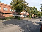
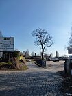
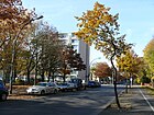
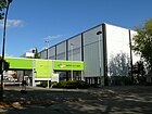
- Image : Photo of the street or an adjacent object.
| Name / location | Length / dimensions (in meters) |
Origin of name | Date of designation | Remarks | image |
|---|---|---|---|---|---|
|
Adam-von-Trott-Strasse
( Location ) |
730 | Adam von Trott zu Solz (1909–1944), lawyer, diplomat and resistance fighter against the Nazi regime | Oct 29, 2001 | The street in the industrial area connects Saatwinkler Damm and Friedrich-Olbricht-Damm. |

|
| At the Jungfernheide train station
( Location ) |
410 | nearby Jungfernheide train station | June 27, 1925 | The first name was Street 65, Section VI a - 7/8 of the development plan. The unpaved path opens up the allotment gardens here and connects Lise-Meitner-Straße with the Goslarer Ufer. Before Max-Dohrn-Strasse was named, it was part of the street Am Bahnhof Jungfernheide. |

|
| At the Heidebusch
( Location ) |
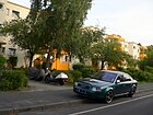
290 | Overgrowth on the neighboring Jungfernheide | 4th Sep 1954 | The cul-de-sac from Heckerdamm is in the Paul-Hertz-Siedlung . |
|
|
Bernhard-Lichtenberg-Strasse
( Location ) |
530 | Bernhard Lichtenberg (1875–1943), priest and resistance fighter against the Nazi regime | Jan. 23, 1962 | The street opens up the Paul-Hertz-Siedlung and leads from Heckerdamm to Reichweindamm. |

|
| Buchholzweg
( Location ) |
220 | Peter Buchholz (1888–1963) theologian, priest in Plötzensee , resistance fighter against the Nazi regime | Jan. 1, 1992 | The first name was 74a Street . This is where the head office was Air Berlin . |

|
|
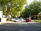
Dahrendorfzeile
( Location ) |
90 | Gustav Dahrendorf (1901–1954), politician, resistance fighter against the Nazi regime | 4th July 1957 | The cul-de-sac from Heilmannring is in the Charlottenburg-Nord housing estate. |
|
|
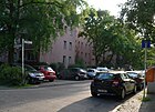
Delp line
( Location ) |
140 | Alfred Delp (1907–1945), Catholic theologian, member of the Kreisau Circle in the resistance against National Socialism against the Nazi regime | Nov 23, 1962 | The cul-de-sac from Bernhard-Lichtenberg-Straße is in the Paul-Hertz-Siedlung . |
|
|
Emmy Zehden Way
( Location ) |
120 | Emmy Zehden (1900–1944), resistance fighter against the Nazi regime | Jan. 1, 1992 | The first name was Street 229 . The street in the industrial area connects Saatwinkler Damm with the Hüttigpfad. |

|
|
Friedrich-Olbricht-Damm
( Location ) |
1620 | Friedrich Olbricht (1888–1944), general, resistance fighter against the Nazi regime | Oct. 1, 1971 | The first name was Street 211 . The Plötzensee correctional facility and the Plötzensee Memorial (entrance from the Hüttigpfad) are located here on both sides . |
 |
|
Flagellator Trail
( Location ) |
230 | Heinrich Geißler (1814–1879), physicist (Geißler tube) | Dec 15, 1930 | The first name was Street 81 . The street runs from Heckerdamm to Goebelplatz. |

|
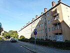
| Geitelsteig
( Location ) |
220 | Hans Friedrich Geitel (1855–1923), physicist | Aug 31, 1937 | The first name was Street 81a to the north side of Goebelplatz. He goes from the Heckerdamm. |
|
| Gloedenpfad
( Location ) |
100 | Elisabeth Charlotte Gloeden (1903–1944), trainee lawyer and resistance fighter against the Nazi regime | March 5, 1963 | The first name was Street 8 . The cul-de-sac from Reichweindamm is in the Paul-Hertz-Siedlung . |

|
| Goebelplatz
( Location ) |
100 × 80 | Heinrich Göbel (1818–1893), precision mechanic | Dec 15, 1930 | The first name in accordance with the development plan was space V . |

|
| Goebelstrasse
( Location ) |
490 (in the district) |
Heinrich Göbel (1818–1893), precision mechanic | Dec 15, 1930 | The first name according to the development plan was Straße 85 . Another section is in the Siemensstadt district . Goebelstrasse is part of the Siemensstadt housing estate . |

|
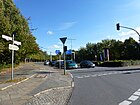
| Goerdelerdamm
( Location ) |
300 | Carl Friedrich Goerdeler (1884–1945), lawyer, national conservative politician and resistance fighter against the Nazi regime | Nov 2, 1953 | The Goerdelerdamm originally ran to the Goerdelerdamm bridge at the intersection of Saatwinkler Damm / Seestraße / Beusselstraße. However, it was built over by the city motorway in the middle section. An eastern section was included on February 1, 1972 in the Friedrich-Olbricht-Damm. The remainder of the present day opens up the buildings behind the motorway bridge on the Westhafenkanal. |
|
| Grenzweg
( Location ) |
320 | border | after 1943 | The Grenzweg opens up an allotment garden . It goes south from Friedrich-Olbricht-Damm. The name seems to be based on the former border between Charlottenburg and the Siemensstadt district, which runs through a forest. An “official” source is (currently) not known. | |
|
Habermann line
( Location ) |
170 | Max Habermann (1885–1944), trade unionist and resistance fighter against the Nazi regime | 4th July 1957 | The cul-de-sac from Heilmannring is in the Charlottenburg-Nord housing estate. |

|
| Haeftenzeile
( Location ) |
120 | Hans Bernd von Haeften (1905–1944), lawyer and resistance fighter against the Nazi regime | 4th July 1957 | The spur road leading from Toeplerstrasse is in the Charlottenburg-Nord settlement. |

|
| Halemweg
( Location ) |
550 | Nikolaus Christoph von Halem (1905–1944), lawyer, resistance fighter against the Nazi regime | 4th July 1957 | The Halemweg leads from Heilmannring to Heckerdamm. The Halemweg underground station of the same name is located here . There is also a school center with the “Erwin-von-Witzleben-Grundschule”, the “Anna Freud Upper School Center for Social Affairs” and the “Poelchau Oberschule”, the elite school of sports. A daycare center and a youth club are also worth mentioning. |

|
| Heckerdamm
( Location ) |
2920 | Oswald Hecker (1869–1921), master builder | March 30, 1950 | The previous name (after 1777-1950) was Königsdamm . On February 1, 1972, a section of the Heckerdamm between the intersection of roads 210 and 211 and the intersection of the Goerdelerdamm bridge / Seestrasse and Beusselstrasse was renamed Friedrich-Olbricht-Damm. The road runs from Jungfernheideweg, the border with Siemensstadt , along Jungfernheide via the A 111 to Friedrich-Olbricht-Damm. |

|
| Heilmannring
( Location ) |
1450 | Ernst Heilmann (1881–1940), lawyer, politician and resistance fighter against the Nazi regime | 4th July 1957 | The street runs in an arch from Goebelplatz to Heckerdamm. |

|
| Heinickeweg
( Location ) |
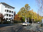
250 | Samuel Heinicke (1727–1790), deaf educator | July 19, 1955 | The first name was 103 street . The path runs as a one-way street from Toeplerstraße to Heckerdamm. |
|
| Hofackerzeile | 120 | Caesar von Hofacker (1896–1944), officer and participant in the uprising of July 20, 1944 | 4th July 1957 | The cul-de-sac from Heilmannring is in the Charlottenburg-Nord housing estate. |

|
| Hüttigpfad
( Location ) |
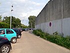
700 | Richard Hüttig (1908–1934), resistance fighter against the Nazi regime | March 30, 1950 | The street runs along the prison wall and opens up an allotment garden colony. On February 28, 1985, the part of the Hüttig path between Friedrich-Olbricht-Damm and the north corner of the Plötzensee prison was de-designated. With effect from January 28, 1987, the Hüttigpfad was withdrawn as public road land. |
|
|
Jakob-Kaiser-Platz
( Location ) |
100 | Jakob Kaiser (1888–1961), politician and resistance fighter against the Nazi regime | May 12, 1961 | Jakob-Kaiser-Platz not only includes the actual square, but also a residential street that runs parallel here. From 1953 to 1961 it was called Siemensplatz . Previously there was another Siemensplatz on Siemensdamm west of today's Nikolaus-Groß-Weg , which disappeared due to the expansion of Siemensdamm and the construction of the motorway access. |

|
| Jungfernheideweg | 1150 (in the district) |
Jungfernheide located here | Jan. 23, 1931 | The first name before 1929 was Street 80 . The Jungfernheideweg forms the border between the districts of Charlottenburg-Nord and Siemensstadt . It runs from Siemensdamm to Saatwinkler Damm. The part between the S-Bahn and Siemensdamm is in Siemensstadt. |

|
|
Kirchnerpfad
( Location ) |
120 | Johanna Kirchner (1889–1944), resistance fighter against the Nazi regime in the Résistance | Nov 23, 1962 | The first name was Street 4 . The cul-de-sac from Bernhard-Lichtenberg-Straße is in the Paul-Hertz-Siedlung . |

|
| Klausingring
( Location ) |
250 | Friedrich Karl Klausing (1920–1944), Wehrmacht officer and resistance fighter of July 20, 1944 | Nov 23, 1962 | The ring road going off Bernhard-Lichtenberg-Straße is in the Paul-Hertz-Siedlung . |

|
|
Letterhausweg
( Location ) |
120 | Bernhard Letterhaus (1894–1944), union official and resistance fighter against the Nazi regime | Apr 7, 1957 | The Letterhausweg is the access road to the Charlottenburg-Nord settlement from the south. It connects the Siemensdamm with the Heilmannring. |

|
| Leuninger path
( Location ) |
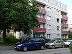
100 | Franz Leuninger (1898–1945), Christian trade unionist and resistance fighter against the Nazi regime | Nov 23, 1962 | The first name was Street 10 . The cul-de-sac from Reichweindamm is in the Paul-Hertz-Siedlung . |
|
| Lise-Meitner-Strasse
( Location ) |
830 | Lise Meitner (1878–1968), Austrian - Swedish nuclear physicist | May 1, 1970 | The first name was Street 211 . On June 1, 1971, the extension, the road 213 to the Westhafenkanal , was named as well. |

|
|
Max-Dohrn-Strasse
( Location ) |
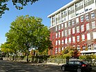
660 | Max Dohrn (1874–1943), chemist | Aug 1, 1970 | Before it was part of the street Am Bahnhof Jungfernheide. It connects the Tegeler Weg with the Lise-Meitner-Straße. The “berlinbiotechpark” was created on the site of the former DRK hospital. |
|
|
Nikolaus-Groß-Weg
( Location ) |
270 | Nikolaus Groß (1898–1945), trade unionist and resistance fighter against the Nazi regime | June 30, 1966 | Nikolaus-Groß-Weg was laid out in 1960 as a residential street for the main fire station located there, which is located on the east side of the street, between Siemensdamm and the section of Nonnendamm , which at that time still ran over the Siemens site . The western side of the road forms the border with Siemensstadt , the road area belongs to the district. |

|
|
Nonnendamm
( Location ) |
710 + 350 | Benedictine convent in Spandau , donated in 1239 | Apr 2, 1914 | The Nonnendamm was built in the 14th century as a stick dam to the property of the nuns (Nonnenwiesen). The Nonnendammallee is developed for Siemens section of the nuns dam. The road layout north of the Spree was retained when the Westhafen Canal was built , only the connection to the Tegeler Weg was changed. It was not until the Neue Schleuse Charlottenburg that road traffic was interrupted in 2003.
In the industrial building Nonnendamm 17, clearly visible from the Rudolf-Wisell-Brücke, there is the studio house Nonnendamm, until the mid-1960s the shoe polish company Urban & Lemm was located there. On the map from 1932, the Nonnendamm runs from the Wernerwerk station following Siemensstrasse on the border between the administrative districts of Charlottenburg and Spandau to the Spree and around the Charlottenburg lock. That ultimately remained unchanged until 1960. |

|
|
Popitzweg
( Location ) |
260 (in the district) |
Johannes Popitz (1884–1945), lawyer, politician and resistance fighter against the Nazi regime | 4th July 1957 | Part of the street runs through Siemensstadt . The street designated as Straße 43 in the development plan was partly in the Spandau district and partly in the Charlottenburg district . The section in the Charlottenburg district was given the name Popitzweg on July 4, 1957, the section in the Spandau district on December 13, 1961. |

|
|
Reichweindamm
( Location ) |
690 | Adolf Reichwein (1898–1944), educator, economist, cultural politician and resistance fighter against the Nazi regime | Nov 23, 1962 | The first name was Street 102 . On November 30, 1973, the extension of the Reichweindamm was also given this name. It connects Goerdelerdamm and Heckerdamm. |

|
| Riedemannweg
( Location ) |
360 | Wilhelm Anton Riedemann (1832–1920), businessman, entrepreneur and pioneer of tanker shipping | Feb 21, 1940 | The previous names were Riedemannstrasse (around 1895 to before 1898) and Riedemanns Privatweg (before 1898–1940). |

|
|
Saatwinkler Dam
( Location ) |
4450 (in the district) |
Saatwinkel, location in the Reinickendorf district | April 19, 1918 | The previous names of parts of today's dam were Am Spandauer Schiffahrtskanal (after 1877-1918), Saatwinkler Chaussee (around 1864-1925), Am Hohenzollern Canal (before 1915-1918). Saatwinkler Damm leads from the Seestraße / Beusselstraße junction along the Hohenzollern Canal to the former Gartenfeld S-Bahn station and on to Haselhorster Damm in Spandau . The streets Am Spandauer Schiffahrtskanal and Am Hohenzollernkanal in Charlottenburg were renamed Saatwinkler Damm on April 19, 1918, and in 1925 the Saatwinkler Chaussee part of Spandau was also given this name. On December 3, 1973, a section of Saatwinkler Damm in Charlottenburg - between Hüttigpfad and Seestraße - was de-designated and deleted from the street register. |
 |
| Schneppenhorstweg
( Location ) |
130 | Ernst Schneppenhorst (1881–1945), trade unionist, politician and resistance fighter against the Nazi regime | 4th July 1957 | The spur road leading from Toeplerstrasse is in the Charlottenburg-Nord settlement. |

|
| Swam line
( Location ) |
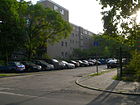
110 | Ludwig Schwamb (1890–1945), lawyer, politician and resistance fighter against the Nazi regime. | Nov 23, 1962 | The cul-de-sac from Reichweindamm is in the Paul-Hertz-Siedlung . |
|
| Schwanenfeldstrasse
( Location ) |
170 | Ulrich Wilhelm Graf von Schwerin von Schwanenfeld (1902–1944), large landowner, reserve officer and resistance fighter against the Nazi regime | Apr 18, 1980 | The first name was Street 241 . Schwanenfeldstraße leads along the wall of the Plötzensee correctional facility to the Schenker shipping company premises . |

|
| Schweiggerweg
( Location ) |
270 | Johann Salomo Christoph Schweigger (1779–1857), mathematician, physicist, chemist | Aug 31, 1937 | The first name was street 81b of the zoning plan. The path runs as a one-way street from Toeplerstraße to Heckerdamm. The "Vivantes-Heimstatt Jungfernheide" is located here. |

|
|
Seestrasse
( Location ) |
120 (in the district) |
Plötzensee | around 1827 | The part between the Northern and Southern Seestrasse Bridge belongs to Moabit . The eastern section of the street runs in the district of Wedding . Only the part between Saatwinkler Damm and the motorway access is part of Charlottenburg-Nord. |

|
| Siemensdamm
( Location ) |
800 (in the district) |
Werner von Siemens (1816–1892), physicist and entrepreneur | July 14, 1914 | Part of the street runs through Siemensstadt . Originally the Siemensdamm , coming from Spandau , led from what was then Nonnendamm to the Tegeler Weg. On November 2, 1953, the new east-west connecting road from the confluence with Siemensdamm to Siemensplatz was also named Siemensdamm. It was the extension of Siemensdamm to the east. In the Spandau area, part of Nonnendammallee was also given the name Siemensdamm on May 19, 1956. |

|
| Stepring
( Location ) |
340 | Hellmuth Stieff (1901–1944), major general and resistance fighter of July 20, 1944 | Feb. 1, 1968 | The Stieffring is located in the Saatwinkler Damm industrial park. |

|
| Street 70
( Location ) |
930 | Number according to the development plan | before 1943 | The road 70 is between Saatwinkler Damm and Heckerdamm (formerly: Königsdamm ) and mainly opens up allotment gardens . The Reichweindamm continues in the south. In the address book from 1943 the street 70, Section VI is listed, some houses named after the owners were already standing and in addition arbor grounds and a public park were mentioned. |

|
| Strünckweg
( Location ) |
90 | Theodor Strünck , lawyer and (1895-1945) resistance fighters of July 1944 20 | Nov 23, 1962 | The initial name was Street 4 . The cul-de-sac from Bernhard-Lichtenberg-Straße is in the Paul-Hertz-Siedlung . |

|
|
Tegeler Weg
( Location ) |
470 (in the district) |
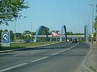
Tegel , part of the Reinickendorf district | before 1884 | The previous name was Weg nach Spandau (before 1767 to before 1884). The Tegeler Weg is a north-south connection that runs parallel to the Spree between the Schloßbrücke and Jakob-Kaiser-Platz . It crosses under the bridge of the Ringbahn and the regional railway and is led through the Mörschbrücke over the Westhafenkanal . The section between Jakob-Kaiser-Platz and Bahnbrücke belongs to Charlottenburg-Nord. The rest is in Charlottenburg . On December 17, 1955, the northern section of the Tegeler Weg was named Kurt-Schumacher-Damm . |
|
| Line of pond graves
( Location ) |
120 | Richard Teichgräber (1884–1945), trade unionist and resistance fighter against the Nazi regime. | Nov 23, 1962 | The first name was Street 3 . The cul-de-sac from Bernhard-Lichtenberg-Straße is in the Paul-Hertz-Siedlung . |

|
| Terwielsteig
( Location ) |
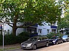
100 | Maria Terwiel (1910–1943), resistance fighter ; she belonged to the circle of the Red Chapel | Nov 23, 1962 | The first name was Street 9 . The cul-de-sac from Reichweindamm is in the Paul-Hertz-Siedlung . |
|
| Thater's private route
( Location ) |
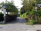
520 | Karl Thater (19th century), ice cream maker | before 1895 | In the city map of Berlin from 1893 the route is entered as an unnamed route. On the map from 1896 the street is named as Thater Straße . In 1901 it was called Thater's Way . It is not to be assumed that official renaming was carried out constantly, but the names were used synonymously. The street was named between 1894 and 1896. It originally ran from Am Spandauer Schiffahrtskanal to an unnamed route, which later fell away. The original route of the route is now in the northern section of the Friedrich-Olbricht-Damm. At the beginning of the 1960s, the path to Heckerdamm was extended. Thater's private path lies in this extension today. It separated Thater's Eiswerke and the complex of the German-American Petrol Society. |
|
| Toeplerstrasse
( Location ) |
490 | August Toepler (1836–1912), physicist | Aug 31, 1937 | The first name was Street 85 of the zoning plan. It runs as an extension of Goebelstraße to Halemweg and opens up the Charlottenburg-Nord settlement. | |
|
Wiersichweg
( Location ) |
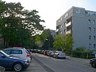
120 | Oswald Wiersich (1882–1945), trade unionist and resistance fighter against the Nazi regime | Nov 23, 1962 | The first name was Street 9 . The cul-de-sac from Bernhard-Lichtenberg-Straße is in the Paul-Hertz-Siedlung . |
|
| Wirmerzeile
( Location ) |
130 | Josef Wirmer (1901–1944), lawyer and resistance fighter against the Nazi regime | Nov 23, 1962 | The first name was Street 7 . The cul-de-sac from Reichweindamm is in the Paul-Hertz-Siedlung . |

|
Former streets and unconverted street names
The current district in the area of what was then the city of Charlottenburg was until the post-war period, with the exception of the Plötzensee manor district, little built up and routed, so in contrast to the Charlottenburg core area, few street names have been renamed. On a map from 1946 there are street names marked as provisional. This also includes Willi-Jahn-Straße . However, this proposal for the Seestrasse was not confirmed when the Charlottenburg renaming in March 1950.
| Formerly | from | to | renamed to | Origin of name | Remarks |
|---|---|---|---|---|---|
| On the Spandau shipping canal | from 1878 | April 19, 1918 | → Saatwinkler Dam | Berlin-Spandauer Schiffahrtskanal : connection between the upper Havel and the Spree | On the map from 1878 the route was entered without a name, it was named between 1878 and 1883. The street runs along the Berlin-Spandau shipping canal and went through the Plötzensee district to Seestrasse. With the expansion of the canal to Großwasserstraße 1906–1914, the name Am Hohenzollern Canal was also used (map from 1918, for Plötzensee from the height of Riedemann's private path to Seestraße). In the address book, the street was entered as Am Spandauer Schi (fff / ff) ahrts (-C / k) anal until 1920 (for Charlottenburg and Plötzensee) and houses were already built on, but these did not have parcel numbers but the name of the owner. Right at the beginning there was a school house and a forester's house and in 1918 there was also a post office here; behind the intersection with Thater's private road lay the Gr. Berl. Ice works, whose owner and operator lived on this canal himself. In the 1921 address book, the properties are listed under Saatwinkler Damm, with the subdivision from Plötzensee to Seestrasse and for Charlottenburg to Tegeler Forst. |
| Garden path | after 1890 | after 1971 | → not applicable | Garden on the edge of the Krummelanke-Rieselfeld. | The garden path ran west around the Plötzensee prison and led to the later named Heuweg . In the city map of Berlin from 1890 an unmarked route was entered, which was marked by name as a garden path in 1893. In the 1971 plan, the path was still there, but was omitted due to the expansion of the prison grounds. |
| Goby path | March 30, 1950 | after 1960 | → deleted | Gobies using well gudgeon from the channel were eponymously | Kanalstrasse in Plötzensee was on the southeast edge of the prison between Heuweg / Saatwinkler Damm and Königsdamm . It was renamed Grundelweg in 1950, probably because there were several canal streets in the Berlin urban area (Charlottenburg, Hessenwinkel, Rudow and Siemensstadt). The Grundelweg is still indicated on the map from 1960 ; in 1961 the Plötzensee prison area increased here, so that the route disappeared from the address books around 1963. |
| Hefner-Alteneck-Strasse | 1924 | around 1931 | → not applicable | Friedrich von Hefner-Alteneck (1845–1904), designer and electrical engineer | The route is marked on the map from 1920 as Straße 47, Section VI of the Charlottenburg development plan for the area east of Siemensstadt.
In January 1925 this was named in the southern part on the western edge of Charlottenburg zu Siemensstadt between Nonnen-, over Siemens- to Holtzdamm, in Hefner-Alteneck-Straße. The S-Bahn to Gartenfeld was built on the Charlottenburg side along the administrative district border with Spandau. The Charlottenburg area (as Siemensstadt-Ost) remained undeveloped until the 1950s and the Holtzdamm has been shortened. Since the further development east of Siemensstadt to Charlottenburg was not carried out in the 1930s, the alignment has probably been omitted, but the street is still listed as "undeveloped" in the 1943 address book. The development of the "Charlottenburg North settlement" was redesigned and the streets were named accordingly. |
| Hay path | after 1893 | March 30, 1950 | → Hüttigpfad | Path to the meadows at Plötzensee | In 1901, the Heuweg is indicated by name as a route in the city map of Berlin from 1893 . It formed the north-eastern boundary of the Plötzensee prison. |
| Canal Street | before 1893 | March 30, 1950 | → Goby Path | Spandau shipping canal | In the city map of 1884, the street was entered as a route in Plötzensee from 1848 to 1859 without a designation. On the map from 1893 it is already marked by name from the Königsdamm via the Heuweg, which was not yet named at the time, to the Spandau shipping canal. In the 1900 address book under Canalstrasse there is the note “s. New prison ”. It delimited the Plötzensee prison on the southern side. The necessary renaming from 1950 is based on the second Charlottenburger Kanalstrasse , which has been named Thrasoltstrasse since March 1950 . |
| Karlshofer way | after 1952 | around 1964 | → not applicable | "Restaurant Karlshof" on Saatwinkler Damm | The name of the restaurant has been transferred to the "Kolonie Karlshof" to the west, which probably gave it its name as an area object. On the map from 1955 the name of the route was marked between Thaters Weg and Heckerdamm on the corner of that with Riedemann-Weg . It is still recorded in the map from 1963, but no longer in the map from 1964. The excursion restaurant in Plötzensee was founded between 1879 and 1883 as the “Zum Deutschen Kronprinzen” restaurant. In 1901 it was called the “Carlshof” restaurant. According to the map from 1921, the area around Plötzensee has already been prepared and laid out for building. However, this development did not take place and the area between Thaters and Riedemanns private road from the German-American Petroleum-Ges. occupied on the canal. The area east of the Charlottenburg-Nord housing estate is designated as an allotment garden on the Pfefferluch after the war . |
| King dam | after 1877 | March 30, 1950 | → Heckerdamm | Friedrich Wilhelm I (1688–1740) King in Prussia (the soldier king) | Presumably King Friedrich Wilhelm I had this dam built in the 18th century in order to gain the Mäckeritzwiesen as building land. A route between Spandau and Berlin was marked by name on the map from 1767 and was later given the name Königsdamm . The old Königsdamm led from Plötzensee (Charlottenburg) along the edge of the Jungfernheide to Gartenfelder Strasse. As a result of the development that began in the 1920s, the old street was canceled in many places. With partially new management, the western section in the Spandau district was turned into Schuckertdamm on November 23, 1931. In the 1943 address book the Königsdamm is listed, with Post Plötzensee between Heuweg and Tegeler Weg and Post Siemensstadt for the remaining part. |
| Extended Keplerstrasse | before 1964 | after 1968 | → not applicable | Johannes Kepler (1571–1630), astronomer, mathematician. | The extended Keplerstraße ran from Goerdeler- to Heckerdamm and is marked under this name in the 1964 city map, but the route was discontinued after 1967. It was located on the western edge of the Loewe settlement in the extension of Keplerstrasse across Goerdelersteg. |
Further locations in Charlottenburg-Nord
Allotment gardens (colonies)
The garden and settler colonies (KGA) in the district are preferably located in Plötzensee on the Pfefferluch. The allotment garden development plan of the Senate Department for Urban Development from 2004 determined the security levels of the Berlin allotment garden facilities (KGA), which resulted from reserve areas, land use plan (FNP) and development plans. The umbrella association of allotment gardeners in Charlottenburg indicates a number of around 3000 members for the district. The state-owned areas of the KGA are subordinate to the district office of Charlottenburg-Wilmersdorf.
The district has a large number of KGA due to the many green spaces.
The KGAn Jungfernheide (1904), Königsdamm (1908) and Weidenbaum (1906) were created as workers gardens of the Red Cross and go back to a philanthropically motivated representative of the Reich Insurance Office, Alwin Bielefeldt . The government of the Weimar Republic passed the first German allotment garden law in 1919 : legal security through protection against dismissal, abolition of the commercial general lease system. The Reich Association of Allotment Garden Associations in Germany, in which the allotment and planter associations gathered, became the form of organization. During the First World War and shortly afterwards the colonies of Olympia (1919), Pascalstrasse (1918) and Schleusenland (1915) were established. In 1936, garden associations in the Charlottenburg area were combined to form "Main Group 6" on state instructions . The foundations in the mid-1940s were aimed at finding shelter ( bomb victims ) and obtaining food: Am Heckerdamm (1944/1945), Bleibtreu II (1945), Dahmshof (1945), Degenhof (1945), Frischer Wind (1945), Gemütlichkeit (1945) ) Good hope (1945), Heideschlosschen (1945), Hinckeldey (1946) Loewe (1944), horses (1945), branch channel (1945) and future (1945).
In 1961, the population register still shows 775 "permanent users" in KGA for the area. When the land use plan was published in 1986 and the garden areas were designated as residential building space, the "IG Nord" was founded to save the allotment gardens from being abolished. On this occasion the previously loose colony associations were organized into " registered associations ".
The largest contiguous allotment garden area is in the north region and, with over 3000 parcels, is the largest contiguous allotment garden area in Berlin. The area was laid out for development in the 1920s, but remained undeveloped. The 30 allotment gardens are located in Plötzensee on the former Pfefferluch and its southern connection area. The area is bounded to the west by the A 111, to the north and east by the Berlin-Spandauer Schifffahrtskanal (Saatwinkler Damm), and the Heckerdamm runs centrally through the allotment garden area. Completed in the south by the city motorway on the Westhafenkanal, here in the east is the Paul Hertz settlement and on the east edge the Plötzensee prison and in the north-east the industrial area on Stieffring.
- Facilities west of the road 70 to the A 111, previously the Tegeler Weg ran on the western edge and opposite was the Volkspark Jungfernheide.
- There are building rights for the area according to § 35 BauGB, the development plan VII-164b DKG has been discontinued, as there was no longer a planning requirement due to the security via FNP and allotment garden development plan.
-
- Hinkeldey Colony (Strasse 70 No. 31-39, Lage )
- Hinkeldey is a (fictitious) permanent allotment garden with 155 plots on 67,990 m² of state-owned leased land, including eight permanent residents. KGA Hinckeldey e. V. is located in the northeast of the colony areas of the district, west of Straße 70 and on the southeast corner of the Charlottenburg motorway triangle , Saatwinkler Damm junction. The Königsdamm forestry department and the Hinkeldey monument were located on the site .
-
- Jungfernheide Colony (Strasse 70, No. 19/23, Lage )
- is a fictitious permanent allotment garden with 231 plots on 78,117 m² of state-owned leased land, with twelve permanent users living on the site. The colony was founded in 1904 by the DRK for “workers' gardens” and at that time it was on the edge of the Jungfernheide , which was on the Tegeler Weg on Spandauer Flur.
- Systems east of the street 70
- The systems are located in strips 30 to 50 meters wide between Straße 70 and the Pfefferluchgraben with a length of 220 to 420 meters. The list follows from north to south. An existing development plan VII-164b for these areas was discontinued, because the facilities are permanently secured by the representation in the land use plan as green areas. The strip shape of the facilities probably follows the structures that resulted from the surfaces of the Karlshof ice works.
-
- Fresh Up Colony (Strasse 70, No. 36/38, Lage )
- This fictitious permanent allotment garden on 18,451 m² of state-owned leased land consists of 54 parcels (18,224 m²) and one permanent user and is located north of the KGA Bienenheim . This colony was founded in 1927 and is permanently secured by the allotment garden development plan. It is entered in the land use plan with building rights.
-
- Colony Bienenheim , (Strasse 70 No. 34, location )
- The garden colony consists of owner gardens. The colony areas are highly secured by being presented as grassland with the status "construction area" and are suitable as settlement areas. The residential property with 18 plots on private land is 210 meters long and 30 meters wide (7,200 m²). A development plan VII-164b from the 1970s was discontinued.
-
- Colony Birkenweg 04004 (street 70, location , colony number 32)
- This fictitious permanent allotment garden has 26 plots on 10,617 m² of state-owned leased land. It was founded in 1933 and it is permanently secured by the FNP as a green area (KGA).
-
- Pfefferluch Colony (Strasse 70 No. 30, Lage )
- The garden colony consists of owner gardens. On 12,833 m² of private land, there are 32 parcels that are designated as green space (KGA) according to the zoning plan. A development plan VII-164b from the 1970s was canceled.
-
- Akazienhain Colony (Strasse 70 No. 28, Lage )
- The garden colony with 12,416 m² consists of 25 parcels of owner gardens (§ 35 BauGB). A development plan draft VII-164b has been discontinued. The high level of security is based on the representation in the zoning plan as “green space (allotment garden)”.
-
- Colony Alpenrose (Strasse 70 No. 26, Lage )
- These 15 plots are located on the Pfefferluchgraben and border the KGA 'Pfefferluchwiesen' in the east. The garden colony consists of 8,900 m² of 15 owner gardens. A development plan draft VII-164b from the 1970s was discontinued, the safeguarding of the facility is based on the representation in the land use plan as "green area (allotment garden)".
-
- Waldfrieden Colony (Strasse 70 No. 22/24, Lage )
- The allotment garden colony is located on an area of 22,283 m² of state-owned leased land and is divided into 74 parcels, including one permanent user. It is permanently secured as a fictitious allotment garden.
-
- Colony Heide Freiheit (Strasse 70 No. 20, Lage )
- Of the tenants of the 28 parcels on 11,602 m², three are permanent users. On the state's own leased land, the fictitious garden is permanently secured by an entry in the land use plan. It was founded in 1905 and belongs to the northern region. The “homesteads of Heide Freiheit” belong to the colony. On the strip of the allotment garden on the southern edge, 18 owner gardens were set up on 7,215 m², resulting in changes in the building law.
-
- Pfefferluchwiesen colony (Friedrich-Olbricht-Damm 59, Lage )
- This facility is located east of the aforementioned colonies along the banks of the Pfeffeluchgraben. It is a fictitious permanent garden on 8257 m² of state-owned leased land (26 plots). The name arises from the location on the north branch of the Pfefferluchgraben, which previously filled the waters of the Karlshof ice works instead of the Hohenzollern Canal. Listed in the street directory, it borders on the Adam-von-Trott-Straße industrial estate on the eastern edge .
-
- Abendruh Colony (Strasse 70, Lage )
- This fictitious permanent allotment garden, founded in 1973, has 33 plots on 9,247 m² of state-owned leased land and, like the previous ones, is located south of a branch of the Pfefferluchgraben in a strip of land from road 70 to the east.
-
- Friedrichsweg Colony (Strasse 70 No. 14, location )
- This allotment garden consists of owner gardens and the existing structure is highly secured because it is designated as a green area (allotment garden) in the zoning plan. The property with its 39 plots is on private land with a length of 390 meters and 40 meters wide. The development plan draft VII-164b was abandoned.
-
- Colony Unity (Strasse 70 No. 12, Lage )
- This fictional allotment garden on 17,929 m² of state-owned leased land consists of 47 plots. It is also shown in the FNP as grassland (KGA) and is permanently secured.
-
- Weidenbaum Colony (Strasse 70 No. 8, Lage )
- It is a permanent allotment garden on 27,952 m² with 71 plots. The facility still includes eight permanent users, who received their hereditary right of use, combined with right of residence , in the special regulations of the post-war period . The facility is located on the state's own leased land and was founded as a colony of Weidenbaum in 1906; in the allotment gardeners' association, it belongs to the northern region.
-
- Sonnenheim Colony (street 70 No. 6, location )
- Sonnenheim is on the Grenzweg, which separates the KGA Königsdamm. This fictitious permanent allotment garden has 70 plots on 20,912 m² of state-owned leased land. The KGA Sonnenheim in the north region of the Charlottenburg district association was founded in 1970.
-
- New Hope Colony (Strasse 70 No. 4, Lage )
- It was founded in 1983, initially as the Müllberg facility , and lies on a plateau 320 meters long and 20 meters wide, about two meters above the level of the subsequent colonies. With its 16 parcels, it has had the status of "recreation and leisure gardens" since April 1, 2003. In the 1990s, soil investigations revealed an increased level of heavy metals in the soil, so that fruit and vegetable cultivation is not unlimited. A closure of the plant could be prevented after the ground was covered. The gardens are located next to the north end of Reichweindamm in Straße 70. To the east, the Pfefferluchgraben forms the edge of the complex, behind which the KGA horse market is located. In the south, the complex borders on the multi-storey residential buildings Reichweindamm 36–41 of the Paul-Hertz-Siedlung across Wiesenweg. It is not included in the allotment garden development plan, but is safeguarded by being shown in the zoning plan as grassland (allotment garden).
-
- Wiesengrund Colony (Heckerdamm 212 / Straße 70, Lage )
- This Wiesengrund facility was founded in 1906 and is located on the southern edge of the group (west of road 70). This permanent system consists of three parts A, B, C. Wiesengrund A with 56 parcels on 19,855 m² of land owned by the state is a permanently secured section as a fictitious system according to Vb as a strip to the Pfefferluchgraben and a subsequent piece north to Heckerdamm on the edge of the Paul-Hertz-Siedlung. Colony part B on 5,989 m² owned by the state and used by 15 parcels is only temporarily secured. Colony part C has 16 plots on private land of 2,192 m² and these were included in the B-Plan VII-164b Sport for the adjacent sports field. The development plan was discontinued and replaced by the representation of B and C as green with the addition of sport. These two parts of the system are therefore not permanently secured. KGA Wiesengrund was founded in 1906. Permanent users live on four parcels, who have arbors from the post-war period that were formerly residential arbors and are larger than 24 m². These can still be used for a limited time, even if they contradict the Federal Allotment Garden Act.
- Areas in Plötzensee east of the Pfefferluchgraben (Heckerdamm, Pfefferluchgraben, Friedrich-Olbricht-Damm)
-
- Permanent colony Königsdamm ( location )
- When it was founded in 1908, it was named after the Königsdamm road that runs along it . In the Senate plan for the KGA development, it is included as a fictitious permanent allotment garden with 273 plots (one permanent user) on 79,622 m² of state-owned leased land. The area is located between Thater's private road and the Grenzweg on the course of the Pfefferluchgraben, from which a branch limits the colony to the north. Further to the north, the industrial area joins Adam-von-Trott-Straße , on which the Karlshof ice works were previously located. The development plan VII-164b DKG was created for use in the 1970s, and its processing was discontinued because the colony is included in the zoning plan as a green KGA.
-
- Horse market colony (Heckerdamm 196–202, Lage )
- The horse market colony was founded in 1945 on the site of the former municipal horse market on the former Königsdamm . The layout paths refer to it, in the north is the Reiterweg, from which the saddle, trotter, derby and jockey path lead to Heckerdamm. South of Königsdamm and also between Grenzweg (Pfefferluchgraben) and Thaters Privatweg, the east part of the colony is permanently secured on 31,397 m² of state-owned leased land for 88 plots as green (allotment garden). Towards the sports field, 8156 m² of state-owned land with 20 parcels are included as green (sport) in the zoning plan in the colony part of the horse market-west. This representation replaces the processing of the development plan VII-164b DKG according to building law (§35 BauGB) with the result that these parcels are only equipped with a protection period until 2020.
-
- Olympia Colony (Heckerdamm 178–182, Lage )
- The allotment garden colony was founded in 1919. and was built around the 1936 Olympic cycling track . It is located in the Association Region North. After the First World War , the famine years of inflation followed, and in 1919 workers from Bamag-Megium (Moabit) and garden friends founded a planting association on fallow land in Plötzensee (30,000 m² from private property on lease). Colonies formed by the Red Cross were in the neighborhood. In 1936 the association lost its independence and came to main group 6. During bombing raids between September 1943 and November 1944, parts of the facility and the surrounding buildings including the KGA documents were destroyed. 50 new parcels were created from the area of the destroyed Olympic cycling track. With the widening of the Heckerdamm in 1965, six parcels were lost, some of which are on the south side of the Heckerdamm. The KGA Olympia with the north and south parts is a fictitious permanent garden with 140 parcels (including eight permanent users) in the east of Thater's private road on 57,512 m² of state-owned leased land. In the east, the border path between Heckerdamm 178 and Thaters Privatweg 6 delimits the colony to KGA Karlshofer Wiesen . The parcels in the west are accessed by the main path in the east through the Schillerweg, in between there are further garden paths as side paths, as well as the Schulzeweg.
- Colonies in the south from Heckerdamm to the city motorway.
- The following colonies are listed in clockwise order around the "Juliusruh Settlement".
-
- Colony Juliusruh (Heckerdamm 205/213, 191, Lage )
- The settlement lies in the middle of the surrounding garden colonies. These owner gardens are shown in the FNP as green (allotment gardens). The settlement is located on a 540 meter long main path that branches off from the Grenzweg on both sides and has characteristic circular turning areas with three buildings each at its ends. Not yet in 1926, but in 1932 the typical settlement form from the Pfefferluchgraben to the east in the area south of the Heckerdamm was added. For the surrounding colonies from the northeast, clockwise: KGA Zukunft , Gute Hoffnung , Heideschlößchen and further south the KGA Loewe , Gemütlichkeit , Frischer Wind und Heimat , the building use plan VII-237 ("Beschr. Arbeitsgeb.") Was drawn up through the zoning plan this rests.
-
- Kolonie Zukunft (Heckerdamm 205-213, Lage )
- It is located with 124 parcels on 34,537 m² of state-owned leased land and is permanently secured. The parcels of this KGA to the east of the Paul-Hertz-Siedlung are accessed by the plant trails (tulip, carnation, dahlia, rose, aster, border trail) that lead south from Heckerdamm to the Juliusruh settlement . The Grenzweg also separates the KGA Gute Hope, which adjoins it to the east . The KGA was founded in 1945 as a shelter and for growing fruit and vegetables.
-
- Good Hope Colony (Heckerdamm 181–191, Lage )
- This is a permanent allotment garden (4028) with 85 plots, two of which are used by permanent users with right of residence. These 39,028 m² of state-owned leased land are located east of the Grenzweg along Heckerdamm to the east, and the Heideschlößchen colony adjoins it. The colony of good hope e. V. was founded in 1945 to be used as a shelter and source of food, the area in the Charlottenburg district of Nonnendamm was already parceled out in 1906 , but no residential development took place. In the zoning plan, the colony is shown as green (allotment garden), whereby the building use plan VII-237 DKG is suspended.
-
- Colony Heideschlößchen e. V. (Friedrich-Olbricht-Damm 41 / Schwanenfelderstraße, location )
- The KGA is located on 64,384 m² of state-owned leased land and is divided into 146 plots. The development plan VII-237 DKG is suspended. According to the zoning plan, the western part of the facility is permanently secured because it is registered as green (KGA). The east part with its location between the Schwanenfeldstrasse commercial area (nine parcels on 2,800 m²) is shown as commercial and intended for other uses. In addition, this commercial space separates the associated KGA Am Heckerdamm , which is also specified as a commercial in the FNP.
-
- Loewe settlement colony (Heckerdamm 193, Lage )
- The permanent garden between Heideschlößchen and Gemütlichkeit (in north-south between Juliusruh and Kanal) with 48 plots is located on 20,817 m² of state-owned leased land. This colony is included in the RBS system as an object and in the allotment garden development plan, assigned to the northern region in the allotment garden district association. It was founded in 1945, but with its location on Goerdeler-Damm and east of the extended Keplerstraße , it came to the northern edge of the city motorway in the 1960s .
-
- Kolonie Gemütlichkeit (Heckerdamm 195 / Rosenweg 110, Lage )
- The KGA Gemütlichkeit e. V. was founded in 1945 and adjoins the Loewe estate as a permanent facility up to the Grenzweg to the west. 153 parcels are registered on 58,087 m² of state-owned leased land. It is in turn between 'Colony Juliusruh' and A 100 for the construction of which parcels were lost. The garden paths for daisies, violets, asters, roses and dahlias are parallel to the A 100, and are connected across the carnation path.
-
- KGA Fresh Wind (Heckerdamm 203, Lage )
- It is located with 75 parcels, two of which are permanent users, on 24,659 m² of state-owned leased land and is permanently secured. The colony, founded in 1946, is located north of the motorway ring road in the southwest corner of the colony area around the Juliussiedlung and borders on the Paul-Hertz-Siedlung. The plots are accessed by three garden paths: rabbit, hare and pigeon path.
-
- KGA Heimat (Heckerdamm 201, Lage )
- It is a (fictional) permanent allotment garden on 13,206 m² of land owned by the state with 39 parcels, which is included in the allotment garden development plan. The Heimat colony was founded in 1958. It borders directly on the Paul-Hertz-Siedlung and lies between Juliusruh and KGA Frischer Wind . The main path (opposite the Rosenweg of the KGA Gemütlichkeit) opens up the parcels with branch paths to the north.
- Systems to the west on Friedrich-Olbricht-Damm
-
- KGA Am Heckerdamm (Friedrich-Olbricht-Damm 37, Lage )
- This fictitious permanent allotment garden with 26 plots on 10,189 m² of leased land owned by the state, which was only established in 1945, is to be used for another purpose. This facility is located southwest on Friedrich-Olbricht-Damm from the corner of Heckerdamm to the corner of Schwanenfeldstraße (men’s penal institution)
-
- Leisure and recreation facility Degenhof ( location ).
- This facility is to the east of the Heideschlößchen facility . This facility is not an allotment garden facility according to the Federal Allotment Garden Act, it is located on state property with an area of 29,100 m². The site was cultivated in 1945 in the famine years after World War II . The existing development plan VII-237 (DKG) is still being processed. The status of a leisure and recreation facility was chosen by a resolution of the members in order to secure the existing structure, which is based on the representation in the zoning plan as “green space (allotment garden)”. The complex is separated from Heckerdamm by the KGA Dreilinden strip.
-
- KGA Dreilinden (Heckerdamm 175/177/179, Lage )
- The fictitious permanent allotment garden is located on 15,354 m² leased land of the State of Berlin with 43 plots, it extends along the eastern part of the Heckerdamm. The KGA is included in the development plan 4017 (street number: 6255) and was founded in 1923.
- Colony areas northeast of Friedrich-Olbricht-Damm
- Between the juvenile detention center, the Stieffring / Buchholzer Weg industrial park, Saatwinkler Damm and Emmy-Zehden-Weg, there are plans to expand Saatwinkler Damm and use it for commercial buildings.
-
- Linden blossom colony (Saatwinkler Damm 22, Lage )
- It was founded in 1929 and belongs to the north garden area, it is an unsecured allotment garden with 38 parcels for the period after 2020, five of which are permanent users on 12,985 m² of state-owned leased land. It is located on Saatwinkler Damm / corner of Emmy – Zehden-Weg, the eastern end of the garden area in the district. The KGA is accessed through Lindenweg, Weidenweg, Schifferweg and is open to the public. The facility would fall victim to a widening of Saatwinkler Damm with a second carriageway on its eastern part.
-
- Saatwinkler Damm Colony (Saatwinkler Damm 27-34, Lage )
- The colony was founded after the KGA Lindenblüte was founded in the spring of 1923, it arose away from the city of Charlottenburg, in the Plötzensee district, on uncultivated land without parcel boundaries. Due to inflation , food was unaffordable and growing on one's own piece of land was vital. The KGA is located between KGA Lindenblüte and Jungbrunnen on the Hüttigpfad. The KGA Saatwinkler Damm Nord of the entire facility are 91 parcels on 36,373 m² of state-owned leased land are secured as a fictitious permanent facility and 23 parcels with two permanent users on 8,715 m² of private land according to the zoning plan. A different use is planned for the KGA Saatwinkler Damm Süd 141 parcels with 19 permanent users on 51,867 m² of land, this area is reserved for a long-term commercial location according to the FNP.
-
- Jungbrunnen Colony (Riedemannweg 24, Lage )
- It was founded in 1935 and adjoins the KGA Saatwinkler Damm Nord to the industrial area and Buchholzweg. It is a state-owned permanent allotment garden on 17,855 m² with 48 plots. A permanent resident still has special rights of use for a residence from the post-war period. There are 22 plots on each of the three facility paths on the Quellweg and Kirschenweg, while the dwarf path contains only four plots. The neighboring colony to Friedrich-Olbricht-Damm is the KGA Karlshofer Wiese .
-
- Karlshofer Wiese-Lehmannshof Colony (Friedrich-Olbricht-Damm 54, Lage )
- This is a fictitious permanent allotment garden with 212 plots. In the allotment garden development plan this amalgamation of the south-western part of the colony Karlshofer Wiese and Lehmannshof is listed separately. Over the Friedrich-Olbricht-Damm lies Karlshofer Wiese in the southwest with the neighboring KGA Olympia in Karee Hecker-Damm and Thaters Privatweg and 'Lehmannshof' to the northeast between the juvenile detention center and industrial area Stieffring and bordering KGA 'Saatwinkler Damm' and 'Jungbrunnen' . The Karlshof was a restaurant on Saatwinkler Damm.
- Karlshofer Wiese : 62,660 m² of state-owned leased land with 173 parcels, five of which are permanent users. It was founded in 1923. Part of the complex lies over the Friedrich-Olbricht-Damm. In the northeast section, the Kurzer, Rosen- and Kantinenweg garden paths are parallel to Riedemann's private path, the Krumme path in the north and Sommerweg in the west opens up the parcels. In the south-west section of the straight way and the Karlshofer way parallel to the Friedrich-Olbricht-Damm and again to the latter the Steinweg, parallel to the Heckerdamm lies the Ostweg and in the triangle in between opens the Sandweg. The Grenzweg separates the colony plots from the KGA Olympia .
- Lehmannshof : ( location ), 12,712 m² of state-owned land with 36 plots and one permanent user. The KGA is separated from the Karlshofer Wiese by Riedmanns Privatweg, the parcels open up along the Steinrecherweg with the Rutenbergweg and Kastanienweg crossing it, at the northern end is the Hochweg.
- Other allotment gardens in the south of the district are listed by the allotment garden association as the region 'All about gas works'.
- They are located around the former Charlottenburg gasworks between the railway line, the Charlottenburg connecting canal and south of the Westhafenkanal. The choice of the name Stichkanal refers to the unfinished western section of the Westhafenkanal leading to the Charlottenburg lock at the time the colony was founded.
-
- KGA Atlantis (Lise-Meitner-Strasse 44, Lage )
- This is a system secured by representation in the zoning plan with 92 plots on 33,650 m² of state-owned leased land. It is located in the northeast of the canal branch. The colony, founded in 2002, is included in the Senate Administration's allotment garden development plan. From Lise-Meitner-Straße 44, the Atlantisallee leads east as a garden path into the KGA, from here Korallen- and Delphinweg, as well as To the Blue Lagoon go south as garden paths to the neighboring KGA. In the area close to the canal, the Neptunallee with the transverse Nixengasse, Neptunpfad, Nymphen- and Nautilusweg opens up the garden properties. These paths are private paths of the garden association, the georeferencing is carried out using the KGA name / garden path and parcel number.
-
- KGA Dahmshof (Lise-Meitner-Straße 42, location )
- This permanent allotment garden includes 87 plots on 32,197 m² of state-owned leased land. The colony was founded in 1945. The KGA has a section in the southwest and one in the southeast of the local colony area, south of the Stichkanal-Wickelshof colony, along the Am Bahnhof Jungfernheide road ( S-Bahn ring ) .
-
- KGA branch canal-Mulde (Lise-Meitner-Straße 46/48, Lage )
- With 79 plots, it is a permanent garden on 26,260 m² of state-owned leased land and is located east of Lise-Meitner-Strasse on the Westhafen Canal . The KGA Atlantis joins the Charlottenburg canal to the south and east . The commercial area of the building yard is embedded in the north to the Westhafenkanal.
-
- KGA branch canal-Wickelshof (Lise-Meitner-Straße 40, Lage )
- This fictitious permanent allotment garden on 15,200 m² of state-owned leased land with 44 parcels is permanently secured by an entry in the FNP. It is located east of Lise-Meitner-Straße between KGA Atlantis and KGA Dahmshof (in the south).
-
- KGA branch canal : (Max-Dohrn-Straße 5, location )
- This KGA owned by the State of Berlin with 25 parcels on 7,924 m² of state-owned leased land is located on Max-Dohrn-Strasse. The facility is included in the allotment garden development plan and cannot be secured in the existing structure because the area has been sold for commercial use. Lise-Meitner-Strasse 50, which was run as a green area according to FNP, was taken over by KGA Stichkanal-Mulde. With the different location in the zoning plan, it was divided into five parcel areas. Only the systems at the Kanaleck are secured, the system parts at Max-Dohrn-Straße are not. “In 2007, 99 parcel owners had to clear their arbours. An electrical machine factory bought the property on Max-Dohrn-Straße [...] The trees are still there, including a chestnut ”.
-
- KGA branch canal lily of the valley (Max-Dohrn-Straße 1, Lage )
- It is located between Max-Dohrn- / Lise-Meitner-Straße and the S-Bahn-Ring . The existing facility is dedicated to FNP as a commercial area.
- KGA branch canal square (Max-Dohrn-Strasse 4 and 5, location )
- It is located on Max-Dohrn-Straße to the east of the Jungfernheide U- / S-Bahn station. The facility has been rededicated as a commercial area.
-
-
- KGA Bleibtreu II ( Nonnendamm 10, 30, Lage ).
- It lies in three parts between the curve of the motorway ring (A 100, AD Charlottenburg) and on both banks of the new Charlottenburg lock, north side of Nonnendamm . Plots were built over with the new Charlottenburg lock. The eastern parts of the colony in the south and north of the new lock will be retained. These 31 parcels of the fictitious permanent system have the status Vb (permanently secured) through their entry in the FNP. The 10,913 m² of land are owned by the State of Berlin and leased to the allotment gardeners. The protection period has expired for the section to the west under the Rudolf-Wisell-Brücke (A 100). The surface Bleibtreu II-West is from the Berlin fire claimed to assist in the closure of the Tegel airport accommodate be rearranged art. These 36 parcels on 13,131 m² of state-owned leased land have status III and will remain in place until 2017, when Tegel Airport is expected to end .
Housing estates
- Large settlement Siemensstadt , in the district are the buildings of the eastern continuation of the large settlement south of the Jungfernheide park.
- Charlottenburg-Nord settlement
- The housing estate was built from 1955 to 1961 using subsidized social housing. In the 1930s, the largest housing estate from the National Socialist era was planned. A draft submitted by Hans Scharoun for the GSW after the Second World War could only be partially implemented due to the preparatory work (road layout). Partly equipped with arcades and balconies facing the (indicated) courtyards. GSW implemented designs by several architects in three to eight-story buildings with bathrooms and central heating. In 1987, the part of the settlement built by Scharoun had 2227 inhabitants according to the urban planning concept of the 1950s. The architect Edmund Meurin (1893–1983) worked for the GSW southwest of the Heilmannring . In the eastern section of the Heilmannring, Gewobag built 1,328 apartments with three loosely fanned settlement cells (eight-storey) to the west and east of the Heilmannring settlement cells around three side streets (four-storey) and two eight-storey point houses in the south of this part of the settlement. The part of the settlement of the Charlottenburger Baugenossenschaft is located between Heckerdamm and Toeplerstrasse , west of the Halemweg . The settlement today comprises a total of 3811 apartments.
Parks
- Pfefferluch: The Pfefferluch was in the east of the Jungfernheide on the area that is now occupied by the allotment gardens. Bounded in the west by the Tegeler Weg (today: A 111) and in the east by Thaterstrasse (Thater's private route), along the Pfefferluchgraben. On both sides of the Königsdamm, the Luch stretched between the Berlin-Spandau shipping canal over the Königsdamm to the Hamburg railway line . Thaters Eiswerk and the German-American Petroleum Society were located on today's commercial site in the northeast between Adam-von-Trott-Straße and Riedemann- / Buchholzweg on Saatwinkler Damm.
- Jungfernheide public park
Other facilities
- Charlottenburg lock
- Berlin-Plötzensee correctional facility
- Plötzensee memorial
- Saatwinkler Damm industrial park
- Traffic areas
- The federal motorways A 100 (Rudolf-Wisell-Brücke) and A 111 run through Charlottenburg-Nord and the Charlottenburg motorway triangle is located in the district .
- The Jungfernheide station is crossing point of the underground line U7 to the ring road , the eastern ring road section to the Charlottenburg Canal located in the district.
See also
- List of cultural monuments in Berlin-Charlottenburg-Nord
- List of stumbling blocks in Berlin-Charlottenburg-Nord
literature
- Dagmar Girra, Sylvia Lais: The Berlin street names, Charlottenburg-Wilmersdorf . Stapp Verlag Berlin 2001. ISBN 3-87776-360-X .
Web links
- Map of Berlin 1: 5000 with district boundaries. Senate Department for Urban Development Berlin, 2009, accessed on May 27, 2010 .
- Street directory Charlottenburg-Nord. kaupert media gmbh, accessed on October 30, 2010 .
- Berlin-Brandenburg Statistics Office: Directory of streets and squares in the Charlottenburg-Wilmersdorf district (as of February 2015); pdf
- Lexicon: Charlottenburg-Wilmersdorf from A to Z - streets
- Hermann Jansen: small settlement Charlottenburg-Nord, Berlin
Individual evidence
- ^ Kauperts: Goerdelerdamm
- ↑ An exact date could not be determined. The Grenzweg in Charlottenburg is not included in the Berlin address book until 1943 (last time it was online).
- ↑ Course of the Grenzweg on an open street map
- ^ Erwin-von-Witzleben elementary school
- ^ Anna Freud School
- ↑ Poelchau High School
- ^ Kauperts: Hüttigpfad
- ↑ berlinbiotechpark
- ↑ RBS address search: Nonnendamm
- ↑ District Office Charlottenburg-Wilmersdorf: atelierhaus_nonnendamm17.html
- ↑ The Atelierhaus Nonnendamm 17
- ↑ Berliner Morgenpost: The No Man's Land on Nonnendamm - Island for 20 artists from July 31, 2014.
- ^ Westermann's plan of Berlin. Georg Westermann / Berlin W 40 / Braunschweig: Charlottenburg around 1932 ( page no longer available , search in web archives ) Info: The link was automatically marked as defective. Please check the link according to the instructions and then remove this notice.
- ↑ Pharus City Map Berlin Large Edition. Pharus-Plan-Verlag in Treuhand / Berlin N54 / Schwedter Straße 263: Charlottenburg around 1954 ( page no longer available , search in web archives ) Info: The link was automatically marked as defective. Please check the link according to the instructions and then remove this notice.
- ^ Kauperts: Saatwinkler Damm
- ↑ Berlin.de Vivantes-Heimstatt Jungfernheide
- ^ Kauperts: Siemensdamm
- ^ Plötzensee> Strasse 70, Section VI . In: Berliner Adreßbuch , 1943, Part IV ..
- ↑ Kauperts: Thater Private
- ↑ a b c d Charlottenburg around 1946 on a city map of Berlin . Richard Schwarz, map dealer u. Geogr. Verlag, Berlin W.35 ( page no longer available , search in web archives ) Info: The link was automatically marked as defective. Please check the link according to the instructions and then remove this notice.
- ↑ a b Pharus city map Berlin large edition, Charlottenburg around 1954 ( page no longer available , search in web archives ) Info: The link was automatically marked as defective. Please check the link according to the instructions and then remove this notice.
- ↑ Am Spandauer Schifffahrtscanal . In: Address book for Berlin and its suburbs , 1900, V, p. 56.
- ↑ On the Spandauer Schifffahrts-Canal . In: Berliner Adreßbuch , 1910, V.
- ↑ On the Spandau shipping canal in Plötzensee . In: Berlin address book , 1918.
- ↑ Saatwinkler Dam . In: Berliner Adreßbuch , 1921. "In the 1921 address book, Plötzensee is still included under suburbs, but the municipality of Berlin, administrative district VII is indicated as belonging."
- ↑ New prison . In: Berliner Adreßbuch , 1890. "Gartenweg is named on plot 1a, other streets: Königsdamm (1b to 2a), Canalstrasse (12b to 13a), Rieselfeld (next to 19b), then school". [1]
- ^ Supplement to the Berlin address book 1893 . Verlag Julius Straube> Plötzensee ( page no longer available , search in web archives ) Info: The link was automatically marked as defective. Please check the link according to the instructions and then remove this notice.
- ↑ Garden path . In: Address book for Berlin and its suburbs , 1900. “Gartenweg: s. New prison, under this keyword it is listed as Randweg ”.
- ↑ Alphabetical index of streets and squares in Berlin . In: Berliner Adreßbuch , 1943. “In 1943, for example, there were 14 church streets and three church squares in Berlin”.
- ↑ Berlin with sector boundaries . Verlag Richard Schwarz Nachf .: Charlottenburg around 1960 ( page no longer available , search in web archives ) Info: The link was automatically marked as defective. Please check the link according to the instructions and then remove this notice.
- ↑ Grundelweg on berlingeschichte.de
- ↑ Hefner-Alteneck-Strasse . In: Berliner Adreßbuch , 1929. "/ Siemensdamm / Nonnendamm (unbuilt)".
- ↑ Hefner-Alteneck-Strasse . In: Berliner Adreßbuch , 1931. "/ Siemensdamm / Nonnendamm (unbuilt)".
- ↑ a b Pharus Plan Berlin (large edition with suburbs) . Pharus Verlag GmbH / Berlin SW 68 / Linden-Strasse 3: Siemensstadt around 1921 ( page no longer available , search in web archives ) Info: The link was automatically marked as defective. Please check the link according to the instructions and then remove this notice.
- ↑ a b c d Sanwald Plan Berlin . Verlag Karl Sanwald / Pasing near Munich: Siemensstadt around 1926 ( page no longer available , search in web archives ) Info: The link was automatically marked as defective. Please check the link according to the instructions and then remove this notice.
- ↑ Line network. Verlag Berliner Verkehrs Betriebe (BVG): Siemensstadt around 1939 ( page no longer available , search in web archives ) Info: The link was automatically marked as defective. Please check the link according to the instructions and then remove this notice.
- ↑ Pharus City Map Berlin Large Edition. Pharus-Plan-Verlag in Treuhand / Berlin N54 / Schwedter Straße 263: Siemensstadt around 1954 ( page no longer available , search in web archives ) Info: The link was automatically marked as defective. Please check the link according to the instructions and then remove this notice.
- ↑ City map Berlin 1955
- ↑ Hefner-Alteneck-Strasse . In: Berlin address book , 1939. "(Post Bln.-Siemensstadt) / Siemensdamm / Nonnendamm (unbuilt)".
- ^ Pharus plan Berlin. PHARUS-PLAN publishing house, Berlin N 54, Schwedter Straße 263: Siemensstadt around 1943 ( page no longer available , search in web archives ) Info: The link was automatically marked as defective. Please check the link according to the instructions and then remove this notice.
- ^ A b Westermann's plan of Berlin . Verlag Georg Westermann, Berlin W 40, Braunschweig: Siemensstadt around 1932 ( page no longer available , search in web archives ) Info: The link was automatically marked as defective. Please check the link according to the instructions and then remove this notice.
- ↑ Hefner-Alteneck-Strasse . In: Berlin address book , 1943.
- ↑ Berlin city map 1961
- ^ Pharus Plan Berlin. Pharus Verlag GmbH / Berlin SW 68 / Linden-Strasse 3: Charlottenburg around 1906 ( page no longer available , search in web archives ) Info: The link was automatically marked as defective. Please check the link according to the instructions and then remove this notice.
- ^ Charlottenburg> Plötzensee> Canalstrasse . In: Address book for Berlin and its suburbs , 1900.
- ↑ City map Berlin 1955
- ^ Sanwald-Plan Berlin, Verlag Karl Sanwald / Pasing before Munich: Charlottenburg around 1926 ( page no longer available , search in web archives ) Info: The link was automatically marked as defective. Please check the link according to the instructions and then remove this notice.
- ↑ Königsdamm . In: Berliner Adreßbuch , 1943, IV, p. 1088.
- ^ Website of the Charlottenburger Kleingartenverband , as of August 2011
- ↑ a b mdb-alle_kolonien_mit_b_planverarbeitung_a3.pdf
- ↑ a b Kleingartenammlung_04.pdf ( Memento of the original from September 29, 2013 in the Internet Archive ) Info: The archive link has been inserted automatically and has not yet been checked. Please check the original and archive link according to the instructions and then remove this notice.
- ↑ Allotment garden development plan Textteil_2004.pdf ( Memento of the original from March 19, 2013 in the Internet Archive ) Info: The archive link was inserted automatically and has not yet been checked. Please check the original and archive link according to the instructions and then remove this notice.
- ↑ a b c 80 years of Kolonie Olympia e. V. on kolympia80-1.jpg ( Memento of the original from July 24, 2014 in the Internet Archive ) Info: The archive link was inserted automatically and has not yet been checked. Please check the original and archive link according to the instructions and then remove this notice.
- ↑ a b c d allotment garden colonies at Luise-Berlin.de
- ↑ Information on the planning history according to the archives of the district office Charlottenburg of Berlin, city planning office
- ^ Senate Department for Urban Development: History of Berlin's Urban Green
- ↑ a b c d e f g h i Location of the facilities in the north region with a list of garden paths under Pharus-Gartenplan.pdf
- ↑ a b c d e f g h List of all allotment garden colonies in the Charlottenburg-Wilmersdorf district ( memento of the original from October 6, 2014 in the Internet Archive ) Info: The archive link was inserted automatically and has not yet been checked. Please check the original and archive link according to the instructions and then remove this notice.
- ↑ a b c d e f g h i j k l m n o p q r s t u v w x y z aa ab ac ad level Vb: Fictitious permanent allotment gardens in accordance with Sections 16 and 20a of the Federal Allotment Garden Act. The fictitious permanent allotment gardens are additionally protected by the representation in the FNP as green areas (allotments).
- ↑ RBS Hinkelday
- ↑ Location around 1926 on the Berlin Sanwald plan . Verlag Karl Sanwald / Pasing vor München ( page no longer available , search in web archives ) Info: The link was automatically marked as defective. Please check the link according to the instructions and then remove this notice.
- ↑ Pharus Plan Berlin 1906 ( page no longer available , search in web archives ) Info: The link was automatically marked as defective. Please check the link according to the instructions and then remove this notice.
- ↑ RBS Fresh Up
- ↑ a b c d e These settlements on private land are not included in the allotment development plan due to the ownership structure. Since they are not subject to the Federal Allotment Garden Act, there are no restrictions on their use, so there is no restriction to arbors with a floor area of less than 20 m².
- ↑ a b c Development plan index of the established development plans
- ↑ a b c d e f Owner's gardens are shown in the FNP as green (allotment area) and thus have the status: "Highly secured"
- ↑ RBS Alpenrose
- ↑ RBS: Heide Freiheit
- ↑ RBS Pfefferluchwiesen
- ^ RBS Friedrichsweg
- ↑ RBS willow tree
- ^ RBS Sonnenheim
- ↑ RBS New Hope
- ↑ a b Property of the State of Berlin and not shown in the FNP as a green allotment area, but with a protection period until 2020.
- ↑ RBS Königsdamm
- ↑ kolonie-olympia.de ( Memento of the original from July 24, 2014 in the Internet Archive ) Info: The archive link was inserted automatically and has not yet been checked. Please check the original and archive link according to the instructions and then remove this notice.
- ^ RBS Olympia
- ↑ RBS Juliusruh
- ^ Westermann's plan of Berlin . Verlag Georg Westermann / Berlin W 40 / Braunschweig: Charlottenburg around 1932 ( page no longer available , search in web archives ) Info: The link was automatically marked as defective. Please check the link according to the instructions and then remove this notice.
- ↑ City map of Berlin. Richard Schwarz, map dealer u. Geogr. Verlag, Berlin W 35: Charlottenburg in January 1946 ( page no longer available , search in web archives ) Info: The link was automatically marked as defective. Please check the link according to the instructions and then remove this notice.
- ↑ RBS future
- ↑ RBS Good Hope
- ↑ a b c d Level III a: Fictitious permanent allotment gardens that are to be used for another purpose according to the representations of the land use plan.
- ↑ RBS Heideschlößchen
- ↑ Pictures of the KGA Heideschloesschen in Charlottenburg-Nord
- ↑ Pictures of the allotment garden settlement Loewe
- ^ RBS Loewe settlement
- ↑ RBS comfort
- ↑ Pictures of the KGA-Gemuetlichkeit in Charlottenburg-Nord
- ↑ RBS fresh wind
- ↑ Am Heckerdamm, allotment garden
- ↑ Clarification of the situation on map 1: 5000, produced by the district surveying offices (Senate Department for Urban Development and the Environment)
- ^ RBS Degenhof
- ↑ For the following allotment gardens or sub-systems that are protected until 2010 or 2014, the protection period will be extended to 2020. In: Publication 16-2914
- ↑ 1923 Founding of the Saatwinkler Damm allotment garden association ( Memento of the original from October 6, 2014 in the Internet Archive ) Info: The archive link was inserted automatically and has not yet been checked. Please check the original and archive link according to the instructions and then remove this notice.
- ↑ a b Level IV: Allotment garden areas which, according to the presentation of the land use plan, are to be retained.
- ↑ Text part of the allotment garden development plan (page 13): 8. Review of the protection periods depending on the priorities of urban development
- ^ RBS Karlshofer Wiese
- ^ RBS Lehmannshof
- ↑ RBS list
- ^ Allotment gardens signpost Charlottenburg-Wilmersdorf
- ↑ see aerial photo on Google Earth from summer 2000 and September 2005: 52 ° 31'59 / 13 ° 18'33
- ↑ RBS Dahmshof
- ↑ RBS branch channel recess
- ↑ RBS branch canal-Wickelshof
- ↑ Level II allotment gardens with limited security: fictitious permanent allotment gardens, the areas of which are intended for transport, social or technical projects that are implemented at short notice.
- ↑ RBS branch channel
- ↑ Clear- cutting at the arbor beeper . In: BZ , September 1, 2012
- ↑ RBS canal lily of the valley
- ↑ RBS branch duct space
- ↑ Small question from the MP Fréderic Verrycken (SPD) on June 24, 2013 and answer Is there an acute danger to the Bleibtreu II colony?
- ↑ Supplement to the Berlin address book 1893, Julius Straube publishing house: Charlottenburg around 1893 ( page no longer available , search in web archives ) Info: The link was automatically marked as defective. Please check the link according to the instructions and then remove this notice.
- ↑ Berlin Business Location Center, industrial areas in Charlottenburg-Wilmersdorf ( Memento from December 23, 2014 in the Internet Archive )

