List of streets and squares in Berlin-Falkenhagener Feld

The list of streets and squares in Berlin-Falkenhagener Feld describes the street system in the Berlin district of Falkenhagener Feld with the corresponding historical references. At the same time, this compilation is part of the lists of all Berlin streets and places .
overview
history
The district of Falkenhagener Feld has 38,759 inhabitants (as of December 30, 2019) and includes the postal code areas 13583 and 13589.
The district consists for the most part of a large housing estate that was built between 1962 and the 1990s on an area originally used for agriculture. The most important traffic artery of the settlement is the Falkenseer Chaussee . It was expanded to a six-lane main road in the 1960s and forms the connection from Berlin to Falkensee (location Falkenhagen) in an east-west direction , from which the name of the district is derived. Other main roads are the Seegefelder Weg – Seegefelder Strasse south of Falkenseer Chaussee and Spandauer Strasse to the north .
Statistical data
In the district there are 109 dedicated streets and paths as well as two named places. The length of all roads in the district is 46.3 kilometers (according to the following list, according to the official directory from June 2013, it is 46.9 kilometers). Of these, 13 streets are partly in the neighboring district or continue into it. The streets are preferably residential streets, with a large number of access roads in settlement areas. Some streets and paths continue as (unnamed or unofficially named) footpaths in green spaces, which according to the agreed principles for this project are ignored in the following list.
Description of the district boundaries
Due to its location on the western outskirts of Berlin, the district borders the city limits of Falkensee. In the north, the Radelandstraße in Hakenfelde forms the boundary of the district to the east, which is continued to the south by the Hohenzollernring (east side including the road area belonging to Spandau ). The further course follows the Spekteweg to the southwest and goes on the western edge of the southern section of the Zeppelin - and the Nauener Straße to the south to the railway line. Here it follows the northern edge of the railway site to the west, but then crosses the railway track to the Spandau freight station. When it meets Staaken , the Leuthinger Weg forms the boundary of the district, which then crosses the Seegefelder Weg . Finally, she follows Street 396 and Street Wolfshorst to the west. The northern plots 52-56 belong to Staaken up to the street 393 in the district, but the turning hammer belongs to Falkenhagener Feld again. From there, the district boundary on the south and south- west edge of the Spekte wiesen and the Spektelake lead back to the city limit with Falkensee (location Gartenstadt Falkenhöh).
Principles of the assigned street names
The Westfalenviertel is a settlement with single-family houses from the 1930s and comprises 9 streets that are named after places in Westphalia . To the east of the Westfalenviertel, the Siegener Viertel was built in 1962, the streets of which are related to the Siegerland . Siegen has been a twin town of the Spandau district since 1952. In the settlement around Germersheimer Platz (from the 1930s), which is largely a listed building, the streets are named after places from Rhineland-Palatinate .
Around 30 street names refer to local characteristics, 15 street names are reminiscent of personalities. Twelve streets in the "outskirts settlement in Falkenhagener Feld" are named after insects, this street system is therefore also known as the insect district. Another 15 streets are named after German low mountain ranges .
Overview of streets and squares
The following table gives an overview of the streets and squares in the district as well as some related information.
- Name / location : current name of the street or square. Via the link Location , the street or the square can be displayed on various map services. The geoposition indicates the approximate center of the street length.
- Traffic routes not listed in the official street directory are marked with * .
- Former or no longer valid street names are in italics . A separate list may be available for important former streets or historical street names.
-
Length / dimensions in meters:
The length information contained in the overview are rounded overview values that were determined in Google Earth using the local scale. They are used for comparison purposes and, if official values are known, are exchanged and marked separately.
For squares, the dimensions are given in the form a × b for rectangular systems and for (approximately) triangular systems as a × b × c with a as the longest side.
If the street continues into neighboring districts, the addition ' in the district ' indicates how long the street section within the district of this article is. - Name origin : origin or reference of the name.
- Notes : further information on adjacent monuments or institutions, the history of the street and historical names.
- Image : Photo of the street or an adjacent object.
| Name / location | Length / dimensions (in meters) |
Origin of name | Date of designation | Remarks | image |
|---|---|---|---|---|---|
|
At the bow
( Location ) |
610 | runs in an arc to the north through the new development area | Nov 1, 1969 | The road was laid out in 1968 and extended in the following two years. It got its name from the curved road layout and is located between Beerwinkel and Hauskavelweg. |

|
| At the Finkenherd
( Location ) |
610 | Finkenherd, mentioned already in 1571 Flurname | 23 Sep 1959 | The street was created with the Siemens housing estate Spekte, which was built in 1933/1934 and was called Straße 605 in the development plan . It lies between An der Felgenlake to Kleiner Querweg. |

|
| At the home care center
( Location ) |
230 | Buildings of the non-profit housing association, see Hort | Jan. 30, 1933 | The settlement road is on the eastern edge of the district between Hohenzollernring (district boundary) and Zweibrücker Straße. The 21 flat roof residential buildings with the numbers 1–9c are located in the south of the access road and were occupied for the first time in 1934. |

|
| At the shell pool
( Location ) |
740 | Cover pool, name of an earlier pond here | March 1, 1963 | The concrete street with pavements in the "Siemens-Siedlung Spekte", built in 1933/1934, was called Straße 604 according to the development plan . It is located between An der Felgenlake and Falkenseer Chaussee. |

|
| At the Kiesteich
( Location ) |
1040 (in the district) |
Water-filled gravel pits from the 1950s | Apr 1, 1966 | The street is classified according to the street development plan (StEP) in the higher-level street system. It is between Falkenseer Chaussee and Seegefelder Weg. It continues south of the street Wolfshorst in Staaken . The two-lane road in the north between Spektefeld and Spektesee, lined with multi-storey residential buildings, is led over the green corridor with the Spektebrücke (bridge on the Kiesteich) and leads to Staaken in the southern part through a residential area. |

|
| At Kirchenland
( Location ) |
100 | former property of the Nikolaikirche | Nov 1, 1969 | The street connects Stadtrandstraße and Am Mantelpfuhl. |

|
| Ant path
( Location ) |
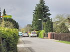
620 | Ants , colonizing insects | June 9, 1933 | The street lies between Feuerkäfer- and Goldkäferweg in the "outskirts settlement" that was laid out in 1932. It belongs to the insect district. According to the development plan, it was called Straße 84 . |
|
| On the rim sheet
( Location ) |
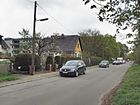
350 | Here the "Felgen Laake " lay between Spektefeld and Klosterfelde. | Jan. 1, 1990 | The road runs between Am Mantelpfuhl and Beerwinkel. To the west it goes as a residential street to Am Finkenherd, where the turning hammer is, and further as a footpath into the street An der Tränke. The western part of the Spekteweg , which was interrupted by the Großer Spektesee, was named. The street runs along the northern edge of the Spekte green corridor. |
|
| On the cap
( Location ) |
1040 (in the district) |
Parcel south of the Spektewiesen | 1878 | The street is in the district between Dyrotzer and Zeppelinstraße, it continues in Spandau to the east. The path has always been called the Schinder weg or Poor Sinner's Path because it led to the former Galgenberg. On the north side of the street are the allotment gardens “Gustavs Ruh” and the weekend settlement “An derkap”, whereby the former also takes up part of the street area. At the level of the Wunderlandstraße, An derkap is limited to a two meter wide paved driveway. |

|
| At the potion
( Location ) |
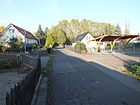
600 | Potions , formerly occupied in Spektefeld for cattle supply water | 23 Sep 1959 | The road runs between the end of the corridor in an arc to the north on the Spektegrünzug to the Kleiner Querweg. To the north of the cross road it leads as a cul-de-sac to plots 54–57. The street was laid out as street 607 in the western part of the Siemens Spekte settlement in 1933/1934 and was not yet built on in 1943. |
|
|
Ballersdorfer Strasse
( Location ) |
110 | Ballersdorf , Upper Alsace town, Haut-Rhin department, France | May 13, 1929 | The street lies between Siegener and Remscheider Straße and was formed and named in 1929 from Straße F and Straße 50 . A separated eastern section was detached on December 1, 1963 and was named Buschhüttener Weg . |

|
| Beerwinkel
( Location ) |
600 | Beerwinkel, field name for an area between Spandau and Falkenhagen | Feb. 18, 1955 | The street 594 , which was laid out and built on in the 1930s, was named in 1955. On March 10, 1986, a section of the Spekteweg in Beerwinkel was included. |

|
| Bee path
( Location ) |
370 | Bees , several hymenoptera families | June 9, 1933 | The street in the "suburban settlement" laid out in 1932 lies between the stag beetle and ant path. The settlement, known as the insect district because of the street names, was created as a residential area for the unemployed . |

|
| Bohemian Forest Path
( Location ) |
130 | Bohemian Forest , mountain range on both sides of the Czech-German-Austrian border | June 25, 1964 | The street was built to open up new residential buildings; it ends in a turning hammer . Parallel to it, other roads named after the low mountain range run northwards from the Erzgebirgsweg. |

|
| Bramwaldweg
( Location ) |
160 | Bramwald , part of the Weser Uplands, Lower Saxony | Aug 1, 1971 | The access road to the new residential buildings branches off from the Pionierweg southwards. |

|
| Bratringweg
( Location ) |
120 | Friedrich Wilhelm August Bratring (1772–1829), historian | Jan. 29, 1958 | According to the development plan, the traffic route was built in 1935 as road 505 . It is the access road westward from Viersener Strasse into the settlement square. The street 505 was built from 1935 and listed in the address book in 1936. |

|
| Burbacher way
( Location ) |
130 | Burbach , Siegerland municipality in the Siegen-Wittgenstein district, North Rhine-Westphalia | Sep 1 1963 | The street is a dead end between Siegener Straße and the extending Freudenberger Weg, to which no passage is possible. It belongs to the "Siegen district". Burbacher Weg is also the address of the Jeremiah Church , which opens onto Henri-Dunant-Platz. |

|
| Buschhüttener way
( Location ) |
80 | Buschhütten , southernmost district of Kreuztal in Siegerland, North Rhine-Westphalia | Dec. 1, 1963 | The road goes westward from Zeppelinstrasse and gives access to Freudenberger Weg. The path is the eastern part of Ballersdorfer Straße, which was divided in 1963 due to overbuilding . The course of the road continues to curve south in Wittgensteiner Strasse without any noticeable change. The path belongs to the "Siegener district". |

|
|
Darby Street
( Location ) |
540 | Abraham Darby (1676–1717), English iron manufacturer | March 15, 1975 | The road was built on the site of the former coke and coal depot of the British protective power that suggested the street name. The street with its side streets opens up a residential area going south from Pionierstraße and has an eastward side street as a connection to Frankenwaldstraße. The apartment buildings on the west side were supplemented by row houses on the east side in the 2010s. |

|
| Dyrotzer Strasse
( Location ) |
730 | Dyrotz, Havelland rural community, since 1958 part of Wustermark , Brandenburg | Jan. 18, 1936 | In 1936 Plan Strasse was named 492 . It lies in the arch to and from Seegefelder Straße and hugs the branch of the Bötzowbahn to the west, and runs along the regional railway line to the east. |

|
|
Ederkopfweg
( Location ) |
160 | Ederkopf , mountain in the southern Rothaar Mountains (Siegerland) | Apr 21, 1965 | The dead-end street goes from Wittgensteiner Weg to the west and is the entrance to eight-story apartment buildings and a 15-story apartment block. It belongs to the Siegen district. |

|
| Eiserfelder Ring
( Location ) |
410 | Eiserfeld , Siegerland municipality, incorporated in 1975 to Siegen, North Rhine-Westphalia | March 1, 1965 | The street curves westwards from and to Wittgensteiner Weg around the assigned residential buildings. It belongs to the "Siegen district". |

|
| Elmweg
( Location ) |
90 | Elm , ridge in the Harz foreland southeast of Braunschweig | June 25, 1964 | The road goes west as a cul-de-sac from Steigerwaldstraße. The street opens up the apartment blocks with multi-storey houses. In the area, other streets are named after low mountain ranges. |

|
| Erzgebirgsweg
( Location ) |
350 | Ore Mountains , low mountain range between Bohemia and Saxony | Apr 7, 1964 | The path lies between Westerwaldstrasse and Steigerwaldstrasse to the north, parallel to Falkenseer Chaussee and leads local traffic to some of the cross-cutting spur roads named after low mountain ranges. To the west the street is extended from Haardtweg . |

|
|
Falkenseer Chaussee
( Location ) |
3160 (in the district) |
Falkensee , neighboring town to the west | Feb 14, 1958 | It is the main street in the district and connects Spandau with Falkensee. The path in the direction of the former village of Falkenhagen, which was already designated as the main or middle path in 1860, was laid out as a road to the city limits by the city of Spandau in 1895 at the suggestion of the Falkenhagen community council and called Falkenhagener Chaussee . At the time of the Wall , traffic on the Berlin city limits was interrupted here. The name was changed in 1958 to avoid confusion with Falkenhagener Straße in Spandau-Neustadt. The six-lane road in mostly two separate lanes lies between Zeppelinstrasse and the city limits. |

|
| Feldgrabensteig
( Location ) |
110 | Feldgraben, historical field name | Sep 1 1971 | The road between Am Bogen and Hauskavelweg was laid out with this settlement of single-family houses between the surrounding multi-storey residential buildings. |

|
| Fire Beetle Trail
( Location ) |
340 | Fire beetle beetle family spread around the world, incorrectly also fire bug | March 19, 1956 | The street lies in the "outskirts settlement" laid out in 1932; it was initially called Straße 75 . The fire beetle trail comprises 32 plots, connects the stag beetle trail with the ant trail and is part of the insect district. Unofficially, the path at the seepage basin to the north to the district boundary is also called this. |

|
| End of the hallway
( Location ) |
650 | Location on the Spandau municipal boundary | 23 Sep 1959 | The street between An der Felgenlake and Falkenseer Chaussee is in the Siemens Spekte settlement. It was laid out as street 606 according to the development plan and built with small settlement houses in the 1940s. |

|
| Frankenwaldstrasse
( Location ) |
520 | Franconian Forest , low mountain range between the Thuringian Forest and the Fichtel Mountains | Apr 7, 1964 | The road connects Falkenseer Chaussee and Pionierstraße. It closes off the new buildings from the 1960s to the west. |

|
| Freudenberger way
( Location ) |
330 | Freudenberg , city and climatic health resort in Siegerland in North Rhine-Westphalia | Sep 1 1963 | The properties on this street are connected to Wittgensteiner Straße westwards via Buschhüttener Weg. This footpath has a passage to the Burbacher Weg and belongs to the "Siegener Viertel". |

|
| Freudstrasse
( Location ) |
350 | Sigmund Freud (1856–1939), Austrian psychoanalyst | Aug 1, 1971 | It is located between Falkenseer Chaussee and Goldkäferweg. Freudstrasse opens up the multi-storey residential buildings west of the city limits. The 137 bus runs on this two-lane road to Goldkäferweg. |

|
|
Gelsenkircher Strasse
( Location ) |
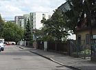
460 | Gelsenkirchen , independent city in the Ruhr area in North Rhine-Westphalia | Oct 3, 1928 | Gelsenkircher Straße was laid out as Straße 48 in accordance with the development plan . It runs between Siegener and Unnaer Straße in a north-south direction and is located in the "Westfalenviertel".
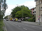
About in the middle of the street on the south side is a building designed with small mosaics that functions as a youth theater workshop. (lower picture) |
|
| Germersheimer Platz
( Location ) |
150 × 50 | Germersheim , Palatinate district town, Rhineland-Palatinate | Nov 5, 1942 | The square is designated as Platz A in the development plan from the 1920s and was named with the development along Zweibrücker Straße in 1942. The square is between Zweibrücker Straße and Germersheimer Weg. Plots 1–8 on the south side as well as 9–9d and 10–10d, which extend from the square to the north into the current inner courtyard, are assigned the addresses to the square. The park-like facility has a popular playground . |

|
| Germersheimer way
( Location ) |
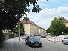
750 | Germersheim , Palatinate district town, Rhineland-Palatinate | Nov 5, 1942 | The planned road 561 was built on by Gehag from 1940 and named in 1942 between Spekteweg and Falkenhagener Chaussee, plots 1–29 are designated as arbor grounds. On November 1, 1961, a southern extension and a newly built section of road north of the Falkenseer Chaussee were added. The road currently runs between Kandeler Weg and Pirmasenser Straße. In the north, beyond the Pirmasenser Straße, a section continues as a dead end to the turning hammer , in the south the route continues as Zweibrücker Straße . |
|
| Firefly Trail
( Location ) |
820 | Fireflies , also known as St. John's beetles, are a global soft beetle family | June 9, 1933 | The traffic route was laid out as road 83 according to the development plan . It runs between Heimchen- and Goldkäferweg in the "outskirts settlement" (also known as the insect district), which was built in 1932 for unemployed settlers. |

|
| Gold beetle trail
( Location ) |
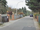
420 | Gold beetle, genus of the species Rose Beetle | June 9, 1933 | The road lies between Freudstrasse and Ameisenweg, over which it continues as a cul-de-sac. It belongs to the "insect district". |
|
| Griesingerstrasse
( Location ) |
1020 | Wilhelm Griesinger (1817–1868), internist and psychiatrist | June 20, 1961 | The street lies between the outskirts of the city and Radelandstrasse and leads west and south around the State Neurological Clinic (currently Evangelisches Waldkrankenhaus Spandau ), which was built in 1961 , which explains the choice of the street name. |

|
| Gütersloh way
( Location ) |
250 | Gütersloh , district town in East Westphalia-Lippe, North Rhine-Westphalia | Dec 3, 1937 | Plan- Strasse 612 was named with the development. It is located between Iserlohner and Portaer Straße and belongs to the Westfalenviertel. |

|
|
Haackzeile
( Location ) |
170 | Albert Haack (1832–1906), Berlin timber merchant and city councilor, head of department for the Berlin waterworks | May 1, 1964 | With the inclusion of the street 589 , the street was created in the "Großsiedlung Falkenhagener Feld" built from 1961. The Haackzeile is a cross street between Wolburgsweg and Wasserwerkstraße, southeast of the area of the Spandau waterworks . |

|
| Haardtweg
( Location ) |
450 | Haardt , part of the low mountain range Palatinate Forest | Nov 1, 2011 | The street is located between Frankenwaldstraße and Westerwaldstraße to the north, parallel to Falkenseer Chaussee and is used to split up local traffic. The Haardtweg was created by renaming the western section of the Erzgebirgweg. |

|
| Hainleiteweg
( Location ) |
120 | Hainleite , Muschelkalkhöhenzug in the Kyffhäuserkreis, Thuringia | June 25, 1964 | The road opens up from the Erzgebirgsweg northwards to the residential buildings next to it, north of the Falkenseer Chaussee. Like the surrounding streets, it was named after areas in the German low mountain range. |

|
| Hauskavelweg
( Location ) |
680 | Hauskavel, drawn pieces of meadow by the citizens' offices | Jan. 29, 1958 | The street lies between An der Felgenlake and Falkenseer Chaussee and was laid out in the Siemens estate Spekte around 1930 as street 599 . It got its name with the subsequent densification of buildings. |

|
| Heimchenweg
( Location ) |
150 | Crickets , house crickets, a long-feeler horror | March 19, 1956 | Heimchenweg was planned and named as road 573 . It is located between the stag beetle and glowworm path in the “suburban settlement” and belongs to the “insect district”. |

|
| Henri Dunant Square
( Location ) |
130 × 40 wide path |
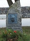
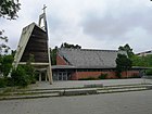
Henry Dunant (1828–1910), Swiss founder of the Red Cross | May 1, 1965 | The square is on Siegener Straße, and the green area to the east is assigned. On it is the Protestant Jeremiah Church (whose address, however, is Burbacher Weg). The space is bounded by Burbacher and Salchendorfer Weg. In a small green area on the square there is a designed boulder with a copper relief for the name giver of the plant. (lower picture) |
|
| Hermann-Schmidt-Weg
( Location ) |
360 |
Hermann Schmidt (1917–1983), politician Schmidt was the initiator of the partnerships between the Spandau district and the city and district of Siegen. |
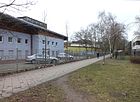
June 1, 2002 | The footpath (with limited access to motor vehicles) without assigned land enables access to public facilities between Frankenwaldstrasse and Westerwaldstrasse. |
|
| Behind the gardens
( Location ) |
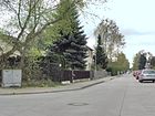
210 | was initially behind neighboring house gardens | Oct. 1, 1975 | The street is a section of street 603 from Im Spektefeld , which was laid out in the 1960s, going south with lots 2–34 (straight). It continues southwards as a footpath to An der Felgenlake. |
|
| Stag beetle trail
( Location ) |
760 | Stag beetle , “antler-bearing” native beetle | June 9, 1933 | The path, set up as Straße 82 in 1930 , runs between Heimchenweg and Freudstraße in the “outskirts of the town”. It belongs to the "insect district". |

|
| Hochhausweg
( Location ) |
140 | adjacent high-rise group | Sep 1 1973 | The street was created and named in 1973 in the (former) Siemens Spekte settlement by removing a section of the street 600 . It runs in a west-east direction between Im Spektefeld and Am Mantelpfuhl. The eponymous ten-story high-rise block is east of the street, the land on which small residential buildings are built. |

|
| Hohenzollernring
( Location ) |
1300 (in the district) |
Hohenzollern , ruling family whose line Brandenburg-Prussia provided the Prussian kings and German emperors | April 16, 1909 | The road runs in the districts of Spandau and in Falkenhagener Feld. The west side between Radelandstrasse and Spekteweg belongs to the district. Initially, the glacis or ring roads were outside the fortifications of the city of Spandau. With the deconsolidation, the newly laid out street course was named by resolution of the Spandau magistrate and "should take place with regard to our current glorious and energetic ruling dynasty and symbolize the modern times and the prosperity of the city." |

|
| Hümmlingweg
( Location ) |
90 | Hümmling , sandy hill country in the Emsland in Lower Saxony | Oct 3, 1964 | The road runs from Pionierstraße as a cul-de-sac to the south in the settlement area with street names to the low mountain ranges. The plan name before the development was Straße 11 . The road ends at a turning area with a parking lot. |

|
|
In the spectacle field
( Location ) |
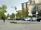
660 | Field name on the Spekte | Oct. 1, 1966 | The eastern part of the street 600 was named in the area of the "Großsiedlung Falkenhagener Feld" between Am Kiesteich and Hauskavelweg in 1966; From November 1, 1969, the western extension to the city edge road was included. The large green area at the east end of the street is called Spektefeld. |
|
| Iserlohner Strasse
( Location ) |
440 | Iserlohn , Sauerland town in North Rhine-Westphalia | Oct 3, 1928 | The street runs between Remscheider and Unnaer Straße. Projected before the naming as street 51 , street 609 was also included on December 3, 1937 . It belongs to the Westfalenviertel. |

|
|
Junikäferweg
( Location ) |
350 | Junikäfer, common name for the ribbed curl beetle , sometimes belated cockchafer | June 9, 1933 | The path in the "outskirts settlement" started in 1932 lies between the stag beetle and ants path. According to the development plan, it was named Straße 79 and belongs to the insect district. |

|
|
Kandeler way
( Location ) |
130 | Kandel , town in Rhineland-Palatinate | 21 Sep 1961 | The spur road leads south at the transition from Germersheimer Weg to Zweibrücker Straße. The street ends in front of the Spectrum Basin. |

|
| Kellerwaldweg
( Location ) |
90 | Kellerwald , eastern branch of the Rhenish Slate Mountains in Hesse | Apr 7, 1964 | As a residential street, the street opens up the residential buildings of the “Großsiedlung Falkenhagener Feld” from the 1960s. It goes north from Haardtweg as a parallel street to Falkenseer Chaussee. |

|
| Kisselnallee
( Location ) |
560 | In the 19th century, kissels or kisses were the designations for raised areas overgrown with pine trees | May 13, 1929 | Kisselnallee is located with lots 1–19 (odd) between Pionierstrasse and the suburbs on the eastern edge of the “ Friedhof An den Kisseln ”. The road A in Radeland was expanded with the plans for the expansion of the cemetery as "West cemetery for Greater Berlin" in 1927 and named 1929th |

|
| Small cross way
( Location ) |
260 | Location to the rest of the road system | Feb 14, 1966 | The street 601 in the Siemenssiedlung south of the Falkenseer Chaussee (Spekte-Siemens-Siedlung) was given this name when it was built because of its location. The road runs parallel to Falkenseer Chaussee and across between An der Tränke and Am Finkenherd. |

|
| Knüllweg
( Location ) |
90 | The Knüll , low mountain range in Hesse | Apr 7, 1964 | The cul-de-sac goes north from Haardtweg to the residential blocks of the "Großsiedlung Falkenhagener Feld". The street was named after areas in the German low mountain range. Knüllweg is the northern parallel road to Falkenseer Chaussee for local traffic . |

|
| Kohstallweg
( Location ) |
120 | Franz Kohstall (1866–1931), educator and historian, Spandau local researcher | May 20, 1958 | The path branches off from Dyrotzer Straße as a cul-de-sac to the east. Initially laid out as road 522 , according to the address book from 1943 it was still vacant. |

|
| Kraepelinweg
( Location ) |
320 | Emil Kraepelin (1856–1926), psychiatrist | Aug 1, 1971 | The street is located between Freudstrasse and the outskirts of town and was laid out in the “outskirts of town”. The street name was chosen with reference to the Spandau mental hospital . |

|
|
Leuthingerweg
( Location ) |
390 (in the district) |
Nikolaus Leuthinger (1554–1612), pedagogue, chronicler | Feb. 18, 1955 | The road runs between Seegefelder Weg and across Senzker Strasse to the junction of the Bötzowbahn. It was laid out as Road 493 in the 1930s. |

|
| Lüdinghauser Weg
( Location ) |
250 | Lüdinghausen , town in North Rhine-Westphalia southwest of Munster | Dec 3, 1937 | The street in the Westfalenviertel lies between Iserlohner and Portaer Straße, to the east parallel to Gütersloher Weg. It was laid out as road 613 of the development plan. |

|
| Cockchafer Trail (*)
( Location ) |
730 | Cockchafer |
not dedicated to 1995 |
The footpath without assigned land was not officially designated based on the insect district to the south. It runs on the northern edge of the "outskirts of the town" and south of the area of the forest hospital and Vivantes hospital Spandau. It lies between the outskirts of the city and the city limits, where it connects to the Falkenseer Pestalozzistraße to the north . |

|
|
Merziger Strasse
( Location ) |
100 | Merzig , district town on the Saar, Saarland | Oct 3, 1928 | The street is between Zeppelinstraße and Germersheimer Weg. This access road from Zeppelinstraße to the settlement around Germersheimer Platz is still noted in the 1928 address book as Street Fa , with construction sites and houses of the non-profit building company Adamstraße mbH (town hall) between Zeppelinstraße and Straße 21 . |

|
| Mülheimer Strasse
( Location ) |
220 | Mülheim , independent city in the western Ruhr area, North Rhine-Westphalia | March 20, 1929 | The street is south across the Frankenwaldstraße between Falkenseer Chaussee and Iserlohner Straße. According to the development plan, it was first called Straße 53 . It belongs to the "Westfalenviertel". |

|
|
Nauener Strasse
( Location ) |
150 (in the district) |
Nauen , to the west of Brandenburg, since 1988 twin town of the Spandau district | 1878 | The field path to Nauen was already in the Klosterfelde area before 1846 . When the Berlin-Hamburg railway was built in 1846, the Nauener Weg crossed . In 1878, after its expansion, it was officially renamed Nauener Strasse.
The street is between Seegefelder Straße and Brunsbütteler Damm. Plots 2–5 on the western side of the street up to the railway line belong to the district. On the Spandau side, the road leads along the allotment garden to Altonaer Strasse at the industrial park. |

|
| Netphener way
( Location ) |
230 | Netphen , municipality in Siegerland in North Rhine-Westphalia | Nov. 26, 1980 | The street is a cycle and cycle path with no assigned land and is located between An derkap and Spekteweg. It connects Viersener and Siegener Straße across the green corridor through the weekend settlement here. Since the conversion of this settlement into a residential area, the Netphener Weg has been a dedicated street. It connects the “Siegener Quarter” with the southern part of the district via the Spektegrünzug. In the summer of 2014, extensive earthworks were carried out to relocate district heating connections, which also significantly impaired car traffic in the adjacent streets. |

|
|
Oberhauser Strasse
( Location ) |
190 | Oberhausen , independent city in the Ruhr area, North Rhine-Westphalia | Oct 9, 1928 | In 1928 Straße 54 and Straße 59a were merged and named. The street lies between Iserlohner Straße and Falkenseer Chaussee. It belongs to the "Westfalenviertel". |

|
| Osningweg
( Location ) |
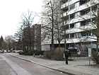
140 | Osning , old name of the Teutoburg Forest | Oct 3, 1964 | The street in the route of the previous street 12 is a cul-de-sac from Pionierstrasse to the south. This access road to the adjoining apartment block is named according to the surrounding streets in the "Großwohnsiedlung Falkenhagener Feld" after areas in German low mountain ranges. |
|
|
Paul Gerhardt Ring
( Location ) |
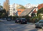
430 | Paul Gerhardt (1607–1676), theologian, hymn poet | June 1, 1968 | The road runs in a semi-ring from the Spektefeld road northwards. The naming is related to the nearby evangelical Paul Gerhardt community center. |
|
| Pepper way
( Location ) |
100 | Walter Pfeffer (19th century), responsible for the installation and expansion of the irrigation and drainage system in the city of Spandau in the 1890s; initiated and directed the construction of the waterworks | May 1, 1964 | The path goes eastwards from Wasserwerkstraße about in its middle. It's a dead end . |

|
| Pioneer Road
( Location ) |
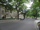
2100 | Pioneers , specially trained military personnel | 1896 | Pionierstrasse runs in a south-east-north-west direction in the north of the district, starting from the Hohenzollernring. Its course was described as follows: from the Falkenhagener Forst, over the railway (line), the Zeppelinstrasse to the Hohenzollernring and back. It led past the municipal waterworks (today's address Pionierstrasse 206), a “commercial gardening” and the municipal cemetery.
The address Pionierstrasse 82 is the cemetery in the Kisseln . There are u. a. Memorial plaques for 350 victims of National Socialism ( picture of the plaque ) and the victims of a fire accident in the inn "Karlslust" in Hakenfelde in 1947 ( picture of the plaque ). The road comprises 206 parcels and has a few branches at the north-western end for the development of the residential property and the area of the Spandau waterworks . The road led to a military training area, which was set up at the end of the 19th century for the pioneer unit stationed in Spandau. A branch of the “German Police Sports Board” has been set up on an area between Pionierstrasse 10 and Radelandstrasse. In the 1950s it was the location of a police school and a "bathing establishment" to the north. Next to it is currently the “Green Belt” sports facility. A stumbling stone in front of house number 69 reminds of the fate of Regina Postrong, who was deported in 1945. |
|
| Pirmasenser Strasse
( Location ) |
150 | Pirmasens , today a town in Rhineland-Palatinate, in the year the street was named it belonged to Bavaria | Oct 3, 1928 | The traffic route was laid out as street E according to the development plan . It goes from Zeppelinstraße on both sides and connects Steigerwaldstraße with Germersheimer Weg. |

|
| Portaer Street
( Location ) |
230 | Porta Westfalica , breakthrough valley of the Weser in East Westphalia | Dec 3, 1937 | It runs in a gently curved route from Recklinghauser Weg (east) to Unnaer Straße (west). It was laid out as road 610 according to the development plan . Their naming is based on the surrounding street system, which got names from the Westphalia region and is therefore called Westphalian or Westphalia Quarter. |

|
| Posthausweg
( Location ) |
160 | Post office , opened in the year the street was named | Nov 25, 1966 | The road goes south from Falkenseer Chaussee and is a dead end . The eponymous building has the address Posthausweg 5. |

|
|
Radelandstrasse
( Location ) |
2650 (in the district) |
cleared land (Low German) | 1870 | The Radelandstrasse runs from the Hohenzollernring (east-south-east) to the Berlin city limits over Griesingerstrasse (west-north-west). It continues as a footpath and bike path to Martin-Luther-Straße in the Falkenhöh district of the city of Falkensee . To it belong 222 house numbers, of which the odd numbers 1-51 and 131-205 on the south side belong to the district Falkenhagener field. The remaining parcels are in the district of Berlin-Hakenfelde , which also includes the municipal cemetery “In den Kisseln” (numbers 39–129). |

|
| Reckeweg
( Location ) |
110 (in the district) |
Otto Karl Louis Recke (1844–1922), theologian, pastor in the Nikolaigemeinde in Spandau 1874–1915 made himself a. a. also made a name as a local researcher |
Feb. 18, 1955 | The traffic route was built in the 1930s as road 390 . The path is divided into two parts - the eastern section runs in a straight line in an east-west direction between the embankment of the Bötzowbahn, across street 396 to street 603 (numbers 1–116), the western section goes in a U-shape from Seegefelder Weg ( Numbers 117-145).
The southern side of the street (house number range 35–144) belongs to the Berlin-Staaken district . |

|
| Recklinghauser way
( Location ) |
610 | Recklinghausen , district town in the Ruhr area in North Rhine-Westphalia | Sep 9 1931 | The path was laid out in 1929 as Straße 58 , and Straße 55 (between Falkenhagener Chaussee and Iserlohner Straße) was added in May 1931. The Busendorfer Weg , named in 1929, was also incorporated in 1935 (allegedly because of the offensive name). The current name is based on neighboring traffic routes, which are named after places in Rhineland-Palatinate. The Recklinghauser Weg comprises 45 parcels. Numbers 26–32 belong to the “B. Traven Oberschule (BTO)” community school, which opened in 2008. |

|
| Remscheider Strasse
( Location ) |
470 | Remscheid , independent city in the Bergisches Land in North Rhine-Westphalia | Sep 9 1931 | The street was laid out as street 56 according to the development plan . When it was named, it ran in a north-south direction between Falkenhagener Chaussee (later renamed Falkenseer Chaussee) and Gelsenkircher Straße, the house numbers are assigned in a horseshoe shape. |

|
| Rockenhausener Strasse
( Location ) |
120 | Rockenhausen , town in the Donnersbergkreis in Rhineland-Palatinate | Sep 1 1962 | It goes from Zweibrücker Straße - as an extension of the street Germersheimer Platz - as a dead end eastwards. |

|
|
Salchendorfer way
( Location ) |
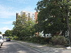
120 | Salchendorf , district of Neunkirchen in Siegerland in North Rhine-Westphalia | May 1, 1965 | The path is a short cul-de-sac going east from Siegener Straße. It belongs to the “Siegenerviertel” and borders the Henri-Dunant-Platz. |
|
| Schulzenstrasse
( Location ) |
330 | Schulze (19th century), landowner in Klosterfelde and entrepreneur | 1878 | The street was built around 1875 on the initiative of the property owner and entrepreneur Schulze. The request for a street to be named after the owner was granted. In the 1920s, when Spandau became an administrative district of Berlin, the “Schultze's heirs” were entered in the address book as owners of parcel 17 (spelling, however, with “tz”).
The street runs between Seegefelder Straße and An der cap. The 20 parcels are numbered in a horseshoe shape. |

|
| Seegefelder Strasse
( Location ) |
1040 (in the district) |
Seegefeld , part of the city of Falkensee since 1923 ; Direction of the road | around 1878 | The Seegefelder Straße and the Seegefelder Weg form a contiguous, busy street that leads from Spandau in a north-westerly direction to the former independent village of Seegefeld. The road runs from the Old Town Square in Spandau to Dyrotzer Straße. Housing development along the street began in the 1870s. When it was added to the Berlin address book in 1925, it was entered between Potsdamer Tor (in Spandau) and the “Staaken district” (presumably the crossing with the railway) with 146 house numbers in horseshoe numbering. |

|
| Seegefelder Weg
( Location ) |
280 (in the district) |
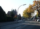
Seegefeld , part of the city of Falkensee since 1923 ; Direction of the way | Dec 13, 1934 | The Seegefelder Straße and the Seegefelder Weg form a contiguous, busy street that leads from Spandau in a north-westerly direction to the former independent village of Seegefeld.
The route runs between Dyrotzer Straße (East) and the Berlin city limits (Straße 339; West). The continuation in the state of Brandenburg is again called Seegefelder Straße. The south side and the entire road area belong to the Staaken district. The numbers 220–250 (even and odd) are in the Falkenhagener Feld. |
|
| Mermaid Trail
( Location ) |
140 | Mermaid, former name for dragonflies | March 19, 1956 | According to the development plan, the path was laid out as road 574 in the "suburban settlement". It comprises 16 parcels and is part of the "insect district". |

|
| Senzker Strasse
( Location ) |
150 | Senzke , formerly an independent village, today a municipality in Brandenburg | Nov 3, 1938 | It is a short north-south connection between Seegefelder Weg and Leuthinger Weg. According to the development plan, it was laid out as road 494 . |

|
| Siegener Strasse
( Location ) |
570 |
Siegen , city in Siegerland in North Rhine-Westphalia, from 1952 the first twin city of the Spandau district |
Sep 1 1963 | The Viersener Straße, completed and named in 1928, was a two-part street, separated by the meadows on the Spekte. Therefore the northern section got its own name.
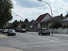
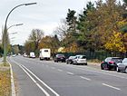
Siegener Straße runs north from the Spekteweg to Falkenseer Chaussee. To the north the street continues as Westerwaldstraße. It belongs to the "Siegen district". Extensive earthworks in the summer of 2014 led to traffic disruptions around this street (top picture). |

|
| Solling line
( Location ) |
100 | Solling , low mountain range in Lower Saxony and North Rhine-Westphalia | Apr 7, 1964 | It goes off the Frankenwaldstraße eastwards. After plot 6, the route makes a hook that runs south and then westwards to number 11, where it meets the continuation of the Hermann-Schmidt-Weg. |

|
| Spekteweg
( Location ) |
1750 (in the district) |
( Spekte ) “Spektefeld und Spektewiesen” are listed as direct namesake in the address book | 1895 | The Spekte, north of the old town of Spandau, was in the 18./19. A small brook, part of an amelioration system . This traffic route was one of the first streets to receive its current name during the structural expansion in Spandau. For the time being, the Spekteweg only started a little west of the Hohenzollernring; in 1925 only two owners are named.
On March 10, 1986, a northward section was spun off and added to the Beerwinkel road. On January 1, 1990, another section (located west of the Großer Spektesees ) was renamed An der Felgenlake. The Spekteweg has connected the Hohenzollernring (east) with the Unnaer Straße (west) since 1990. The house numbers 1, 29–30, 46–52, 54–91 belong to the Falkenhagener Feld, while the numbers 110–119 belong to Spandau. (The count was retained after the spin-offs.) |

|
| Outskirts road
( Location ) |
1770 | It is the main street of the "suburban settlement in Falkenhagener Feld". | June 9, 1933 | First the traffic route was laid out as road 77 . In 1935 the following route is given: "From Falkenhagener Chaussee (nine construction sites) via Hirschkäferweg, Glowworm Path to the Ameisenweg and Pionierstraße" (odd on the left, even on the right). A total of 46 parcels were listed, with the count starting with 501, i.e. extending to 546!
After 1945 the street was extended to the south (from Falkenhagener Chaussee to Spekteweg), laid out as street 603 according to the development plan . The northern section was incorporated into the city's peripheral road on November 11, 1968, and the southern section was given its own name, Hinter den Garten, after the residential development was completed . The street leads to the Spandau hospital. |

|
| Steigerwaldstrasse
( Location ) |
460 | Steigerwald , low mountain range in Bavaria | June 25, 1964 | The street was only laid out and built on in the 1960s. It was named after a German low mountain range. Currently (as of May 2013) it comprises 31 plots. |

|
| Street 396
( Location ) |
50 | Zoning plan | around 1940 | This officially managed footpath without assigned land is located on the district boundary to Staaken between Seegefelder Weg and Wolfshorst. The Leuthingerweg connects to the south. |

|
| Street 598
( Location ) |
90 | Zoning plan | around 1940 | The street was built in the late 1930s. According to the address book, it ran between Spekteweg / Falkenhagener Chaussee and Straße 601 with 21 parcels, many of which were still construction sites around 1943. The street numbering has been retained over the years, but officially it does not belong to any properties and it is only a footpath. The path lies between Am Bogen and Falkenseer Chaussee. |

|
| Street 600
( Location ) |
270 | Zoning plan | after 1943 | This numbered street with lots 13-17 (odd) lies between An der Tränke and Am Mantelpfuhl. |

|
|
Tangermünde way
( Location ) |
140 | Tangermünde , town in the Stendal district in Saxony-Anhalt | Feb. 19, 1938 | The Tangermünder Weg, laid out as Straße 563 , connects the Hohenzollernring with the Zweibrücker Straße in an east-west route. |

|
|
Unnaer Strasse
( Location ) |
290 | Unna , district town in the eastern Ruhr area in North Rhine-Westphalia | Dec 3, 1937 | The street, laid out as street 611 according to the development plan , leads in a south-north direction from Spekteweg to Iserlohner Straße, where it forms a small "S" at the confluence with Gelsenkircher Straße. It belongs to the Westfalenviertel. |

|
|
Viersener Strasse
( Location ) |
180 | Viersen , district town in North Rhine-Westphalia | Oct 3, 1928 | When it was named, this road consisted of a northern section and a southern section. They were separated by the Spektewiesen, on which the Netphener Weg was later laid as a connection in the same direction. The northern area was separated out in 1963 with its own name ( Siegener Straße ). Viersener Straße belongs to the "Westfalenviertel" and runs between Netphener Weg and Dyrotzer Straße. |

|
|
Wasserwerkstrasse
( Location ) |
550 | Spandau waterworks | May 1, 1964 | The traffic route with the parcels 1–49 was created on the previously unnamed driveway to the Spandau waterworks, which was inaugurated around 1895. It runs from Pionierstrasse to Falkenseer Chaussee. |

|
| Wasp path
( Location ) |
330 | Wasps , group of insects | June 9, 1933 | According to the development plan, the traffic route was laid out as road 78 in the “suburban settlement”. It belongs to the "insect district" and runs between the ant trail and the stag beetle trail. |

|
| Westerwaldstrasse
( Location ) |
540 | Westerwald , low mountain range in Rhineland-Palatinate, Hesse and North Rhine-Westphalia | Apr 7, 1964 | The street was not built until the early 1960s. It leads in a south-north direction with two bends from Falkenseer Chaussee to Pionierstraße. To the south the route becomes Siegener Straße. It belongs to the road system with names after low mountain ranges. On parcel 16–18 in the middle section are the parish hall and the evangelical “refuge church” (see picture) on what used to be a nursery. The church buildings were built in 1964 and 1965 based on designs by the architect Bodo Fleischer .
The Spandau district administration implemented a development plan between 2010 and 2012, according to which the “new quarter square in the area of the S-curve of Westerwaldstrasse [becomes] a lively and attractive center in Falkenhagener Feld”, using around two million euros the Urban Redevelopment West program. |

|
| Wittgensteiner way
( Location ) |
460 | Wittgensteiner Land , landscape in the Siegen-Wittgenstein district , North Rhine-Westphalia | March 1, 1965 | It runs a little west parallel to Zeppelinstrasse in north-south direction between Buschhüttener Weg and Spekteweg and belongs to the “Siegener Viertel”. At the corner of Freudenberger Weg there is a food hall that offers Russian specialties (Jastwa; in German, refreshment; lower photo) |

|
| Wolburgsweg
( Location ) |
550 | Wolburg, historical field name ; should of Walpurgis resulting | Jul 31, 1954 | According to the development plan, the traffic route was laid out as road 590 in the 1930s . It ran between Falkenhagener Chaussee (after renaming Falkenseer chaussee) and Pionierstraße. Parcels 39–45 were originally planned as "arbor areas". |

|
| Wolfshorst
( Location ) |
580 (in the district) |
Wolfshorst, historical field name | Nov 3, 1938 | Before the name was given, the traffic route was street 391 . Wolfshorst runs in the Falkenhagener Feld district to the north, parallel to the Reckeweg on both sides of the Am Kiessee road in a west-east direction. House numbers 1–45 (odd; north side of the street) and 52–56 (even) belong to the Staaken district. |

|
| Wolmirstedter Weg
( Location ) |
120 | Wolmirstedt , town in the Börde district in Saxony-Anhalt | Feb. 19, 1938 | The path is a very short east-west connection between Hohenzollernring and Zweibrücker Straße. According to the development plan, it was built as street 532 . |

|
| Wunderwaldstrasse
( Location ) |
160 | Gustav Wunderwald (1882–1945), painter | Aug 1, 1966 | The traffic route was built in the 1940s as road 503 to connect Seegefelder Strasse with An der cap; it has 14 plots. Currently (as of 2014) the Wunderwaldstraße runs between Dyrotzer Straße (south) and An der cap (north). |

|
| Wustermarker Strasse
( Location ) |
470 (in the district) . |
Wustermark , municipality in Brandenburg | Oct 3, 1928 | Today's traffic route emerged from Straße 28 (before 1928).
The street runs in an east-west direction from the Spandau district (Dallgower Straße) across Elstaler Straße as a dead end (house number range 1–39). After an interruption (missing house numbers 40-43), Wustermarker Straße in the Falkenhagener Feld district leads from Nauener Straße to Seegefelder Straße (end with house number 105). |

|
|
Zeppelinstrasse
( Location ) |
1570 (in the district) |
Ferdinand Graf von Zeppelin (1838–1917), developer and namesake of the airships | April 16, 1909 | The street was laid out as street A in the first years of the 20th century according to plans by a terrestrial society and from 1907/1908 the development of the adjacent properties began. In 1909, the traffic route was given the name Zeppelinstrasse, as a result of the development of the airship and the destruction of LZ 9 near Echterdingen and because of the enthusiasm for Count Zeppelin at the time. On July 1, 1975, the southern extension was incorporated into Zeppelinstrasse. Most of the street belongs to the district Falkenhagener Feld, the house numbers 58-63, however, to the district Spandau.
A small section of this street between Wustermarker Straße and An derkap in the Klosterfelde area was called Hochgerichtsstraße from 1878 to June 1977 after the Galgenberg that existed here . It was canceled because of the residential development that began in 1977. Then Zeppelin Strasse and Nauener Strasse were swiveled, creating a new, continuous route . |

|
| Zirpenweg
( Location ) |
290 | Cicada, popular name for crickets and crickets for the generated noise | March 19, 1956 | According to the development plan, the Zirpenweg was laid out as road 76 in the “ suburban housing estate ”. It runs from the stag beetle trail via the glow worm trail to the ant trail and comprises 32 plots. The Zirpenweg is part of the "insect district". |

|
| Zweibrücker Strasse
( Location ) |
890 | Zweibrücken , independent city in Rhineland-Palatinate | Oct 3, 1928 | It was laid out as Road 20 in accordance with the development plan . In 1955 it was extended to the south beyond Falkenseer Chaussee, which was incorporated into Zweibrücker Straße on July 15, 1961. |

|
Previous and planned streets
- The 600er streets were intended for the Siemens housing estate Spekte and in 1937 either summer houses were built or construction sites were indicated.
-
Busendorfer Weg :
The new residential street was named Busendorfer Weg on May 28, 1929 . The path is possibly named after the then still independent municipality of Busendorf bei Beelitz (today part of Beelitz). Because of its location in a quarter with West German names, under which Ballersdorfer Straße , which is almost simultaneously named, is also a place in Alsace (whose affiliation to (West) Germany was often proclaimed in the 1920s for revisionist reasons), is one Named after the Lorraine Bouzonville , German Busendorf, more likely. In the Berlin address books 1930–1935 the street between Spekteweg and Gelsenkircher Straße is noted, initially as vacant and in 1935 with two houses and construction sites. Since some residents found this name immoral, the street in the Westfalenviertel was incorporated into Recklinghauser Weg in 1935 . The reference to Recklinghauser Weg can already be found in the 1936 address book under Busendorfer Strasse. - Falkenhagener Chaussee : The road from Spandau to the village of Falkenhagen, which was documented as early as 1860, was expanded as a road in 1895 and renamed Falkenseer Chaussee on February 14, 1958 .
- High Court Road : a short street, named after an earlier here had been present high court at the south end of Zeppelin road that was built over the 1977th
- Nauener Weg : The route towards Nauen existed in Klosterfelde (locality in Spandau) as early as 1846 when the Berlin-Hamburg railway was built , which it crossed. With the fortification, the name was changed to Nauener Strasse in 1878 , which was continued by Zeppelinstrasse.
Further locations of Falkenhagener Feld
Allotment gardens
The listed allotment gardens (KGA) (formerly called colonies ) are listed in Berlin's allotment garden development plan (Spandau district). They are also noted on the map of Berlin 1: 5000 (K5 color edition). The KGA in the district are considered long-term, some have already been rededicated as settlement areas with permanent residents.
- KGA "Am Kiesteich" (Wolfshorst 60, Lage ), permanent allotment garden with eight plots secured according to the B-Plan and 42 plots according to the zoning plan on 14,136 m² of state-owned leased land.
- "Bahnlandwirtschaft BLW" - Sub-district Spandau Group Leuthingerweg, ( location ), the facility is located in the angle between the continuous railway line and the industrial track on the railway's own premises in the district, but the greater part on Spandau premises.
- KGA "Frisch Auf" (Pionierstrasse 36, Lage ), permanent allotment garden with 124 parcels on 50,621 m² of state-owned leased land.
- KGA "Gustavs Ruh 1" (Spekteweg 85 and An derkap 174, Lage ), permanent allotment garden with 17 plots on 6,898 m² of state-owned leased land, as well as (An derkap 89-91 Lage ) with 17 plots on 5195 m² of private leased land.
- KGA “Neu-Sternfeld” (Falkenseer Chaussee 147–150, Lage ) with 33 parcels on 10,246 m² of land owned by the state. The facility south of Falkenseer Chaussee is on the outskirts along the Spekte .
- KGA “An der Bötzowbahn” (Pionierstrasse / Falkenseer Chaussee Lage ), permanent allotment garden along the Bötzowbahn (Osthavelländische Eisenbahn) with 21 plots on 7385 m² of state-owned leased land.
Parks and other facilities
- Municipal cemetery In den Kisseln ( location )
- Spekte field with the large Spektesee ( location )
- Spekte wiesen ( location )
- Spandau waterworks , grounds of the Berliner Wasserbetriebe ( location )
literature
- Gesellschaft Wirtschaftshof Spandau eV (Hrsg.): Street chronicle with signposts through the Spandau economy . H. Born & Co Spandau, Berlin 1957.
Web links
- Street directory Falkenhagener-Feld. kaupert media GmbH, accessed on February 11, 2013 .
- Office for Statistics Berlin-Brandenburg: List of streets and squares in the Spandau district (as of February 2015); pdf
- Map of Berlin 1: 5000 with district boundaries. Senate Department for Urban Development Berlin, 2009, accessed on February 11, 2013 .
- District management Falkenhagener Feld West
- Falkenhagener Feld district
- Surveying map from 1938 - Spandau, Reinickendorf, Osthavelland district - 1: 10000. Berlin-Spandau surveying office, 1938, accessed on September 24, 2012 .
Individual evidence
- ↑ a b Database of the regional reference system
- ↑ a b c d e f g h i j k checked by fisbroker: Map of Berlin 1: 5000 (K5 color edition) accessed 23 September 2012
- ↑ Partnerships Spandau ( Memento of the original from April 7, 2014 in the Internet Archive ) Info: The archive link was automatically inserted and not yet checked. Please check the original and archive link according to the instructions and then remove this notice.
- ^ Streets in Spandau . In: Berliner Adreßbuch , 1936, Part IV, p. 1182.
- ↑ a b Streets in Spandau . In: Berliner Adreßbuch , 1935, Part IV, p. 1162.
- ↑ to the person Bratring
- ^ Spandau administrative district> Strasse 505 . In: Berliner Adreßbuch , 1936, Part IV, p. 1236.
- ^ Falkenhagener Feld West
- ↑ a b Germersheimer Platz, Germersheimer Weg . In: Berliner Adreßbuch , 1943, Part IV, pp. 1218, 1219.
- ↑ a b c d e Spandau . In: Berliner Adreßbuch , 1934, Part IV, p. 1230.
- ↑ Gütersloher Weg . In: Berliner Adreßbuch , 1939, Part IV, p. 1236.
- ↑ All streets in this residential area are named after low mountain ranges. checked by fisbroker: Map of Berlin 1: 5000 (K5 color edition) accessed September 23, 2012.
- ↑ a b Berlin city map 1961 ( page no longer available , search in web archives ) Info: The link was automatically marked as defective. Please check the link according to the instructions and then remove this notice. : see road 603 as the southern continuation of the city-fringing road.
- ↑ on the person of Kohstall
- ↑ on the person of Leuthinger
- ↑ County Spandau> N-Z . In: Berliner Adreßbuch , 1928, Part IV, p. 1374.
- ↑ City map Berlin 1955 ( page no longer available , search in web archives ) Info: The link was automatically marked as defective. Please check the link according to the instructions and then remove this notice. : Falkenhagener Feld area; at that time still called "Neustadt".
- ↑ a b Spandau . In: Berliner Adreßbuch , 1932, Part IV, p. 1271.
- ^ History of Schulzenstrasse on kauperts.de
- ↑ Schulzenstrasse in Spandau . In: Berliner Adreßbuch , 1922, Part IV, p. 1188.
- ↑ for the first time in the Spekteweg . In: Berliner Adreßbuch , 1925, Part IV, p. 1331. with specific information on the origin of the name
- ↑ The plan numbers from 469 to over 600 were assigned in the late 1930s for the road system in Falkenhagener Feld.
- ↑ Street 598 . In: Berliner Adreßbuch , 1940, Part IV, p. 1266.
- ↑ Refuge Church on kirchenkreis-spandau.de ( Memento of the original from November 14, 2012 in the Internet Archive ) Info: The archive link was inserted automatically and has not yet been checked. Please check the original and archive link according to the instructions and then remove this notice. ; Retrieved May 22, 2013
- ^ Urban development planning on berlin.de ; accessed on February 5, 2016.
- ↑ History Wolborgsweg on kauperts.de
- ↑ Berlin city map 1943 ( page no longer available , search in web archives ) Info: The link was automatically marked as defective. Please check the link according to the instructions and then remove this notice. : Wustermarker Straße already in today's alignment. According to kauperts.de, Street 7 is said to have been included in 1955 , but according to the address book it was laid out in 1928 in today's Staaken area between Radelandstrasse and Hubertusstrasse, Street 7 . In: Berliner Adreßbuch , 1926, Part IV, p. 1371.
- ↑ Hochgerichtsstrasse on berlingeschichte.de
- ↑ City map of Berlin ( page no longer available , search in web archives ) Info: The link was automatically marked as defective. Please check the link according to the instructions and then remove this notice. see the southern continuation of Zeppelinstrasse
- ^ Streets in Spandau> (from) Straße 604 . In: Berliner Adreßbuch , 1937, Part IV, p. 1245.
- ^ Kauperts.de: Busendorfer Weg
- ^ Spandau administrative district> Busendorfer Weg . In: Berliner Adreßbuch , 1935, Part IV, p. 1171.
- ^ Spandau> Busendorfer Weg . In: Berliner Adreßbuch , 1936, Part IV, p. 1191.
- ^ Allotment garden inventory_05.pdf (Spandau) ( Memento of the original from September 29, 2013 in the Internet Archive ) Info: The archive link was inserted automatically and has not yet been checked. Please check the original and archive link according to the instructions and then remove this notice.
- ↑ Allotment garden areas that are defined as permanent allotment gardens by the B-Plan.
- ↑ a b c d Fictitious permanent allotment gardens * according to §§ 16 and 20a BKleingG. The fictitious permanent allotment gardens are additionally protected by the representation in the FNP as green areas - allotments.
- ↑ Allotment garden areas which, according to the FNP, should be preserved. The state-owned areas at this stage are allotment gardens that were established after the BKleingG came into force and are therefore not fictitious permanent allotments.


