List of listed objects in Sankt Barbara im Mürz valley
The list of listed objects in Sankt Barbara im Mürzzuschlag contains the 19 listed , immovable objects of the Austrian municipality Sankt Barbara im Mürzzuschlag in the Styrian district of Bruck-Mürzzuschlag .
Monuments
| photo | monument | Location | description | Metadata |
|---|---|---|---|---|

|
Cemetery ObjectID: 10500 |
Friedhofweg 2 KG location : Veitsch village |
ObjectID: 10500 Status: § 2a Status of the BDA list: 2020-02-29 Name: Aufbahrungshalle GstNr .: .36 |
|

|
Town hall / municipal office, market town office ObjectID : 12921 |
Obere Hauptstrasse 18 KG location : Veitsch village |
ObjectID : 12921 Status: § 2a Status of the BDA list: 2020-02-29 Name: Town Hall / Municipal Office, Market Municipality Office GstNr .: .17 Municipal Office Veitsch |
|

|
Secondary school ObjectID: 10503 |
Untere Hauptstrasse 1 location KG: Dorf Veitsch |
The secondary school was built from 1958 to 1963 based on a design by Ferdinand Schuster . The three-story functionalist school building has a U-shaped floor plan with an angled gymnasium. The classrooms have mostly two-sided lighting. In 2011 the school was closed due to lack of demand. |
ObjectID: 10503 Status: § 2a Status of the BDA list: 2020-02-29 Name: Hauptschule GstNr .: 65/1; 65/5 |

|
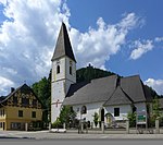
Catholic parish church hl. Veit ObjectID : 10498 |
KG location : Veitsch village |
The late Gothic church was first mentioned in a document in 1206. The three-bay nave was completed in 1456. It is vaulted with a net rib vault, which rests on semicircular services or recessed buttresses with leaf capitals . The interior decoration includes elements from the late Gothic to the early 20th century. In the middle yoke there are keystones with coats of arms, next to the Heiliggeistloch with two heads. The single-bay choir is separated from the nave by a drawn-in, tapering front arch (5/8 end, raised by one step). It is vaulted by a deeply drawn cross-ribbed vault that rests on consoles. One of the round keystones at the end of the choir depicts a blessing bishop. Here the buttresses are flat, in between a heavily damaged, late Gothic fresco depicting Christ as judge of the world and the Mother of God with St. John represents. Gothic ornamental discs have been preserved in the tracery of two choir windows. To the south of the choir is the baroque St. Veit Chapel with a barrel cap barrel on pilasters and an altar from the mid-18th century, which is attributed to Johann Michael Eisenschmidt . There is a wall niche here, which is closed off by a wrought iron grille from the 18th century. The other side altars are from the Rococo (St. Vitus Chapel, late 18th century). The pulpit with a relief of Christ was built in the middle of the 18th century. The neo-Gothic organ was created by A. Mauracher in 1894 . The mighty, three-storey bell tower on the west side of the church has a high wedge roof. In the tower hall is a barrel vault with stitch caps. The south gate, the main entrance to the church, is a barbed round arch portal. The bell was donated by Theresia Weyrin in 1736. In 1956 the church was extensively restored. |
ObjectID : 10498 Status: § 2a Status of the BDA list: 2020-02-29 Name: Catholic parish church hl. Veit GstNr .: .21; 12 Parish Church of St. Veit, Veitsch |

|
Stiftshof / Gutshof / Lesehof, Pfarrhof ObjectID : 10499 |
KG location : Veitsch village |
The building complex is located north of the church and is connected to it by a corridor from the Gothic period. This is in turn provided with a round arched passage and an Easter bay (with a barbed window). On his windowsill are two head consoles. The churchyard is separated from the provost house by a high wall. The individual wings of the building are arranged around a two-story arcade courtyard. The east wing is connected to a farm building, in which there is a room covered with stucco and a barrel vault, which was created between 1730 and 1740 - probably - by Johann Cajean Androy . The building has served as a youth hostel, arcade tavern, accommodation for pilgrims and event center since 1989. |
ObjectID : 10499 Status: § 2a Status of the BDA list: 2020-02-29 Name: Stiftshof / Gutshof / Lesehof, Pfarrhof GstNr .: .22 / 1 Stiftshof - Pfarrhof, Veitsch |

|
Swimming pool, indoor swimming pool ObjectID : 10488 |
Badstrasse 21 KG location : Großveitsch |
Oldest indoor swimming pool in Styria. (Built 1954) |
ObjectID : 10488 Status: § 2a Status of the BDA list: 2020-02-29 Name: Badeanlage , Hallenbad GstNr .: .300 |

|
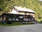
Alpengasthof Radwirt ObjectID : 10492 |
Brunnalmstrasse 36 KG location : Großveitsch |
Oldest prefabricated house in the world. In 1882 Count Franz Hardegg was elected to the Veitsch community council, but he rarely attended its meetings because he lived in Vienna. He bought a prefabricated house at the World Exhibition in Vienna in 1873 and built it as a hunting lodge on the count's country estate. Today the oldest prefabricated house in the world serves as the "Alpengasthof Radwirt" at the foot of the Hohe Veitsch. |
ObjectID : 10492 Status : Notification Status of the BDA list: 2020-02-29 Name: Alpengasthof Radwirt GstNr .: .123 / 2 |

|
Corridor / path chapel, Heissenberger chapel (Schaffenberger chapel) ObjektID : 10489 |
Location KG: Großveitsch |
ObjectID : 10489 Status: § 2a Status of the BDA list: 2020-02-29 Name : Flur- / Wegkapelle, Heissenberger-Kapelle (Schaffenberger-Kapelle) GstNr .: .1 / 5 |
|

|
Wayside shrine, so-called plague cross ObjectID : 10490 |
Location KG: Großveitsch |
Presumably donated by six Veitsch farmers around 1529, restored between 1997 and 1998 with the help of the Federal Monuments Office . |
ObjectID : 10490 Status: § 2a Status of the BDA list: 2020-02-29 Name: wayside shrine, so-called Pestkreuz GstNr .: .3 |

|
Kilometer / milestone ObjectID : 9879 |
at Dorfstrasse 24, KG location : Mitterdorf |
ObjectID : 9879 Status: § 2a Status of the BDA list: 2020-02-29 Name: Kilometer / milestone GstNr .: 668/4 |
|

|
Catholic branch church, library, formerly Catholic Filial church hl. Johannes Nepomuk ObjectID : 9876 |
Hauptplatz 2 KG location : Mitterdorf |
ObjektID : 9876 Status: § 2a Status of the BDA list: 2020-02-29 Name: Kath. Filialkirche, Bibliothek, Former. cath. Filial church hl. Johannes Nepomuk GstNr .: .40 Saint John of Nepomuk Church (Mitterdorf im Mürz Valley) |
|

|
Castle, School, Castle Pichl / Forestry and Forest Workers School ObjectID: 9878 |
Rittisstrasse 1 KG location : Mitterdorf |
The castle is located on a terrace at the exit of the Veitschgraben and was built from 1555 by Jörg Idungspeuger on the place of a courtyard that was mentioned in 1363. It is surrounded by the remains of a renewed enclosure wall with two round towers. The U-shaped building block has four protruding corner towers with tent roofs. In the northeast tower is the former chapel with a primitive star rib vault. The wood-paneled hall on the ground floor has a field ceiling. The castle now serves as an agricultural school. |
ObjectID: 9878 Status: § 2a Status of the BDA list: 2020-02-29 Name: Castle, school, Pichl Castle / Forestry and Forestry Workers School GstNr .: .56 / 2 Pichl Castle, Mitterdorf |

|
Lichtenegg castle ruins ObjectID : 10514 |
Burgruinenweg location KG: Scheibsgraben |
The square was first mentioned in a document around 1280. At first there was probably only a farm here. The expansion to the castle began around the middle of the 14th century. On February 3, 1395, Hans Liechtenegger was allowed to raise the courtyard by one or two brick floors and to fortify it. Between the late 14th and 15th centuries, the castle was expanded and expanded under changing owners. Nothing is known of sieges; in uncertain times they served primarily as a place of refuge for the residents of the area. Around 1600 it came into the possession of the Sebald Pögl trade; It was abandoned in 1757 and the last residents left the castle around 1792, which has now fallen into ruins. In 1855 parts of the castle collapsed in an earthquake. In 1953 part of the curtain wall had to be removed because of the acute danger of collapse. The complex consists of a wide ditch , a round arched castle gate, a kennel , the keep and a small courtyard that is completely enclosed by buildings. Today the owner is the Association for the Preservation of the Lichtenegg Castle Ruins, which was founded in 1929 by Richard Antauer in order to stop its rapidly progressing decline. The association carries out maintenance work on an ongoing basis. A local history museum was set up in the rooms of the keep between 1980 and 1990. |
ObjectID : 10514 Status : Notification Status of the BDA list: 2020-02-29 Name: Burgruine Lichtenegg GstNr .: .8 Burgruine Lichtenegg, Wartberg im Mürz Valley |

|
Road bridge, Wartberg Mürz Bridge ObjectID : 10518 |
KG location : Scheibsgraben |
The Wartberg Mürz Bridge was built in 1937. With a clear width of 42.80 m, it spans the Mürz between the cadastral communities Scheibsgraben and Wartberg . |
ObjectID : 10518 Status: § 2a Status of the BDA list: 2020-02-29 Name: Strassebrücke, Wartberger Mürz-Brücke GstNr .: 642/1; 634/2 |

|
Catholic parish church hl. Erhard ObjektID: 10506 |
Dorfstrasse 30 KG location : Wartberg |
Today's parish church was built by Remigius Horner in 1730–1731 based on the model of the Pöllau collegiate church. In the 20th century it was restored first inside and later outside. The altars date from the middle of the 18th century. |
ObjectID: 10506 Status: § 2a Status of the BDA list: 2020-02-29 Name: Catholic parish church hl. Erhard GstNr .: .53 parish church hl. Erhard, Wartberg in the Mürz Valley |

|
Wayside shrine, Erhard Chapel ObjectID : 10507 |
Dorfstrasse 30 KG location : Wartberg |
ObjectID : 10507 Status: § 2a Status of the BDA list: 2020-02-29 Name : wayside shrine, Erhard-Kapelle GstNr .: .53 Erhard-Kapelle, Wartberg im Mürzal |
|

|
Parsonage Object ID: 10508 |
Dorfstrasse 30 KG location : Wartberg |
ObjectID : 10508 Status: § 2a Status of the BDA list: 2020-02-29 Name: Pfarrhof GstNr .: .52 |
|

|
Road bridge, Wartberg Mürz Bridge ObjectID : 10522 |
KG location : Wartberg |
The Wartberg Mürz Bridge was built in 1937. With a clear width of 42.80 m, it spans the Mürz between the cadastral communities Scheibsgraben and Wartberg. |
ObjectID : 10522 Status: § 2a Status of the BDA list: 2020-02-29 Name: Strassebrücke, Wartberger Mürz-Brücke GstNr .: 759/1; 746 |

|
Wayside shrine, " Plague Cross " ObjectID : 10510 |
KG location : Wartberg |
ObjectID : 10510 Status: § 2a Status of the BDA list: 2020-02-29 Name: wayside shrine, "Pestkreuz" GstNr .: 751/3 |
literature
- Kurt Woisetschläger, Peter Krenn: Dehio Handbook - The Art Monuments of Austria: Styria (excluding Graz). Topographical inventory of monuments, ed. from the Federal Monuments Office, Department for Monument Research. Verlag Anton Schroll, Vienna 1982, ISBN 3-7031-0532-1 .
Web links
Commons : Listed objects in Sankt Barbara im Mürz valley - collection of images, videos and audio files
Individual evidence
- ↑ a b Styria - immovable and archaeological monuments under monument protection. (PDF), ( CSV ). Federal Monuments Office , as of February 18, 2020.
- ↑ HS Veitsch has to block - Director: 'My heart is bleeding'. In: Kronen Zeitung. April 19, 2011, accessed July 3, 2017 .
- ↑ a b c Information board on site
- ^ Georg Clam Martinic : Austrian Burgenlexikon - Palaces, castles and ruins . 1991.
- ^ Robert Baravalle: Castles and palaces of Styria . Graz 1961, p. 457 f .
- ↑ additional GstNr. according to GIS-Styria
- ↑ additional GstNr. according to GIS-Styria
- ↑ § 2a Monument Protection Act in the legal information system of the Republic of Austria .

