Josefův Důl dam
| Josefův Důl dam | |||||||||
|---|---|---|---|---|---|---|---|---|---|
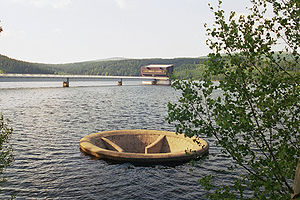
| Josefův Důl dam: overflow and control station | |||||||||
|
|||||||||
|
|
|||||||||
| Coordinates | 50 ° 47 '57 " N , 15 ° 11' 4" E | ||||||||
| Data on the structure | |||||||||
| Construction time: | 1976-1982 | ||||||||
| Height of the barrier structure : | 43 m | ||||||||
| Data on the reservoir | |||||||||
| Total storage space : | 23 million m³ | ||||||||
| Josefův Důl dam: dam | |||||||||
The Josefův Důl dam (Czech Republic) above the village of Josefův Důl u Jablonce nad Nisou ( Josefsthal ) dams the water of the Kamnitz . It was built between 1976 and 1982, has a dam height of 43 m and a capacity of 23 million m³ and is the largest in the Jizera Mountains. It is used to supply drinking water and is therefore not approved for recreational purposes.
Web links
Commons : Josefův Důl Reservoir - collection of pictures, videos and audio files


