Wachusett Reef
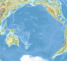
putative position of the Wachusett reef |
The Wachusett Reef (also Wachusett Bank , English Wachusett Reef or Shoal ) is an alleged reef in the southern Pacific . It was built on June 4, 1899 by Captain HM Lambert from the US ship Wachusett at 32 ° 18 'S; 151 ° 08'W, but its existence could not be confirmed later.
Lambert drove through an approximately 150 m wide sea passage with a dark gray color, which stood out strongly against the surrounding deep blue water. Captain Lambert thought this place was a coral reef and estimated its depth at 9-11 m; No soundings were made.
The supposed reef could not be found again in the following period and was deleted from the French nautical charts. According to the British Admiralty's Pacific Islands Pilot , the appearance of reefs and breakers can be faked by cloud reflections, volcanic phenomena, schools of fish and marine microorganisms, so that even the most experienced skipper is at risk of being deceived.
Regardless of this, the Wachusett Reef can still be found today in renowned world atlases.
Individual evidence
- ^ Pacific Islands pilot / United States Hydrographic Office, Vol. 2; Washington, DC 1916, p. 56
- ↑ Doubtful hydrographic data = Données hydrographiques douteuses, Pt. E: South Pacific Ocean; Monaco 1968 (3rd ed.) (Special publication / International Hydrographic Bureau; 20), p. 99, no. 423.20 / 01 Z
- ↑ Eade, JV: Geological notes on the Southwest Pacific Basin in the area of Wachusett Reef and Maria Theresa Reef; Wellington 1976 (New Zealand Oceanographic Institute oceanographic summary, No. 9, Febr. 1976, p. 3)
- ↑ z. B. in Knaur's Great World Atlas, 18th corr. Ed., Licensed edition; 1999, plate 122. There: Wachusettbank
Coordinates: 32 ° 18 ′ 0 ″ S , 151 ° 8 ′ 0 ″ W.

