
Arusha (region)
| Arusha | |
|---|---|
  |
|
| Basic data | |
| Country | Tanzania |
| Capital | Arusha |
| surface | 37,576 km² |
| Residents | 1,999,907 (2018) |
| density | 53 inhabitants per km² |
| ISO 3166-2 | TZ-01 |
| politics | |
| Regional Commissioner | Mrisho Mashaka Gambo |
Coordinates: 3 ° 0 ′ S , 36 ° 0 ′ E
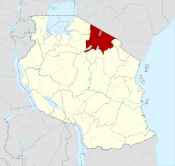
Arusha is one of the 31 administrative regions of Tanzania . The capital and largest city is Arusha . The region borders the Republic of Kenya in the north, the Kilimanjaro region in the east, the Manyara and Singida regions in the south, and the Simiyu and Mara regions in the west .
geography
The region is 37,576 square kilometers and has around 2 million inhabitants (as of 2018), which corresponds to a population density of 53 people per square kilometer. In the northwest lies the Serengeti plain, in the south the Maasai steppe, which is interrupted by individual gneiss hills . The East African Trench runs through the central part , where lava plains and volcanoes formed, as well as the highest mountain in the region, Mount Meru with a height of 4566 meters and the active volcano Ol Doinyo Lengai .

This results in different forms of vegetation, from wooded savannahs to mountain forests to alpine areas. Annual rainfall ranges from 500 millimeters in the semi-arid plains to 1800 millimeters on Mount Meru. The climate is mild and temperate, according to the effective climate classification , the Cw corresponds to a subtropical mountain climate . The rainfall is very unevenly distributed over the year, with an annual average of 1103 millimeters in the city of Arusha.
|
Climate table Arusha
Source: climate-data.org
|
||||||||||||||||||||||||||||||||||||||||||||||||||||||||||||||||||||||||||||||||||||||||||

history
Early human skull bones have been found in the Olduvai Gorge near the Ngorongoro Crater . After the beginning of the Christian era, Nilotic tribes immigrated to the area from the north. In 1900, when the area was part of German East Africa , the city of Arusha was founded. The name goes back to the local Wa-Arusha tribe.

Administrative division
The Arusha region is divided into six districts and includes seven constituencies (councils):
| District | Constituency | Residents
2002 |
Residents
2012 |
surface
km 2 |
|---|---|---|---|---|
| Arusha | Arusha DC | 251.856 | 323.198 | 1,239 |
| Arusha CC | 313.004 | 415,442 | 267 | |
| Karatu | Karatu | 177,951 | 230.166 | 3,207 |
| Monduli | Monduli | 102,966 | 158,929 | 6,993 |
| Meru | Meru | 231,399 | 268.144 | 1,266 |
| Ngorongoro | Ngorongoro | 129,362 | 174.278 | 15,499 |
| Longido | Longido | 81,550 | 123.153 | 7,885 |
population
In 2012, 42 percent of the region's population were under 15 years old and only three percent were older than 65; in 1988, 47 percent were younger than 15. The gender ratio was 94 men per 100 women (as of 2012).

Most of the residents speak Swahili , the official language of Tanzania, and their own tribal language. Many also speak English as an educational and lingua franca.
The Maasai are an influential tribe in the region. They live on the edge of Mount Meru, in Rwa, Mbulu, Iraqw, Temi, Mbugwe and other smaller towns.
Facilities and services
- Education: In 1996 there were 608 elementary schools and 50 secondary schools in the Arusha area. The proportion of the population who could read and write rose from 26 percent in 1967 to 58 percent in 1988.
- Health: There were 72 pharmacies, three public, 69 private and 32 hospitals in the region (as of 2012).

Economy and Infrastructure

Of those over the age of ten, 57 percent were employed, thirteen percent worked in the household, 24 percent in training and only three percent were unemployed. Of the employees, 53 percent worked in agriculture (as of 2012).
|
 |
- Roads: There are three main paved roads leading to Arusha. One from Dodoma , one from Dar es Salaam and one from neighboring Kenya to the north . A fourth, partially unpaved road leads northwest to Lake Victoria . Of the 539 kilometers of national roads, 326 kilometers are paved (as of 2018).
- Railway: The Tanga railway line, which was closed in 2007, was reopened in 2019. It connects Arusha via Moshi with the port of Tanga in the Tanga region .
.jpg)
Nature reserves, sights
- Ngorongoro Conservation Area : The area of the Ngorongoro Crater, declared a UNESCO World Heritage Site in 1979, is the main tourist attraction of the region. The rare black rhinos, buffalos, elephants, lions, different species of antelopes, zebras, warthogs, wildebeests and jackals are among the inhabitants.
- Lake Manyara National Park : The region is part of this animal-rich national park.
- Arusha National Park : This small park is 45 minutes by car from the town of Arusha around Mount Meru.
- Olduvai Gorge : Archaeological site of early humans.
- Laetoli : site of fossil footprints of hominini .
Web links
Individual evidence
- ^ Tanzania Regional Profiles, 02 Arusha Regional Profiles. (pdf) The United Republic of Tanzania, 2016, p. i , accessed on October 20, 2019 .
- ↑ Tanzania in Figures 2018. (pdf) The United Republic of Tanzania, June 2019, p. 17 , accessed on October 24, 2019 .
- ↑ a b c Britannica, Arusha. Retrieved October 20, 2019 .
- ↑ Climate Data, Arusha. Retrieved October 20, 2019 .
- ↑ Country Lexicon, Tanzania History. Retrieved October 20, 2019 .
- ^ History of Arusha City. United republic of Tanzania, accessed October 20, 2019 .
- ^ Tanzania Regional Profiles, 02 Arusha Regional Profiles. (pdf) The United Republic of Tanzania, 2016, p. 16 , accessed on October 20, 2019 .
- ↑ 2012 Population and Housing Census. (PDF) National Bureau of Statistics Ministry of Finance, March 2013, p. 26 , accessed on January 11, 2020 .
- ↑ City population, Tanzania, Northern Tanzania, District. Retrieved October 31, 2019 .
- ^ Tanzania Regional Profiles, 02 Arusha Regional Profiles. (pdf) The United Republic of Tanzania, 2016, pp. 19, 24 , accessed on October 20, 2019 .
- ^ Arusha Region, Socio-Economic Profile. (pdf) Republic of Tanzania, April 1998, pp. 110, 134 , accessed on October 20, 2019 .
- ^ Arusha Region, Socio-Economic Profile. (pdf) Republic of Tanzania, April 1998, p. 139 , accessed on October 20, 2019 .
- ^ Tanzania Regional Profiles, 02 Arusha Regional Profiles. (pdf) The United Republic of Tanzania, 2016, pp. 85, 95 , accessed on October 20, 2019 .
- ^ Arusha, Agriculture. United Republic of Tanzania, February 27, 2014, accessed October 20, 2019 .
- ^ René A. Pelletier: Mineral Resources of South-Central Africa . Oxford University Press, Cape Town, London, New York, Toronto 1964, p. 258
- ↑ Venancia Ndoo: Soda ash mining at Lake Natron is not economically viable . News from August 29, 2012 on www.birdlife.org (English)
- ^ Arusha Region Roads Network. (PDF) March 2018, accessed on January 28, 2020 .
- ^ Trunk and Regional Roads Network. Tanzania, Ministry of Works, accessed October 20, 2019 .
- ^ Daily News, Tanga-Moshi Railway Relaunched. October 31, 2019, accessed October 31, 2019 .
- ^ Ngorongoro Conservation Area. Retrieved October 20, 2019 .
- ↑ Lake Manyara National Park. Retrieved October 20, 2019 .
- ^ Arusha National Park. Retrieved October 20, 2019 .
Arusha City | Arusha | Karatu | Longido | Meru | Monduli | Ngorongoro
Arusha | Dar es Salaam | Dodoma | Geita | Iringa | Kagera | Katavi | Kigoma | Kilimanjaro | Lindi | Manyara | Mara | Mbeya | Morogoro | Mtwara | Mwanza | Njombe | Pemba Kaskazini | Pemba Kusini | Pwani | Rukwa | Ruvuma | Shinyanga | Simiyu | Singida | Songwe | Tabora | Thong | Unguja Kaskazini | Unguja Kusini | Unguja Mjini Magharibi