
Bürstadt
| coat of arms | Germany map | |
|---|---|---|

|
Coordinates: 49 ° 38 ' N , 8 ° 27' E |
|
| Basic data | ||
| State : | Hesse | |
| Administrative region : | Darmstadt | |
| Circle : | Mountain road | |
| Height : | 90 m above sea level NHN | |
| Area : | 34.46 km 2 | |
| Residents: | 16,453 (Dec. 31, 2019) | |
| Population density : | 477 inhabitants per km 2 | |
| Postal code : | 68642 | |
| Primaries : | 06206, 06245 (Bobstadt) | |
| License plate : | HP | |
| Community key : | 06 4 31 005 | |
| LOCODE : | DE BDT | |
| City structure: | 3 districts | |
City administration address : |
Rathausstrasse 2 68642 Bürstadt |
|
| Website : | ||
| Mayoress : | Barbara Schader ( CDU ) | |
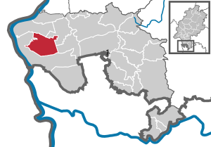
| Location of the city of Bürstadt in the Bergstrasse district | ||
  |
||


Bürstadt is a town in the south of Hesse in the Bergstrasse district .
geography
Geographical location
Bürstadt lies in the Upper Rhine Plain between the Rhine and the Odenwald in the Hessian Ried .
Neighboring communities
Bürstadt borders in the north on the municipality Biblis , in the northeast on the municipality Einhausen , in the east on the city of Lorsch , in the south and west on the city of Lampertheim .
City structure
Bürstadt is divided into three districts: Bobstadt , Bürstadt and Riedrode . The two districts of Bobstadt and Riedrode are about one kilometer from Bürstadt. There is also the “Boxheimerhof”, which has grown into its own small district thanks to some building areas, and a gardeners' settlement in the south of the city, which has its roots in Roman times.
history
From the beginning to the 18th century
Bürstadt is located in one of the oldest regions in Germany, steeped in culture and history. Due to the fertile soils and the wildlife and species richness of the Upper Rhine Plain , the high banks of the Rhine were populated very early.
A 1.35 m high monolith in the district of Bürstadt, the so-called Sackstein, is probably a menhir from the late Neolithic . Grave mounds in the forests of Bürstadt resulted in some finds that can be assigned to the Hallstatt period . A number of finds from the early La Tène period are also noteworthy . B. a hand-formed mug with a finger pattern, which dates from around 500 BC. BC. At the edge of the Bürstädter Forest there are remains of an extensive Roman settlement. For travelers, Bürstadt, with a former Carolingian royal court, was halfway between the Nibelung city of Worms , which dates back to a Celtic foundation, and the former imperial abbey of Lorsch .
In 764 the monastery was founded in neighboring Lorsch by Count Cancor. On January 20, 773, Charlemagne donated the city of Heppenheim and the associated district, the extensive Mark Heppenheim as the administrative district of the Franconian Empire, to the imperial monastery of Lorsch . From there the area was made arable and settled. In the 19th century it was one of the largest and most powerful Benedictine abbeys in Germany.
On November 1st, 767 Bürstadt was mentioned for the first time in a deed of donation of the Lorsch Codex , a register of property of the monastery, when Turinicbert gave the monastery a yard , a meadow and six yoke of farmland "in Birstather marca". In addition, numerous other donations have come down to us.
In 789, the Boxheimer Hof was mentioned for the first time under the name "Villa wizzilin" or "Wizzelai" as a monastery property of the imperial abbey of Lorsch. In 1275 the farm was already called Boxheim. At the end of April 873, Ludwig the German held an imperial assembly (placitum) in Bürstadt at the Bürstadt royal court. Negotiations were conducted with an embassy from the Danish King Siegfried and a messenger from the Great Moravian Prince Svatopluk was received. In addition, the reconciliation between Ludwig the German and his sons took place there.
Further mentions of the Bürstadt royal court on the occasion of high visits have also been preserved. King Ludwig the Younger stayed there from May 22nd to 26th, 877 , and Emperor Karl III on May 22nd, 882 . , the youngest brother of Ludwig the Younger, as well as in May and October 984 and for the last time in May 994 Emperor Otto III.
The heyday of the Lorsch Monastery, in whose area Bürstadt was located, was followed by its decline in the 11th and 12th centuries. During the investiture dispute from 1076 (Reichstag in Worms) to 1122 (Worms Concordat), many possessions had to be surrendered to the nobility. The result of the Concordat of Worms were the "Bürstädter forest meadows" on September 23 with the presence of Emperor Henry V proclaimed. At the beginning of the 20th century, the field name Laubwiese was retained in hall 20/21 of the old Bürstadt district.
The Bürstädter Laubwiesen were mentioned again in 1147 when the French crusader army under King Ludwig VII. Camped there in anticipation of further influx in June and July .
In the late 12th century, an attempt was made to reorganize the administration of the Lorsch Monastery by recording the old title deeds ( Lorsch Codex ). Nevertheless, in 1232, Emperor Friedrich II subordinated the imperial abbey of Lorsch to the Archdiocese of Mainz and its bishop Siegfried III. von Eppstein on reform. The Benedictines opposed the ordered reform and had to leave the abbey. They were replaced by Cistercians from the Eberbach monastery and in 1248 by Premonstratensians from the Allerheiligen monastery . From this point on, the monastery was continued as a provost's office. Due to the freedom of the imperial monastery, the monastery bailiffs were administrators and court lords within the monastery property. This office came into the possession of the Count Palatine around 1165. From this constellation, severe disputes developed between the Archdiocese of Mainz and the Electoral Palatinate as the owner of the bailiwick . The disputes could not be settled until the beginning of the 14th century through a contract in which the possessions of the monastery were divided between Kurmainz and Electoral Palatinate and the bailiwick rights of the Count Palatine were confirmed.
In 1267, a burgrave on the Starkenburg (above Heppenheim) was named for the first time , who also administered the Starkenburg office , to which Bürstadt belonged. The high jurisdiction was exercised by the Zent Heppenheim , whose chief judge was also the burgrave.
In the course of the Mainz collegiate feud , which was fateful for Kurmainz , the Starkenburg office was pledged redeemable to Kurpfalz and then remained in the Palatinate for 160 years. Count Palatine Friedrich had the “Amt Starkenburg” pledged for his support from Archbishop Dieter - in the “Weinheimer Bund” concluded by the Electors on November 19, 1461 - whereby Kurmainz received the right to redeem the pledge for 100,000 pounds.
In 1511 Bürstadt belonged to the Bensheim (also Bergstrasse) regional chapter . The Alt-St.-Michael church was built around 1550, but in 1732 it had to give way to the new building of the baroque church of St. Michael .
In the early days of the Reformation , the Palatinate rulers openly sympathized with the Lutheran creed, but it was not until Ottheinrich (Elector from 1556 to 1559) that the official transition to Lutheran teaching took place. After that, his successors and inevitably the population changed several times between the Lutheran , Reformed and Calvinist religions. As a result of the Reformation, the Electoral Palatinate abolished Lorsch Abbey in 1564. The existing rights such as tithes , basic interest, validity and gradient of the Lorsch monastery were from then on exercised and administered by the Lorsch chief advisor.
During the Thirty Years War (1618–1648), Spanish troops of the Catholic League conquered the region and in 1623 restored the rule of Kurmainzer. The Reformation introduced by the Count Palatine was largely reversed and the population had to return to the Catholic Church. Although the Spanish troops withdrew from the approaching Swedes after ten years, after the catastrophic defeat of the Evangelicals in the Nördlingen in 1634, the Swedes also left the Bergstrasse and with the Swedish-French War, the bloodiest chapter of the Thirty Years' War began in 1635. The chroniclers of that time reported from the region: “Plague and hunger rage in the country and decimate the population, so that the villages are often completely empty”. Bürstadt was uninhabited for ten years and all the houses had burned down. In 1618 about 700 people lived in Bürstadt, and in 1648 there were 154 inhabitants. With the Peace of Westphalia of 1648, the redemption of the Palatinate pledge was finally established.

In the middle of the 18th century, the superstructure of the old town hall and the baroque church of St. Michael were built, which was consecrated on September 16, 1753 by Pastor Joseph Thomas Loskandt. In 1756 the church was given a tower and around 1760 a rectory that still exists. The schoolhouse next to the church was built in 1733 and later served as a teacher's apartment.
In 1782 Kurmainz carried out an administrative reform in the area of the Starkenburg office, with which an administrative bailiff was established in Lorsch . The office was renamed Oberamt and consisted of the district bailiffs Lorsch, Fürth , Heppenheim and Bensheim . In addition to Bürstadt, Lorsch , Biblis , Klein-Hausen and Viernheim also belonged to the Lorsch District . The Oberamt Starkenburg was subordinate to the Lower Archbishopric of the Electorate of Mainz .
From the 19th century until today
Bürstadt becomes Hessian
The late 18th and early 19th centuries brought far-reaching changes to Europe. As a result of the Napoleonic Wars , the left bank of the Rhine and thus the left bank of Kurmainz was annexed by France as early as 1797 . In the last session of the Perpetual Reichstag in Regensburg in February 1803, the Reichsdeputationshauptschluss was passed, which implemented the provisions of the Peace of Lunéville and reorganized the territorial relations in the Holy Roman Empire (German Nation) .
Through this reorganization, Kurmainz was dissolved, the Oberamt Starkenburg and with it Bürstadt came to the Landgraviate of Hessen-Darmstadt . The Lorsch Office was continued as the Hessian District Bailiwick, but the Oberamt was dissolved in 1805. In the same year the elector moved from Mainz to Regensburg. The superordinate administrative authority was the administrative district Darmstadt, which from 1803 was also called the Principality of Starkenburg.
Under pressure from Napoleon , the Rhine Confederation was founded in 1806 , this happened when the member territories left the empire at the same time and led to the deposition of the imperial crown on August 6, 1806, with the result that the old empire ceased to exist. On August 14, 1806, the Landgraviate of Hesse-Darmstadt was raised by Napoleon to the Grand Duchy against placing high military contingents on France and joining the Confederation of the Rhine , otherwise he was threatened with invasion.
Konrad Dahl reported in 1812 in his historical-topographical-statistical description of the principality of Lorsch, or church history of the Upper Rhinegau, about the Lorsch office and the market town of Bürstadt:
»The Lorsch office contains 5 localities, namely: Lorsch, Biblis, Würrstadt, Kleinhausen and Virnheim and with these borders on the offices of Heppenheim, Bensheim, Gernsheim, Lampertheim and Weinheim. There are 1071 residential buildings and 7083 souls in the whole of Lorsch. Among the latter are 6969 Catholics, 10 Lutherans, 8 Reformists, and 96 Jews. All the subjects of this land are serfs. In terms of land, the office contains 14.269 acres and 3 square meters of fields, 3462 square meters. Meadows and willows, and 15015 m. 2 Vrtl. Grove. The whole Lorsch office still belongs to Cent Heppenheim, just as it did old times; the supplement shows us ... what the localities of this office have to do and achieve in embarrassing court cases. Before the 17th century, the cellar or taker of the monastic and later sovereign gradient always lived in Lorsch. But after the Archbishopric of Mainz came back into possession of Bergstrasse and the Lorsch Monastery, and the latter had finally been destroyed, it came to Bensheim, where a lordly office was established itself, but at the same time the head conductors from Lorsch were connected with it. This official cellar was also responsible for the administration of justice until 1782, when a separate justice office was set up not only in Bensheim, but also in Lorsch. After the senior office in Starkenburg was repealed (1804), it became independent.
...
Birrstadt or Bürrstadt, Birstat, Bisistat called in old documents, a considerable area in the so-called Ried, almost two hours from Lorsch, 3 hours from Heppenheim and an hour and a half from Worms at the opposite end of the Lorsch Forest, has the villages of Hofheim as neighbors and Bobstat and the Boxheimer Hof and is one of the oldest possessions of the Lorsch Monastery. Because as early as 768, Thurinebert, the brother of Count Cancor, who founded the Lorsch monastery, not only gave a fenced-in place (Mansum proprisimus) to the new monastery in Lauresharm, but also gave this monastery in Stück Feld in the Birstadter Mark (in Birstather marca) ... Several other donations that were added meant that the Lorsch monastery soon became completely owned by Bürstat and its extensive marrow. The proximity of the Lorsch monastery near Bürrstadt also made the latter place known at an early stage through various imperial acts.
…
As far as the parish of Birrstadt is concerned, it was owned by the Lorsch monastery and can be found in the Lorsch donation book (Nro. 3824). Names a priest in Birrstadt who probably administered pastoral care there. The parish rights to the Archbishop of Mainz came from the Lorsch Monastery and from there to the Grand Duke of Hesse. The parish church was rebuilt before 1739 but was only consecrated in 1753. It is spacious and beautiful. The rectory is also new, handsome and dermally provided with a large garden. The pastor receives his salary for the most part from the Heppenheim cellar, which also receives the big toe there alone; but the pastor has 1/3 on the small - and on the hay duck. The toe toe leg is the sole responsibility of the Lorsch head shop. The schoolmaster has little toes from the Marquardsackers. The old town hall was given to the schoolmaster in 1608 by order of the elector and a new town hall was built on it. Bürrstadt has the privilege of having a fair on Tuesday after Lätare, the same doesn't want to say much more. This place counts 187 with 1354 souls in residential buildings. Its field mark consists of 2606 acres of fields and meadows. With regard to the forest, it is like Lorsch.
From fiefs and other aristocratic estates one finds there:
a.) A former Bishop's Worms estate, which the Junkers von Affenstein previously owned as a fief.
b.) The von Kettenheimische Guth, which later came to the Barons von Speth.
c.) The Marquards or Horneckelsguth, which was formerly owned by the Lorsch Abbey, but was sold for redemption by the same in 1412 to those of Horneck, from whom it subsequently came to the Lords of Hoheneck.
d.) The Knoblauchsguth, modo von Boos belonging and
e.) That of Wamboldisch Guth.
Because of the fish water in the rose garden near Worms as well as because of the customs house there used to be a long quarrel with the Palatinate.
...
The Boxheimer Hof also belongs to the municipality and parish of Birrstadt; it is half an hour from Birrstadt towards Virnheim and is an old, direct property of the monastery of the subsequent provost and chief deputy Lorsch. This courtyard is probably the old Villa Wizzilin or Wizzelai, which appears with Birrstadt in a Lorsch document from the year 789. «
After the final defeat of Napoléon, the Congress of Vienna in 1814/15 regulated the territorial situation in Germany, the affiliation of the Principality of Starkenburg to the Grand Duchy was confirmed, whereupon the area renamed the Province of Starkenburg . In 1814 serfdom was abolished in the Grand Duchy and with the constitution of the Grand Duchy of Hesse introduced on December 17, 1820, it was given a constitutional monarchy , in which the Grand Duke still had great powers. The still existing civil rights such as lower jurisdiction , tithe, basic interest and other gradients remained in place until 1848.
On January 2, 1815, 72 residents were counted at the Boxheimer Hof, all of whom were Catholic except for one Protestant. In that year, the request for a little church in honor of St. Wendelinus was made there . On April 7th of the same year, permission to build the chapel was granted under certain conditions and in 1818 it was completed. The chapel on the Boxheimer Hof belongs to the Catholic parish of Bürstadt.
In 1821 the district bailiffs in the provinces of Starkenburg and Upper Hesse of the Grand Duchy were dissolved as part of a comprehensive administrative reform and administrative districts were introduced, with Bürstadt being assigned to the administrative district of Heppenheim . As part of this reform, regional courts were also created that were independent of the administration. The Lorsch district court was responsible for the district of Heppenheim in the first instance. This reform also regulated the administration at the municipal level. The mayor's office in Bürstadt was one of twelve mayor's offices in the district. According to the municipal ordinance of June 30, 1821, there were no longer appointed mayors , but an elected local council, which was composed of the mayor, the aldermen and the local council.
In the description or statistics and topography of the Grand Duchy of Hesse from 1825 it says about Bürstadt:
»Bürstadt, Catholic parish village of 194 houses and 1540 inhabitants, 3 hours from Heppenheim and 2 hours from Lorsch. The main nourishment is agriculture and animal husbandry, for which 2610 old acres of fields and meadows are available, tobacco growing and handicrafts. "
On November 3, 1824, the Reuter dike broke near Nordheim . The floods of the Rhine inundated the Ried , with Bobstadt particularly hard hit.
The "Statistical-topographical-historical description of the Grand Duchy of Hesse" reported in 1829 about Bürstadt and the associated courtyards:
»Bürstadt (L. Bez. Heppenheim): cath. Parish village; is 3 St. from Heppenheim, 2 St. from Lorsch and 1½. St. of Worms; has 228 houses and 1807 inhabitants, except for 2 Luth. and 44 Jews are all Catholic; a beautiful church built in 1739 but only consecrated in 1753, a small chapel and a synagogue. "
»Boxheimer Hof (L. Bez. Heppenheim) Hof; has 9 houses and 68 inhabitants, except for 1 reform. are catholic. The court came to Hessen in 1802 and a prayer house was built here in 1818 «
»Rheinschanz Customs House (L. Bez. Heppenheim) Hof; belongs to Bürstadt; consists of meadows and pastures and is stately «
In 1832 the units were enlarged one more time and circles were created. As a result, Bürstadt came to the Bensheim district in August 1832 . In 1842 the tax system in the Grand Duchy was reformed; the tithe and the basic rents (income from property) were replaced by a tax system, the main features of which still exist today.
In the newest and most thorough alphabetical lexicon of all localities of the German federal states from 1845 the following entries can be found:
»Bürstadt b. Heppenheim. - Village with a Catholic parish church, belonging to the parish of Lampertheim with regard to the Protestants. - 228 H. 1807 E. (inc. 44 Jews). - Grand Duke. Hesse. - Prov. Starkenburg. - Bensheim district. - Lorsch District Court. - Darmstadt Court of Justice. - The village of Bürstadt, which is occupied by 3 St. from Heppenheim, 2 St. from Lorsch and 1½ St. from Worms, has a small chapel and a synagogue in addition to the parish church. The place came with the Lorsch monastery (1232) to the archbishopric Mainz and from there (1802) to Hesse. "
»Boxheim near Bürstadt. - yard, to evangel. Parish church Lampertheim belonging. - 9 H. 68 E. - Grand Duchy of Hesse. - Prov. Starkenburg. - Bensheim district. - Lorsch District Court. - Darmstadt Court of Justice. - The court, which came to Hessen in 1802, has a prayer building. "
"Rheinschanzzollhaus b. Bürstadt. - Court; to the evangelical parish of Nordheim, resp. Catholic parish of Bürstadt belonging. - 1 H. 6 E. - Großherzogth. Hesse. - Prov. Starkenburg. - Bensheim district. - Landger. Lorsch. - Darmstadt Court of Justice. - The courtyard is on the eastern side of the road leading from Hofheim to Worms. There are meadows and pastures. "
As a result of the March Revolution of 1848, the law on the conditions of landlords and noble court lords of April 15, 1848, finally abolished the special rights of the landlords . In addition, the counties and administrative districts of the Grand Duchy were abolished in the provinces on July 31, 1848 and replaced by administrative districts, but this was reversed as early as May 12, 1852, in the reaction era. As a result, Bürstadt was part of the Heppenheim administrative district between 1848 and 1852 , which arose from the Bensheim and Heppenheim districts. After the government districts were dissolved, Bürstadt was added to the Heppenheim district.
The population and cadastral lists recorded in December 1852 showed for Bürstadt: Catholic parish village with 2718 inhabitants. The district consists of 6906 acres , 4167 acres of arable land, 2478 acres of meadows and 15 acres of forest. The Boxheimer Hof, the Hof Rheinschanz and the Zollhaus belong to Bürstadt.
In the German War of 1866 , in which the Grand Duchy of Hesse fought on the side of the German Confederation against Prussia and its allies, Georg Franz Kreiner from Bürstadt was involved. He fell on July 13, 1866 near the town of Hösbach near Aschaffenburg and was buried there. The grave next to Bundesstraße 26 is still tended today.
In the statistics of the Grand Duchy of Hesse, based on December 1867, Bürstadt had its own mayor's office, 370 houses, 2678 inhabitants, the Heppenheim district, the Lorsch district court, the Protestant parish Lampertheim of the Deanery of Zwingenberg and the Catholic parish of Bürstadt of the Deanery of Bensheim. The Boxheimer Hof (5 houses, 47 inhabitants) was also administered by the mayor's office.
In 1870 the Prussian Prime Minister Otto von Bismarck provoked the Franco-German War with the so-called Emser Depesche , in which the Grand Duchy of Hesse took part as a member of the North German Confederation on the side of Prussia . Even before its official end on May 10, 1871, the southern German states joined the North German Confederation, and on January 1, 1871, its new constitution came into force, with which it called itself the German Empire . On the German side, this war claimed around 41,000 deaths. About 100 men from Bürstadt were involved in the war, four of which never returned. On October 25, 1870, a severe hurricane-like storm raged in Bürstadt, affecting almost all the houses and damaging the ornamental pillars on the tower of St. Michael’s Church so badly that they had to be removed. With the Reich Coin Act of 1871, there was only one currency in Germany, the mark with 100 pfennigs as a sub-unit.
After the Grand Duchy of Hesse belonged to the German Empire from 1871, a series of administrative reforms were carried out in 1874. The state-specific rules of procedure as well as the administration of the districts and provinces were regulated by district and provincial assemblies. The new regulation came into force on July 12, 1874 and also decreed the dissolution of the Lindenfels and Wimpfen districts and the reintegration of Bürstadt into the Bensheim district.
In May 1882 the Catholic pastor of St. Michael, Peter Itzel, was stabbed to death by the day laborer Fischbach. As a result, Bürstadt got a bad reputation and was nicknamed "Knife Set". In December of the same year the Rhine flooded again and the Rhine dam broke between Lampertheim and Rosengarten , so that large parts of the reed were flooded. Bürstadt was also badly affected, which led to the evacuation of parts of the population to Bergstrasse.
At the end of the 19th century, the industrial age was also heralded in Bürstadt. In 1842, an entrepreneur from Worms had steam boats, the "The Eagles of the Upper Rhine", ply on the Rhine between Mannheim and Mainz. Further improvements to the infrastructure resulted from the construction of railway lines. In 1869 the opening of the Nibelungen Railway from Worms via Lorsch to Bensheim was celebrated, where it was connected to the Rhein-Neckar Railway , which was completed in 1846 . For 1900 there were further infrastructure improvements, so near Worms both the Ernst Ludwig Bridge as a road bridge and the railway bridge over the Rhine were opened to traffic. The numbers of emigrants show that the times were also marked by a lot of poverty. From 1881 to 1900, 529,875 German emigrants were counted. On January 1, 1900, the Civil Code came into force throughout the German Empire .
On November 11th, 1894, the sister house built by the community was inaugurated, in which the Mainz sisters worked. They carried out nursing at home and ran a school for young children. A knitting and sewing school were also housed in this house.
The time of the world wars
On August 1, 1914, the First World War broke out, which put an end to the positive economic development in Bürstadt and throughout the German Empire . When the armistice was signed after the German defeat on November 11, 1918, Bürstadt had many casualties to mourn, while the war cost a total of around 17 million human lives. The end of the German Empire was thus sealed, and the troubled times of the Weimar Republic followed. In the period from 1921 to 1930, there were 566,500 emigrants in Germany who tried to escape the difficult conditions in Germany. In 1931 the " Boxheimer Documents " named after the "Boxheimer Hof" were created at the "Boxheimer Hof" , with which members of the NSDAP tried to prepare for a violent takeover of power in the German Reich. The publication of the documents caused quite a stir in the tense domestic and national political situation in autumn 1931.
On January 30, 1933, Adolf Hitler became Chancellor, which sealed the end of the Weimar Republic and the beginning of the National Socialist dictatorship. In the spring of 1933, Adolf Hitler made May 1 a public holiday called “German Labor Day”. In this way, a union demand was met by the government of all people, which the unions strictly opposed. The unions called for participation in the May events, as they felt they were the initiators of the May idea. The official program was already heavily influenced by the National Socialists: “6 o'clock wake up by the SA bands. 8 a.m. flag hoisting in the factories, march to the parade ground, 9 a.m. transmission of the rally from the pleasure garden in Berlin to the public squares of the cities. 10.45 am State act of the Hessian government (...), reception of a workers delegation from the three Hessian provinces. (...) Common singing of the “Song of the Workers”. (...) 7.30 a.m. Transmission from the Tempelhofer Feld, Berlin: Manifesto of Reich Chancellor Adolf Hitler, “The first year of the four-year plan”. Then light music and German dance. 12 noon: Broadcast of the speech by Prime Minister Hermann Göring. (...) Former Marxist singing, gymnastics and sports clubs can take part in the parades, but carry Marxist flags or symbols with you. ”The rude awakening for the unions came a day later when the“ NSDAP led the red unions took over ”:“ The since then Marxist leaders in protective custody - A 3 million account of the former Reichstag President Löbe blocked - The rights of the workers secured - The buildings of the free trade unions occupied ”, headlined the newspapers, which had already been harmonized throughout the Reich.
In Hesse, on July 3, 1933, the "Law for the implementation of field clearing for the purpose of creating jobs in the course of the redevelopment" was passed. In 13 municipalities in the Starkenburg province, including Bürstadt, the field clearing procedure was ordered over an area of 200,000 ha. In the course of this amelioration and settlement program, the two places Riedrode and Worms-Rosengarten were created . With the establishment of the independent community of Rosengarten, the “Wehrzollhaus” district belonging to Bürstadt was separated and Bürstadt's free access to the Rhine was interrupted. For many centuries Bürstadt had free access to the Rhine and the people of Bürstadt could water their cattle on the Rhine without having to cross foreign territory. On July 10, 1936, the first Hessian hereditary farm village Riedrode was inaugurated and 28 families took over their hereditary farms.
The Hessian provinces of Starkenburg, Rheinhessen and Upper Hesse were abolished in 1937 after the provincial and district assemblies were dissolved in 1936. On November 1, 1938, a comprehensive regional reform came into force at the district level. In the former province of Starkenburg, the Bensheim district was particularly affected, as it was dissolved and most of it was added to the Heppenheim district. The district of Heppenheim also took over the legal successor to the district of Bensheim and was given the new name Landkreis Bergstrasse . Bürstadt, however, with the neighboring communities of Lampertheim , Hofheim , Rosengarten and Biblis was added to the district of Worms , which at that time belonged to Rheinhessen .
In November 1938 the so-called Reichskristallnacht brought hardship and misery to the Jewish fellow citizens. The Bürstadt synagogue had already been sold by this time. SA men broke into the apartment of a Jewish family, devastated it and abused the 17-year-old daughter. Two Jewish fellow citizens were arrested in May 1938 and taken to the Osthofen concentration camp . As early as 1933, part of the 23-person Jewish community at that time had moved away or emigrated as a result of increasing reprisals. In 1936, 20 of these people lived in the city. The five residents of Jewish descent who were still in the city in 1939 were arrested and deported to extermination camps. Of those born in Bürstadt or those who lived here for a long time, 17 died as a result of the Nazi tyranny.
On September 1, 1939, when German troops marched into Poland, the Second World War began , the effects of which were even more dramatic than the First World War and the number of victims estimated at 60 to 70 million people. From 1944 onwards, the intensified air war against Germany was also felt in Bürstadt. Large aviation associations flew over Bürstadt in their attacks on the surrounding industrial cities of Ludwigshafen, Mannheim or Worms. Despite some damage, Bürstadt is largely spared. In that year, work in the fields became life-threatening due to the continued low-flying attacks. Nobody was safe on the train or on the streets either. In the final phase of the Second World War in Europe, the American units reached the Rhine between Mainz and Mannheim in mid-March 1945. The bridgeheads on the left bank of the Rhine could not be held by the weak German forces, which led to the demolition of the Rhine bridges at Worms, Nordheim and Gernsheim on March 20. The remnants of the German 7th Army, which had withdrawn to the right bank of the Rhine, had to leave almost all of their heavy equipment such as tanks and artillery behind, which made the continuation of the fighting with the absolute air supremacy of the Americans completely pointless.
On the American side, the primary goal was now to avoid further losses, which led to the massive use of artillery, tanks and aircraft, even without precise knowledge of a possible resistance, on all cities and villages to be captured. If the advancing forces encountered resistance, there was an immediate retreat and massive use of the air force and artillery. On March 22nd, the 3rd US Army crossed the Rhine near Oppenheim and occupied Darmstadt on March 25th. From the American point of view, this made it necessary for the neighboring US 7th Army to move up quickly to secure its flanks. In preparation for their crossing of the Rhine, most of the Ried communities were shelled by American artillery on March 25th and on the night of March 26th. In all affected communities people were killed and property damage was caused to buildings.
In the first hours of March 26, 1945, American troops crossed the Rhine north of Worms near Hamm , Ibersheim and Rheindürkheim . The forces transferred at Worms took possession of the village of Rosengarten that night, marched into Bürstadt in the early hours of the morning and advanced on today's B47 in the direction of Lorsch. Since Bürstadt was not defended, there was no major damage when the Americans marched in. On March 27, the American units were in Lorsch, Bensheim and Heppenheim and a day later Aschaffenburg am Main, as well as the western and northern parts of the Odenwald, were occupied. The war in Europe ended with the unconditional surrender of all German troops, which came into effect on May 8, 1945 at 11:01 p.m. Central European Time. Bürstadt had about 500 fallen or missing soldiers in this war.
The Grand Duchy of Hesse was a member state of the German Confederation from 1815 to 1866 and then a federal state of the German Empire . It existed until 1919, after the First World War, the Grand Duchy for was republican written People's State of Hesse . In 1945 after the end of the Second World War , the area of today's Hesse was in the American zone of occupation and by order of the military government, Greater Hesse was created , from which the state of Hesse emerged in its current borders.
Post-war and present

With the reallocation of the federal states by the victorious powers of World War II after 1945, Rheinhessen west of the Rhine was added to the state of Rhineland-Palatinate and Bürstadt was integrated into the Bergstrasse district.
After the war, the population increased due to the settlement of many expellees and within a very short time the population increased by around 1200 inhabitants or around 13%.
In 1961 the size of the district was given as 2561 ha , of which 820 ha were forest.
The municipality of Bürstadt was granted the right to use the designation city on June 1, 1967 by the Hessian Minister of the Interior .
In 2005, the world's largest roof photovoltaic system was put into operation in Bürstadt (45,000 m² roof area; 5 MW output). In the same year Bürstadt was German champion in the Solar League (category 10,000-100,000 inhabitants). In 2006 Bürstadt won the gold medal in the Entente Florale competition . On February 22, 2007 the foundation stone was laid for one of the largest biogas plants in Germany (approx. 2.2 MW electrical system output). The trade fair EnergieTrends + (trade fair for renewable energies) was held for the first time from September 5 to 7, 2008.
Incorporations
In the course of the regional reform in Hesse on July 1, 1971, the previously independent municipality of Riedrode was incorporated into Bürstadt on a voluntary basis . On December 31, 1971, Bobstadt was incorporated . Local districts with local advisory council and local councilor were formed for the two parts of the city in accordance with the Hessian municipal code.
External administration
The formerly independent community of Rosengarten was administered by the city of Bürstadt from 1945 to 1955. It has belonged to the city of Lampertheim since October 1st, 1971.
Courts in Hessen
In the Landgraviate of Hesse-Darmstadt, the judicial system was reorganized in an executive order of December 9, 1803. The Darmstadt Court Court was set up as a court of second instance for the Principality of Starkenburg . The first instance was offices or landlords . The court court was second instance for civil disputes, first instance for civil family law matters and criminal cases. The superior court of appeal in Darmstadt was superordinate . With this, the Zent and the Zentgericht associated with it had finally lost its function.
With the formation of the regional courts in the Grand Duchy of Hesse, the Lorsch regional court in the Heppenheim district was the court of first instance from 1821 . On the occasion of the introduction of the Courts Constitution Act with effect from October 1, 1879, the previous grand-ducal Hessian regional courts were replaced by local courts in the same place, while the newly created regional courts functioned as higher courts. This led to the renaming of the Lorsch District Court and allocation to the district of the Darmstadt District Court .
On October 1, 1934, the Lorsch district court was dissolved and from the district of the district court the place Hofheim was assigned to the district court Worms , the place Bobstadt and the city Bürstadt to the district court Lampertheim and with Lorsch the remaining places were assigned to the district court Bensheim .
Territorial history and administration
The following list gives an overview of the territories in which Bürstadt was located and the administrative units to which it was subordinate:
- before 1782: Holy Roman Empire , Electorate of Mainz , Office Starkenburg (pledged to Electoral Palatinate from 1461–1650 ), Cent Heppenheim
- from 1782: Holy Roman Empire, Electorate Mainz, Lower Archbishopric, Oberamt Starkenburg , District Bailiwick Lorsch
- from 1803: Holy Roman Empire, Landgraviate of Hesse-Darmstadt (through Reichsdeputationshauptschluss ), Principality of Starkenburg , Lorsch Office
- from 1806: Grand Duchy of Hesse , Principality of Starkenburg, Lorsch Office
- from 1815: German Confederation , Grand Duchy of Hesse, Province of Starkenburg , Lorsch Office
- from 1821: German Confederation, Grand Duchy of Hesse, Starkenburg Province, Heppenheim District District (separation between justice ( Lorsch District Court ) and administration)
- from 1832: German Confederation, Grand Duchy of Hesse, Starkenburg Province, Bensheim district
- from 1848: German Confederation, Grand Duchy of Hesse, administrative district of Heppenheim
- from 1852: German Confederation, Grand Duchy of Hesse, Province of Starkenburg, District of Heppenheim
- from 1867: Grand Duchy of Hesse, Province of Starkenburg, District of Heppenheim
- from 1871: German Empire , Grand Duchy of Hesse, Province of Starkenburg, District of Heppenheim
- from 1874: German Empire, Grand Duchy of Hesse, Starkenburg Province, Bensheim district
- from 1918: German Empire, People's State of Hesse , Starkenburg Province, Bensheim district
- from 1938: German Empire, People's State of Hesse , Worms district (In the course of the regional reform in 1938 , the three Hessian provinces of Starkenburg, Rheinhessen and Upper Hesse are dissolved.)
- From 1945: American occupation zone , Greater Hesse , Darmstadt Region , Kreis Bergstraße
- from 1949: Federal Republic of Germany , State of Hesse , Darmstadt district, Bergstrasse district
Surname
The name Bürstadt is derived from Biso's site. Biso was a Frankish prince who owned properties in the area. Historically documented forms of the name of the place are (in brackets the year it was mentioned):
| Birstather marca (767) | Bisenstadt (1113) | Birstat (1407) | Burstatt (1759) |
| Bisistat (770, 826) | Birrstadt (1275) | Berstadt (1468) | |
| Bisestat (795) | Berstad (1318) | Birgstat (1475) | |
| Birstat (c. 900, around 1200) | Birstad (1341) | Byrstat (1488) |
population
Population structure
According to the surveys of the 2011 census , 15,211 residents lived in Bürstadt on May 9, 2011. These included 1248 (8.2%) foreigners of whom 721 came from outside the EU , 416 from other European countries and 6 from other countries. 7.4% of the German residents had a migration background . The inhabitants lived in 6567 households. 1899 of them were single households , 2082 couples without children and 1653 couples with children, as well as 492 single parents and 141 shared apartments .
Population development
Source: Historical local dictionary
| • 1623: | 66 (citizen) |
| • 1806: | 156 inhabitants, 179 houses |
| • 1829: | 1807 inhabitants, 228 houses |
| • 1867: | 2731 inhabitants, 376 houses |
| Bürstadt: Population from 1806 to 2015 | ||||
|---|---|---|---|---|
| year | Residents | |||
| 1806 | 1,256 | |||
| 1829 | 1,807 | |||
| 1834 | 2,101 | |||
| 1840 | 2,381 | |||
| 1846 | 2,635 | |||
| 1852 | 2,718 | |||
| 1858 | 2,737 | |||
| 1864 | 2,764 | |||
| 1871 | 2,992 | |||
| 1875 | 3,067 | |||
| 1885 | 3,577 | |||
| 1895 | 4,203 | |||
| 1905 | 5,487 | |||
| 1910 | 6.117 | |||
| 1925 | 7.154 | |||
| 1939 | 8.211 | |||
| 1946 | 9,249 | |||
| 1950 | 10.142 | |||
| 1956 | 10,527 | |||
| 1961 | 10,871 | |||
| 1967 | 12,359 | |||
| 1970 | 12,621 | |||
| 1972 | 15,428 | |||
| 1976 | 14,884 | |||
| 1984 | 14,223 | |||
| 1988 | 15.214 | |||
| 1992 | 15,360 | |||
| 2000 | 15,200 | |||
| 2005 | 15,354 | |||
| 2010 | 15,573 | |||
| 2011 | 15,211 | |||
| 2015 | 15,917 | |||
| Data source: Historical municipality register for Hesse: The population of the municipalities from 1834 to 1967. Wiesbaden: Hessisches Statistisches Landesamt, 1968. Further sources:; 1972 :; 1976 :; 1984 :; 1992 :; 2000 :; 2005 :; 2010 :; 2011 census; 2015: From 1972 including the towns incorporated into Hesse as part of the regional reform . | ||||
Religious affiliation
| • 1829: | 2 Lutheran (= 0.11%), 44 Jewish (= 2.43%) and 1761 Catholic (= 97.45%) residents |
| • 1961: | 1212 Protestant (= 11.15%), 9504 Roman Catholic (= 87.43%) inhabitants |
| • 2011: | 3840 Protestant (= 25.2%), 7990 Catholic (= 52.5%), 270 Orthodox (= 1.8%), 320 non-believers (= 2.1%), 2740 other (= 18.0%) residents |
| • 2017: | 6584 Roman Catholic (= 40%) inhabitants |
Gainful employment
The municipality in comparison with the district, administrative district Darmstadt and Hesse:
| year | local community | district | Administrative district | Hesse | |
|---|---|---|---|---|---|
| Employees subject to social security contributions | 2017 | 3715 | 72,939 | 1,695,567 | 2,524,156 |
| Change to | 2000 | + 25.4% | + 17.1% | + 16.1% | + 16.0% |
| of which full-time | 2017 | 71.9% | 70.8% | 72.8% | 71.8% |
| of which part-time | 2017 | 28.1% | 29.2% | 27.2% | 28.2% |
| Only marginally paid employees | 2017 | 744 | 15,613 | 224.267 | 372.991 |
| Change to | 2000 | + 18.1% | −4.3% | + 9.0% | + 8.8% |
| Branch | year | local community | district | Administrative district | Hesse |
|---|---|---|---|---|---|
| Manufacturing | 2000 | 49.8% | 39.6% | 27.0% | 30.6% |
| 2017 | 34.8% | 32.1% | 20.4% | 24.3% | |
| Commerce, hospitality and transport | 2000 | 22.6% | 25.1% | 26.4% | 25.1% |
| 2017 | 18.6% | 25.8% | 24.7% | 23.8% | |
| Business services | 2000 | 7.9% | 11.6% | 25.1% | 20.2% |
| 2017 | 15.0% | 15.5% | 31.6% | 26.1% | |
| other services | 2000 | 14.7% | 22.0% | 20.1% | 22.5% |
| 2017 | 20.2% | 25.3% | 23.0% | 25.4% | |
| Other (or without assignment) | 2000 | 5.1% | 1.7% | 1.4% | 1.5% |
| 2017 | 1.2% | 1.1% | 11.4% | 0.4% |
politics
City Council
The city council is the highest body of the city. Its political composition is determined every five years in local elections by the city's electorate. Whoever has reached the age of 18 and is a German citizen within the meaning of the Basic Law or a citizen of one of the other member states of the European Union may vote. Everyone has to have been registered in the city for at least three months.
The local elections on March 6, 2016 produced the following results, compared to previous local elections:
| Nominations | CDU | SPD | Green | FDP | BFB | Distribution of seats | |
|---|---|---|---|---|---|---|---|
| 2016 | Voting share a | 44.5 | 30.4 | 13.2 | 11.9 | - |
 |
| Seats (of 31) | 14th | 9 | 4th | 4th | - | ||
| 2011 | Voting share a | 44.9 | 27.1 | 19.0 | 9.0 | - |
 |
| Seats (of 31) | 14th | 8th | 6th | 3 | - | ||
| 2006 | Voting share a | 57.7 | 31.1 | - | 11.2 | - |
 |
| Seats (of 31) | 18th | 10 | - | 3 | - | ||
| 2001 i | Voting share a | 61.6 | 38.4 | - | - | - |
 |
| Seats (of 37) | 23 | 14th | - | - | - | ||
| 1997 | Voting share a | 44.7 | 28.7 | - | - | 16.6 |
 |
| Seats (of 37) | 17th | 14th | - | - | 6th | ||
| CDU | SPD | Green | FDP | BFB b | Distribution of seats | ||
31 city councilors had to be elected for the legislative period from April 1, 2016 to March 31, 2021. 6,256 of the 13,007 eligible voters went to vote. This means that voter turnout remained almost constant at 48.1% in 2016, compared to 48.2% in 2011.
mayor
From 1989 to 2013 Alfons Haag (CDU) was mayor of Bürstadt. On February 17, 2013, Barbara Schader (CDU) was elected the city's first female mayor and took office on July 1, 2013. On January 27, 2019, she was re-elected with 52.0% of the vote.
Districts
The following local districts with local advisory board and local councilor according to the Hessian municipal code exist in the municipality:
- Bobstadt district (areas of the former Bobstadt municipality ). The local advisory board consists of nine members.
- Riedrode district (areas of the former Riedrode municipality ). The local advisory board consists of seven members.
Youth Council
The Bürstadt Youth Council is a political body whose central task is to represent the young people and their interests in relation to the city's political decision-makers. The directly elected young people have the right to be heard, speak and submit proposals in the city council and in the various committees. In addition, the youth council plans activities, projects and events especially for the young people from Bürstadt. The youth council consists of a minimum of 6 and a maximum of 15 members who are between 12 and 21 years old on election day. They are elected for two years.
15 young people between the ages of 13 and 20 are active in the current youth council.
coat of arms
The Lorsch Spitznagelkreuz is a reminder of belonging to the Lorsch Monastery from 767 to 1232. In 1461 Bürstadt was pledged to the Electoral Palatinate , hence the silver-blue, roughened shield head. In 1632 it returned to Kurmainz , and from 1803 it belongs to the Grand Duchy of Hesse, hence the red field under the coat of arms.
Bürstadt has been allowed to wear this coat of arms since it was granted city rights in 1967.
Town twinning
There have been partnerships with Krieglach (Austria) since 1974 and with Wittelsheim (France) since 1982 . In 1984 a friendship agreement was signed with Minano (Japan), and in 1991 with Glauchau .
Culture and sights
museum
Bürstadt has a private museum of local history with tools and equipment for soil cultivation, household appliances and an old carpenter's workshop.
Sports
The flagship with great national recognition is VfR Bürstadt , which belonged to the 2nd Bundesliga for four years and currently (as of 28th matchday 2013/14) is 70th in the all-time table of the 2nd Bundesliga with 180 points. The club had its greatest success on June 29, 1975, when it became German amateur football champions with a 3-0 win over Victoria Hamburg . Currently, after few successful years in the sporting insignificance due to financial problems, the black and whites are flying high again - the direct march through from the district league A to the sixth class association league south in Hesse, where the VfR in the 2013/2014 season started.
Buildings

In the center of the village is the historic town hall, built in 1608, which housed the municipal administration until 1930. In the period from 1996 to 1999 it was extensively renovated. The old town hall is a listed building .
Other listed buildings are the station building , the waterworks and the St. Andreas church.
Economy and Infrastructure
Land use
The municipal area covers a total area of 3446 hectares, of which in hectares are:
| Type of use | 2011 | 2015 | |
|---|---|---|---|
| Building and open space | 379 | 348 | |
| from that | Living | 209 | 211 |
| Business | 45 | 48 | |
| Operating area | 14th | 13 | |
| from that | Mining land | 7th | 7th |
| Recreation area | 27 | 28 | |
| from that | Green area | 12 | 12 |
| traffic area | 257 | 258 | |
| Agricultural area | 1774 | 1764 | |
| from that | moor | 0 | 0 |
| pagan | 0 | 0 | |
| Forest area | 948 | 948 | |
| Water surface | 41 | 41 | |
| Other use | 7th | 7th | |
traffic

Bürstadt is located in the north of the Rhine-Neckar metropolitan region on federal highways 47 and 44 . The Autobahn 67 can be reached via the Lorsch junction (about five kilometers away).
The station Bürstadt is a tower station at the intersection of Riedbahn and Nibelungen Railway (train lines: Mannheim-Frankfurt and Worms-Bensheim).
In Bürstadt the bus lines of the VRN line bundle Bürstadt, as well as line 643 (Heppenheim – Bürstadt), the night line 646 (Bensheim – Bürstadt – Worms) and the school minibus line 651 (Gärtnersiedlung – Riedrode – Bürstadt) operate from the line bundle Ried. The Bürstadt line bundle consists of the minibus line 652 from Bobstadt to Boxheimerhof, which runs every half hour from Monday to Friday, and the only sporadic minibus line 655 from Lampertheim via Bürstadt to Riedrode, which was set up in spring 2018. It is operated by the Bibliser travel agency Walter Müller.
The Frankfurt airport is about 60 km away.
Recreational facilities
Bürstadt has a solar-heated forest swimming pool (outdoor pool) and an athletics facility with a six-lane tartan surface . A football stadium with a grandstand for 500 spectators was built for the footballers of VfR Bürstadt , and there are two artificial turf pitches in the Riedrode district and on Wasserwerkstrasse. A new youth center is currently under construction, which is expected to be completed in summer 2018. In Bürstadt there is a skate facility and a public basketball court.
education
Bürstadt has three primary schools. The Astrid Lindgren School is located in the Bobstadt district, the Schiller School in Bürstadt and the supervised primary school “Bärenhöhle” in the Boxheimerhof district. The Erich Kästner Comprehensive School is also located in Bürstadt.
power supply

Since 2004, Bürstadt has been the location of the largest roof photovoltaic system in the world at the time of its construction (5 MW on 45,000 m² roof area), which was built on the roof of a logistics company . It was partially destroyed in a fire on June 28, 2009 and has now been restored.
Adjacent to Bürstadt, in the Rosengarten district of Lampertheim, is the 380 kV Bürstadt substation from Amprion GmbH, which was installed on October 4, 1957 as part of the commissioning of the Rommerskirchen – Bürstadt – Hoheneck line , the first German 380 kV line Was put into operation.
Between Bürstadt and the Bobstadt district was a biogas plant that was built in 2007 and has since been dismantled.
Established businesses
Bürstadt is the seat of the furniture manufacturer and IKEA supplier Bürstadt Furniture, which belongs to Paderborner Welle Holding .
Personalities
Born in Bürstadt
- Georg Stadtmüller (1909–1985), historian and Byzantinist
- Ilona Dörr (* 1948), politician
- Ingrid Schmidt (* 1955), President of the Federal Labor Court
Connected with Bürstadt
- Alexander Bauer (* 1972), Hessian politician (CDU)
- Mandy Capristo (* 1990), singer in the former band Monrose
- Christian Frommert (* 1967), journalist and book author
- Eric Linhart (* 1976), political scientist
literature
- Literature by and about Bürstadt in the catalog of the German National Library
- Literature about Bürstadt in the Hessian Bibliography
Web links
- History of Bürstadts- In: Website of the city of Bürstadt.
- Bürstadt, Bergstrasse district. Historical local dictionary for Hessen. In: Landesgeschichtliches Informationssystem Hessen (LAGIS).
- Link catalog about Bürstadt at curlie.org (formerly DMOZ )
Remarks
- ↑ Not a member of any public religious community.
Individual evidence
- ↑ Hessian State Statistical Office: Population status on December 31, 2019 (districts and urban districts as well as municipalities, population figures based on the 2011 census) ( help ).
- ↑ Karl Josef Minst [transl.]: Lorscher Codex (Volume 2), Certificate 167 November 1, 767 - Reg. 247. In: Heidelberger historical stocks - digital. Heidelberg University Library, p. 11 , accessed on February 1, 2016 .
- ↑ List of places for the Lorsch Codex, Bürstadt. In: Archivum Laureshamense - digital. Heidelberg University Library, accessed December 2019 .
- ↑ a b c d e f g h i j k Chronicle of the city of Bürstadt. Municipality of Bürstadt, archived from the original on October 6, 2014 ; Retrieved April 26, 2015 .
- ^ Wilhelm Müller: Hessian book of place names - Starkenburg. Darmstadt 1937, pp. 100-101
- ^ Johann Konrad Dahl: Historical-topographical-statistical description of the principality of Lorsch or church history of the Upper Rhinegau . Darmstadt 1812, OCLC 162251605 , p. 178 ff ( online at google books ).
- ^ Heinrich Karl Wilhelm Berghaus : Germany for a hundred years: Abth. Germany fifty years ago . tape 3 . Voigt & Günther, Leipzig 1862, OCLC 311428620 , p. 358 ff . ( Online at google books ).
- ^ Johann Konrad Dahl: Historical-topographical-statistical description of the principality of Lorsch or church history of the Upper Rhinegau . Darmstadt 1812, OCLC 162251605 , p. 219 ff . ( Online at google books ).
- ^ M. Borchmann, D. Breithaupt, G. Kaiser: Kommunalrecht in Hessen . W. Kohlhammer Verlag, 2006, ISBN 3-555-01352-1 , p. 20 ( partial view on google books ).
- ^ Johann Andreas Demian: Description or statistics and topography of the Grand Duchy of Hesse . tape 2 . Le Roux 1825, p. 46 ( online at google books ).
- ^ A b c Georg Wilhelm Justin Wagner : Statistical-topographical-historical description of the Grand Duchy of Hesse: Province of Starkenburg . tape 1 . Carl Wilhelm Leske, Darmstadt October 1829, OCLC 312528080 , p. 31 f . ( Online at google books ).
- ^ Georg Wilhelm Justin Wagner : Statistical-topographical-historical description of the Grand Duchy of Hesse: Province of Starkenburg . tape 1 . Carl Wilhelm Leske, Darmstadt October 1829, OCLC 312528080 , p. 23 ( online at google books ).
- ^ Georg Wilhelm Justin Wagner : Statistical-topographical-historical description of the Grand Duchy of Hesse: Province of Starkenburg . tape 1 . Carl Wilhelm Leske, Darmstadt October 1829, OCLC 312528080 , p. 201 ( online at google books ).
- ^ Johann Friedrich Kratzsch : The newest and most thorough alphabetical lexicon of all localities in the German federal states . Part 2nd volume 1 . Zimmermann, Naumburg 1845, OCLC 162810696 , p. 223 ( online at google books ).
- ^ Johann Friedrich Kratzsch : The newest and most thorough alphabetical lexicon of all localities in the German federal states . Part 2nd volume 1 . Zimmermann, Naumburg 1845, OCLC 162810696 , p. 181 ( online at google books ).
- ^ Johann Friedrich Kratzsch : The newest and most thorough alphabetical lexicon of all localities in the German federal states . Part 2nd volume 2 . Zimmermann, Naumburg 1845, OCLC 162810705 , p. 419 ( online at google books ).
- ↑ Law on the Conditions of the Class Lords and Noble Court Lords of August 7, 1848 . In: Grand Duke of Hesse (ed.): Grand Ducal Hessian Government Gazette. 1848 no. 40 , p. 237–241 ( online at the information system of the Hessian state parliament [PDF; 42,9 MB ]).
- ^ Ordinance on the division of the Grand Duchy into circles of May 12, 1852 . In: Grand Ducal Hessian Ministry of the Interior (ed.): Grand Ducal Hessian Government Gazette 1852 No. 30 . S. 224–229 ( online at the Bavarian State Library digital [PDF]).
- ^ Ph. AF Walther : The Grand Duchy of Hessen: according to history, country, people, state and locality . G. Jonghaus, Darmstadt 1854, DNB 730150224 , OCLC 866461332 , p. 335 ( online at google books ).
- ↑ a b Ph. AF Walther : Alphabetical index of residential places in the Grand Duchy of Hesse . G. Jonghaus, Darmstadt 1869, OCLC 162355422 , p. nn ( online at google books ).
- ^ Lists of casualties of the German army in the campaign 1870/71. In: Online project fallen memorials. Archived from the original on May 6, 2015 ; accessed on May 10, 2018 .
- ↑ Martin Kukowski: Hessisches Staatsarchiv Darmstadt: Tradition from the former Grand Duchy and the People's State of Hesse. Volume 3. KG Saur, 1998, page 23, ISBN 3-598-23252-7 .
- ↑ a b Timeline of the community of Biblis. (1900-1944). Biblis parish, accessed December 15, 2014 .
- ↑ Headlines from Bensheim on the 175th anniversary of the "Bergsträßer Anzeiger" 2007. (PDF 8.61 MB) Fresh birch green, waving flags. P. 66 , archived from the original on October 5, 2016 ; accessed on December 28, 2014 .
- ↑ Headlines from Bensheim on the 175th anniversary of the "Bergsträßer Anzeiger". (PDF; 9.0 MB) The creation of the Bergstrasse district. 2007, p. 109 , archived from the original on October 5, 2016 ; Retrieved February 9, 2015 .
- ↑ a b c d e f g h Bürstadt, Bergstrasse district. Historical local dictionary for Hessen. (As of March 23, 2018). In: Landesgeschichtliches Informationssystem Hessen (LAGIS).
- ^ History of the Jewish community in Bürstadt. In: Alemannia Judaica. Accessed December 2019 .
- ^ End of the war in Ibersheim among Americans. In: website. City of Worm, accessed December 2019 .
- ↑ Series of articles in the Bergstrasse Gazette from 2005 about the end of the war on Bergstrasse. Bergstrasse and Bürstadt. Bergsträßer Anzeiger, accessed on December 20, 2014 .
- ↑ Granting the right to use the designation "city" to the municipality of Bürstadt, Bergstrasse district, Darmstadt administrative district on June 1, 1967 . In: The Hessian Minister of the Interior (ed.): State Gazette for the State of Hesse. 1967 No. 26 , p. 739 , point 625 ( online at the information system of the Hessian state parliament [PDF; 6.1 MB ]).
- ^ Municipal reform in Hesse: mergers and integrations of municipalities from June 21, 1971 . In: The Hessian Minister of the Interior (ed.): State Gazette for the State of Hesse. 1971 No. 28 , p. 1117 , item 988; Paragraph 24. ( Online at the information system of the Hessian State Parliament [PDF; 5.0 MB ]).
- ↑ Karl-Heinz Meier barley, Karl Reinhard Hinkel: Hesse. Municipalities and counties after the regional reform. A documentation . Ed .: Hessian Minister of the Interior. Bernecker, Melsungen 1977, DNB 770396321 , OCLC 180532844 , p. 202 .
- ↑ a b main statute. (PDF; 28 kB) §; 5. In: Website. City of Bürstadt, accessed February 2019 .
- ^ Federal Statistical Office (ed.): Historical municipality directory for the Federal Republic of Germany. Name, border and key number changes in municipalities, counties and administrative districts from May 27, 1970 to December 31, 1982 . W. Kohlhammer, Stuttgart / Mainz 1983, ISBN 3-17-003263-1 , p. 348 .
- ^ Ordinance on the implementation of the German Courts Constitution Act and the Introductory Act to the Courts Constitution Act of May 14, 1879 . In: Grand Duke of Hesse and the Rhine (ed.): Grand Ducal Hessian Government Gazette. 1879 no. 15 , p. 197–211 ( online at the information system of the Hessian state parliament [PDF; 17.8 MB ]).
- ^ Ordinance on the reorganization of district courts of April 11, 1934 . In: The Hessian Minister of State Jung (Hrsg.): Hessisches Regierungsblatt. 1934 No. 10 , p. 63 , §2, Paragraph 6) ( Online at the information system of the Hessian State Parliament [PDF; 13.6 MB ]).
- ^ Michael Rademacher: German administrative history from the unification of the empire in 1871 to the reunification in 1990. State of Hesse. (Online material for the dissertation, Osnabrück 2006).
- ^ Grand Ducal Central Office for State Statistics (ed.): Contributions to the statistics of the Grand Duchy of Hesse . tape 1 . Großherzoglicher Staatsverlag, Darmstadt 1862, DNB 013163434 , OCLC 894925483 , p. 43 ff . ( Online at google books ).
- ↑ a b List of offices, places, houses, population. (1806) HStAD inventory E 8 A No. 352/4. In: Archive Information System Hessen (Arcinsys Hessen), as of February 6, 1806.
- ^ A b Population by nationality groups: Bürstadt, Stadt. In: Zensus2011. Bavarian State Office for Statistics , accessed in July 2015 .
- ↑ Migration background in%: Bürstadt, city. In: Zensus2011. Bavarian State Office for Statistics , accessed in July 2015 .
- ^ Households by family: Bürstadt, Stadt. In: Zensus2011. Bavarian State Office for Statistics , accessed in July 2015 .
- ^ City of Bürstadt
- ^ Local elections 1972; Relevant population of the municipalities on August 4, 1972 . In: The Hessian Minister of the Interior (ed.): State Gazette for the State of Hesse. 1972 No. 33 , p. 1424 , point 1025 ( online at the information system of the Hessian state parliament [PDF; 5.9 MB ]).
- ↑ Local elections 1977; Relevant population figures for the municipalities as of December 15, 1976 . In: The Hessian Minister of the Interior (ed.): State Gazette for the State of Hesse. 1976 No. 52 , p. 2283 , point 1668 ( online at the information system of the Hessian state parliament [PDF; 10.3 MB ]).
- ^ Local elections 1985; Relevant population of the municipalities as of October 30, 1984 . In: The Hessian Minister of the Interior (ed.): State Gazette for the State of Hesse. 1984 No. 46 , p. 2175 , point 1104 ( online at the information system of the Hessian state parliament [PDF; 5.5 MB ]).
- ↑ local elections 1993; Relevant population of the municipalities as of October 21, 1992 . In: The Hessian Minister of the Interior (ed.): State Gazette for the State of Hesse. 1992 No. 44 , p. 2766 , point 935 ( online at the information system of the Hessian state parliament [PDF; 6.1 MB ]).
- ↑ a b municipality data sheet : Bürstadt. (PDF; 222 kB) In: Hessisches Gemeindelexikon. HA Hessen Agency GmbH
- ^ The population of the Hessian communities (June 30, 2005). In: Hessian State Statistical Office . Archived from the original .
- ^ The population of the Hessian communities (June 30, 2010). In: Hessian State Statistical Office . Archived from the original .
- ^ The population of the Hessian communities (June 30, 2015). In: Hessian State Statistical Office . Archived from the original .
- ^ Religious affiliation : Bürstadt, Stadt. In: Zensus2011. Bavarian State Office for Statistics , accessed in July 2015 .
- ^ Echo Newspapers GmbH: Bürstadt: Pastor Peter Kern wants a church of sharing. In: Echo Online. Echo Newspapers GmbH, January 7, 2019, accessed December 2019 .
- ^ Result of the municipal election on March 6, 2016. 431005 Bürstadt, Stadt. Hessian State Statistical Office, accessed in April 2016 .
- ^ Result of the municipal election of March 27, 2011. 431002 Bürstadt, Stadt. Hessian State Statistical Office, accessed in November 2019 .
- ^ Result of the municipal election of March 26, 2006. 431005 Bürstadt, Stadt. Hessian State Statistical Office, accessed in November 2019 .
- ↑ Results of the municipal elections of 2001 and 1997. (No longer available online.) Hessian State Statistical Office, archived from the original ; accessed in October 2019 .
- ↑ Mayoral elections in Bürstadt, Stadt. Hessian State Statistical Office , accessed in December 2019 .
- ^ Private local history museum in Bürstadt. In: www.nibelungenland.net. Retrieved May 12, 2018 .
- ↑ Headlines from Bensheim on the 175th anniversary of the "Bergsträßer Anzeiger" 2007. (PDF 8.61 MB) 1975: The "Witcher" enchants Bürstadt. P. S 23 , archived from the original on October 5, 2016 ; accessed on December 28, 2014 .
- ↑ Bürstadt historical town hall. In: www.nibelungenland.net. Retrieved May 12, 2018 .
- ↑ Hessisches Statistisches Informationssystem In: Statistics.Hessen.
- ↑ Walter Müller Reise GmbH & Co KG will take over the bus routes in the Bürstadt line from the timetable change in December. VRN GmbH, November 30, 2018, accessed on August 30, 2019 .
- ↑ DGS comments on the fire of the world's largest rooftop photovoltaic system in Bürstadt and warns of further dangers. ( Page no longer available , search in web archives )
- ↑ Photovoltaics: BP Solar and Tauber-Solar agree on a further procedure for solar roof in Bürstadt. In: SolarServer. The internet portal for renewable energies. EEM Energy & Environment Media GmbH, December 22, 2009 .

Abtsteinach | Bensheim | Biblis | Birkenau | Bürstadt | Einhausen | Fürth | Gorxheimertal | Grasellenbach | Gross-Rohrheim | Heppenheim (Bergstrasse) | Hirschhorn (Neckar) | Lampertheim | Lautertal (Odenwald) | Lindenfels | Lorsch | Mörlenbach | Neckarsteinach | Rimbach | Viernheim | Wald-Michelbach | Zwingenberg
Non- parish area in the Bergstrasse
Michelbuch district