Balleny Islands
| Balleny Islands | |
|---|---|
| Satellite image of the Balleny Islands off the Antarctic coast | |
| Waters |
Somow Lake ( Southern Ocean ) |
| Geographical location | 66 ° 55 ′ S , 163 ° 45 ′ E |
| Number of islands | 13 |
| Main island | Sturge Island , Buckle Island and Young Island |
| Total land area | 791.9 km² |
| Residents | uninhabited |
| Map of the Balleny Islands | |
The Balleny Islands ( English Balleny Islands ) are a group of uninhabited islands stretching over 190 km from northwest to southeast in the Somow Sea in the Southern Ocean around 2300 km south of New Zealand . The archipelago is about 300 kilometers from the Antarctic mainland ( Oatesland ) and is part of the Ross subsidiary area , the Antarctic territory claimed by New Zealand. However, since claims south of 60 degrees south latitude are not recognized under the Antarctic Treaty , the islands are not yet part of any state. The Balleny Islands are all completely in the Screaming Sixties .
geography
The 95% glaciated islands have a total area of approximately 800 km² and are of volcanic origin. The archipelago consists of the three main islands Young Island , Buckle Island and Sturge Island as well as numerous, much smaller islets and rocks.
The Balleny Islands from north to south Island / isle Area (km²) Highest elevation Young group Seal Rocks 0.0 15th Pillar 0.0 51 Young Island 225.4 Freeman Peak 1340, ~ 1200 Row Island 1.7 180, 183 Borradaile Island 3.5 381 Beale Pinnacle 0.0 61 Buckle group Buckle Island 123.6 740, 1238 Scott Cone 0.0 30, 31 Eliza Cone 0.0 67, 70 Chinstrap Island 0.0 Sabrina Island 1.5 90, 180 The monolith 0.1 79 Sturge group Sturge Island 437.4 Brown Peak 1167, 1524, 1705, ~ 1800 Balleny Islands 791.9
The Arctic Circle cuts the archipelago between Young and Buckle Island near Borradaile Island. The highest point of the archipelago, the still unclimbed Brown Peak with 1524 m height, is on Sturge Island. There are small emergency shelters on two islands: "Swan Base" on Borradaile and "Sabrina Refuge" on Sabrina Island.
history

The archipelago was discovered in 1839 by whaling captains John Balleny with the schooner Eliza Scott and Thomas Freeman († 1839) with the cutter Sabrina . Thomas Freeman set foot on one of the islands for the first time on February 12, 1839 - this was also the first landing beyond the Arctic Circle.
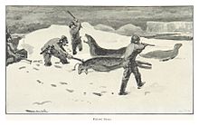
In December 1894, the Balleny Archipelago was called by the Norwegian Bark Antarctic . The expedition under Captain Henryk Bull was commissioned to research the climatic and economic conditions of the Antarctic waters, especially for whale and seal hunting .
Since 1982 part of the archipelago (Sabrina Island, The Monolith and Chinstrap Island) has been under the protection of the Antarctic Treaty , since 2002 as specially protected area No. 104.
Wildlife
Seven species of birds have been shown to breed on the Balleny Islands. The silver petrel colonies on the northwest coast of Sturge Island are estimated to consist of 10,000 to 20,000 pairs, while the western cliffs are populated by approximately 10,000 pairs of snow petrels. 6000 pairs of the silver petrel breed on Row Island. The most common penguin species is the Adelie penguin . 3500 pairs breed on Sabrina Island alone. The chinstrap penguin, which is rarer on the Balleny Islands, is found in three colonies out of a total of 1350 pairs on Buckle Island. The other breeding birds are the Cape petrel , the Antarctic petrel and the spotted petrel .
Web links
- Sailing Directions. Pub. 200: Antarctica (Planning Guide & Enroute) (PDF; 4.8 MB), Ninth Edition, National Geospatial-Intelligence Agency, Springfield, Virginia, 2011 (English)
Individual evidence
- ↑ a b c d e f g h Sailing Directions. Pub. 200: Antarctica (Planning Guide & Enroute). P. 167.
- ^ Young Island . In: Antarctic place names. Australian Antarctic Data Center (English)
- ^ Row Island . In: Antarctic place names. Australian Antarctic Data Center (English)
- ↑ Beale Pinnacle . In: Antarctic place names , Australian Antarctic Data Center (English)
- ^ Buckle Island . In: Antarctic place names. Australian Antarctic Data Center (English)
- ↑ Scott Cone . In: Antarctic place names , Australian Antarctic Data Center (English)
- ↑ Eliza Cone . In: Antarctic place names. Australian Antarctic Data Center (English)
- ↑ Management Plan For Antarctic Specially Protected Area No. 104: Sabrina Island, Northern Ross Sea, Antarctica . (PDF 678 kB) Antarctic Treaty Secretary , 2009, accessed on December 23, 2017 (English).
- ↑ a b Sailing Directions. Pub. 200: Antarctica (Planning Guide & Enroute) , p. 168.
- ↑ Sturge Island . In: Antarctic place names , Australian Antarctic Data Center (English). That's exactly 5000 feet
- ↑ Brown Peak , Geographic Names Information System, US Board on Geographic Names
- ↑ a b Liz Cruwys: Balleny Islands . In: Beau Riffenburgh (Ed.): Encyclopedia of the Antarctic. Vol. 1: A-K. Routledge, New York / London 2007, ISBN 978-0-415-97024-2 , pp. 123f. ( limited preview in Google Book Search, English)
- ↑ ASPA 104: Sabrina Island, Balleny Islands in the Antarctic Protected Areas Database on the website of the Antarctic Treaty Secretariat (English, Spanish, French, Russian), accessed on November 16, 2019.


