
Becherbach near Kirn
| coat of arms | Germany map | |
|---|---|---|

|
Coordinates: 49 ° 44 ' N , 7 ° 30' E |
|
| Basic data | ||
| State : | Rhineland-Palatinate | |
| County : | Bad Kreuznach | |
| Association municipality : | Kirner Land | |
| Height : | 260 m above sea level NHN | |
| Area : | 8.41 km 2 | |
| Residents: | 387 (Dec. 31, 2019) | |
| Population density : | 46 inhabitants per km 2 | |
| Postal code : | 55608 | |
| Area code : | 06757 | |
| License plate : | KH | |
| Community key : | 07 1 33 010 | |
| Association administration address: | Bahnhofstrasse 31 55606 Kirn |
|
| Website : | ||
| Local Mayor : | Karl-Otto Selzer | |
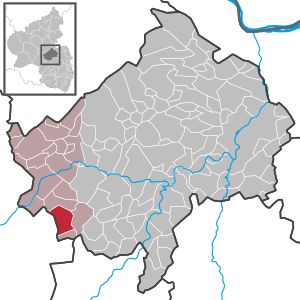
| Location of the local community Becherbach near Kirn in the Bad Kreuznach district | ||
  |
||


Becherbach bei Kirn is a municipality in the Bad Kreuznach district in Rhineland-Palatinate . It belongs to the Kirner Land association. The community of Becherbach bei Kirn, which has had the addition of "bei Kirn" since July 1, 1969, is often confused with Becherbach , which is located in the same district .
geography
The place is located on the Großbach in the North Palatinate Uplands between the Nahe and Glans valleys . To the north is Heimweiler , east Limbach and Hundsbach , south Otzweiler and west is Schmidthachenbach in Birkenfeld .
history
Archaeological finds in the Becherbach district already show settlement during Roman times .
The place name may be derived from mhd . "Bechaere" and its content is likely to be related to the extraction of pitch or charcoal processing.
Located on a trade route that connected the Kirner area with the Glantal , Becherbach was the administrative and court seat for a number of surrounding villages in the Middle Ages. The Becherbach court included the villages of Becherbach, Krebsweiler , Heimberg , Limbach , Otzweiler , Schmidthachenbach and Thal, a small settlement with 4 households in 1599, whose residents enjoyed certain special privileges. There are conjectures about the location of this village, which later became desolate . B. near the Naumburg or between Otzweiler and Becherbach, but no certainty.
The sub-district of Becherbach was part of the Naumburg office , which - in addition to the Becherbach court - was formed by the courts of Bärenbach , Martin-Weierbach, Oberhachenbach, Oberreidenbach and Löllbach.
Half of this office in Naumburg was ceded by the Raugrafen , a sideline of the Wildgraves , in 1349 and completely to the Counts of Sponheim-Kreuznach towards the end of the 14th century . The administrative seat of the office was the Naumburg near Bärenbach, which was first mentioned with its owner Raugraf Emich in 1146.
When the Vorderen Grafschaft Sponheim was divided in 1707 , the Naumburg office was assigned to the Baden portion. In 1776 the official seat was moved to Herrstein .
Economically, the residents of the Naumburg district tended to Kirn , where, as documented in 1579, the so-called “Zollhafer” had to be paid as import duty and sales tax to the Ganerbe von Steinkallenfels when visiting the Kirner market .
The judicial district of Becherbach was also the parish whose mother church was in Becherbach. It was not until 1820 that Schmidthachenbach came to the parish of Sien . The church conditions in the parish of Becherbach determined from 1345 to 1606 the lords of Oberstein , later the lords of Löwenstein and lords of Schmidtburg .
After the introduction of the Reformation in 1557, Becherbach was predominantly Protestant until 1706, after which there was a simultaneous relationship until 1892. The church has a Romanesque steeple from the 12th century, on which a new nave was built in the years 1783–88 instead of a dilapidated predecessor. In 1837 the three-story tower was raised by two stories and given the pointed spire.
In 1785 Becherbach had 45 houses with 46 families. Some houses were two-story. A Catholic elementary school had existed since 1757, although only 5 Catholic families lived in Becherbach. The Reformed creed predominated among the Protestants, and each creed had its own teacher.
After the conquest by French revolutionary troops , the villages of the old Naumburg office came under French rule from 1794. Becherbach temporarily lost its function as official place and from 1801/02 belonged to Mairie Schmidthachenbach in the canton of Grumbach , which belonged to the Saar department . These included the villages of Becherbach, Otzweiler, Limbach, Heimberg, Krebsweiler and Bärenbach.
After the end of French rule, the area was initially under a Bavarian-Austrian transitional administration from 1814, became Prussian the following year and finally came to the Landgraviate of Hesse-Homburg in 1816/17 . Becherbach was now again the seat of an official mayor's office in the Hesse-Homburg Oberamt Meisenheim as the "Oberschultheißerei". After the Hesse-Homburg family died out in 1866, the Landgraviate first came to the Grand Duchy of Hesse by way of inheritance and only half a year later it finally fell to Prussia.
With the formation of the Prussian district of Meisenheim in 1869, the administrative district of the mayor's office in Becherbach was expanded to include Hoppstädten and Hundsbach , which remained there until 1940. In 1932 the Meisenheim district was dissolved and integrated into the Kreuznach district . The Becherbach office was dissolved and it was assigned to the Kirn-Land office in 1940. Since 1968, the local congregation has been part of the Kirn-Land association.
- Population development
The development of the population of the municipality of Becherbach bei Kirn, the values from 1871 to 1987 are based on censuses:
|
|
politics
Municipal council
The municipal council in Becherbach consists of eight council members, who were elected by a majority vote in the local elections on May 26, 2019 , and the honorary local mayor as chairman.
mayor
The local mayor is Karl-Otto Selzer. No candidate ran in the local elections on May 26, 2019, so his election was made by the local council on July 11.
coat of arms
|
|
Blazon : “Above a blue and gold shield base in red, a silver house wall with six columns connected by arches above a base, which is broken through by a staircase in the width of three arches. In the middle arch there is a door, in the others there are windows. " |
|
Justification of the coat of arms: The house wall represents the entrance portal of the official building in Becherbach, which was destroyed by bombs in 1944. The building, as the seat of the official administration for the communities of Becherbach, Bärenbach , Heimberg , Hoppstädten , Hundsbach , Krebsweiler , Limbach and Otzweiler , was for a long time the center of the community and of historical importance.
After the office was dissolved in 1940 until it was destroyed, the building served the Becherbach community as a community hall. The nested field refers to the former affiliation to the Vordere Grafschaft Sponheim . On June 11, 1965, the municipal council commissioned the graphic artist Brust from Kirnsulzbach to develop a design for a municipal coat of arms. At the meeting on September 18, 1965, the council accepted the draft presented. After approval by the State Archives, the Ministry of the Interior in Mainz granted on December 29, 1965 permission to use one's own coat of arms. |
Culture and sights
Becherbach is known in the region for its "bridge choir".
See also: List of cultural monuments in Becherbach near Kirn
Economy and Infrastructure
The federal highway 41 runs to the west . In Kirn-Sulzbach there is a train station on the Bingen – Saarbrücken line .
Web links
- Local community Becherbach on the website of the association community Kirn-Land
- Literature about Becherbach near Kirn in the Rhineland-Palatinate state bibliography
Individual evidence
- ↑ a b State Statistical Office of Rhineland-Palatinate - population status 2019, districts, municipalities, association communities ( help on this ).
- ↑ Official municipality directory 2006 ( Memento from December 22, 2017 in the Internet Archive ) (= State Statistical Office Rhineland-Palatinate [Hrsg.]: Statistical volumes . Volume 393 ). Bad Ems March 2006, p. 203 (PDF; 2.6 MB). Info: An up-to-date directory ( 2016 ) is available, but in the section "Territorial changes - Territorial administrative reform" it does not give any population figures.
- ^ Office Naumburg and Parish Becherbach, Bad Kreuznach 1913
- ↑ State Statistical Office Rhineland-Palatinate - regional data
- ^ The Regional Returning Officer RLP: City Council Election 2019 Becherbach. Retrieved September 23, 2019 .
- ↑ The regional returning officer RLP: direct elections 2019. see Kirn-Land, Verbandsgemeinde, second line of results. Retrieved September 23, 2019 .
- ↑ Information sheet Kirn-Land for the area of the Verbandsgemeinde: Minutes of the meeting of the local council Becherbach on July 11th, 2019. Edition 30/2019, official announcements and notices from the local congregations. Retrieved September 23, 2019 .

Abtweiler | Allenfeld | Altenbamberg | Eagle swings | Floodplains | Bad Kreuznach | Bad Sobernheim | Bärenbach | Bärweiler | Becherbach | Becherbach near Kirn | Biebelsheim | Bockenau | Boos | Braunweiler | Brauweiler | Breitenheim | Bretzenheim | Bruschied | Burgsponheim | Callbach | Dalberg | Daubach | Daxweiler | Desloch | Dörrebach | Dorsheim | Duchroth | Eckenroth | Feilbingert | Frei-Laubersheim | Fürfeld | Gebroth | Guldental | Gutenberg | Hackenheim | Hahnenbach | Hallgarten | Hargesheim | Heimweiler | Heinzenberg | Hennweiler | Hergenfeld | Hochstätten | Hochstetten-Dhaun | Horbach | Hüffelsheim | Hundsbach | Ippenschied | Jeckenbach | Kellenbach | Kirn | Cherry red | Königsau | Langenlonsheim | Langenthal | Laubenheim | Listener | Lettweiler | Limbach | Löllbach | Almond | Martinstein | Meckenbach | Meddersheim | Meisenheim | Merxheim | Monzingen | Münchwald | New Bamberg | Niederhausen | Norheim | Walnut | Oberhausen an der Nahe | Oberhausen near Kirn | Oberstreit | Odernheim am Glan | Otzweiler | Pfaffen-Schwabenheim | Pleitersheim | Raumbach | Rehbach | Rehborn | Reiffelbach | Roth | Roxheim | Rudesheim | Rümmelsheim | Saint Catherine | Schloßböckelheim | Schmittweiler | Schneppenbach | Schöneberg | Black earth | Schweinschied | Schweppenhausen | Seesbach | Seibersbach | Simmertal | Summer slump | Spa bridges | Spall | Sponheim | Staudernheim | Stromberg | Tiefenthal | Traisen | Volxheim | Waldböckelheim | Waldlaubersheim | Wallhausen | Warmsroth | Hamlet near Monzingen | Weinsheim | Weitersborn | Windesheim | Winterbach | Winterburg