
Beetzsee (municipality)
| coat of arms | Germany map | |
|---|---|---|

|
Coordinates: 52 ° 29 ′ N , 12 ° 34 ′ E |
|
| Basic data | ||
| State : | Brandenburg | |
| County : | Potsdam-Mittelmark | |
| Office : | Beetzsee | |
| Height : | 45 m above sea level NHN | |
| Area : | 21.27 km 2 | |
| Residents: | 2652 (Dec. 31, 2019) | |
| Population density : | 125 inhabitants per km 2 | |
| Postal code : | 14778 | |
| Primaries : | 03381, 033836 | |
| License plate : | PM | |
| Community key : | 12 0 69 018 | |
| Community structure: | two districts | |
| Address of the municipal administration: |
Chausseestraße 33b 14778 Beetzsee |
|
| Website : | ||
| Mayor : | Rainer Britzmann ( CDU ) | |
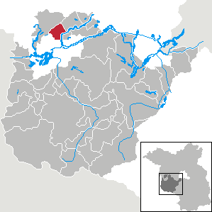
| Location of the municipality of Beetzsee in the Potsdam-Mittelmark district | ||
  |
||

Beetzsee [ ˈbeːʦeː ] is a municipality with a little over 2,400 inhabitants in the Potsdam-Mittelmark district in Brandenburg. It was created in 2002 through the voluntary amalgamation of the municipalities of Brielow, Radewege and Marzahne in the run-up to the planned Brandenburg municipal reform in 2003 . In 2008 Marzahne moved to the neighboring town of Havelsee. The namesake for the community was the Beetzsee belonging to the city of Brandenburg an der Havel , a channel lake on whose west bank it lies. The municipality is the seat of the office of the same name , to which, in addition to Beetzsee, three other municipalities and the city of Havelsee belong.
The landscapes of the Beetzsee municipality such as the lake, wetlands and plateaus are primarily of Ice Age origin. Large areas are variously placed under protection, for example as a nature park, landscape or nature reserve. In addition to the protected areas, there are designated natural, soil and architectural monuments in the Beetzsee villages. Several finds in and around Beetzsee date from prehistoric times. Historically the oldest district is the village of Brielow, first mentioned in a document in the late 13th century.
geography

Geographical location

The municipality of Beetzsee has an area of about 21 square kilometers. The eponymous Beetzsee is located on the eastern edge of the municipality. Direct neighboring cities are the center city of Brandenburg an der Havel in the South as the main center of the region and the town Havelsee in the northwest.
Beetzsee is located about 40 kilometers west of the federal capital Berlin and in the western part of the metropolitan region Berlin / Brandenburg . Depending on the water level, the Beetzseeufer has an average height of 28 to 29 meters above sea level . The highest point of Beetzsee is the 89.3 meter high Black Mountain on the border with Havelsee. The elevation is part of a chain of hills formed during the Ice Age and a southwestern branch of the Nauener Platte . Dry valleys lie between the hills. To the east of the chain of hills is the glacier tongue basin or the meltwater channel of the Marzahner Fenn , through the bottom of which the municipal boundary leads to the Havelsee.
Community structure and neighboring cities and communities
Beetzsee is divided into two districts. Brielow is in the south of the municipality. The Brielow development residential area right on the border with the city of Brandenburg belongs to him . The northern or northeastern district is Radewege . The Radewege Siedlung residential area, which is centrally located in the municipality, belongs to it .
The following cities and municipalities border the municipality of Beetzsee in a clockwise direction: In the west and northwest the city of Havelsee with the districts of Hohenferchesar and Marzahne , in the northeast the municipality of Beetzseeheide with the district of Butzow . Both Havelsee and Beetzseeheide belong, like the municipality of Beetzsee, to the district of Potsdam-Mittelmark. In the east lies the Beetzsee. This belongs to the independent city of Brandenburg an der Havel, the eastern shore of the lake with the village of Mötzow zu Beetzseeheide. In the south the community borders on the city of Brandenburg.
geology

The eastern part of the municipality lies in a subglacial channel, the Beetzseerinne , in which the Beetzsee, a typical channel lake, formed alongside other lakes. This channel was formed during the last, the Vistula glaciation , and initially runs from the northeast to the southwest. Just below the Radeweg, it bends south.
In the western or northwestern area, the foothills of the hilly plateaus of the Nauener Platte, which were also formed during the Ice Age, determine the picture. The core of the compression moraine complex around the Black Mountain is said to be shaped by the Cold Age . A chain of hills with the elevations Eichberg (69.2 meters) and Fichtenberg (57.5 meters) with typical, predominantly gravelly to fine-sandy deposits extends from the swell moraine crest of the Black Mountain to the northeast. Between this and a parallel chain of hills to the northwest, in a wide and flat valley, lies the Glacier Tongue Basin, which also followed the flow of the ice in a south-westerly direction, or the Marzahner Fenn meltwater channel. It is characterized by bog formation without natural runoff. Immediately north of Radeweges is the Hasselberg at 58.8 meters, which also belongs to a chain of hills, represents a compression moraine and how the Black Mountain came into being at ice edge layer 2 of the so-called Brandenburg phase . Meltwater channels lie to the north and south of Brielow. Part of the southern part is the Butter Laake , in which a large number of ditches have been dug for drainage.
Floors
Four types of soil dominate in the Beetzsee area. In the south around the Brielow district you will primarily find Auengley . Only in a narrow strip of the southern meltwater channel there are humus gley and low earth bogs. In contrast, brown soils are predominant in the west and northwest in the area of the range of hills and in the northeast around the Hasselberg . In the wide valley between the brown-earth elevations, pseudogleye dominate in the north . This type of soil extends over a wide area as far as Beetzseeheide. In the area of the Marzahner Fenn and in areas north and south-east of Brielow you can find low earth bogs and lime bogs.
Land use
| Land use 2012 | Area in ha |
|---|---|
| Buildings and open spaces | 174 |
| including living space | 90 |
| including commercial and industrial areas | 21st |
| Traffic areas | 70 |
| of which streets, paths, squares | 70 |
| Bodies of water | 100 |
| Agricultural land | 1297 |
| Forest areas | 360 |
| Operating areas | 3 |
| of which mining areas | 3 |
| Recreational areas | 15th |
| including green spaces | 15th |
| Areas of other use | 93 |
| including cemeteries | 1 |
| of it land | 92 |
| total area | 2112 |
Almost 85 percent of the municipality is made up of forest, water and arable land. Agricultural land has by far the largest share at 61.4 percent. The share in the municipality is well above the national average of around 49 percent. At 17 percent, the proportion of forest areas, which makes up 35.6 percent throughout Brandenburg, is below the national average. The largest forest areas are in the area of the Ice Age compression moraines in the west of the Beetzsee. At 4.7 percent, water areas make up a significantly larger share of the total area than the national average of the already water-rich state (3.4 percent), although the Beetzsee belongs entirely to the city of Brandenburg and not to the municipality of the same name. Only a small area of the Beetzsee is built on. The type of actual land use in Beetzsee is broken down in the 2012 land use table .

Waters

Beetzsee is shaped by a large number of bodies of water. Dominating is the eponymous Beetzsee in the east, which, however, does not itself belong to the municipal area, but completely to the independent city of Brandenburg. The municipal boundary is directly on the west bank of the lake. The almost 22-kilometer-long Beetzsee was created within an ice age channel that was formed by advancing inland ice. It is designated as a class IV federal waterway at the municipal level . Until the 20th century, the lake played an important role as a transport route, especially for the surrounding brickworks. Today it is of increasing importance primarily for tourism and water sports.
In addition to the Beetzsee there are a large number of other lakes, all of which, however, are of anthropogenic origin. They are mostly former clay pits in which the material for local brickworks was extracted. A larger clay pit lake north-west of Brielow was described as weakly eutrophic in the landscape framework plan of the Potsdam-Mittelmark district, while a larger lake to the south-east was described as weakly polytrophic. In the Marzahner Fenn there is a rectangular lake that was formed in a former peat cut . There are no rivers in the community. The only flowing waters are ditches created to drain the wetlands, which are controlled by weirs . For example, the so-called snake trench drains a large part of the Laake butter towards the Beetzsee. The ditch flows through a former clay pit southeast of Brielow before it flows into the Beetzsee. A weir is used to adjust the discharge. The Eisengraben also rises only about 100 meters west of the Schlangengraben in the Butter Laake , which leaves the municipality in a westerly direction, takes in water from the Bohnenländer See within the city of Brandenburg and in the Havelsee des Kranepfuhl and flows south of Tieckow into the Lower Havel .
Another trench system with the so-called Russengraben as the main arm drains the Marzahner Fenn. Between the Schwarzer Berg and Eichberg, this trench runs underground through the chain of hills and, after it has absorbed water from several clay pit lakes, flows into the Beetzsee south and west of Radewege. This system is controlled by four weirs in the Russengraben.
climate
The Beetzsee municipality has a temperate climate, influenced by the continental climate in the east and the Atlantic maritime climate in the west. The precipitation is distributed relatively evenly over the year with a maximum in summer, there are no dry months. The average annual rainfall in the municipality of Beetzsee is 539 mm. The driest month is February with a rainfall of 32 mm, the most rainfall falls on average in June with 64 mm.
The annual average temperature is 9.1 ° C. The warmest month is July with an average temperature of 18.3 ° C. In January, the coldest month, the average temperature is -0.2 ° C.
|
Monthly average temperatures and precipitation for Beetzsee
Source: AmbiWeb GmbH
|
|||||||||||||||||||||||||||||||||||||||||||||||||||||||||||||||||||||||||||||||||||||||||||||||||||||||||||||||||||||||||||||||||||||||||||||||||||||||||||||||||||||
history
Prehistory and early history
.jpg)
The area around today's municipality of Beetzsee was already inhabited by people in prehistoric times. On the basis of archaeological finds, settlements in the area between the Havel and Beetzsee have been proven since the Middle Stone Age at the latest . Numerous bone and antler artifacts have been excavated in the area , which could be dated to the Upper Paleolithic or Mesolithic times. There are also individual finds from the younger Stone Age . For example, graves of the Havelländische culture were secured at Hasselberg , located on the border with the Beetzsee municipality . Several hanging vessels were found. Some of these are exhibited in the Museum of Prehistory and Early History in Berlin .

An urn grave field discovered on the Black Mountain dates from the younger Bronze Age . This was discovered in the 19th century and consists of nine individual graves. During the excavation work, a large number of grave objects such as spiral plate brooches , spiral rings , finger rings and arm rings were found in addition to the urns . Further Young Bronze Age and Iron Age graves could be discovered on Mühlenberg in Radewege. On the Hasselberg, in addition to the Stone Age graves, one of the largest urn grave cemeteries in the Elbe-Havel area from the later Roman Empire until the beginning of the migration of peoples could be secured. Mostly, bowl-shaped urns without additions were found. The finds were dated between the 3rd and 5th centuries.
In his work Germania , Tacitus described the area east of the Elbe up to the Oder as a settlement area of the Suebian tribe of the Semnones . Apart from a few remaining groups, the Semnones left their old settlement area on the Havel in the direction of the Rhine before or at the latest during the time of the migration of peoples from the 3rd or 4th century . From the 5th or 6th century, Germanic settlement activity largely came to a standstill. From this time until the 8th century there are only a few archaeological finds. At the beginning of the 8th century, Slavs immigrated to the area largely devoid of settlements after the Germans had emigrated . Remnants of the Germanic population went into the Slavic majority population. Finds along the banks of the Beetzsee date from the early Slavic period. It was mainly ceramics that were discovered from this era.
middle Ages

After the Slavic castle of Brandenburg had been conquered by Heinrich I 20 years earlier , Emperor Otto I established the Diocese of Brandenburg in 948 . Since there was a revolt of the Slavs in 983 , in which Brandenburg and its surrounding areas fell back into the hands of pagan Slavs, the bishops lived formally in continuous occupation from this time, but in exile in Magdeburg as titular bishops and had no rule over their areas in the east on the Havel. This condition existed for almost 200 years until 1157 Albrecht the Bear was able to recapture Brandenburg.
The historical time of Beetzsee began in 1290 when Brielow was first mentioned as "Brilow" in a document. Margrave Otto IV. Sold the village in the old town of Brandenburg for "9 Mark Stendal money and 21 pounds sterling" and at the same time freed the city from customs duties and dam work for Brielow. The first written mention of Radeweges as "Radenwede" comes from the year 1335. Margrave Ludwig I obligated several villages along the Beetzsee in the document to help in addition to Radewege, for example, the places Butzow and Lünow with the maintenance of dams and paths. In 1373 citizens of the old town were listed as owners of several Hufen . The Bishop of Brandenburg also had possessions in the village .
In the Country Book of Charles IV. Of 1375 and Brielow Radewege were mentioned. Brielow was listed in these records with 37 hooves, two of which belonged to the parish. 42.5 hooves were counted in Radewege. In addition, there are said to have been three hooves for the parish and other Schulzenland. Of tax revenue money and corn were noted by the farmers, while for Brielow Kossäten each had to give a chicken. There was a jug in Radewege and a fisherman who had to pay taxes lived.
Since Brielow belonged to the old town, it exercised the right of patronage and occupied the parish with its own clergy. In 1377 a Brandenburg altarist headed the local parish . The parish of Radeweges was mentioned on the one hand as the mother church and on the other hand as a subsidiary church of Brielows. In 1409 Radewege came to the old town after Elector Jobst had ceded the village to it. Like Brielow, Radewege also remained in municipal ownership until the 19th century. In addition to the city, Johann von Quitzow and the cathedral chapter also owned properties in Radewege.
In 1413 Radewege was attacked and devastated by robber knights from the Archdiocese of Magdeburg , but settled again a short time later. Brielow had also been ambushed. In 1418, five years after the robber barons sacked it, Johann von Quitzow set the village of Radewege on fire.
The streets and dams in the area were not maintained by the old town, but by the new town . Due to the deed of donation from 1290, according to which it was expressly exempted from maintaining the dams and roads to and around Brielow, the old town could not be used for this purpose. In a comparison between the two cities in 1423 it was determined, among other things, that the old town council had to pay the dam money, i.e. the maintenance costs, for the Hufen Radeweges.
Early and modern modern times

Wine was grown between the villages of Brielow and Radewege from 1545 at the latest . In that year the Elector Joachim I allowed the old town to grow wine on the Radeweg mountain. In this context, the old town council had paid out Brielower Kossaten to create living space for the winegrowers.
The village church in Radewege was damaged in a fire in 1607 and repaired again by 1608. The Thirty Years War (1618 to 1648) also hit the Protestant Brandenburg. Among other things, Swedish troops invaded the area around the cities of Old Town and New Town. The name of the Schwedenlinde , a natural monument in Brielow, comes from this time . According to legend, a Swedish officer who died in the war was buried under this tree. On the western boundary of the municipality, between the Bohnenländer See and the Grönschen Bruch, about half of which is in the Bohnenland district of Brandenburg , there are the so-called Schwedenwwall , an approximately 30-meter-wide and one-kilometer-long Landwehr , consisting of two walls and three ditches. They had previously been created by the old town and were used by Swedish troops in the Thirty Years War
In 1674 there was another war with the Kingdom of Sweden , which at that time belonged to Pomerania, and devastation around the cities of Old Town and New Town. During the Northern War , Swedish troops from Pomerania invaded Brandenburg and in 1675 occupied the western Havelland, among other things, and plundered a large number of towns. Before the advancing Brandenburg troops, the Swedes retreated north via Brielow, where the decisive battle at Fehrbellin took place.
In a record in 1708, 16 hoof farmers, a Kossät, a shepherd and a blacksmith were counted for Radewege. 31 years later, 140 people are said to have lived in the village. Brielow's population is said to have been between 180 and 200 people continuously from the Middle Ages to around 1850, including twelve hoof farmers, eight kossaers and one shepherd who lived in 27 to 28 houses. There was a major fire that destroyed large parts of the village in 1727. In 1774 the sexton Brielows also acted as the village school teacher. Radeweges school was around 1800 in the southwest and a syringe house and a forge in the east of the village. For the years 1813, 1890 and 1901 several major fires are recorded for Radewege.

19th century Prussian map:

Brickworks red, clay pits bordered in purple


In 1815 provinces were formed in the Kingdom of Prussia after the Wars of Liberation and the associated political changes. The areas around the city of Brandenburg were incorporated into the new Prussian province of Brandenburg . A year later, the Westhavelland district was founded in Brandenburg , to which the towns of Brielow and Radewege belonged. In the entire area along the Havel and the lakes connected to it, there was an economic boom at the beginning and in the course of the 19th century and with the beginning and advancing industrialization in Prussia. Due to the rich clay deposits in the area and the proximity of the lake, several brickworks were built around the villages of Brielow and Radewege . The Havel enabled transport to industrial centers. The fired clinker was loaded onto barges on site and transported by ship to the cities of Brandenburg, Potsdam and Berlin. A shipload usually consisted of around 40,000 to 50,000 bricks. Clinker production was partially maintained until the middle of the 20th century. Then the clay deposits were exhausted and more modern materials were used. Due to the economic boom through the brick industry, the villages along the Beetzsee grew in a short time, sometimes considerably. Brielow had a population of 322 within a few years by 1858. At that time there were 38 residential buildings and 111 farm buildings, including four brick factories, while there were three brick factories in Radewege six years earlier. In the 19th century Beetzsee had five windmills , three of them in Brielow and two in Radewege. In 1886 the first dairy was set up in Radewege.
20th and 21st centuries

In 1900, along with other traders, the owner of a starch factory and a petroleum dealer had their headquarters in Brielow. Radewege grew from the old town center mainly to the east along the Beetzsee shore. In 1907 there lived a blacksmith, a master baker, a brickworks owner, two millers and there were two inns. Beetzsee had been connected to the German rail network three years earlier. That year, a branch line of the West Havelland district railways , which had existed since 1901 and connected Brandenburg with Nauen in the northeast, was opened via Brielow and Radewege . In addition to Brielow and Radewege, stops were in today's Beetzsee, Radewege Ziegelei and Brielow Expansion. The railway connection played an important role primarily in freight traffic for the Beetzsee communities, especially for the transport of agricultural and brickwork products. After the decline of rail traffic, the connection via Brielow and Radewege was discontinued in 1969 and subsequently dismantled. Only Brielow Expansion still has a short connection that is used as a siding.
During the First World War , 34 residents of Brielow died or were reported missing. From Radewege there were 29. In the inter-war period, the population continued to grow rapidly. In 1933 there were 607 people in Radewege, and six years later there were already 672 people. During the same period, Brielow's population grew from 679 to 829.
During the last weeks of the Second World War, major fighting broke out north of Brandenburg. From the end of April 1945 over 300 Soviet soldiers lost their lives. They were buried on the southern edge of Brielow. In 1947 this cemetery was expanded into a memorial with a cenotaph. For Radewege 23 and for Brielow 49 fallen or missing residents are given as victims of the war.
In the course of the land reform in the Soviet zone of occupation from 1945 onwards , land that was larger than 100 hectares was expropriated and redistributed among the landless or poor population. In Radewege, for example, this affected an estate with 177 hectares. In 1952 an administrative reform took place in the GDR, which was founded in 1949 . The states were dissolved and districts were formed for them. In this context, it was also necessary to restructure the existing circles. The Westhavelland district, to which the towns belonged, was dissolved, and the communities were incorporated into the new Brandenburg (Land) district in the Potsdam district. From 1953, like everywhere else in the GDR, in today's districts of Beetzsee, the collectivization of agricultural businesses, some of which were very small due to the land reform, in agricultural production cooperatives (LPG) took place in order to be run profitably or effectively . A large cattle fattening facility was set up in Brielow . In addition, Brielow became the seat of a cooperative plant production department (KAP), to which the plant productions of the LPG in the area were affiliated.
With the political upheavals of 1989 and 1990 there were again changes. In 1990 the Potsdam district was dissolved and merged into the re-established state of Brandenburg. After reunification, the new district of Potsdam-Mittelmark was founded in 1993, into which the district of Brandenburg was merged. In the run-up to the Brandenburg municipal area reform planned for 2003, Brielow, Radewege and Marzahne volunteered to form the municipality of Beetzsee on February 1, 2002. On January 1st, 2008 Marzahne moved to the neighboring town of Havelsee. In the course of the suburbanization around the city of Brandenburg in the years after the fall of the Wall, Brielow and Radewege recorded some strong influxes. In this context, new settlements with single-family houses were built.
Municipality and place names
The name Beetzsee was chosen for the community because a new foundation including all merger-willing places and no incorporation into one place was intended. A new name should make this clear. Since the adjacent lake dominates the image of the community, the choice fell on Beetzsee. The origin of the name Beetzsee is not exactly clear. For example, a possible connection to other possible names of lakes (Bützsee, Bötzsee, Bützowsee) is established. A borrowing from the Ur-Slavonic is discussed. For example, a reference to bъčъ for “large vessel” or “field well” or bučatri for “swell with moisture” or “rotten” is suspected.
The name Brielows, like that of most of the surrounding towns, is of Slavic origin. The place was first mentioned in a document as “Brilow” in 1290. The name is derived from the Polish word bryla for “lump” or “plaice”. Brielow describes a place on lumpy or clumpy terrain. Radewege was first mentioned in 1335 as "Radenwede". The origin of this name is not exactly clear. The Slavic personal name Radoved seems possible, so that Radewege was described as the residence of a man with this name.
population
At the 2011 census , Beetzsee had 2,430 inhabitants. In the Potsdam-Mittelmark district, only Wusterwitz had a larger population among the municipalities belonging to the office. The proportion of foreigners was 1.4 percent. 14.9 percent of the population or 363 residents belonged to Protestant Christianity , 2.8 percent or 67 absolutely to Catholic Christianity. When asked about religious affiliation, the remaining population was summarized under “other, none, no information”, so that it is not possible to make a statement about other religious communities on the basis of these data.
Population development
|
|
In 1875 Brielow and Radewege together had a population of 1,149. In the following decades until the outbreak of the Second World War , this increased slowly, so that in 1939 already 1,500 people lived in the towns. The influx of refugees and displaced persons after 1945 brought a sudden increase to a first maximum of 1709 inhabitants in 1950. By 1989 this value fell slowly and the population was still 1314 inhabitants. After the reunification of Germany , Brielow and Radewege benefited from the increasing suburbanization of Brandenburg. New residential areas with owner-occupied houses emerged. The population doubled in 15 years to its all-time high of 2,644 residents in 2004. This was followed by a slight but continuous decline. The 2011 census made a leap when the population had to be revised down by around 100 residents.
Dialects
Up until the 19th and 20th centuries, the regional dialect was a typical Brandenburg dialect that was spoken by the majority of the population in everyday life. In the time of Theodor Fontane, for example, this Low German dialect was still used in the area . So often p was spoken instead of f, t instead of s-sounds and k instead of ch . For example, they talked grot instead of big and Dörp held village. There were also differences in vowels such as ie and u instead of the diphthongs ei and au. So the house was a huus at that time . Starting in the second half of the 19th century, the language in the cities changed more and more from Low German to the Berlin dialect , so that today Low German around the city of Brandenburg is almost extinct. Exemplary for the language of the 20th and 21st centuries, au is spoken as o ( lofen instead of running) and z as voiceless s ( sitrone instead of lemon). The frequent rewriting of the genitive like Gregor's car is also typical .
politics
Community representation
| Election 2014 | number | % | +/- | Seats | +/- | ♀ |
|---|---|---|---|---|---|---|
| Eligible voters | 2128 | |||||
| Voters | 1072 | 50.4 | −2.8 | |||
| invalid ballot papers | 22nd | 2.1 | −0.3 | |||
| valid votes (up to three per voter) | 3085 | 95.9 | +0.8 | |||
| Beetzsee citizens list | 1074 | 34.8 | −15.0 | 6th | −2 | 0 |
| CDU | 724 | 23.5 | +11.8 | 4th | +2 | 1 |
| (For) law and order | 709 | 23.0 | −8.4 | 4th | −1 | 3 |
| The left | 207 | 6.7 | +6.7 | 1 | +1 | 1 |
| Individual applicant Torsten Richter | 137 | 4.4 | −1.8 | 1 | 0 | 0 |
| Single applicant Veronika Schwarzer | 102 | 3.3 | +3.3 | / | / | / |
| Individual applicant Mario Schneider | 75 | 2.4 | +1.6 | / | / | / |
| Individual applicant Klaus Pulvermachen | 57 | 1.8 | +1.8 | / | / | / |
The Beetzsee municipal council consists of 16 women and men as well as the honorary mayor. The last local election took place on May 25, 2014. The elections were combined person and list elections. Each voter could cast up to three votes. After there were only minor changes, mostly in the low single-digit percentage range, in the previous local elections, there were often significant gains and losses in 2014. For example, the Beetzsee citizens' list, which was by far the first, lost 15 percentage points with 34.8 percent compared to the 2008 local elections. For the citizens' list, six instead of the previous eight members moved into the local parliament. In 2008 she had gained 1.4 percentage points with 49.8 percent and only missed the absolute majority by six votes.
The CDU came second in 2014 , doubling its share of the vote from 11.7 percent in 2008 to 23.5 percent, and was elected to the municipal council for the four candidates. In 2008 two MPs were elected. The electoral list (for) law and order lost over eight percentage points and one seat and came to 23.0 percent compared to 31.4 percent in 2008. It also has four community representatives. Starting with a new candidate, Die Linke came in at 6.7 percent and was able to achieve the desired seat. Despite the losses of the individual applicants, Torsten Richter, who was able to defend the seat he won in 2008, won the 16th seat in the municipal council. He won 4.4 percent compared to 6.2 percent in 2008 when he first competed. The remaining 7.6 percent of the vote was divided between three other individual candidates, who, however, could not win a seat.
The CDU and Die Linke got the best possible seats in the election, since all candidates were elected. Five members of the municipal council are female. This is two more than in the previous legislative period. As before, three of the community representatives represent the electoral group (for) law and order and now one each from the CDU and Die Linke.
mayor
On May 25, 2014, Rainer Britzmann was elected as the new mayor of the municipality of Beetzsee as a candidate of the CDU for a term of five years. He ran for election without any opponents. With a turnout of 50.4 percent, 60.8 percent (638 voters) voted for and 39.2 percent (411 voters) against him.
Britzmann replaced Manfred Gorecki, who had prevailed in the 2008 election with 73.1 percent of the valid votes (815 voters) against Elisabeth Elsner with 26.9 percent (300 voters). Gorecki was a candidate for the Beetzsee citizens' list, while Elsner was a candidate for the PRO electoral association. It was the second term of office of Gorecki, who had been elected Mayor of Beetzsee five years earlier on November 19, 2003.
The scheduled election date of October 26, 2003 had been canceled due to a lack of applicants, and so the mayor had to be elected by the municipal council in November. Gorecki had previously been mayor of the still independent Brielows.
coat of arms
The municipality of Beetzsee, founded in 2002, does not yet have a coat of arms.
Attractions
Buildings

The village church in Brielow is worth seeing , a hall church with a baroque tower from the 17th or 18th century and a historicist nave from 1873. The baroque west tower is simply designed, the nave is built in the neo-Romanesque style. It was built from red clinker bricks, the typical material of the region at that time. The main portal of the church is centrally located in a risalit on the north side . It is two tiered and has a cranked cornice. The church is hidden or covered by another building and trees, away from Brielower Hauptstrasse. Access from the village is through an old wrought iron gate. Along the main street there are other listed buildings next to the church. The manor house at Hauptstrasse 41 and the residential buildings at Hauptstrasse 7 and 34 are listed as architectural monuments . At the southern exit of the village there is a military cemetery with a Soviet memorial for the soldiers of the Red Army who died in and around Brielow at the end of the Second World War . A total of 368 soldiers and 23 civilians were buried in the cemetery.

The Radeweg village church is a hall church in the center of the village. The main construction phase should start around 1400. In 1607 the church was damaged in a fire and was rebuilt by 1608. The church tower was extended in the 18th century. So an onion-shaped tower hood was put on him. The current flat tent roof was put on after 1973 after the existing tower hood was damaged as a result of a lightning strike. The church with west tower , nave and choir was made of red bricks and field stones with lime mortar . The interior is supported by a classic masonry ribbed vault and services . The organ based on plans by the master organ builder Carl Eduard Gesell , a so-called slider chest organ , was built in the years 1894 and 1895 on the newly built west gallery. A wooden Renaissance pulpit dates from the second half of the 16th century. Next to this pulpit an artfully protruding sacrament niche was incorporated. Above this stands a wooden, colored Madonna and Child. Around the sacrament niche, the north-east wall of the choir was decorated with painted foliage. In Radewege, next to the church, the houses at Dorfstrasse 1 and 58 are under monument protection.
The list of monuments in Beetzsee contains the monuments entered in the list of monuments of the state of Brandenburg.
Natural and soil monuments
In the Brielow churchyard south of the church there is a centuries-old natural monument , the Swedish linden tree . A Swedish officer who died during the Thirty Years' War is said to be buried under her . The tree has been secured several times over the years by chains and steel cables. With a trunk circumference of 11.65 meters, it is considered the thickest tree in Brandenburg. In addition, a chestnut avenue between Brielow and Radewege settlement was designated as a natural monument. This has been deleted from the list.
On the municipal boundary to the city of Brandenburg, there are the Swedish Ramparts , which are protected as a ground monument . These are a late medieval or early modern defense system between the northern Bohnenländer See and the Grönschen Bruch Brielow. The two ramparts and three trenches were created by the old town of Brandenburg as a Landwehr and later popularly named with their current name in the course of the Thirty Years War .
Further ground monuments are listed in the list of ground monuments in Beetzsee .
Protected areas
A large number of partially overlapping protected areas are located in the municipality. Beetzsee, for example, lies with its entire area in the area of the Westhavelland Nature Park . Some protected areas cross the municipal boundary in parts. There is a nature reserve , a landscape protection area , a nature park , three protected landscape components , a surface natural monument , a natural monument and a SPA area (European bird sanctuary). In addition, other areas are designated as protected biotopes and some streets as protected avenues.

| Protection expulsion | Surname | Size in ha |
|---|---|---|
| Nature reserves | Marzahner Fenn and Dünenheide | 725 |
| Landscape protection areas | West Havelland | 136.071 |
| Nature parks | West Havelland | 131,500 |
| Protected landscape components | Marzahner Fenn | |
| Grönsche Bruch Brielow | ||
| Radeweger earth holes | ||
| Area natural monuments | Seehofinsel Brielow | |
| Natural monuments | Swedish linden tree | |
| SPA areas | Middle Havel lowlands | 25,024 |
Westhavelland Nature Park

The municipality of Beetzsee is part of the Westhavelland nature park, which extends along the Lower Havel, and is the largest protected area in Brandenburg with an area of 1315 square kilometers. It comprises one of the largest contiguous wetlands in inland and Central Europe and is the largest resting and breeding area for waders and waterbirds inland. The wetlands are also one of the largest inland resting places for Nordic migratory birds. In spring, thousands of gudgeons and diving ducks rest on the lakes and flat flooded meadows along the Havel . Large flocks of waders look for food before moving on to their northern and eastern homes. Sometimes the birds also find suitable breeding areas there, and so the lowlands of the nature park accommodate the largest proportion of the highly endangered and endangered meadow breeders in Brandenburg. The curlew , lapwing , black-tailed godwit , redshank , snipe and corncrake nest in the reserve . Endangered species of ducks such as the shoveler , teal and gadfly breed there . Also Pintail there are still at home. As for birds of prey, there are sea and ospreys , kites and Montagu's harriers . The ruff is the heraldic animal of the Westhavelland Nature Park. In the autumn months gray geese and cranes roam the nature park. In addition to the large number of birds, beavers and otters also live on the Beetzsee .
Marzahner Fenn and Dünenheide nature reserve

The Marzahner Fenn in the north of the Beetzsee is part of the nature reserve Marzahner Fenn and Dünenheide. This 725 hectare nature reserve is characterized by a close spatial relationship between different habitats. There are near-natural alder and pine forest communities on nutrient-poor locations, bodies of water, slight mountain ranges with only extensively used dry valleys, so-called dwarf shrub and dune heaths, small fens, wet and wet meadows. Due to the different habitats, a large number of partly endangered plant, bird, reptile and amphibian species live in the protected area. According to the German Nature Conservation Union , 78 of the 156 vertebrate species found in the Marzahner Fenn and Dünenheide are considered endangered. The area is an ecological link between the Beetzsee and the Riewendsee in the east, the Havelniederung in the west and the Havelländischer Luch in the north. Some of the animal and plant species living in the nature reserve are osprey, spotted eagle , tree falcon , snipe, quail , crane and great shrike , Sand lizard , grass snake , common garlic toad , moor frog , crested newt , purple loosestrife and milfoil . The nature reserve Marzahner Fenn and Dünenheide is in its entirety part of the European bird sanctuary (SPA area) Middle Havelniederungen and in the northern area part of the FFH area Weißes Fenn and Dünenheide. It is part of the European Natura 2000 network of protected areas .
economy
The main industries of the Beetzsee are tourism and agriculture. In Beetzsee there are only small and medium-sized companies. A larger industrial area is located in Brielow Expansion. In addition to other companies, a medium-sized mechanical engineering company and a wire mill are located there.
tourism

Due to its direct location on the Beetzsee and the surrounding landscape, nature , water and water sports tourism in particular is of increasing economic importance in the municipality . Sailing and motor boating are possible on its entire surface. In addition to the Beetzsee, a large number of clay pit lakes also offer bathing opportunities. Water hikes from the direction of the Lower Havel along the Beetzsee-Riewendsee chain are also popular with tourists. New are trips and vacations in rented houseboats without a license on the lake. When there is no ice, the Beetzsee can be reached by private boats all year round via the Havel and the waterways connected to it. There are several hotel and holiday home complexes in the villages and many Brandenburgers have their weekend and holiday homes in the community and along the lake. The Beetzsee-Havel-Radweg and Storchenwanderweg have been touching the community for several years. Both lead as circular routes around the Beetzsee. The Beetzsee holiday region is one of the holiday regions in Brandenburg with the highest growth.
Agriculture and Forestry
Agriculture is an important economic factor in the municipality. 1297 hectares of the Beetzsee area are used for agriculture. This corresponds to a share of 61.4 percent. The natural conditions for arable farming are to be assessed differently. On the one hand, sandy, dry and nutrient-poor soils dominate large areas, on the other hand, large areas of former moorland are productive. The pseudogley-containing extensive agricultural area north of Radewege is described as an area with a very high yield potential. Further agricultural areas with high yields are located in the Marzahner Fenn, in the Butter Laake and between Brielow and Radewege. The largest local producer is Brielower Agrar GmbH, in which cooperative operations were previously organized.
There are 360 hectares of forest in Beetzsee. The largest contiguous forest areas are the northern foothills of the Old Town Forest and the wooded mountain ranges of the Black Mountain and the range of hills running to the northwest. The vast majority of the forestry areas are planted with pines. The pine forests are mostly single-tier, pure stands, so-called age-class forests. The background to this is that in the first two decades after the Second World War, extensive clear cuts took place, which were increased again on a monoculture basis with the stipulation of maximum timber production. In recent years, however, a forestry restructuring of these forests can be observed. Clear-cutting and monocultural afforestation are increasingly being avoided and the development of more natural deciduous mixed and deciduous forests is being promoted instead.
Infrastructure
traffic

The main axis of road traffic is the state road 98, which leads from Brandenburg to Rathenow . It is the busiest street in the municipality. Coming from Brandenburg from the south, it crosses Brielow Aufbau, Brielow and Radewege Siedlung before it leaves the community on the edge of the Marzahner Fenn to Havelsee. State road 981 branches off north of Radewege Siedlung and runs right through Radewege. This state road ends in the far east at state road 911, which runs through the municipality for a short stretch between Mötzow and Butzow, which belong to Beetzseeheide. There are also municipal and private roads.
The municipality of Beetzsee is located with some port facilities on the Beetzsee-Riewendsee-Wasserstraße , a federal waterway. At the municipality level, it is designated as class IV . This means that so-called European ships with the dimensions 85 meters in length, 9.50 meters in width and 2.50 to 3.00 meters in draft are permitted. The Beetzsee is only used by such ships in the extreme south on a short distance between the suburban lock Brandenburg and the silo canal . While the lake in the municipality used to be an important traffic route for commercial shipping, this picture has now completely changed. In fact, commercial shipping in the form of cargo shipping no longer takes place. Only watercraft for repair and improvement work in the area of the waterway and passenger ships, in addition to recreational and sport shipping, use the lake at the level of the municipality. In the latter, in contrast to commercial shipping, there has been a very strong increase in recent decades, so that the lake is particularly busy in the spring and summer months. The port facilities include piers for passenger ships in Brielow and Radewege and marinas for motor and sailing boats.
With the cessation of traffic on the Westhavelländische Kreisbahnen route through Brielow and Radewege in the 1960s and the extensive dismantling of the track, today's Beetzsee was almost completely decoupled from the German rail network. Only Brielow Expansion in the south still has a track of almost 500 meters in length, which is connected to Brandenburg and represents the rest of the route of the circular railways. This is mainly used as a siding for freight wagons.
Since the closure of the railway line, bus traffic is the only public transport operator in the municipality. Brielow expansion is served by the Brandenburg an der Havel GmbH (VBBr) city bus line at two stops on weekdays . There are also three regional bus routes that run through Beetzsee. These are used by Verkehrsgesellschaft Belzig mbH (VGB). The most important line is the 569, which leads from Brandenburg to Päwesin or Riewend via Brielow Expansion, Brielow, Radewege Siedlung and Radewege. It is the only line that runs on weekends and public holidays and has a certain frequency. In addition, on school days, the lines 564 from Brandenburg via Brielow to Havelsee and 552 from Brandenburg via Mötzow to Radewege are used. These lines run without a cycle and are only served with individual trips. Beetzsee is part of the Berlin-Brandenburg transport association and is integrated into its tariff system. This makes it possible to travel to Beetzsee with a single ticket using different modes of transport, for example from the cities of Berlin, Potsdam or Brandenburg.
Education, public institutions

The only school in the community is today's primary school "Am Beetzsee" in Radewege, which is located directly on Hasselberg in the east of the village. It primarily teaches the students of Beetzsee and the districts of Butzow, Gortz and Ketzür of the Beetzseeheide community up to the end of the sixth grade. The Radeweg school was inaugurated as a new building on June 1, 1962 and was a ten-class general education polytechnic high school until 1991 . From 1976 to 1991 she was called " Vladimir Ilyich Lenin ". It was then converted into a primary school. The closest secondary schools are in the city of Brandenburg.

There is a kindergarten each in Brielow and Radewege. The Beetzsee volunteer fire brigade consists of the Brielow and Radewege volunteer fire brigades. In both districts there are fire stations with fire engines and emergency vehicles. The municipality has its seat in Brielow Expansion in Chausseestrasse 33 b. There is also the seat of the Beetzsee office with the registry office, building office, office for order and social affairs and the office for central services and finances.
Medical institutions
A general practitioner, a pediatrician and a dental practice in Brielow guarantee basic outpatient medical care in the community. In addition to the general practitioner's practice, there is also a physiotherapeutic practice in the same building. The closest hospitals are in the city of Brandenburg. The local clinic serves as a hospital for special care. The Sankt-Marien-Krankenhaus is a geriatric, the Asklepiosklinik a neurological and psychiatric special hospital and the Heliosklinik Hohenstücke a neurological rehabilitation facility. For the emergency services are rescue stations in Brandenburg and Bollmannsruh ( Pawesin ) responsible. The nearest rescue helicopter location is also in the city of Brandenburg. In Brielow there is a veterinary medical facility, the Havelland Horse Clinic, where horses can be given extensive medical treatment.
Media and sport
The daily newspaper with the best-selling circulation in Beetzsee is the Märkische Allgemeine based in Potsdam. The local editorial office, which is also responsible for the community, is based in neighboring Brandenburg an der Havel. There are also the two free newspapers, Brandenburger Wochenblatt (BRAWO) and PreussenSpiegel , which are financed by advertisements and publish regional and local news.
There is a municipal sports field and a sports hall in Radewege. Both facilities are used for school and club sports. There are also equestrian facilities in Beetzsee. Sports clubs in the municipality are the SG Blau-Weiß 90 Brielow, the SV North Star Radewege with the divisions volleyball, gymnastics and cycling and riding and driving club Beetzsee 93. Immediately southeast of the community is the international competition venue regatta course Beetzsee , on the regular rowing - and canoe competitions take place. In addition, the Beetzsee is a designated sailing area.
Personalities
- Corinna Breite (* 1967) is an actress and local politician in Beetzsee and lives in Radewege.
- Oliver Breite (* 1963) is a theater and film actor and lives in Radewege.
- Karl Neumann (1916–1985) was a German writer for children and young people, lived in Brielow since 1972 and died in Radewege.
- Gertrud Piter (1899-1933) was a trade unionist, resistance fighter against National Socialism and was born in Brielow.
- Paul Pribbernow (* 1947) is a German cartoonist and lives in Radewege.
- Jens Riechers (* 1964) was a rugby union national player of the GDR , is a local politician in Beetzsee and lives in Radewege.
literature
- Sebastian children, Haik Thomas Porada on behalf of the Leibniz Institute for Regional Geography and Saxon Academy of Sciences in Leipzig (ed.): Brandenburg an der Havel and surroundings . A geographical inventory in the area of Brandenburg an der Havel, Pritzerbe, Reckahn and Wusterwitz (= Landscapes in Germany. Values of the German homeland . Volume 69 ). Böhlau Verlag, Cologne 2006, ISBN 3-412-09103-0 .
- Günther Mangelsdorf: The devastation of the Havelland . de Gruyter, Berlin 1994, ISBN 3-11-014086-1 .
- Uwe Czubatynski (Hrsg.): History of the Chur and capital Brandenburg on the Havel . Becker, Potsdam 2012, ISBN 978-3-88372-044-9 .
Web links
- Beetzsee municipality. At a glance. Beetzsee municipality, accessed on July 17, 2014 .
- Office Beetzsee. At a glance. Beetzsee Office, accessed on July 17, 2014 .
Individual evidence
- ↑ Population in the State of Brandenburg according to municipalities, offices and municipalities not subject to official registration on December 31, 2019 (XLSX file; 223 KB) (updated official population figures) ( help on this ).
- ^ A b c S. Children, HT Porada (Ed.): Brandenburg an der Havel and surroundings . 2006, p. 138.
- ↑ Main statutes of the Beetzsee municipality. Beetzsee Office, accessed on October 14, 2018 .
- ↑ Beetzsee municipality. State government of Brandenburg, accessed on October 14, 2018 .
- ^ A b c S. Children, HT Porada (Ed.): Brandenburg an der Havel and surroundings . 2006, p. 243.
- ^ A b S. Children, HT Porada (ed.): Brandenburg an der Havel and surroundings . 2006, p. 137.
- ↑ S. Children, HT Porada (ed.): Brandenburg an der Havel and surroundings . 2006, p. 298, fig. 72. (draft by J. Marcinek and L. Zaumseil)
- ↑ a b c d S. Children, HT Porada (ed.): Brandenburg an der Havel and surroundings . 2006, p. 150.
- ↑ Part sheet Northwest Floors. (PDF) In: Landkreis Potsdam-Mittelmark landscape framework plan. Office for Environmental and Landscape Planning, archived from the original on August 7, 2011 ; Retrieved October 16, 2013 .
- ↑ Survey of area according to type of actual use in the State of Brandenburg 2012 . Statistical report. Office for Statistics Berlin-Brandenburg, Potsdam, June 2013, pp. 24 and 25.
- ^ Partial sheet Northwest Surface Waters. (PDF) In: Landkreis Potsdam-Mittelmark landscape framework plan. Office for Environmental and Landscape Planning, archived from the original on October 21, 2014 ; Retrieved October 16, 2013 .
- ↑ a b Climate: Beetzsee. AmbiWeb GmbH, accessed on May 2, 2014 .
- ↑ S. Children, HT Porada (ed.): Brandenburg an der Havel and surroundings . 2006, p. 90 ff.
- ↑ S. Children, HT Porada (ed.): Brandenburg an der Havel and surroundings . 2006, p. 140.
- ↑ S. Children, HT Porada (ed.): Brandenburg an der Havel and surroundings . 2006, p. 140.
- ↑ Felix Biermann, Stefan Dalitz, Karl-Uwe Heussner: The fountain of painke, city of Brandenburg ad Havel, and the absolute chronology of the early Slavic settlement in north-east Germany. In: Praehistorische Zeitschrift. Volume 74 (1999), Issue 2, ISSN 0079-4848 , pp. 219-244 passim .; Following them expressly Thomas Kersting: Slavs in Brandenburg: an archaeological snapshot. In: Joachim Müller, Klaus Neitmann, Franz Schopper (eds.): How the Mark came about. 850 years of the Mark Brandenburg. BLDAM, Wünsdorf 2009, ISBN 978-3-910011-56-4 , pp. 15–31, here p. 23.
- ↑ Otto Tschirch: History of the Chur and capital Brandenburg an der Havel, Festschrift for the millennium of the city in two volumes. Wiesike, Brandenburg an der Havel 1928, p. 46.
- ^ Günther Mangelsdorf: The local devastation of the Havelland. de Gruyter. Berlin 1994, pp. 187 and 289.
- ↑ Otto Tschirch: History of the Chur and capital Brandenburg an der Havel, Festschrift for the millennium of the city in two volumes. 1928, Volume 1, p. 96.
- ↑ a b Theo Engeser and Konstanze Stehr: Radewege (Protestant village church). 2004, accessed September 4, 2014 .
- ↑ Otto Tschirch: History of the Chur and capital Brandenburg an der Havel, Festschrift for the millennium of the city in two volumes. 1928, p. 124.
- ↑ Otto Tschirch: History of the Chur and capital Brandenburg an der Havel, Festschrift for the millennium of the city in two volumes. 1928, Volume 2, p. 32.
- ^ Municipal information board The Schwedenwwall . Accessed May 7, 2014.
- ^ A b S. Children, HT Porada (ed.): Brandenburg an der Havel and surroundings . 2006, p. 154.
- ↑ General Encyclopedia of Sciences and Arts , JS Verlag and JG Gruber, FA Brockhaus, Leipzig 1833, p. 190.
- ↑ Otto Tschirch: History of the Chur and capital Brandenburg an der Havel, Festschrift for the millennium of the city in two volumes. 1928, p. 74.
- ↑ The brickyard Krahnepuhl in Briest. (No longer available online.) Harumi Michelle Waßerroth, archived from the original on October 23, 2013 ; Retrieved October 22, 2013 .
- ^ Michael Rademacher: German administrative history from the unification of the empire in 1871 to the reunification in 1990. Westhavelland district. (Online material for the dissertation, Osnabrück 2006).
- ↑ СПИСОК. Retrieved September 4, 2014 (Russian).
- ^ A b S. Children, HT Porada (ed.): Brandenburg an der Havel and surroundings . 2006, p. 151.
- ^ A b Frank Bürstenbinder: Soldiers' graves in steel. Soviet cemetery of honor is changed. In: Märkische Allgemeine. Märkische Verlags- und Druck-Gesellschaft mbH Potsdam, May 12, 2014, accessed on September 4, 2014 .
- ^ R. Krukenberg: Radewege, Beetzsee community, Potsdam-Mittelmark district, Brandenburg. Online project Memorial Monuments, September 1, 2012, accessed on September 4, 2014 .
- ^ Wolfgang Garz: Brielow, district of Potsdam-Mittelmark, Brandenburg :. Online project Memorial Monuments, October 9, 2010, accessed September 4, 2014 .
- ^ Black Book of Land Reform - Contained Communities and Places ( Memento from January 28, 2011 in the Internet Archive )
- ↑ S. Children, HT Porada (ed.): Brandenburg an der Havel and surroundings . 2006, p. 60. Fig. 15. (Design by S. Kinder)
- ↑ Area changes from 01.01. until December 31, 2002. Federal Statistical Office, 2014, accessed on September 4, 2014 .
- ↑ Area changes from 01.01. until December 31, 2008. Federal Statistical Office, 2014, accessed on September 4, 2014 .
- ↑ S. Children, HT Porada (ed.): Brandenburg an der Havel and surroundings . 2006, p. 139.
- ↑ Population and households. (PDF) Beetzsee municipality on May 9, 2011. In: 2011 census. Statistics Office Berlin-Brandenburg, 2014, accessed on September 4, 2014 .
- ↑ Historical municipality directory of the state of Brandenburg 1875 to 2005. (PDF) Potsdam-Mittelmark district. In: Contribution to statistics. State Office for Data Processing and Statistics Information Management Department, December 2006, pp. 14-17 , accessed on May 28, 2016 .
- ^ Population in the state of Brandenburg from 1991 to 2014 according to independent cities, districts and communities. (PDF) (No longer available online.) Berlin-Brandenburg Statistics Office, 2015, archived from the original on March 3, 2016 ; accessed on May 28, 2016 .
- ↑ Population in the state of Brandenburg by municipalities, offices and municipalities not subject to office in the respective year
- ↑ Joachim Wiese: Dialects and colloquial language . Published in S. Kinder, HT Porada (Hrsg.): Brandenburg an der Havel und Umgebung . 2006, p. 73 f.
- ↑ a b 2014 municipal elections, Beetzsee municipal council. (PDF) Beetzsee Office, May 28, 2014, accessed on September 4, 2014 .
- ↑ a b Statistical Report. (PDF) Local elections in the state of Brandenburg on September 28th, 2008 Elections to the local councils. Office for Statistics Berlin-Brandenburg, p. 107 , accessed on September 2, 2014 .
- ↑ Section 73 of the Brandenburg Local Election Act
- ^ Result of the mayoral election on May 25, 2014
- ^ Statistical report. (PDF) Local elections in the state of Brandenburg on September 28, 2008 mayoral elections. Office for Statistics Berlin-Brandenburg, December 2008, p. 11 , accessed on September 4, 2014 .
- ↑ Local elections October 26, 2003. (PDF) Mayoral elections. State Office for Data Processing and Statistics Brandenburg, January 2004, pp. 5 and 30 , accessed on September 4, 2014 .
- ↑ Potsdam-Mittelmark district. Results of the municipal elections in 1998 (mayoral elections) for the district of Potsdam-Mittelmark. The State Returning Officer / State Voting Officer of the State of Brandenburg, 2014, archived from the original on December 1, 2017 ; Retrieved September 4, 2014 .
- ^ Förderverein Dorfkirche Brielow eV Amt Beetzsee, accessed on September 4, 2014 .
- ↑ S. Children, HT Porada (ed.): Brandenburg an der Havel and surroundings . 2006, p. 152.
- ^ The village church of Brielow (Potsdam-Mittelmark district). Förderkreis Alte Kirchen Berlin-Brandenburg eV, accessed on September 4, 2014 .
- ↑ Brochure Kirchendach eV Förderkreis Dorfkirche Radewege
- ↑ List of monuments of the state of Brandenburg, Potsdam-Mittelmark district. (PDF) (No longer available online.) Brandenburg State Office for Monument Preservation and State Archaeological Museum, December 31, 2012, archived from the original on January 6, 2016 ; accessed on January 15, 2014 .
- ^ Ingrid Kaufmann: Schwedenlinde. Retrieved September 4, 2014 .
- ↑ ikr: Brandenburg's thickest tree - the "Schwedenlinde" in Brielow. In: The world. Axel Springer SE, October 6, 2005, accessed on September 4, 2014 .
- ↑ Natural monuments Potsdam-Mittelmark deletion of avenues, individual trees and groups of trees. (PDF) (No longer available online.) In: Official Journal for the Potsdam-Mittelmark district. District Office Potsdam-Mittelmark, December 2006, archived from the original on August 7, 2011 ; Retrieved September 8, 2013 .
- ↑ Part sheet Northwest Protected Areas. (PDF) In: Landkreis Potsdam-Mittelmark landscape framework plan. Office for Environmental and Landscape Planning, archived from the original on August 7, 2011 ; Retrieved October 16, 2013 .
- ↑ Appendix 1 Natural Monuments. (PDF) (No longer available online.) In: Official Journal for the Potsdam-Mittelmark district. District Office Potsdam-Mittelmark, 2001, archived from the original on August 7, 2011 ; Retrieved April 29, 2013 .
- ↑ Appendix 1 Natural Monuments. (PDF) (No longer available online.) In: Official Journal for the Potsdam-Mittelmark district. District Office Potsdam-Mittelmark, 2001, archived from the original on August 7, 2011 ; Retrieved April 29, 2013 .
- ↑ a b Marzahner Fenn and Dünenheide. (PDF) Westhavelland Nature Park. NABU Foundation for National Natural Heritage, November 1, 2013, accessed July 20, 2014 .
- ^ Ordinance on the "Westhavelland" nature reserve. State government of Brandenburg, January 29, 2014, accessed on June 28, 2014 .
- ↑ a b Westhavelland Nature Park. State Office for the Environment, Health and Consumer Protection, July 3, 2014, archived from the original on July 30, 2014 ; Retrieved July 28, 2014 .
- ↑ 3542-421 Middle Havelniederung. (EU bird sanctuary) Profiles of the Natura 2000 areas. Published by the Federal Agency for Nature Conservation . Retrieved March 12, 2017.
- ↑ Westhavelland Nature Park. Introducing the natural landscape ... TMB Tourismus-Marketing Brandenburg GmbH, accessed on October 16, 2013 .
- ↑ Fascination Havel - water sports area Potsdam-Brandenburg Havel lakes. Destination IT Consult, accessed on September 4, 2014 .
- ↑ Charter for everyone. WIR - Water Tourism Initiative Region Potsdamer & Brandenburger Havelseen, accessed on May 3, 2014 .
- ↑ Seehotel Brandenburg on the Havel. STG Stadtmarketing- und Tourismusgesellschaft Brandenburg an der Havel mbH, accessed on September 4, 2014 .
- ↑ "Beetzsee-Havel-Radweg" cycle route. STG Stadtmarketing- und Tourismusgesellschaft Brandenburg an der Havel mbH, accessed on September 4, 2014 .
- ↑ Stork hiking trail around the Beetzsee. Beetzsee Office, accessed on September 4, 2014 .
- ↑ Thorkit Treichel: Berlin leaves New York and London behind. In: Berliner Zeitung. Berliner Verlag GmbH, February 21, 2013, accessed on July 20, 2014 .
- ↑ Part sheet Northwest Special Soils. (PDF) In: Landkreis Potsdam-Mittelmark landscape framework plan. Office for Environmental and Landscape Planning, archived from the original on August 7, 2011 ; Retrieved May 4, 2013 .
- ↑ Water tourism development concept of the city of Brandenburg an der Havel. (PDF) Reppel and Lorenz Tourismusberatung, Tourismus-Kontor Heike Helmers, City Administration Brandenburg, accessed on July 20, 2014 .
- ↑ C. (PDF) 523. Brandenburg an der Havel Transport Company (VBBr), archived from the original on May 4, 2014 ; Retrieved September 4, 2014 .
- ↑ 569. (PDF) Brandenburg - Brielow - Riewend - Päwesin and Päwesin - Riewend - Brielow - Brandenburg. Verkehrsgesellschaft Belzig mbH, accessed on July 20, 2014 .
- ↑ 552. (PDF) Mötzow - Lünow - Radewege and Radewege - Lünow - Brandenburg. Verkehrsgesellschaft Belzig mbH, accessed on September 4, 2014 .
- ↑ 564. (PDF) Brandenburg - Hohenferchesar - Pritzerbe and Pritzerbe - Hohenferchesar - Brandenburg. Verkehrsgesellschaft Belzig mbH, accessed on September 4, 2014 .
- ^ Frank Bürstenbinder: Festival week on the Hasselberg The Radewege primary school turns 50 ; published on May 25, 2012 in the Märkische Allgemeine Zeitung.
- ↑ Imprint. Beetzsee municipality, accessed on September 4, 2014 .
- ↑ Employees. Beetzsee Office, accessed on July 20, 2014 .
Cities: Bad Belzig | Beelitz | Bridge | Havelsee | Niemegk | Teltow | Treuenbrietzen | Werder (Havel) | Ziesar
Municipalities: Beetzsee | Beetzseeheide | Bensdorf | Borkheide | Borkwalde | Buckautal | Golzow | Görzke | Trenches | Gross Kreutz (Havel) | Kleinmachnow | Lehnin Monastery | Linthe | Michendorf | Mill flow | Nuthetal | Päwesin | Broken plan | Planetal | Rabenstein / Fläming | Rosenau | Roskov | Schwielowsee | Seddiner See | Stahnsdorf | Wenzlow | Wiesenburg / Mark | Wollin | Wusterwitz