Bregenz Oh
| Bregenz Oh | ||
|
Lower course of the Bregenz Ach |
||
| Data | ||
| Water code | AT : 8111 | |
| location | Austria | |
| River system | Rhine | |
| Drain over | Lake Constance → Rhine → North Sea | |
| source | Mohnenfluh above Schröcken | |
| Source height | 2400 m above sea level A. | |
| muzzle | Near Bregenz in Lake Constance coordinates: 47 ° 30 ′ 15 ″ N , 9 ° 41 ′ 40 ″ E 47 ° 30 ′ 15 ″ N , 9 ° 41 ′ 40 ″ E |
|
| Mouth height | 395 m above sea level A. | |
| Height difference | 2005 m | |
| Bottom slope | 30 ‰ | |
| length | 67 km | |
| Catchment area | 835 km² | |
| Discharge at the Kennelbach A Eo gauge: 826.3 km² Location: 7.5 km above the mouth |
NNQ (2005) MNQ 1951–2008 MQ 1951–2008 Mq 1951–2008 MHQ 1951–2008 HHQ (2005) |
1.07 m³ / s 5.14 m³ / s 41 m³ / s 49.6 l / (s km²) 603 m³ / s 1350 m³ / s |
| Left tributaries | Argenbach , Mellenbach | |
| Right tributaries | Subersach , Weißach , Rotach , Rickenbach | |
| Medium-sized cities | Bregenz | |
The Bregenzer Ach (also Bregenzer Ache or Bregenzerach ) is an approximately 67 kilometer long tributary of Lake Constance in the Austrian state of Vorarlberg . With a catchment area of around 830 km², the river drains almost the entire area of the Bregenzerwald and, with an average water flow of 41 m³ / s, is the most important river in the northern part of the state. The Ach is named after the Vorarlberg state capital Bregenz , for which it represents the border to the neighboring communities Hard and Lauterach .
geography
River course
The Bregenzer Ach rises on the eastern flank of the Mohnenfluh above Schröcken in the Lechquellen Mountains at an altitude of 2,400 meters. With its tributaries, it drains the northern part of the Lechquellen Mountains, the western part of the Allgäu Alps and large parts of the Bregenzerwald Mountains in a north- westerly direction . Along with the valley of the Bregenzer Ach, there is also the settlement of the Bregenzerwald. Almost all of the villages and communities in the Bregenzerwald are located in the valley of the Bregenz Ach or in the valley of one of its tributaries.
After about 67 km of the river, the Bregenzer Ach flows into Lake Constance as the municipality boundary between the state capital Bregenz and the market town of Hard .
Tributaries
Of the numerous tributaries of the Bregenz Ach, the Rotach and Weißach (with Bolgenach ) and the Subersach in the middle course are the most important. It is they who shape the most striking valleys of the so-called Vorderwald, which are decisive for its settlement.
use
traffic
The Bregenzer Ach has always represented a transport challenge for the farmers in the region. The unpredictable river was only passable in a few places, so that the first bridges were soon built. Some of these wooden structures still exist today and are under monument protection . In addition, some of the modern bridges are of considerable dimensions, such as the Lingenau high bridge , one of the tallest reinforced concrete arch bridges in Central Europe. The three cable car ferries that were used in the Andelsbuch / Bersbuch area were a specialty .
Currently, the Bregenzerwaldstrasse (L200) from Egg follows the course of the Bregenzer Ach and the valley it has created for most of its course through the Bregenzerwald. From Bregenz to Bezau , the Bregenzerwald Railway followed the course of the river until it was closed .
Sports
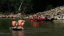
The lower course of the Bregenzer Ach is also of touristic importance because of its suitability for white water sports and can be navigated all year round. Beginners in these sports can take special courses; Accommodation, parks and campsites are available. The upper course of the Ach is a strong white water and is therefore even more interesting for experienced athletes. However, due to the construction of hydropower plants (e.g. Andelsbuch power plant ) and water drains, it is only accessible in spring, sometimes even later after heavy rainfall. A weir at the Weißach estuary is used to regulate the amount of water for fans of whitewater paddling or kayaking . On the Ach, kayaking is held as part of the outdoor trophy , an extreme relay competition with the disciplines of mountain running , paragliding , white water kayaking and mountain biking .
Energy generation
The Bregenz Ach and its tributaries are used by five hydropower plants from illwerke vkw AG to generate electrical energy. Among these is the Langenegg power plant , which uses the Bolgenach and Subersach rivers. There are also the Alberschwende and Andelsbuch power plants as well as the small power plants in Au and Schoppernau .
Web links
- Bregenz Ache and power station (Vorarlberg from above) . Video (flash), 2:37, vorarlbergvonoben.at
Individual evidence
- ↑ Vorarlberg Atlas
- ↑ Catchment area of the Kennelbach gauge (826.3 km²), increased by the remaining catchment area up to the confluence with Lake Constance (9 km² (Federal Office for Topography of Switzerland, swisstopo, area measurement function ))
- ↑ Federal Ministry for Agriculture, Forestry, Environment and Water Management (Ed.): Hydrographisches Jahrbuch von Österreich 2011. 119th Volume. Vienna 2013, p. OG 80, PDF (12.9 MB) on bmlrt.gv.at (Yearbook 2011)
- ↑ Website of the Outdoortrophy ( Memento of the original from April 15, 2017 in the Internet Archive ) Info: The archive link was inserted automatically and has not yet been checked. Please check the original and archive link according to the instructions and then remove this notice.


