Col des Planches
| Col des Planches | |||
|---|---|---|---|
|
Col des Planches |
|||
| Compass direction | west | Southeast | |
| Pass height | 1411 m above sea level M. | ||
| Canton | Valais | ||
| Watershed | Rhone | On it | |
| Valley locations | Martigny | Sembrancher | |
| expansion | Pass road | ||
| Winter closure | November - May | ||
| Mountains | Alps | ||
| profile | |||
| Ø pitch | 9.2% (944 m / 10.3 km) | 8.5% (697 m / 8.2 km) | |
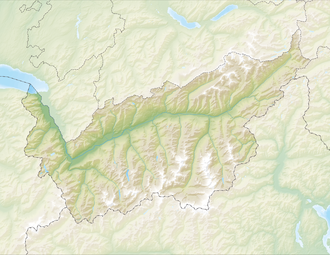
| Map (Valais) | |||
|
|
|||
| Coordinates | 575 722 / 105036 | ||
The Col des Planches is a Swiss pass in the municipality of Vollèges in the canton of Valais , which connects Martigny and Sembrancher across the ridge that separates the Rhone Valley from the Dranse Valley. The main road from Martigny to the Great Saint Bernhard leads south through the Dransetal.
A road connects the pass in a north-easterly direction with the Col du Tronc ( 1606 m ) and further unpaved with the Col du Lein ( 1658 m ).

