
Cursdorf
| coat of arms | Germany map | |
|---|---|---|

|
Coordinates: 50 ° 34 ' N , 11 ° 8' E |
|
| Basic data | ||
| State : | Thuringia | |
| County : | Saalfeld-Rudolstadt | |
| Management Community : | Schwarzatal | |
| Height : | 690 m above sea level NHN | |
| Area : | 13.95 km 2 | |
| Residents: | 598 (Dec. 31, 2019) | |
| Population density : | 43 inhabitants per km 2 | |
| Postal code : | 98744 | |
| Area code : | 036705 | |
| License plate : | SLF, RU | |
| Community key : | 16 0 73 013 | |
| LOCODE : | DE CUK | |
| Address of the municipal administration: |
Markt 5 98744 Oberweißbach / Thür. Forest |
|
| Website : | ||
| Mayor : | Frank Eilhauer ( CDU ) | |
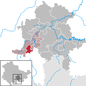
| Location of the municipality of Cursdorf in the Saalfeld-Rudolstadt district | ||
  |
||


Cursdorf is a municipality in the Saalfeld-Rudolstadt district in Thuringia (Germany). The community belongs to the administrative community Schwarzatal , which has its administrative seat in the city of Schwarzatal .
geography
The state-approved resort town of Cursdorf is the highest place in the region and is located in the Thuringian Forest Nature Park on a mountain saddle between the Schwarzatal and Lichtetal.
history
The place was first mentioned in 1537 as Cunradesdorf . The place on an old trade route from Erfurt to Nuremberg belonged to the Grafschaft Schwarzburg-Rudolstadt . The local population has traditionally been involved in forestry and glass processing, as well as in the oil trade . After the construction of the gas works in the neighboring town of Oberweißbach and the construction of a gas pipeline, glassblowing in particular developed in Cursdorf from 1905 onwards . Until 1918 the place belonged to the sovereignty of the Principality of Schwarzburg-Rudolstadt.
In 1923, Cursdorf became the terminus of the Oberweißbacher Bergbahn .
In 1920 the place came to the district of Rudolstadt , 1952 to the district of Neuhaus am Rennweg .
At the end of the 1920s, under emergency conditions at the time of the global economic crisis, construction of the Friedensschanze began on the northern slope of the Rosenberg. When it was completed in 1932, it became the largest natural hill in Europe, the hill record is 91.0 m. When G. Beyer from Cursdorf took part in a competition in Schierke, he persuaded Hans Renner to go to Cursdorf with the national team. It included such well-known jumpers as Harry Glaß, Werner Lesser, Franz Knappe, Queck and others. a.
Today the complex in the valley of the white Schwarza has grown over and can only be guessed at.
politics
Municipal council
The council of the community of Cursdorf consists of 8 councilors and councilors.
(Status: local elections on June 27, 2004)
mayor
The honorary mayor Frank Eilhauer was re-elected on June 5, 2016.
coat of arms
The coat of arms was approved on December 2, 1991.
Blazon : “Split of gold and blue with a silver shield base; in front a green fir tree, behind an upright right-turning golden lion, in the base of the shield a red spreading fork over a red horse crest. "
Culture and sights
- Historical Glass Apparatus Museum

traffic
The flat line of the Oberweißbacher Bergbahn connects Cursdorf via Oberweißbach with Lichtenhain , where a funicular with goods platform connects to the Schwarzatalbahn .
Sons and daughters of Cursdorf

- Georg Heinrich Macheleid (1723–1801), one of the subsequent inventors of porcelain approx. 50 years after Johann Friedrich Böttger and Ehrenfried Walther von Tschirnhaus
- Otto Preßler (1875–1946), German glassblower and entrepreneur in Leipzig
- Rudolf Preßler (1877–1935), German glassblower and entrepreneur in Cursdorf
- Arno Bergmann (1882–1960), German lepidopterologist
Individual evidence
- ^ Population of the municipalities from the Thuringian State Office for Statistics ( help on this ).
- ^ August Elsäßer: The parish Oberweißbach through the ages . A review of the 150th anniversary of the dedication of the church in Oberweißbach with a short chronicle of the parish towns of Oberweißbach, Cursdorf, Deesbach, Lichtenhain and Leibis. Oberweißbach 1929, p. 175 .
- ↑ Chronicle of the Preßler companies in Leipzig and Cursdorf (accessed on June 9, 2015)
Web links

Allendorf | Altenbeuthen | Bad Blankenburg | Bechstedt | Cursdorf | Deesbach | Döschnitz | Drognitz | Graefenthal | Hohenwarte | Katzhütte | Kaulsdorf | Koenigsee | Lehesten | People Mountain | Meura | Probstzella | Rohrbach | Rudolstadt | Saalfeld / Saale | Schwarzatal | Schwarzburg | Sitzendorf | Uhlstädt-Kirchhasel | Unterweißbach | Unterwellenborn