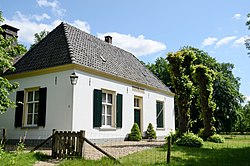
Deelen (Netherlands)
| province |
|
| local community |
|
|
Area - land - water |
29.75 km 2 29.7 km 2 0.05 km 2 |
| Residents | 135 (Jan 1, 2017) |
| Coordinates | 52 ° 4 ′ N , 5 ° 52 ′ E |
| Important traffic route |
|
| prefix | 026 |
| Postcodes | 6816, 6877, 7352, 7371 |
| Location of Deelen in the municipality of Ede | |
| Lebrets Hoeve | |
Deelen is a village in the eastern part of the municipality of Ede in the Dutch province of Gelderland with 135 inhabitants.
location
Deelen is about 60 meters above sea level in the southern Veluwe , surrounded by forest , heather , dunes and small lakes .
In the southwest of the village is the former military airfield Deelen ( ICAO code EHDL), in the southeast about five kilometers from the glider airfield Terlet (ICAO code EHTL).
Attractions
The Museum Vliegbasis Deelen on Hoenderloseweg (N804) in Deelen shows permanent exhibitions on the topic of aerial warfare 1940–1945. It also offers changing exhibitions and readings on the topic of aerial warfare as well as guided tours of the Deelen airfield and the tea rose positions (radio pilots from the Second World War ) in Terlet and de Posbank .
Web links
Individual evidence
- ↑ a b Kerncijfers wijken en buurten 2017 Centraal Bureau voor de Statistiek , accessed on July 9, 2018 (Dutch)
- ↑ a b Museum Vliegbasis ( page no longer available , search in web archives ) Info: The link was automatically marked as defective. Please check the link according to the instructions and then remove this notice.
- ↑ Aeronautical Information Package Netherlands, Part 3, AD 2.

