Dison
| Dison | ||
|---|---|---|

|

|
|
|
|
||
| State : |
|
|
| Region : | Wallonia | |
| Province : | Liege | |
| District : | Verviers | |
| Coordinates : | 50 ° 37 ' N , 5 ° 51' E | |
| Area : | 14.01 km² | |
| Residents: | 15,248 (Jan 1, 2019) | |
| Population density: | 1,088 inhabitants per km² | |
| Post Code: | 4820 (Dison) 4821 (Andrimont) |
|
| Prefix: | 087 | |
| Mayor: | Véronique Bonni (PS) | |
Local government address : |
Administration Communale Rue Albert 1er, 66 4820 Dison |
|
| Website: | www.dison.be | |
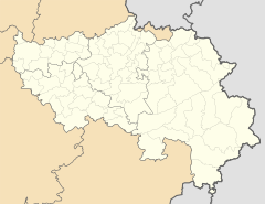
Dison is a Belgian city in the Wallonia region in the province of Liège.
geography
The place is about 30 kilometers away from Liège and Aachen , on the A27 motorway , two kilometers south of the Battice triangle on the A3 ; the nearest regional train station is in the town of Verviers , about four kilometers to the south , which forms a closed urban center with Dison.
history
Until the French Revolution, Dison belonged to the Petit-Rechain rule within the Herve high bank in the Duchy of Limburg .
Only with the progressive development of the textile industry in the Verviers area did the population increase and Dison became an independent municipality from 1798. In the area of Andrimont above the core community, which formerly belonged to the margravate Franchimont , graves from the Celtic era were discovered at the beginning of the 20th century .
partnership
Dison has been related to the French community of Audincourt in Franche-Comté since 1962 .

