Donon
| Donon | ||
|---|---|---|
|
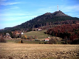
South side |
||
| height | 1009 m | |
| location | Alsace , Bas-Rhin department , Grand Est region , France | |
| Mountains | Vosges | |
| Dominance | 16.1 km | |
| Notch height | 273 m ↓ | |
| Coordinates | 48 ° 30 '48 " N , 7 ° 9' 54" E | |
|
|
||
|
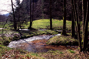
The "red Saar" at the foot of the Donon |
||
The Donon (German Hohe Donne ) is a mountain in the Vosges Mountains in Alsace in the Bas-Rhin department , France . With a height of 1009 m , the mountain in the district of Grandfontaine (German Michelbrunn ) marks one of the highest elevations in the Northern Vosges (the Rocher de Mutzig is also 1009 m high). It sits as a mighty red sandstone block on the granite bedrock, which is exposed in many places in the Northern Vosges. Another regional peculiarity is its pronounced summit.
The two source rivers of the Saar have their source on the Donon : the Red Saar (Sarre Rouge) and the White Saar (Sarre Blanche) . An important road connection leads over the Vosges via a pass road, the Col du Donon (727 m).
history
Today's Vosegus temple on the summit was built in neo- classical style under Napoleon III. built and is a free reconstruction . On the Donon plateau there are remains of Celtic and Roman cults that were dedicated to the god after whom the Vosges may be named. The original archaeological finds are kept in museums in Épinal and Strasbourg ( Archaeological Museum Strasbourg ). With the Christianization of the country, the mountain lost its cultic significance.
In recent wars, the Donon was fiercely contested due to its exposed location. As a result of the war of 1870/71, the German-French border moved close to the mountain. During the First World War it was occupied by German troops until 1918, who built numerous fortifications. In the 1940 war , the 43rd fortification corps of the French army was encircled on the Donon and only surrendered after the second armistice at Compiègne . Numerous soldiers' graves in the area of the summit still bear witness to the heavy fighting.
Distant view
When the weather is favorable, the view extends across Strasbourg to the Black Forest , the High Vosges and far to Lorraine . Occasionally the view extends as far as the Alps and Saarland .
Transmission tower
There is also an 80 meter high, free-standing steel lattice tower on the Donon . It is a transmission tower for VHF radio and television programs. To protect against icing, the top antennas are surrounded by a fiberglass cylinder, which gives the tower a characteristic appearance.
Web links
Individual evidence
- ↑ Numbers and facts: independence for the mountains described here. In: Thehighrisepages.de. Archived from the original on October 19, 2014 ; accessed on October 12, 2018 (prominence, dominance and independence of mountain peaks).
- ^ Günter Schmitt: The Saar: From the source to the mouth. Press sales Saar, Heusweiler, 2001, ISBN 978-3-9805454-4-0 .


