
Eichenberg (Vorarlberg)
|
Eichenberg
|
||
|---|---|---|
| coat of arms | Austria map | |
 |
|
|
| Basic data | ||
| Country: | Austria | |
| State : | Vorarlberg | |
| Political District : | Bregenz | |
| License plate : | B. | |
| Surface: | 11.59 km² | |
| Coordinates : | 47 ° 32 ' N , 9 ° 47' E | |
| Height : | 793 m above sea level A. | |
| Residents : | 420 (January 1, 2020) | |
| Population density : | 36 inhabitants per km² | |
| Postal code : | 6911 | |
| Area code : | 05574 | |
| Community code : | 8 02 12 | |
| NUTS region | AT342 | |
| Address of the municipal administration: |
Dorf 53 6911 Eichenberg |
|
| Website: | ||
| politics | ||
| Mayor : | Josef Degasper | |
|
Local council : (2015) (9 members) |
||
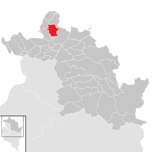
| Location of Eichenberg in the Bregenz district | ||
  |
||
 View over the parish church of St Bernard to Lake Constance |
||
| Source: Municipal data from Statistics Austria | ||


Eichenberg is a municipality in Austria in Vorarlberg in the Bregenz district with 420 inhabitants (as of January 1, 2020).
geography
Eichenberg is located in Vorarlberg, in the Bregenz district east of Lake Constance, on the slope of the Pfändermassiv. 60.7% of the area is forested.
At 1,069 meters, the Hochberg is the highest point in the municipality. It is five meters higher than the nearby Pfänder , which is of great tourist importance as Bregenz's local mountain .
A well-known forest road, the so-called Wirtatobel road, runs through the Wirtatobel, a forest and pasture area on the eastern slope of the Pfänder. It connects the northern end of Fluherstraße (Bregenz / Fluh) with the Tröger Stüble on the Eichenberg.
Eichenberg is the largest municipality in terms of area in the Leiblachtal region and includes numerous districts (e.g. Jungholz, Lutzenreute, Niederholz, Schlüssellehen). There are also scattered individual farmsteads. However, there are no other cadastral communities in Eichenberg.
Neighboring communities
The municipality of Eichenberg shares a municipal boundary with four other Vorarlberg municipalities, which, like Eichenberg, are all in the political district of Bregenz. In a clockwise direction, starting in the north, are the municipalities of Möggers , Langen bei Bregenz , Lochau and the market town of Hörbranz . Eichenberg - in the extreme south of the municipality - does not border on the state capital Bregenz . A very small bulge in the Lochau municipality prevents the Eichenberg and Bregenz municipal boundaries from coming together.
history
The place was first mentioned in a document in 1320 and named "Aichberg". The name of the place is obviously derived from the oak forests in which the first individual farms arose through clearing in the course of the Middle Ages. Until 1523, the area belonged to the Württemberg Tettnang -based Montfortern that after their property to the Habsburg sold. The Upper and Lower Salt Roads have passed north and south of the town since the 15th century, but the residents lived very secluded for a long time. Administratively, Eichenberg initially belonged to Möggers , located in the north, and was ecclesiastically assigned to the parish of Bregenz. After 1839 the St. Bernhard parish church was completed after three years of construction, Eichenberg was raised to an independent parish on June 5, 1873.
After Austria's defeat by Napoleon , Eichenberg came to Bavaria together with Vorarlberg from 1805 to 1814 . By a law of the Vorarlberg state government of December 23, 1921, Eichenberg received the status of an independent municipality with effect from April 5, 1922. In the meantime, independence was lost during the annexation of Austria to National Socialist Germany from 1938 to 1946 due to the incorporation into Bregenz. From 1945 to 1955 Eichenberg was in the French occupation zone .
One of the oldest cheese producer in Vorarlberg in 1902 was dairy Lutzenreute established, consisting as a cooperative today. From 1914 until it was replaced by the VKW, there was an electricity company in the Hinteregg district. In addition to the Hinteregg parcel, the Möschen and Jungholz parcels were supplied. In 1921 the second power station followed in the Lutzenreute district, which also supplied the farms in Lehen, Unterfluh and Schlüssellehen. Both power plants were replaced in the 1930s when the districts were connected to the regular power grid. The village center was connected to the Vorarlberg power plant network in 1922. In 1925 the first telephone was installed in the Gasthof Krone. In 1931 the Eichenberg volunteer fire brigade was founded with 38 founding members. In 1959 the construction of a new school building began, in 1990 the through-town was redesigned to make it attractive, and in 1997 a new multi-purpose building for the community was put into operation.
Population development

politics
The Eichenberg municipal council has 9 members, all of whom belong to the party-independent Eichenberg citizens' list after the 2015 municipal council elections . This list of citizens had previously been determined in an area code and was the only campaigning party to take part in the municipal council election.
In 1922 Adolf Dürr was appointed as the first community leader (the official title of mayor was only introduced in 1935), who conducted his official business from his farm in the district of Lehen, three kilometers from the town center. While he was in office for seven years, Josef Degasper was able to point to the longest term in office to date at the age of 18 (1965–1983). Mayor Hermann Gmeiner, who was elected to office in 1985, surpassed him with a 25-year term of office. After the municipal council election in 2010 , Gmeiner handed over the office to his successor, Alfons Rädler. This, in turn, was only ranked sixth on the list by the voters in the area code for the 2015 municipal council elections and subsequently no longer stood for the municipal council election. His successor was Josef Degasper, the former mayor's son of the same name.
coat of arms
The municipal coat of arms was given to Eichenberg by a certificate from the Vorarlberg state government dated September 23, 1969. It is described in the certificate as follows: “In black over a silver three-mountain, a silver oak branch with four leaves and three golden acorns.”
The design comes from the Schruns artist and heraldist Konrad Honold , who used it to create a “talking” coat of arms.
economy
Until the 20th century, the inhabitants of Eichenberg lived mainly from agriculture. But as early as 1840, several inns were wooing overnight guests. In the “Vorarlberger Gaststättenverzeichnis” from 1929 four inns with guest rooms in Eichenberg are listed. After the Second World War, tourism quickly grew in importance. Since the 1990s, four hotels, several guest houses and holiday apartments have recorded around 17,000 overnight stays annually. In addition to the hospitality industry, there are wood processing companies, two dairies , a butcher's and a car repair shop.
Transport and infrastructure
Up until the 19th century, the next largest town, Lochau, on the shores of Lake Constance, was only accessible through a narrow road. It was not until 1894 and 1895 that the construction of two paved roads to Hörbranz and Lochau began, but some of them were so steep that they could hardly cope with heavily loaded wagons.
The first time in 1934 was the construction of a paved road between the village center and the district of Lutzenreute, where a height difference of 74 meters had to be overcome over four kilometers. Due to an interruption in construction work during the Second World War, the road could not be completed until 1955. Since 1978 it has been part of Landesstraße 11, which was completed in 2007 and leads to Lochau.
Eichenberg can be reached today via the state road 11 from Lochau and via the L 9 from Scheidegg (Germany). The next motorway junctions are Hörbranz-Lochau and Lindau (Germany) on the Munich - Bregenz motorway (A 96 / A 14). From Lochau the bus line no.12 (Scheidegg-Lindau) runs every two hours.
Culture and sights
- Ruins of the Ruggburg
- Catholic parish church Eichenberg
- Chapel of St. Michael
Culinary specialties
Eichenberg is known for the cheese trail over the back of the Pfänder (local mountain of Bregenz ). The dairy farms in Lutzenreute and Jungholz offer mountain cheese. The master cheese maker in Lutzenreute has already been awarded gold medals several times at the Cheese Olympiad.
Web links
- Community website
- 80212 - Eichenberg (Vorarlberg). Community data, Statistics Austria .
Individual evidence
- ↑ Pfänderrücken can delight ( Memento from February 2, 2014 in the Internet Archive )
- ^ Ulrich Nachbaur : Vorarlberg municipalities 1849 to 2008 . (PDF; 177 kB) In: 200 years of community organization - Almanac for the Vorarlberg community year 2008 . Bregenz, 2009. ISBN 978-3-902622-10-5
- ↑ Cornelia Albertani, Ulrich Nachbaur: Vorarlberg municipal coat of arms registry . Ed .: Vorarlberger Landesarchiv. 3. Edition. Bregenz 2011, ISBN 978-3-902622-17-4 , pp. 25 ( vorarlberg.at [PDF]).

Alberschwende | Andelsbuch | Au | Bezau | Bildstein | Bizau | Bregenz | Book | Damüls | Doren | Egg | Eichenberg | Fußach | Gaissau | Hard | Hittisau | Highest | Hohenweiler | Hörbranz | Kennelbach | Krumbach | Langen near Bregenz | Langenegg | Lauterach | Lingenau | Lochau | Mellau | Mittelberg | Möggers | Reuthe | Riefensberg | Schnepfau | Schoppernau | Schröcken | Schwarzach | Schwarzenberg | Sibratsgfall | Sulzberg | Warth | Wolfurt