
Goldisthal
| coat of arms | Germany map | |
|---|---|---|

|
Coordinates: 50 ° 31 ' N , 11 ° 0' E |
|
| Basic data | ||
| State : | Thuringia | |
| County : | Sonneberg | |
| Fulfilling municipality : | Neuhaus am Rennweg | |
| Height : | 512 m above sea level NHN | |
| Area : | 19.69 km 2 | |
| Residents: | 379 (Dec. 31, 2019) | |
| Population density : | 19 inhabitants per km 2 | |
| Postal code : | 98746 | |
| Area code : | 036781 | |
| License plate : | SON, NH | |
| Community key : | 16 0 72 006 | |
| Address of the municipal administration: |
Kirchweg 2 98724 Neuhaus am Rennweg |
|
| Website : | ||
| Mayor : | Andreas Girbardt (independent) | |
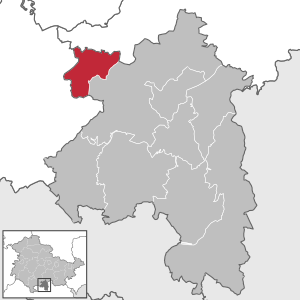
| Location of the Goldisthal community in the Sonneberg district | ||
  |
||


Goldisthal is a municipality in Thuringia in the Sonneberg district . The fulfilling municipality is the city of Neuhaus am Rennweg .
geography
The place is in the upper Schwarzatal deeply cut in the Thuringian slate mountains . Goldisthal is the northernmost municipality in the Sonneberg district . The place is the only one in the district completely north of the Rennsteig . The closest larger cities are Ilmenau in the northwest and Sonneberg in the southeast. Goldisthal is a street village that stretches 2 km in the Schwarzatal. To the east of the village is the 843 meter high Wurzelberg with the upper basin of the Goldisthal pumped storage plant on its peak. The lower basin is in the Schwarzatal above the village. To the west is the 842 meter high Eselsberg, on which the Rennsteigwarte is located.
Neighboring communities
Clockwise, starting in the north: Katzhütte - Neuhaus am Rennweg - Masserberg
history
The place was first mentioned in 1490 with a gold mill on the "Kolitschberg". The place name goes back to the Slavic mountain name Koltsch , in 1718 Golitzschthal was written . A small settlement was renamed Goldisthal in 1715. Gold mining was relatively unsuccessful in Goldisthal until 1774; in the 18th and 19th centuries there were cutting mills in the town in particular . From 1748 to 1863 a hammer mill was operated in the northern part of Blechhammer. Forestry and the wood processing industry formed the economic basis of the place.
A school was built in the middle of the 19th century and the Protestant church in 1892. Goldisthal was in the sovereignty of the principality of Schwarzburg-Rudolstadt . Until 1832 the place belonged to the Schwarzburg office and then to the Schwarzburg-Rudolstadt office of Oberweißbach. In 1850 he came to the Königsee District Office . Between 1922 and 1952 the place belonged to the district of Rudolstadt .
During the Second World War , 60 prisoners of war from Russia and the Ukraine and 30 from France had to do forced labor at the sawmill Berthold Langbein . In March 1945 two Soviet prisoners were shot while trying to escape. A memorial stone in the center of the village commemorates them.
From 1952 to 1994 the place belonged to the Neuhaus district and since then to the Sonneberg district .
politics
The fulfilling municipality for Goldisthal is the city of Neuhaus am Rennweg .
Municipal council
The local council in Goldisthal consists of six council members:
- Goldisthal Fire Brigade voters group 2 seats
- Musikfreunde Goldisthal 2 seats
- Fishing club / Thuringian Forest Club Goldisthal 2 seats
(As of: local election on May 26, 2019 )
coat of arms
|
|
Blazon : "In blue a golden obliquely left wave bar, accompanied at the top by a golden hammer and mallet in an oblique intersection and at the bottom by a golden stag pole." |
| Justification for the coat of arms: The mining tools above represent the importance of mining in the community since the 15th century, with the color gold (heraldic yellow) representing gold mining. The stag stem comes from a coat of arms from Sondershausen , to which the area once belonged. It also symbolizes the many forests and deer in the community. The wave bar represents the river Schwarza . |
Culture and sights


- The Evangelical Lutheran Church was built in 1891/92 as a neo-Gothic hall church with a gable roof and gable turret according to plans by the Schwarzburg-Rudolstadt building council and architect Rudolph Brecht.
- House of Nature - After extensive renovation, the 3-storey half-timbered building of the former 18th-century inn “To the happy man” has housed the newly established natural history museum “House of Nature”.
- The stump of the royal fir - once the mightiest fir in Germany with a height of 44 m and a foot circumference of 8.75 m. At chest height it had a diameter of 2.20 m. The wood mass was calculated and was 66 solid cubic meters. The king fir stood on the Wurzelberg for over 500 years when it fell to the ground during a storm in September 1947.
- Peace Column - The monument with the peace dove has stood on the Wurzelberg since the late 1950s. It was renewed in 2008. Before that, from 1640 to 1900 there was an octagonal hunting salon for the princes of the Schwarzburg-Rudolstadt family.
Economy and Infrastructure
Due to its location in a narrow valley, Goldisthal never allowed large industrial settlements. There used to be mining and the mill and hammer trade.
Above the village on the Farmdenkopf at a height of 869 m is the upper basin of the Goldisthal pumped storage plant with a capacity of 12 million cubic meters. 300 m below is the lower basin with a storage volume of around 19 million cubic meters.
traffic
Goldisthal is on a "dead end". The only road out of town leads north towards Katzhütte . In the past there was also a southern road to Scheibe-Alsbach , which, however, had to give way to the lower basin of the pumped storage plant in 2001. However, there is a substitute road, the so-called Bergstrasse, which leads in the direction of Scheibe-Alsbach, Sonneberg / Coburg. The high-speed line from Nuremberg to Erfurt runs west of Goldisthal .
Individual evidence
- ^ Population of the municipalities from the Thuringian State Office for Statistics ( help on this ).
- ↑ Thuringian Association of the Persecuted of the Nazi Regime - Association of Antifascists and Study Group of German Resistance 1933–1945 (Ed.): Local history guide to sites of resistance and persecution 1933–1945. Volume 8: Thuringia. VAS - Verlag für Akademische Schriften, Frankfurt am Main 2003, ISBN 3-88864-343-0 , p. 283.
- ↑ Hartmut Ulle: New Thuringian Wappenbuch. Eisenach, Gera, Greiz, Hildburghausen, Saale-Holzland-Kreiz, Sömmerda, Sonneberg, Unstrut-Hainich-Kreis, Wartburgkreis . tape 3 . Working Group Genealogy Thuringia, 1998, ISBN 978-3-9804487-3-4 .
Web links
Föritztal | Frankenblick | Goldisthal | Lauscha | Neuhaus am Rennweg | Schalkau | Sonneberg | Steinach