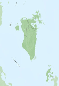
Hawar Islands
| Hawar Islands | ||
|---|---|---|
| Hawar Resort | ||
| Waters | Persian Gulf | |
| Geographical location | 25 ° 41 ′ N , 50 ° 46 ′ E | |
|
|
||
| Number of islands | 6 larger 30 smaller ones |
|
| Main island | Hawar | |
| Total land area | 50.6 km² | |
| Residents | 3875 (2001) | |
The Hawar Islands ( Arabic جزر حوار Juzur Hawār , DMG Ǧuzur Ḥawār ) are a Bahraini group of islands in the Persian Gulf near the west coast of Qatar . Their total area amounts to 50.6 km². They were populated by 3875 people in 2001.
Despite the geographical proximity to Qatar (the minimum distance to the Qatari peninsula Ras Abruq is only 1.4 km, the distance to the main Bahraini islands, however, 19.7 km), the islands belong to Bahrain, since the Qatari-Bahraini border conflict with an arbitration by the International Court of Justice in The Hague on March 16, 2001. The Hawar Islands and the sandbank Qitʿat Jarada were awarded to Bahrain, Qatar the Janan Islands and az-Zubara on the Qatari mainland. The Hawar Islands used to be the Bahraini municipality of Mintaqat Juzur Hawār /منطقة جزر حوار / Minṭaqat Ǧuzur Ḥawār , today they are administered as part of the Southern Governorate .
In 2002, Bahrain applied for the Hawar Islands to be included in the UNESCO World Heritage List , as their unique environment makes them a habitat for endangered animal and plant species. The Hawar Islands are also a popular destination for divers and bird watchers .
List of Hawar Islands
![]() Map with all coordinates of the Hawar Islands: OSM
Map with all coordinates of the Hawar Islands: OSM
| Surname | Name in Arabic | Area in km² | Geographic coordinates | maximum elevation in m |
|---|---|---|---|---|
| Hawar | جزيرة حوار | 40 | 25 ° 39 ' N , 050 ° 45' E | 22nd |
| Rabad al-Gharbiyya | ربض الغربية | 0.7 | 25 ° 45 ' N , 050 ° 46' E | 1 |
| Rabad al-Sharqiyya | ربض الشرقية | 1.7 | 25 ° 45 ' N , 050 ° 47' E | 0.8 |
| ʿAjira | جزيرة عجيرة | 0.02 | 25 ° 44 ' N , 050 ° 49' E | 7th |
| al-Hajjiyyat (archipelago) | 0.13 | 25 ° 42 ' N , 050 ° 48' E | 7.5 | |
| Muhazwara (Umm Hazwara) | 0.4 | 25 ° 40 ' N , 050 ° 47' E | 12.5 | |
| Jazirat Djinan | جزيرة جنان | 25 ° 33 ' N , 050 ° 44' E | ||
| Umm Djinni | 0.06 | 25 ° 41 ' N , 050 ° 47' E | 0.5 | |
| Bu Sadad (archipelago) | جزر بو سداد | 0.16 | 25 ° 38 ' N , 050 ° 47' E | 2 |
| al-Wukur (archipelago) | جزرالوكور | 0.02 | 25 ° 39 ' N , 050 ° 49' E | 10 |
| Suwad al-Shamaliyya | سواد الشمالية | 3 | 25 ° 40 ′ N , 050 ° 49 ′ E | 3 |
| Suwad al-Janubiyya | سواد الجنوبية | 5 | 25 ° 39 ' N , 050 ° 48' E | 4th |
| Bu Tammur (archipelago) | 0.04 | 25 ° 37 ' N , 050 ° 47' E | 1.5 | |
| Umm Charura | أم خرورة | 25 ° 40 ' N , 050 ° 46' E |
Islands between Hawar and Bahrain
| Surname | Name in Arabic | Area in km² | Geographic coordinates | maximum elevation in m |
|---|---|---|---|---|
| Jazirat Mashtan | جزيرة مشتان | 0.02 | 25 ° 48 ' N , 050 ° 41' E | |
| Fascinates Bu Thaur | فشت بو ثور | 25 ° 48 ' N , 050 ° 46' E | ||
| al-Muʿtarid | المعترض | 25 ° 47 ' N , 050 ° 43' E |
See also
literature
- Mike Hill: Hawar Islands. Miracle Publishing, 2005, ISBN 99901-37-13-7 . (on-line)
Web links
Individual evidence
- ↑ International Court of Justice : Maritime Delimitation and Territorial Questions between Qatar and Bahrain (Qatar v. Bahrain) ( Memento of the original dated August 4, 2014 in the Internet Archive ) Info: The archive link was inserted automatically and has not yet been checked. Please check the original and archive link according to the instructions and then remove this notice.


