
Kettle Falls Railroad Bridge
Coordinates: 48 ° 37 '33 " N , 118 ° 7' 1" W.
| Kettle Falls Railroad Bridge | ||
|---|---|---|
.jpg) U.S. Highway 395 ( Kettle Falls Bridge ), looking northeast |
||
| use | Railway bridge | |
| Crossing of | Columbia River | |
| place | Kettle Falls , Washington | |
| Entertained by | Kettle Falls International Railway | |
| construction | Gerber girder - truss bridge | |
| overall length | 371 m | |
| Longest span | 185 m | |
| completion | 1941 | |
| location | ||
|
||

The Kettle Falls Railroad Bridge is a single-track railroad bridge over the Columbia River . It is located about five kilometers northwest of the town of Kettle Falls in northeast Washington state . The Columbia is dammed up here to the more than 240 kilometers long Franklin Delano Roosevelt Lake , which was created by the construction of the Grand Coulee Dam in 1941. Since the northern part of the reservoir flooded a bridge built in 1902 by the Great Northern Railway (GN) over the Columbia near Marcus , the route was moved by the Bureau of Reclamation about five kilometers south to the rapids Kettle Falls , where there was already a road bridge. which also had to be replaced . At the eponymous and also flooded rapids, two parallel tanner girders - truss bridges for the GN and US Highway 395 - were built by 1941 . The GN merged with other railway companies in 1970 to form the Burlington Northern Railroad , which in turn became part of the BNSF Railway in 1995 . The bridge became part of the Kettle Falls International Railway , a subsidiary of OmniTRAX, in 2004 .
history
First railroad lines in Stevens County and previous bridge at Marcus (1902)
.png)
In northeast Washington, railroad lines from Spokane via Colville and Marcus to British Columbia were built in the 1890s. With the construction of the Grand Coulee Dam in 1941, parts of the routes were relocated along the river banks. |

With the construction of the northern transcontinental connections in the USA by the large railway companies Northern Pacific Railway (NP) and Great Northern Railway (GN) at the end of the 19th century, which in Washington via Spokane and the cascade chain ( Stampede Pass or Stevens Pass ) to Puget Sound , a large number of junctions were created mostly by smaller railway companies, most of which were later taken over by the NP or GN. The entrepreneur Daniel Chase Corbin built the Spokane Falls & Northern Railway in Stevens County in northeast Washington , which ran from Spokane (until 1891 Spokane Falls ) north via Colville to Marcus and from here along the Columbia via Northport to the British Columbia border. In order to reach the silver mines near Nelson in Canada , Corbin extended the route with the Nelson & Fort Sheppard Railway and completed the connection to Spokane in 1893. By acquiring the majority of the shares in 1898, the Great Northern, under the direction of James J. Hill, took control of the two railway companies.
As a north-western extension, Hill built the Washington & Great Northern Railway from Marcus in 1901 , which ran along the Kettle River to Laurier and via Grand Forks back south to Republic . From Marcus, which was on the south bank of the Columbia, a wooden bridge with Howe trusses was built (named after its inventor William Howe ). The bridge, completed in 1902, was only the third bridge over the US-American part of the nearly 2000 km long river, over which more than 30 permanent river crossings lead today. On the north bank of the Columbia, the tracks were laid west to the mouth of the Kettle and then further north along the east bank of the tributary. The main reason for the construction of the line was the development of the copper mines at Grand Forks and the gold mines in the area around what is now Republic, which is named after the Great Republic , the largest mine operator at the time . In 1907, the three small railway companies were finally completely integrated into the GN.

With the expansion of the road network in Washington State in the 1910s, a north-south connection was established in the east with the Inland Empire Highway , which followed from Spokane on the Spokane Falls & Northern Railway . At that time the roads were mainly gravel roads and the river crossings were realized by car ferries . Asphalting began in the 1920s and the first road bridges were built, for example the Pasco – Kennewick Bridge (1922) over the Columbia. In the northern part of 1923 at State Road No. 3 expressway had to be crossed on the way to Laurier also the Columbia. The GN provided their bridge near Marcus in 1926 with wooden planks and offered it as a toll river crossing for road traffic. The state did not want paid bridges on roads that were financed by taxpayers' money, and in 1929 built its own bridge six kilometers downstream not far from the Kettle Falls rapids .
Grand Coulee Dam and New Bridges at Kettle Falls (1941)
_Washington_1-125000_topographic_quadrangles_(cut).jpg)


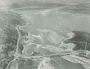
As part of the Columbia Basin Project , the dam of the same name was built on the Columbia River at the northern end of the Grand Coulee in 1933 , which was to damm the upper reaches of the Columbia River and parts of the Spokane River to form the 240-kilometer-long Franklin Delano Roosevelt Lake . The northern part of the reservoir should also flood the towns of Marcus and Kettle Falls and the rapids that give it its name. The Bureau of Reclamation therefore planned the relocation to higher areas and the former Kettle Falls merged with the Meyers Falls further east to form the present-day community of Kettle Falls . Since the relocation of the GN route became necessary and the road bridge at the rapids was too low, a new combined rail and road bridge was to be built here. Ultimately, however, no agreement on the terms of use could be reached with the GN and it was decided to build two separate, parallel bridges, which were built upstream right next to the old road bridge. The American Bridge Company , which had completed the construction work by May 1941, was responsible for the railway bridge . The road bridge from 1929 and the railway bridge at Marcus from 1902 were dismantled before the reservoir rose and parts of them were reused at other river crossings or when building dams.
Since the railway line behind the bridge now ran on the west side of the Columbia, at the mouth of the Kettle, at the level of the headland Kamloops Island , the construction of another bridge was necessary to re-establish the connection to the tracks running northwards on the east bank of the Kettle. The construction of a third run-of-river power station at the Grand Coulee Dam made it necessary to reduce the reservoir in the spring of 1966–1974, which led to the partial exposure of the former rapids that were visible again above the bridges.

Construction of the bridges in October 1940 next to the 1929 road bridge (left pillar of the railway bridge)

The first train passed the new railway bridge on May 26, 1941, looking east
Uncovering of the Kettle Falls in the spring of 1969 during the expansion of the Grand Coulee Dam
.jpg)


Kettle Falls International Railway (2004)
The Great Northern Railway merged with the Northern Pacific Railway , the Chicago, Burlington and Quincy Railroad and the Spokane, Portland and Seattle Railway to form the Burlington Northern Railroad in 1970 , which in turn merged with the Atchison, Topeka and Santa Fe Railway to form today's BNSF Railway in 1995 . In 2004, the regional railroad company Kettle Falls International Railway (KFR), a subsidiary of OmniTRAX , took over the section from Chewelah via Northport to British Columbia and via Grand Forks to Republic and became the owner of the Kettle Falls Railroad Bridge . The stretch from Danville to Republic was closed in 2008. At the end of 2018, the eastern route of the KFR, from Chewelah via Northport, was sold to the St. Paul and Pacific Northwest Railroad , which belongs to the railway and holding company Progressive Rail . The KFL only operates the western section from the bridge to Danville.
description
The riveted steel truss bridge consists of a 371 m long tannery girder , which rests on two river pillars and the abutments . The Gerber carrier has an unusual design, as there is no suspension bracket attached in the middle, as is usually the case , but the central bracket is flanked by two suspension brackets on the outside. The central girder has a span of 185 m between the river pillars (anchor arm) and protrudes 34.7 m over the piers on the outside. The suspension supports, which have a fixed bearing on the abutments, are articulated on these extension arms . The length of the suspension brackets is 46.3 m on the east side and 69.5 m on the west side. The tannery girder is designed as a parallel- chorded strut framework with posts , whereby the lower chord in the area of the pillars inclines downwards to about 30 m on both sides and here increases the otherwise 18.3 m high framework. This design was also chosen for the road bridge and could thus limit the power pillars to a more cost-effective height. The width of the steel beam is around nine meters. The track level is guided inside on two parallel solid wall girders , which are connected to the posts of the trusses by cross girders of the same design.
The railway bridge does not run exactly parallel to the road bridge following downstream. The distance between the central axes of the bridges is about 18 m on the west side and almost 40 m on the east side. In addition, the river pillars of the railway bridge are offset to the west by about 15 m from the pillars of the road bridge.

Suspension bracket on the west side

On the right the railway bridge shortly after its completion in 1941, looking west

Suspension bracket on the east side

.jpg)

See also
Web links
- Kettle Falls Railroad Bridge. HistoricBridges.org
Individual evidence
- ^ FM Barone: Nelson & Fort Sheppard Railway. In: Canadian Rail. No. 412, 1989, pp. 151-157, here p. 151.
- ^ Donald B. Robertson Encyclopedia of Western Railroad History: Oregon, Washington. Caxton Press, 1986, ISBN 978-0-87004-366-6 , pp. 279 f.
- ^ Donald B. Robertson Encyclopedia of Western Railroad History: Oregon, Washington. Caxton Press, 1986, ISBN 978-0-87004-366-6 , pp. 295 f.
- ↑ a b W&GN - Columbia River Railway Bridge. BridgeHunter.com, accessed June 18, 2020.
- ↑ Jim Kershner: Inland Empire Highway. HistoryLink.org, Essay 10644, 2013, accessed June 7, 2020.
- ^ A b Robert W. Hadlow: Columbia River Bridge at Kettle Falls. Historic American Engineering Record, HAER No. WA-91, Washington, DC 1993, p. 3 f.
- ^ KFR - Kamloops Island Bridge. BridgeHunter.com, accessed June 21, 2020.
- ↑ Kathryn L. McKay, Nancy F. Renk: Currents and Undercurrents: An Administrative History of Lake Roosevelt National Recreation Area. National Park Service, US Department of the Interior, 2002, Online: Impact of Third Powerhouse Construction , accessed June 7, 2020.
- ^ Cambridge Systematics, Inc .: Statewide Rail Capacity and System Needs Study: Task 1.1.A - Washington State's Freight Rail System. Washington State Transportation Commission, May 2006, p. 15 and 45.
- ^ Kettle Falls International Railway, LLC-Abandonment Exemption-in Ferry County, WA. STB Docket No. AB-994X, Decision of the Surface Transportation Board, November 5, 2007.
- ^ Progressive Rail to pick up BNSF lines in NE Washington. Railway Age, December 11, 2018, accessed June 21, 2020.
- ^ Kettle Falls International Railway (KFR). Omnitrax, Inc., accessed June 23, 2020.
- ^ Robert W. Hadlow: Columbia River Bridge at Kettle Falls. Historic American Engineering Record, HAER No. WA-91, Washington, DC 1993, p. 5.
- ↑ Kettle Falls Railroad Bridge. HistoricBridges.org, accessed June 22, 2020.