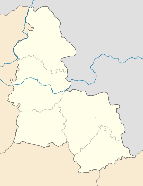
Konotop
| Konotop | ||
| Конотоп | ||

|
|
|
| Basic data | ||
|---|---|---|
| Oblast : | Sumy Oblast | |
| Rajon : | District-free city | |
| Height : | 149 m | |
| Area : | 43.78 km² | |
| Residents : | 87,881 (2016) | |
| Population density : | 2,007 inhabitants per km² | |
| Postcodes : | 41600 | |
| Area code : | +380 5447 | |
| Geographic location : | 51 ° 14 ′ N , 33 ° 12 ′ E | |
| KOATUU : | 5940400000 | |
| Administrative structure : | 1 city 3 villages | |
| Mayor : | Tetiana Syson | |
| Address: | пр. Миру 8 41600 м. Конотоп |
|
| Website : | Konotop City Council | |
| Statistical information | ||
|
|
||
Konotop ( Ukrainian and Russian Конотоп [ kon̪oˈt̪ɔp ]) is a city in Sumy Oblast in northeast Ukraine with about 90,000 inhabitants (2016).
geography
location
The city is 137 kilometers northwest of the Oblast capital Sumy and is the administrative center of the Konotop Rajon as well as an important transport center.
structure
Konotop also includes the district council of Pidlypne with the villages of Pidlypne (Ukrainian Підлипне , 4,015 inhabitants), Kalyniwka (Ukrainian Калинівка , formerly Komsomolska Komuna , 531 inhabitants) and Lobkiwka (Ukrainian Лобківка , 136 inhabitants).
history
The settlement Novoselyci ( new settlement ) was in the early 17th century by Ukrainian Cossacks founded. First mentioned in 1634, a Polish fortress was built in 1642 and named after the river Konotopka (in German horse moor ). In 1659 the battle of Konotop near the village of Shapovaliwka took place here. In this battle, the Cossack hetman Iwan Wyhowskyj , who had sided with the Poles in the Russo-Polish War , triumphed together with the allied Crimean Tatars over a Russian army, whose main power then had to break off the siege of Konotops. About 100,000 soldiers fought on both sides.
In 1782 Konotop received city rights. In 1897 there were 18,770 inhabitants in the city, including 54.8% Ukrainians, 23.5% Russians, 19.0% Jews, 1.4% Belarusians, 0.7% Poles and 0.35% Germans.
Other sources cite 4426 (23.5%) Jewish residents for 1897; At the beginning of the 19th century there were only 80, in 1939 3941 (8.6%), in 1959 about 1600 (3.5%), and in 2017 about 100.
In 1881 there was a pogrom against the Jewish urban population, although they were considered to be well assimilated. There was one dead, many houses were destroyed. In 1923 the synagogue was closed.
During the Second World War , the city was occupied by German troops from the beginning of September 1941 to September 6, 1943 and the seat of a field command . At least 1,000 Jews were murdered during this time.
After the city had recorded a strong population growth from 82,278 (1979) to 95,549 inhabitants (1989) in the 1980s, it has lost around 5% of its inhabitants since the transformation crisis.
In 2015, Artem Semenichin was elected mayor of Konotop, who belongs to the right-wing Svoboda party. He no longer allowed the flag of the city to be shown because, like the coat of arms, it contains a Star of David . In 2018 he was voted out of office by city representatives after long conflicts. In June 2019, he was seriously injured in an assassination attempt.
Economy and Transport
From an economic point of view, mechanical engineering is particularly important, followed by the light and food industries. Operation Aviacon , which maintains and repairs army helicopters, is managed by the Ministry of Defense .
Konotop is an important railway junction. From there there is a connection in the direction of Bachmatsch / Kiev , Brjansk and Sumy / Belgorod . The tram is an important part of the city's public transport .
Personalities from Konotop
- Stepan Radchenko (1869–1911), Russian social democrat and revolutionary
- Jisra'el Bar Jehuda (1895–1965), Israeli politician
- Michail Gerasijewitsch Mamiaschwili (* 1963), Soviet wrestler and Russian wrestler official
- Inna Suprun (* 1983), biathlete
- Maryna Anzybor (* 1987), cross-country skier
Web links
- Konotop . In: Filip Sulimierski, Władysław Walewski (eds.): Słownik geograficzny Królestwa Polskiego i innych krajów słowiańskich . tape 4 : Kęs – Kutno . Walewskiego, Warsaw 1883, p. 351 (Polish, edu.pl ).
Individual evidence
- ↑ a b Population figures on pop-stat.mashke.org
- ^ Konotope on Ukraine Jewish Heritage
- ↑ Jerusalem Post , December 21, 2015.
- ↑ Message on ukrinform.de, June 27, 2019


