
Löschau (Bautzen)
|
Löschau
Lešawa City of Bautzen
Coordinates: 51 ° 12 ′ 20 ″ N , 14 ° 19 ′ 57 ″ E
|
|
|---|---|
| Height : | 195 m above sea level NN |
| Area : | 68 ha |
| Residents : | 30 (Dec. 31, 2019) |
| Population density : | 44 inhabitants / km² |
| Postal code : | 02625 |
| Area code : | 03591 |
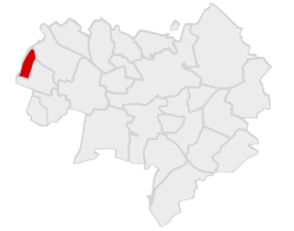  Location of Löschau in Bautzen
|
|

Löschau , Upper Sorbian , is a village in Upper Lusatia and has been the westernmost and smallest district of Bautzen since 1999 . It has 31 inhabitants and is part of the official Sorbian settlement area in Upper Lusatia.
geography
Löschau is located about 6 km northwest of the city center at 195 m above sea level. NN directly north of the Oberlausitz motorway service station ( A 4 ). The Bolbritz water flows north of the village .
history
The place was first mentioned in 1363 as Lessow . The Löschau manor belonged to the von Rein noble family in the 19th century. For his statistics on the Sorbian population in Upper Lusatia, Arnošt Muka determined a population of 55 inhabitants in the 1880s; 53 of them were Sorbs and two Germans.
Before 1936, Löschau was part of the Oberuhna community , then initially to Schmochtitz . From 1948 it was part of Salzenforst (later Salzenforst-Bolbritz ) and was incorporated into Bautzen together with the latter in 1999.
See also: List of cultural monuments in Löschau
Web links
- Löschau in the Digital Historical Directory of Saxony
Individual evidence
- ↑ As of December 31, 2018
- ↑ Digital historical index of places
- ^ New general German nobility lexicon , 1867 (page 435)
- ↑ Ernst Tschernik: The development of the Sorbian population . Akademie-Verlag, Berlin 1954, p. 54 .

Auritz (Wuricy) | Bloaschütz (Błohašecy) | Bolbritz (Bolborcy) | Burk (Bórk) | Döberkitz (Debrikecy) | Well of Health (Strowotna Studnja) | Großwelka (Wulki Wjelkow) | Downtown (Nutřkowne město) | Kleinseidau (Zajdow) | Kleinwelka (Mały Wjelkow) | Löschau (Lešawa) | Lubachau (Lubachow) | Nadelwitz (Nadźanecy) | Niederkaina (Delnja Kina) | Northeast Ring (Sewjerowuchodny wobkruh) | Oberkaina (Hornja Kina) | Oberuhna (Horni Wunjow) | Ostvorstadt (Wuchodne předměsto) | Salt forest (Słona Boršć) | Schmochtitz (Smochćicy) | Stiebitz (Sćijecy) | Südvorstadt (Južne předměsto) | Teichnitz (Ćichońca) | Temritz (Ćemjercy) | West suburb (Zapadne předměsto)