
Mallersdorf district
| coat of arms | Germany map | |
|---|---|---|

|
Coordinates: 48 ° 46 ' N , 12 ° 14' E |
|
| Basic data (as of 1972) | ||
| Existing period: | 1862-1972 | |
| State : | Bavaria | |
| Administrative region : | Lower Bavaria | |
| Administrative headquarters : | Mallersdorf | |
| Area : | 405 km 2 | |
| Residents: | 30,175 (May 27, 1970) | |
| Population density : | 75 inhabitants per km 2 | |
| License plate : | TIMES | |
| Circle key : | 09 2 42 | |
| Circle structure: | 46 municipalities | |
| District Administrator : | Ludwig Meyer ( CSU ) | |
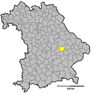
| Location of the Mallersdorf district in Bavaria | ||
  |
||

The Mallersdorf district was part of the Bavarian administrative district of Lower Bavaria . The seat of the district office was in the district capital Mallersdorf . The former area of the district is now in the districts of Dingolfing-Landau , Landshut and Straubing-Bogen in Lower Bavaria and in the district of Regensburg in the Upper Palatinate .
geography
Important places
The most populous communities were Mallersdorf, Geiselhöring , Schierling , Ergoldsbach and Neufahrn in Lower Bavaria .
Neighboring areas
In 1972 the district bordered clockwise in the north, starting with the districts of Regensburg , Straubing , Dingolfing , Landshut , Rottenburg an der Laaber and Kelheim .
history
district Court
In 1840, as a result of the administrative reform of the Kingdom of Bavaria in 1838, the Mallersdorf district court was established. Municipalities from the surrounding district courts were assigned to this.
District Office
The Mallersdorf district office followed the Mallersdorf district court of the same area in 1862 .
In 1875 the district office Mallersdorf was enlarged by the municipalities of the district office Rottenburg an der Laaber. On January 1, 1891, the municipalities of the Rottenburg an der Laaber district office moved to the Mallersdorf district office.
district
On January 1, 1939, the uniform designation Landkreis was introduced in the German Reich . This is how the district office became the Mallersdorf district.
On July 1, 1972, the Mallersdorf district was dissolved as part of the regional reform in Bavaria :
- The communities Bayerbach near Ergoldsbach , Ergoldsbach , Greilsberg , Langenhettenbach , Neufahrn in Lower Bavaria , Prinkofen and Winklsaß came to the Landshut district.
- The communities of Allkofen , Eitting , Geiselhöring , Grafentraubach , Graßlfing , Greißing , Haader , Hadersbach , Haindling , Hainsbach , Hirschling , Hofkirchen , Laberweinting , Mallersdorf , Niederlindhart, Oberhaselbach , Pfaffenberg , Sallach , Upfkofen , Wallkofen and Weichs -Bogen became part of the Straubing district. The former district capital Mallersdorf was combined with Pfaffenberg to form the Mallersdorf-Pfaffenberg market .
- The communities Martinsbuch , Mühlhausen and Süsskofen came to the district of Untere Isar (from May 1, 1973 Dingolfing-Landau ).
- The communities Buchhausen, Eggmühl, Inkofen, Mannsdorf, Oberdeggenbach, Pinkofen, Schierling , Unterlaichling and Zaitzkofen came to the district of Regensburg.
Population development
| year | Residents | source |
|---|---|---|
| 1864 | 18,087 | |
| 1885 | 20,499 | |
| 1900 | 22,961 | |
| 1910 | 24,773 | |
| 1925 | 25,115 | |
| 1939 | 24,852 | |
| 1950 | 35,600 | |
| 1960 | 30,100 | |
| 1971 | 29,900 |
Communities
Before the start of the regional reform, the Mallersdorf district comprised 46 communities in the 1960s:
|
|
Several municipalities lost their independence by 1964:
- Feuchten , 1964 in Bayerbach near Ergoldsbach
- Gerabach , on January 1, 1946 in Bayerbach near Ergoldsbach
- Haimelkofen , on January 1, 1946 in Hofkirchen, today in Laberweinting
- Osterham , on January 1, 1946 in Hofkirchen, today in Laberweinting
- Pullach , on January 1st 1964 to Wallkofen, today to Geiselhöring
District administrators
- 1964–1970: Josef Wallner
- 1970–1972: Ludwig Meyer ( CSU )
License Plate
On July 1, 1956, the district was assigned the distinctive sign MAL when the vehicle registration number that is still valid today was introduced . It was issued until August 3, 1974. Since July 25, 2014, it has been available again in the Landshut district due to the license plate liberalization . Since July 2, 2018, it has also been issued in the Straubing-Bogen district.
Individual evidence
- ^ Wilhelm Volkert (ed.): Handbook of Bavarian offices, communities and courts 1799–1980 . CH Beck, Munich 1983, ISBN 3-406-09669-7 , p. 516 .
- ^ Wilhelm Volkert (ed.): Handbook of Bavarian offices, communities and courts 1799–1980 . CH Beck, Munich 1983, ISBN 3-406-09669-7 , p. 97 .
- ^ Federal Statistical Office (ed.): Historical municipality directory for the Federal Republic of Germany. Name, border and key number changes in municipalities, counties and administrative districts from May 27, 1970 to December 31, 1982 . W. Kohlhammer, Stuttgart / Mainz 1983, ISBN 3-17-003263-1 , p. 618 f .
- ^ Ordinance on the reorganization of Bavaria into rural districts and independent cities of December 27, 1971
- ^ Eugen Hartmann: Statistics of the Kingdom of Bavaria . Ed .: Royal Bavarian Statistical Bureau. Munich 1866, population figures of the district offices 1864 ( digitized version ).
- ↑ Royal Bavarian Statistical Bureau (ed.): Localities directory of the Kingdom of Bavaria . Munich 1888, population figures of the district offices 1885 ( digitized ).
- ↑ a b www.gemeindeververzeichnis.de
- ^ Localities directory for the Free State of Bavaria, based on the census of June 16, 1925
- ↑ Statistical Yearbook for the German Reich 1940
- ↑ Statistical Yearbook for the Federal Republic of Germany 1952
- ↑ Statistical Yearbook for the Federal Republic of Germany 1961
- ↑ Statistical Yearbook for the Federal Republic of Germany 1973
- ^ Official register of places for Bavaria 1964
Aichach | Alzenau i.UFr. | Amberg | Bad Aibling | Bad Neustadt adSaale | Bad Toelz | Beilngries | Berchtesgaden | Bow | Brückenau | Burglengenfeld | Dingolfing | Dinkelsbühl | Donauwörth | Ebermannstadt | Boars | Eggenfelden | Erlangen | Eschenbach idOPf. | Feuchtwangen | Friedberg | Feet | Gemünden a.Main | Gerolzhofen | Grafenau | Griesbach i.Rottal | Gunzenhausen | Hammelburg | Hassfurt | Hersbruck | Hilpoltstein | Höchstadt adAisch | Hofheim i.UFr. | Illertissen | Ingolstadt | Karlstadt | Kaufbeuren | Kemnath | Kempten (Allgäu) | Königshofen i.Grabfeld | Kötzting | Krumbach (Swabia) | Landau adIsar | Lauf adPegnitz | Running | Lohr a.Main | Mainburg | Mallersdorf | Marktheidenfeld | Marktoberdorf | Mellrichstadt | Memmingen | Mindelheim | Münchberg | Nabburg | Naila | Neuburg adDonau | Neunburg vorm Wald | Neustadt adAisch | Nordlingen | Nuremberg | Obernburg am Main | Oberviechtach | Ochsenfurt | Parsberg | Pegnitz | Parish churches | Rehau | Riedenburg | Roding | Rothenburg ob der Tauber | Rottenburg adLaaber | Scheinfeld | Schongau | Schrobenhausen | Schwabach | Schwabmünchen | Sonthofen | Stadtsteinach | Staffelstein | Straubing | Sulzbach-Rosenberg | Uffenheim | Viechtach | Vilsbiburg | Vilshofen | Vohenstrauss | Waldmünchen | Wasserburg a.Inn | Wegscheid | Weilheim i.OB | Weißenburg i.Bay. | Wertingen | Wolfratshausen | Wolfstein
1939–1945 affiliated districts: Bergreichenstein | Eisenstein market | Prachatitz