Lumparland
| coat of arms | map |
|---|---|

|

|
| Basic data | |
| State : |
|
| Landscape : | Åland |
| Administrative community : | Åland Country |
| Geographical location | 60 ° 7 ′ N , 20 ° 15 ′ E |
| Surface: | 87.06 km² |
| of which land area: | 36.25 km² |
| of which inland waterways: | 0.04 km² |
| of which sea area: | 50.77 km² |
| Residents : | 382 (Dec. 31, 2018) |
| Population density : | 10.5 inhabitants / km² |
| Municipality number : | 438 |
| Language (s) : | Swedish |
| Website : | www.lumparland.ax |
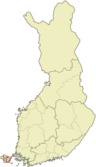
Lumparland is a municipality in the autonomous Finnish province ( Finnish : Lääni ) Åland . It is located in the southeast of Åland's main island, Fasta Åland , about 30 kilometers east of the provincial capital Mariehamn . Lumparland is the smallest municipality on the main island with 382 inhabitants (as of December 31, 2018) and covers an area of 36.29 square kilometers. As in all of Åland, Swedish is the official language.
economy
The traditional branches of the economy of agriculture and fishing have now been largely replaced by occupations directly or indirectly related to tourism . In 2003, around 28 percent of Lumparland's working residents were employed in the service sector and around 26 percent in transport and telecommunications . One of the major economic factors is the port of Långnäs , where many ferry boats between Finland and Sweden stop to allow tax-free shopping.
Localities
The municipality includes the places Klemetsby, Krokstad, Lumparby, Lumpoby, Norrboda, Skag and Svinö.
Attractions
The St. Andrew's Church from the 1730s is the oldest existing wooden church Åland.
References
- ↑ Maanmittauslaitos (Finnish land surveying office): Suomen pinta-alat kunnittain January 1, 2010 (PDF; 199 kB)
- ↑ Statistical Office Finland: Table 11ra - Key figures on population by region, 1990-2018
Web links
- www.lumparland.ax - home page of the municipality