
Neuwerk
| Neuwerk | ||
|---|---|---|
 |
||
| Waters | Helgoland Bay | |
| Geographical location | 53 ° 55 '14 " N , 8 ° 30' 1" E | |
|
||
| length | 2.2 km | |
| width | 2.2 km | |
| surface | 3.3 km² | |
| Highest elevation | 0 m above sea level NHN | |
| Residents | 30th 9.1 inhabitants / km² |
|
| main place | Neuwerk | |
 |
||

Neuwerk [ nɔɪ̯'vɛʁk ] ( ; Low German Neewark ) is an inhabited German island in the southeastern part of the Helgoland Bay or on the southwestern edge of the Outer Elbe . Politically, the island with its uninhabited neighboring islands of Scharhörn and Nigehörn , which was created in 1989 by filling it up, forms the Hamburg-Neuwerk district in the Hamburg-Mitte district of the Free and Hanseatic City of Hamburg , whose urban area is about 120 km as the crow flies in the east-southeast direction. It is the center of the Hamburg Wadden Sea National Park (NPHW), which was founded in 1990 and to which the two neighboring islands belong , in addition to the Wadden Sea . In addition to Neuwerk's centuries-old economic interests in one of the busiest shipping routes, the island and the tidal flats are a maritime habitat for flora and fauna.
geography
Geographical location

The island of Neuwerk is located approximately 15 km northwest of Cuxhaven , which is on the mainland in Lower Saxony . Hamburg is about 120 km east-southeast.
The approximately three square kilometers large area of the island can be divided into the two foreland and the diked inner meadows. The Neuwerker Watt and the protective outer dike area, the foreland , make it possible to follow the processes of the tidal change that regularly (and especially after storms) washes amber .
In the tidal cycle, the tidal high water reaches the Neuwerker pier 30 minutes before the Steubenhöft in Cuxhaven, as the tidal wave runs counterclockwise around the middle amphidromic point in the North Sea. A low tide level cannot be determined for Neuwerk because the water level and almost the entire island are dry.
Natural allocation
Neuwerk and the surrounding mudflats belong to the main natural unit group Ems- and Wesermarschen (No. 61) of the natural area Watten in the Elbe-Weser triangle Jadebusen . At the upper level, it belongs as part of the marshland to the greater region of North German Lowlands .
Island core

The island core ( Binnengroden or Innengroden) is surrounded by an approximately seven meter high dike and occupies around 120 hectares. In addition to the courtyards, paths and meadows in the south is the again diked and raised Turmwurt, in which there are a few houses and the tower square next to the tower, on which the Sahlenburg and Duhner Wattwagen take their approximately one-hour break before they return in the same way Tide start.
foreshore
The foreland is bounded by the outer dike foot and the flood line. It covers approximately 182 hectares. Lahnungsfelder from the 1930s are located on the northeast and east sides , most recently only partially maintained and scientifically surveyed in the mid-1990s. The foreshore is at high tide refuge for wading birds during migration stop for Brent geese and breeding season nesting of terns , gulls and ducks . The foreland is crossed by a summer dike , which protects part of the foreland against the lighter summer storm surges. The Neuwerker Vorland is important for bird protection , for example as a resting place for wigeons , barnacles and barnacle geese during bird migration or as a breeding area for the redshank and other Limikolen .
Eastern Foreland
The eastern part of the foreland is predominantly subject to the protection status of "Zone I", is fenced in and can only be entered on one path. He is not grazed . The salt marshes are criss-crossed by tides and merge into the tidal flats in the Lahnungsfeldern. In the transition to North Foreland standing Ostbake .
Northern foreland
The foreland north of the dike is almost completely separated from the tidal flats with stone packings, which have been protecting the island from erosion since 1931 . In the west they border on the “Hundebalje” fairway and in the north with the “Kleiner Vogelsand”. A fence prevents the cattle , sheep and horses grazing here from entering the dike or the eastern foreland.
Neighboring islands

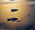
Scharhörn (front) and Ni-horn (rear)
Neuwerk (center), Scharhörn (front left) and Nigehörn (front right) during floods

New work in the Cuxhaven contract

,_Neuwerk,_Scharh%C3%B6rn,_Nigeh%C3%B6rn.jpg)

The nearby islands of Scharhörn and Nigehörn, which also belong to Hamburg, form a bird sanctuary . Visitors are only allowed to enter Scharhörn via a seven-kilometer-long mudflat trail after consulting the bird warden by telephone, so that the protection of the endangered species found there is ensured. It is forbidden to enter Nihhorns. The entire area and the surrounding Wadden Sea form the Hamburg Wadden Sea National Park .
geology


.png)
Despite the march character of Neuwerk and the short period of march formation found in sediment samples from the Neuwerk / Scharhörn area, it is still more of a sand island like Trischen or Mellum . The younger layers show fine, calcareous sand above the bran layers. This seabed could also be verified by drilling near the tower. The last remains of the sand dunes can still be found in the northeast of the foreland. As with many North and East Frisian Islands, the Neuwerk coastline has shifted significantly, at least over the last few centuries. Early maps show an extensive northwestern foreland where the Fireblood and the North Beacon were still standing in 1751 . At the same time, the Elbe fairway has shifted to the north, which previously ran close to the north coast. The island also offered a port for merchant ships, through which the duty was collected.
history


middle Ages
On April 14, 1286, Hamburg received half of the island "O" from the Duke of Saxony-Lauenburg and on November 1, 1299 the right to build a 35-meter-high tower as a navigation mark and as an outpost against sea and beach robbers. In 1316, in the alliance agreement between the Wurtfriesen of the Marsch Land Wursten and Hamburg, the island of Neuwerk was referred to as Nova Ocht and in other sources as Nova O , Nige Oge and Nova Och . At the end of the 14th century there was a feud with the Lappes , in which Neuwerk briefly fell under the administration of the Lappes in Ritzebüttel , before they had to sell their property to Hamburg in 1393. Hamburg now protected the mouth of the Elbe from the Ritzebüttel Office , which was newly founded in 1394 ; as a result, Neuwerk lost its importance as the captain's seat.
Eberhard Ovelacker plundered the island with 5,000 men in 1535 after Vogt Bernd Beseke had given protection to a cattle thief and cattle on the island.
In 1575 Hamburg built two pilot houses on Neuwerk.

Modern times
During the French period in Hamburg , the Ritzebüttel office was a canton in the Bouches de l'Elbe department with Neuwerk and had 81 inhabitants. The commander of Cuxhaven Joseph Barbanègre expelled the English from Neuwerk in 1810.

The foreland, which was still extensive in the Middle Ages, gradually broke off in the south and west. In the middle of the 18th century, the south-west corner and the fisherman's house just a few meters behind the dike were only protected by a Schardeich . Only the pile wall erected in the Watt from 1795 to 1797 under Reinhard Woltman was able to finally save the dike at the Fischerhaus, was later extended to the north and is still standing today. At the south-east corner, the dike was set back by around 70 m to 400 m.
The February flood of 1825 hit Neuwerk hard. The dike had completely disappeared in some places. All residents had to leave their belongings behind while fleeing to the tower and the Vogts house. Their houses were then uninhabitable or badly damaged. Twelve people died and there was damage of 19,405 marks. Then the Neuwerker dyke was strengthened. Furthermore it led to the initiative of the farmers to demand a school from Hamburg.
In 1864, Hamburg rededicated the Ritzebüttel office to the Ritzebüttel estate .
The German Society for the Rescue of Shipwrecked People operated a station on Neuwerk from at least 1905 to around 1940.
The efforts of the teacher Heinrich Gechter , who worked at Neuwerk from 1902 to 1909, and the later vice chairman of the Jordsand Association , to observe the Scharhörnplate more systematically, culminated in the first plantings and protection as a bird sanctuary Scharhörn on 1 December 1939. The island school's schoolhouse was built in 1912.

From 1905 Neuwerk served as a resort and seaside resort. The city of Cuxhaven developed from Ritzebüttel in the second half of the 19th century, which received its town charter on March 15, 1907 and into which Neuwerk and Scharhörn were incorporated on March 1, 1935.
As a result of the Greater Hamburg Act , Hamburg exchanged its areas in Cuxhaven - and thus Neuwerk and Scharhörn - with Prussia in 1937 and received Altona and Wilhelmsburg in return . The restructuring of the federal states after the Second World War meant that Neuwerk was part of the new federal state of Lower Saxony.
In 1965 the former area of the Ritzebüttel office with the islands of Neuwerk and Scharhörn was transferred from the Diocese of Osnabrück to the Diocese of Hildesheim .
The state treaty between Lower Saxony and Hamburg ( Cuxhaven Treaty ) reintegrated the islands of Neuwerk and Scharhörn into Hamburg on October 1, 1969, by relinquishing Hamburg's remaining rights to port facilities in the Cuxhaven area.
In 1982 the nature reserve Insel Neuwerk (200 ha) and the nature reserve Neuwerk and Kleiner Vogelsand (approx. 380 ha) were designated, which included the eastern foreland and has since been looked after by the Jordsand association. This was expanded on October 28, 1986. At the same time, the Neuwerk and Scharhörner Watt nature reserve was designated. Together, around 8,200 hectares in the Hamburg Wadden Sea were under nature protection. The Neuwerk / Scharhörner nature and landscape protection areas were suspended with the National Park Act.
The Hamburg Wadden Sea National Park was designated on April 9, 1990 with initially around 117 km² and, in a change on December 12, 2000, expanded to 137.5 km² on the seaward side via the mean low tide line.
Economy and Transport
economy

The island of Neuwerk is permanently inhabited by around 40 residents. Agriculture , which continued into the 1970s , was almost completely supplanted by tourism as a source of income . Neuwerk is visited by around 100,000 tourists annually in the summer months. In addition to the up to 2000 day guests, there are around 170 guest beds, camping facilities , 240 places in straw camps and several school camps .
traffic


The car-free island new is at low tide to low tide of belonging to Cuxhaven districts Sahlenburg or Duhnen by Watt (on foot, by horse or Wattwagen distance). The hike to the island of Neuwerk along a trail marked with a prick on the wadden high takes about two and a half hours. According to the changes in the mudflat landscape, the path is slightly adjusted every year. There are four rescue beacons on the way for hikers who are surprised by the tide. In the event of flooding , daily trips by ship operated by the Cassen Eils shipping company from Cuxhaven are possible in summer . The journey time is around one and a half hours.
From 1962 to 1986 there was a material web at Neuwerk for the construction of new groynes, which was set up as a result of the severe storm surge in February 1962. For this purpose, 600 mm tracks were laid from the building yard over the southern dike into the foreland. The route extended over the pier to the northern foreland and transported the material for the construction of the new groynes. Two type DS 20 locomotives from Diepholzer Maschinenfabrik Fritz Schöttler (DIEMA) were used. One of them is still operated today by the Ahlenmoor Moor Railway. One of the last pieces of track was still available on the Süddeich in 2002, but has since been dismantled.
Culture and sights
Buildings
tower
The mighty lighthouse was completed as a defensive tower in 1310 and served to protect the mouth of the Elbe from pirates. The beacon on the tower was lit on December 23, 1814. On February 10, 2014, the beacon was taken out of service as a navigation mark for Elbe shipping and has since been operated by the Hamburg Port Authority as a so-called "private fire". The Neuwerk lighthouse is considered the oldest building in Hamburg, the oldest secular structure on the entire German coast and is also Hamburg's last fortress .
Turmwurt

.jpg)
The tower, the school camp, the old school building, the HPA accommodation, two other buildings and the “Herrengarten” with pond are surrounded by their own dike and are slightly above the normal level of the inner garden. It also offers additional protection against particularly severe storm surges.
Cemetery of the Nameless
In the past, corpses were buried in the " cemetery of the nameless " that were washed up by the flood on Neuwerk's banks. It was consecrated on June 22, 1319 by Bishop Konrad von Megara and three other clergymen. It was redesigned in 1900. Today found dead are transferred to the mainland and buried there.
Beacons


Various sea marks have stood around Neuwerk and Scharhörn over the centuries. These were barrels in the fairway, such as the butter barrel , or beacons - storm-proof, solid wooden scaffolding up to 20 meters high - and were used for bearing when driving through the Outer Elbe. The Scharhörnbake also offered shelter for castaways and was regularly supplied with emergency provisions. The Neuwerker Blüse was built as the first navigation aid at night . From 1644 to 1814 it stood in (later in front of) the foreland at that time together with the north beacon and today's school in a line with the tower. The north beacon served to darken the fire when it reached the Schartonne at the end of this line. The blouse was replaced by the small lighthouse in 1815. This stood behind the dike where the school is today until 1885. Today only the east beacon in the east foreland stands next to the tower as a navigation mark. The first east beacon was built in 1635 by the Hamburg bar master Peter Petersen, called a Klappmütze , which is why it was also called a Klappmützenbake . The Ostbake last collapsed during Hurricane Kyrill on January 18, 2007 and was rebuilt on September 11, 2009 by the HPA and the THW Altona. The north beacon in the mudflats at the pier fell victim to the Herwart storm on the morning of October 29, 2017 . Furthermore there was in 16./17. Century the Werck-Balger-Bake in the mudflat between the butter barrel and the tower. The 52 m high radar tower built in 1986 on the west bank is also visible from afar, but not a beacon in the strict sense.
Island school
A small school has existed on Neuwerk since the school opened on June 12, 1827. In the course of time, school operations took place at three locations on the island that still exist today. There are currently no school-age children on the island.
School camp
In 1920 Heinrich Gechter initiated the use of the tower as a school camp for students from Winterhude. From 1924 onwards, they moved to the attic of the state barn on the tower and from 1933 onwards the use of parts of the ground floor was extended. This meant that up to 400 students came to the school camp at the tower every year.
After the establishment of the nature reserve, the barn on the ground floor also housed the information center and the bird keeper's apartment up to the establishment of the national park house.
National Park House
The National Park House of the Authority for Urban Development and Environment (BSU), opened in 2004, houses an exhibition on the Hamburg Wadden Sea National Park.
Cultural monuments
→ See also: List of cultural monuments in the Hamburg district of Hamburg-Mitte
Trivia

- The HMS Proserpine ran aground off Scharhörn in 1799. The English diplomat Thomas Grenville was on board on a secret mission to Berlin . With him, the crew and passengers found refuge in the tower of Neuwerk before he could later travel on via Cuxhaven. The situation was different with the Greek freighter Emmanuel M , which ran aground off Scharhörn in 1968 and was looted by Neuwerkers .
- The Neuwerk volunteer fire brigade has existed since 1929.
- Between 1933 and 1964, several test starts were made with postal rockets from Duhnen to Neuwerk and Scharhörn.
- In 1934, Alfred Ehrhardt found a job as organist and choir director in Cuxhaven and from there undertook photo excursions into the mudflats between Scharhörn and Neuwerk. After the great success of his exhibition of the Watt photos in the Hamburger Kunstgewerbeverein in 1936, the exhibition traveled through Germany for a year. In 1937 he published the illustrated book Das Watt from this .
- In order to better determine the position of the ships, the British occupying powers ordered the establishment of one of the first stations of the North Sea direction finding network on Neuwerk in 1946 .
- In 1946 Dimitri Stein built one of the first German wind power plants on Neuwerk. In 1958 it was dismantled after a power cable could be laid from Cuxhaven to the island.
- In summer, the island serves as an island mating point for mating with queen bees . The island is particularly suitable for this because of its isolated location. The operator is the Lower Saxony Institute for Apiculture in Celle .
- On the back of the 10 DM notes of the last series (1989–2001) a section of the triangulation network from the triangulation of the Kingdom of Hanover by Carl Friedrich Gauß was depicted, which was carried out from 1821 to 1841 and whose northernmost point was the tower on Neuwerk . The measurements regarding Neuwerk took place in July 1825.
- The episode Fährmann hol röver of the crime series Großstadtrevier is mostly set on the island, as are three episodes of Tatort on NDR .
- In Hamburg City Hall , the bond with Neuwerk is shown by an oil painting in the orphanage to the right above the door and another representation of Neuwerk's lighthouse in the Senate arbor on the left edge of the central leaded glass window .
literature
About Neuwerk
- Barthold Heinrich Brockes : The new plant not far from Ritzebüttel . In: Land-Leben in Ritzebüttel as the earthly pleasure in God , Seventh Part , Druckts and publishes Joh. Heinr. Phil. Schramm, Tübingen 1746, pp. 257-267.
- Richard Linde : The Lower Elbe . In: Land and people: monographs on geography . tape 28 . Velhagen & Klasing, Bielefeld & Leipzig 1908, p. 160–166 ( Text Archive - Internet Archive [accessed October 4, 2019]).
- Georg Christoph Lichtenberg : Why doesn't Germany have a large public seaside resort yet? In: Writings and Letters. Volume 3, Munich 1967 ff., ISBN 978-1-4826-4546-0 , pp. 95-103 (first printed in: Göttinger Taschenkalender, 1793 anonymous).
- Theodor von Kobbe , Wilhelm Cornelius: Kuxhaven and Neuwerk. In: Hikes on the North and Baltic Seas. 1841.
- Alfred Ehrhardt : The Watt. Verlag Heinrich Ellermann , Hamburg 1937.
- Ferdinand Dannmeyer , Erich von Lehe , Heinrich Rüther : A tower and its island - monograph of the North Sea island of Neuwerk. Photos by Alfred Ehrhardt. Rauschenplat 1952.
- Wilhelm Lemke: The birds Neuwerk - North Sea island in the Wadden Sea. Ed .: Jordsand Association for the Protection of Sea Birds e. V. Hamburg. Publishing company Cuxhaven, 1982.
- Oliver Neß : Visit to Neuwerk. Verlag Die Hanse, Hamburg 2001, ISBN 3-434-52571-8 .
- Kurt Eisermann: Neuwerk recreation island with history: With Scharhörn and Ni-horns. The Hamburg Islands in the Wadden Sea World Heritage Site. Bremerhaven 2011, ISBN 978-3-86918-047-2 .
- Peter Bussler: Neuwerk. Insel im Wattenmeer , Verlag Atelier im Bauernhaus, Fischerhude 2016, ISBN 978-3-88132-975-0 .
-
Publications in the Niederdeutschen Heimatblatt
- Kurt Eisermann: Work on Neuwerk in the 30s. Voluntary Labor Service and Reich Labor Service set up protective systems . In: Men from Morgenstern , Heimatbund an Elbe and Weser estuary e. V. (Ed.): Niederdeutsches Heimatblatt . No. 805 . Nordsee-Zeitung GmbH, Bremerhaven January 2017, p. 2–3 ( digitized version [PDF; 1.6 MB ; accessed on July 17, 2019]).
- Peter Bussler: A close friendship for the benefit of the Ritzebüttel office. Johann Georg Repsold and Amandus Augustus Abendroth . In: Men from Morgenstern, Heimatbund an Elbe and Weser estuary e. V. (Ed.): Niederdeutsches Heimatblatt . No. 814 . Nordsee-Zeitung GmbH, Bremerhaven October 2017, p. 1–2 ( digitized version [PDF; 5.4 MB ; accessed on July 12, 2019]).
- Kurt Eisermann: Flood disaster 300 years ago. The Christmas flood of 1717 on Neuwerk and the Thode family . In: Men from Morgenstern, Heimatbund an Elbe and Weser estuary e. V. (Ed.): Niederdeutsches Heimatblatt . No. 815 . Nordsee-Zeitung GmbH, Bremerhaven November 2017, p. 3–4 ( digitized version [PDF; 6.6 MB ; accessed on July 6, 2019]).
- Peter Bussler: With Rainer Maria Rilke on Neuwerk. A visit to the island and its expression in Rilke's poetry . In: Men from Morgenstern, Heimatbund an Elbe and Weser estuary e. V. (Ed.): Niederdeutsches Heimatblatt . No. 837 . Nordsee-Zeitung GmbH, Bremerhaven September 2019, p. 3 ( digital version [PDF; 2.5 MB ; accessed on October 10, 2019]).
Prose to Neuwerk
- Neuwerk Island. In: Seaman's legends and fairy tales of boatmen. Heinrich Smidt, 1835, chapter 18.
- The old man from Cape Kullen. In: Heinrich Smidt: Seaman's legends and fairy tales for boatmen. 1849, p. 157 ff.
- Otto Beneke: Hamburg stories and legends . Perthes-Besser & Mauke, Hamburg 1854 ( Wikisource ).
- Helene Pichler: A trip around the bride . In: The Gazebo . Volume 42, 1891, pp. 720 ( digitized version [ Wikisource ]).
- Gorch Fock : seafaring is necessary! 1913.
- Hans Leip : The nigger on Scharhörn , Hamburg 1927, ISBN 3-434-52604-8
- Dieter Riemer : Neuwerk and his fairy tales . Sievern 2012, ISBN 978-3-00-038362-5 .
Web links
- Water for Neuwerk - North Sea island in the Hamburg Mitte district. Hamburg Port Authority , January 13, 2011 (Video: 11 minutes)
Individual evidence
- ^ Website of the Hamburg Wadden Sea National Park.
- ↑ cards NPHW and Neuwerk.
- ↑ Map Scharhörn and Insel Neuwerk West, No. 2016, 1: 25000, 1951, Reichsamt fur Landesaufnahme.
- ^ Insel Neuwerk Ost, No. 2017, 1: 25000, 1951, Reichsamt fur Landesaufnahme.
- ↑ Watten landscape profile in the Elbe-Weser triangle Jadebusen of the Federal Agency for Nature Conservation ( information )
- ↑ Neuwerk - dykes.
- ↑ Jordsand Neuwerk - Current observations from Neuwerk. Jordsand Association , October 23, 2012, accessed on February 16, 2017 (Vogelkundliches Neuwerk Blog).
- ↑ Christoph Moning: Neuwerk and Scharhörn. birdinggermany.de, 2006, accessed on April 14, 2015 .
- ^ Origin of the Hamburg Wadden Sea. In: National Park Atlas Hamburgisches Wattenmeer. Nature conservation and landscape management in Hamburg, series of publications by the environmental authority, issue No. 40, 2001, Free and Hanseatic City of Hamburg
- ^ Neuwerk - City of Hamburg (Authority for Urban Development and Environment). In: hamburg.de. Retrieved October 23, 2015 .
- ↑ Historical map of Dithmarschen, Eiderstedt, Helgoland, Stapelholm, d. Wilster-Marsch, the offices of Hanerow u. Ritzebüttel, as well as from the northern part of the lands of Kehdingen, Hadeln, etc. Wursten: Edited for the period from 1643 to 1648, with special consideration of the Köge, churches, localities etc. that perished before 1643 / by Franz Geerz,…; Signed v. C. Gröger u. H. Gutschmidt; Gest. v. G. Schröder. In: www.gallica.bnf.fr. 1643, Retrieved July 18, 2019 . Image excerpt ( Memento from July 23, 2015 in the Internet Archive )
- ↑ around 1635, current map of the Lower Elbe ("Nobilis fluvius Albis"). Probably a contemporary reprint of the map of the same name by Johann Janssonius. In: christian-terstegge.de. 1635, accessed July 21, 2015 .
- ↑ 1789, Ritzebüttel, from: JL von Heß: Hamburg topographisch…, second part, engraved by GC Pingeling. In: christian-terstegge.de. 1789, accessed July 21, 2015 .
- ↑ Paskaart vande Jade, Weser en Elve meteen gedeelte van Emderland, keydingerland Holsatia en Ditmarschen met alle zyn eylanden diepten en droochte seer naauwkeurich opgelstelt / by Joannes Van Keulen. In: gallica.bnf.fr. 1682, accessed July 21, 2015 .
- ^ Johann Martin Lappenberg : Hamburgisches Urkundenbuch . tape 1 , no. 821, 918 . Voss, 1842, p. 677-678, 762 ( No. 821 No. 918 ).
- ↑ a b Kurt Ferber: The tower and the beacon on Neuwerk . In: Association for Hamburg History (ed.): Journal of the Association for Hamburg History . tape 14 . Johann August Meißner, Hamburg 1909, p. 1–36 ( uni-hamburg.de ).
- ↑ See also: History of Hamburg # Schauenburger time
- ^ Hans Nirrnheim : Hamburgisches Urkundenbuch . tape 2 , no. 360 . Perthes, Besser & Mauke, 1939, p. 262–263 (Hamburg State and University Library, digitized version ).
- ^ History of Neuwerk. In: Website Stadtwiki Cuxhaven. Retrieved July 18, 2019 .
- ^ Albrecht Friedrich Ludolph Lasius : The French Kayser State under the government of the Kayser Napoleon the Great in 1812 . Kißling, Osnabrück 1813, p. 67 ( digitized version ).
- ↑ a b Reinhard Woltman : Brief history and description of the bank structures on the island of Neuwerk . Langhoff, 1826 (Hamburg State and University Library, digitized version ).
- ^ Fridrich Arends : Painting of the storm surges from February 3rd to 5th, 1825 . Bremen 1826, p. 187, 188, 252 . ( Digitized version ).
- ^ Article in the Hamburgischer Correspondent
- ↑ Neuwerk . In: Meyers Großes Konversations-Lexikon . 6th edition. Volume 14, Bibliographisches Institut, Leipzig / Vienna 1908, p. 586 .
- ↑ Concordat between the Holy See and the State of Lower Saxony. February 26, 1965, Article 2.
- ↑ Law on the State Treaty with the State of Lower Saxony on the reorganization of the legal relationships in Cuxhaven and in the area of the Elbe estuary. October 3, 1961, ratified October 5, 1962, entered into force October 1, 1969.
- ^ State treaty with the state of Lower Saxony on the reorganization of the legal relationships in Cuxhaven and in the area of the Elbe estuary. October 3, 1961 (HmbGVBl, p. 317).
- ^ City Archives Cuxhaven : City History Cuxhaven
- ^ The protected area Neuwerk of the Jordsand association.
- ↑ Hamburg Wadden Sea National Park - Origin, Basics and Goals. In: National Park Atlas Hamburgisches Wattenmeer. Nature conservation and landscape management in Hamburg, series of publications by the environmental authority, issue No. 40, 2001, Free and Hanseatic City of Hamburg.
- ↑ Tourism. In: National Park Atlas Hamburgisches Wattenmeer. Nature conservation and landscape management in Hamburg, series of publications by the environmental authority, issue No. 40, 2001, Free and Hanseatic City of Hamburg.
- ^ School camps Meereswoge. Retrieved April 14, 2015 .
- ↑ Marco Polo travel guide.
- ↑ Announcements for Seafarers 53/19, WSA Cuxhaven, June 6, 2019. In: www.elwis.de. Retrieved June 22, 2019 .
- ↑ Inselbahn on Neuwerk.
- ↑ Hamburg's oldest building (Sinstorf Church)
- ^ Hans Nirrnheim : Hamburgisches Urkundenbuch . tape 2 , no. 445 . Perthes, Besser & Mauke, 1939, p. 342–343 (Hamburg State and University Library, digitized version ).
- ↑ Erich von Lehe: Small island chronicle. In: A tower and its island - monograph of the North Sea island of Neuwerk. 1952, p. 165 ff.
- ^ Hermann Joachim: Woltman, Reinhard . In: Allgemeine Deutsche Biographie (ADB). Volume 44, Duncker & Humblot, Leipzig 1898, pp. 192-199.
- ↑ History of the Neuwerker Ostbake.
- ^ Hurricane over Neuwerk. ( Memento from April 12, 2010 in the Internet Archive )
- ↑ Die Ostbake, photo documentation of the reconstruction.
- ↑ History of the Neuwerker Nordbake.
- ↑ Storm claims fatalities - railway lines closed until Monday. In: Hamburger Abendblatt website. October 29, 2017. Retrieved July 18, 2019 .
- ↑ History of the Neuwerker Werck-Balger-Bake.
- ^ Armin Clasen: The Neuwerk school home. In: A tower and its island - monograph of the North Sea island of Neuwerk. 1952, p. 159 ff.
- ↑ Deutschlandspiegel, 160/1968, January 25, 1968, Federal Archives.
- ↑ 31 years ago freighter was looted in front of Neuwerk. In: Hamburger Morgenpost website. October 20, 2000, accessed July 18, 2019.
- ^ The Watt / The Curonian Spit, 1933–1937, Alfred Ehrhardt Foundation
- ↑ Photos from "Das Watt."
- ↑ Harald Ritter: One of the first wind turbines in Germany was in Marzahn. In: www.berliner-woche.de. April 12, 2018. Retrieved May 19, 2019.
- ^ Photo of the wind turbine on Neuwerk from 1946: wind turbine. In: www.deutschefotothek.de. Retrieved July 18, 2019.
- ↑ Beekeeping on the North Sea Islands, Nds. State Office for Consumer Protection and Food Safety
- ↑ Main breeding lines of Am-carnica.
- ^ Gaussian land survey.
- ↑ ferryman fetch Röver , Großstadtrevier, Episode 36 Director / Script: Jürgen Roland , Air Date: April 11 1991st
- ^ Tod auf Neuwerk , Tatort, episode 328, first broadcast: March 24, 1996 with the investigative team " Stoever and Brockmöller "
- ↑ Death before Scharhörn , Tatort, episode 461, first broadcast: January 7, 2001, last crime scene of the team of investigators "Stoever and Brockmöller" with Manfred Krug and Charles Brauer and guest appearance by Jürgen Roland
- ↑ Tschill Out , Tatort, episode 1116, first broadcast: January 5, 2020, with the investigative team " Tschiller und Gümer "

_720.jpg)
Schleswig-Holstein: Heligoland | Dune | Blauort | Trischen - Hamburg: Scharhörn | Niger horns | Neuwerk - Lower Saxony: Hoher Knechtsand | Mellum
West Frisian Islands - East Frisian Islands - North Frisian Islands