Niedwald
The Niedwald is an approximately 60 hectare forest in the west of the city of Frankfurt am Main in the German state of Hesse . The forest, which has been documented since the 13th century, was created through natural vegetation and the reforestation of areas previously used for agriculture. The Niedwald lies on the orographically left, geographically southern bank of the Nidda River and belongs to the area of the Frankfurt Green Belt . A section of the historic Antsanvia trade route runs through the forest .
location
The Niedwald forms the eastern part of the Nieder Auen (→ Aue ) on the edge of the built-up area on the boundary of the places Nied and Griesheim, since 1928 incorporated as Frankfurt-Nied and Frankfurt-Griesheim . In the north of Niedwald borders the Nidda as well as their in the 1920s by river straightening resulting backwaters Waldspitze and Grill'scher bayou. In the west, the forest joins the Nied railway settlement, in the northeast and east with the Westkreuz Frankfurt motorway junction and the federal motorway 5 , and in the south with the Taunus railway line . The forest is divided into a northern and a southern part by Oeserstraße . The two Nidda oxbow lakes determine the appearance of the northern part; the southern part is dominated by the infrastructure of the former Griesheim waterworks - buildings, overflow basins and ditches. An artificially created stream runs through the forest between the two oxbow lakes in the north.
In the north-western corner of the Niedwald there is a 38-meter-deep mineral water fountain, the Selzerbrunnen, which was first mentioned in an official report in 1855. Its water, which is very hard, contains chloride and iron. The swampy meadow in which the mineral spring was located until the 1920s was drained around this time, a well shaft was drilled, provided with a standpipe and set in stone. The current well version dates from 1939. The well water is drinkable (low nitrate content , no bacterial contamination); it has a strong “metallic” taste because of its ingredients.
history
Late antiquity to the 19th century
The Oeserstraße, which runs through the Niedwald in a south-west / north-east direction, is a section of the old road called Antsanvia, a historic trade route . Roman ruins were found on both sides of the road, interpreted as the remains of a fortified Roman rest station or hostel ( mansio ) . The complex, popularly known as the "Heidenschloss" and noted on maps, was about 32 x 24 meters and consisted of a fortification wall surrounded by several wooden structures. The facility is said to have stood at the intersection of Via Regia with a Roman road, roughly in the direction of what will later be the southern Main town of Schwanheim . The rest stop was accessible from the street through a fortified gate about eight meters wide. The system was examined and measured in 1892 by Georg Wolff , who published the results in 1900 with a sketch. At the beginning of the 20th century, the Schützenhaus excursion restaurant was built on the site . After its demolition, a large hotel (Ramada, then renamed several times) was built there.
The first known documentary mention of the Niedwald comes from the 13th century. This document grants the Mariengredenstift (→ St. Maria ad Gradus ) in Mainz the use of the forest. In 1474 the right to use the Niedwald fell to the Archdiocese of Mainz . The Antsanvia bandage that lie along the Nidda possessions of Church basic rule with the Bishop seat.
In the 17th century, the community of Nied received the right to use the forest. Documents from this time prove that the Niedwald was used as a pasture ( Hutewald ) and as a supplier of firewood. Since the late 17th century , the community had also had a field guard who was responsible for forest supervision.
The area of the Niedwald has been given with different numbers in the course of its history. In 1783, 376 acres were measured ; about 94 hectares. The first precise land surveying of the community forest of Nied took place in 1810. The survey showed an area of the forest of 418 acres, 81 rods (approx. 100 hectares). Another official measurement and marking of the forest with boundary stones ("Aussteinung") took place in 1846.
Since the 20th century
In the 20th century, the forestry use of the Niedwald decreased in favor of water management. In 1902 the then independent municipality of Griesheim had a pump and filter plant with a water tower built in the southern part of the forest , which was supplemented by a spring gallery and a forest lake. The daily amount of drinking water pumped there was up to 150,000 liters.
When Nied was incorporated into Frankfurt in 1928, the forest area had become significantly smaller. As a result of assignments to railway companies, partial conversion into agricultural land and increasing development, the Niedwald has only covered around 60 hectares since then. With the incorporation of Nieds, the Forestry Office of the City of Frankfurt became the authority responsible for Hege . The operation of the waterworks was stopped in 2007. Its grounds and buildings were renovated in 2015 by the Hessenwasser Society through the Waldwerk e. V. , who plans to set up a public natural history center there. Since then, the Niedwald has been used exclusively as a local recreation area.
Flora and fauna
The forest is of the hardwood riparian forest type . Despite the river straightening of the Nidda in the 1920s, since the Niedwald is no longer regularly flooded, the botanical type of the alluvial forest has been preserved there. The predominant tree species in the Niedwald are hornbeam ( Carpinus betulus ), wild cherry ( Prunus avium ), ash ( Fraxinus ) and maple ( Acer ) as well as a few large pedunculate oaks ( Quercus robur ) around 250 years old . In the herb layer there is a high density of wild garlic ( Alium ursinum ), hollow lark's spur ( Corydalis cava ) and celandine ( Ficaria verna ), the inconspicuous musk herb ( Adoxa moschatellina ) and wood anemones ( Anemone nemorosa ).
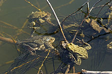
The biodiversity of the Niedwald is particularly enhanced by the Grill'schen Altarm, which protrudes far into the forest , the largest Nidda oxbowl with 29,000 m² of water, and the Waldspitze Altar . In both there are larger populations of the yellow pond rose ( Nuphar lutea ). Kingfisher ( Alcedo atthis ), gray heron ( Ardea cinerea ), pond frogs ( Pelophylax kl. Esculentus ), common toads ( Bufo bufo , spawning waters), various types of dragonflies ( Odonata ) and many other indigenous species live by and in the water . A small population of beaver rats ( Myocastor coypus ) also lives in the oxbow lake . The animals come from an abandoned breed on the Holler old arm on the opposite, Sossenheimer Nidda-Ufer (→ Sossenheimer Unterfeld ) . Another neozoon is the red- eared slider turtle ( Trachemys scripta elegans ), which was probably released there by private owners.
In spring, at the spawning time of the common toad native to the Niedwald, an amphibious fence is erected south of Oeserstraße to protect the animals migrating to the Nidda oxbow lakes north of the road (" toad migration ") from car traffic. The amphibious fence is looked after by BUND Frankfurt.
Transport links
The Niedwald can be reached by motor vehicle (private transport, public transport), by bike and on foot. The bus line 59 of the Frankfurter Verkehrsgesellschaft VgF has two stops on Oeserstraße a short distance from the edge of the forest, Neumarkt in the west and Neufeld in the east of the forest. The Niedwald can be reached from the west via the federal highway 648 . There is a public car park near the Ffm.-Neufeld motorway junction (Messe exit) , accessible via Oeserstraße and Neufeld . On the northern edge of the Niedwaldes Nidda is lined on both sides of the green belt loop trail or greenbelt bike path, the crossing of the river is at the opposite the Grill'schen old arm lying military Sossenheim possible. Both ways are signposted. The hiking trails in the Niedwald itself are mostly unpaved and at ground level, and a bridle path also leads through the forest.
literature
- Adalbert Vollert: Nied am Main - Chronicle of a Frankfurt district . Local history and history association Nied e. V., Frankfurt 1998
- City of Frankfurt am Main, Environment Agency (Ed.): The Green Belt Leisure Card . 7th edition, 2011
- City of Frankfurt am Main, Umweltamt (Ed.): Stadtgewässer - Discovering rivers, brooks, oxbow lakes, Frankfurt 2004. In it: Chapter old arms Nidda III - Griesheim, Sossenheim and Nied, p. 64 ff.
Web links
- Niedwald at par.frankfurt.de , the former website of the city of Frankfurt am Main
- Selzerbrunnen at par.frankfurt.de , the former site of the city of Frankfurt am Main
- Website of the Waldwerk e. V. (accessed April 10, 2017)
- The Gallus history workshop reports historical and current affairs, 50th edition, February 2017, Looking beyond the horizon 1: The Heidenschloss in the Griesheimer Wald (PDF file)
Individual evidence
- ↑ a b c City of Frankfurt am Main, Environment Agency (ed.): The Green Belt Leisure Card . 7th edition, 2011
- ↑ a b c d Niedwald at par.frankfurt.de , the former website of the city of Frankfurt am Main
- ↑ a b c City of Frankfurt: City waters - discovering rivers, streams, oxbow lakes, p. 65
- ^ Adalbert Vollert: Nied am Main, p. 47
- ↑ Selzerbrunnen at par.frankfurt.de , the former site of the city of Frankfurt am Main
- ↑ The Gallus History Workshop reports, Historical and Current Issues, 50th edition: February 2017, Looking beyond the horizon 1: The Heidenschloss in the Griesheimer Wald
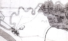
- ↑ See above: Canal construction map from 1870 (excerpt from ISG Frankfurt) of the Nied district
- ↑ a b Waterworks becomes "Waldwerk" - the forest works in a historical context at waldwerk.mnjk.de (accessed on April 10, 2017)
- ^ Adalbert Vollert: Nied am Main, p. 13
- ↑ Georg Wolff: The Roman road from Heddernheim to Nied and the Heidenschloss; from: Association for history and antiquity in Frankfurt am Main: communications about Roman finds in Heddernheim III, Frankfurt 1900
- ↑ Quoted from Adalbert Vollert: Nied am Main, p. 45. The monastery was supposedly awarded the income from the forest.
- ↑ a b c d Adalbert Vollert: Nied am Main, p. 45
- ↑ Das Waldwerk - pearl in the chain of the Frankfurt green belt on waldwerk.mnjk.de (accessed on April 10, 2017)
- ↑ Various authors: Kreuz und quer durch den Frankfurter Grüngürtel, p. 16. CoCon-Verlag, Hanau 1996. ISBN 3-928100-42-4
- ↑ Jutta Erich: Results report toad migration of the common toad ( Bufo bufo ) in Oeserstraße in Frankfurt am Main (Niedwald) 2008 ( Memento from April 26, 2012 in the Internet Archive )
- ^ Rhein-Main Verkehrsverbund (RMV): General route plan for Frankfurt am Main, 2012 edition
Coordinates: 50 ° 6 ′ 33.1 " N , 8 ° 35 ′ 31.4" E


